
Rare old maps of the United States.
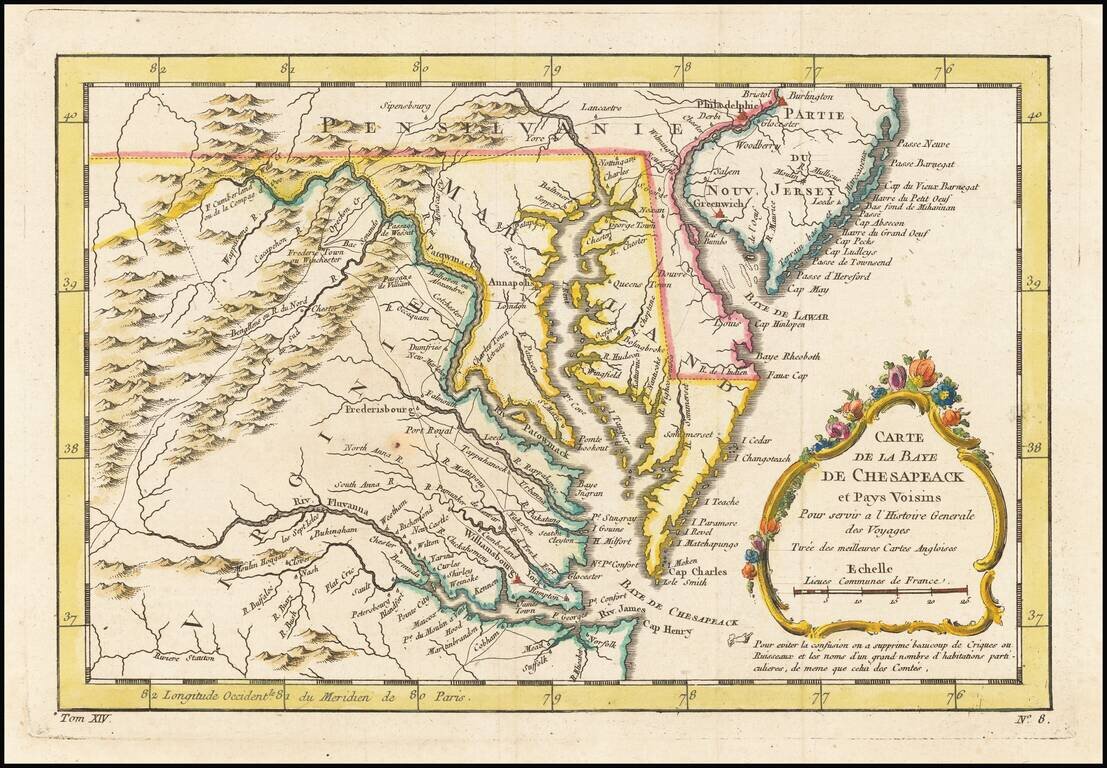
An excellent map of Virginia, Maryland, Delaware, and part of New Jersey. Extends west to the Applachians and shows towns, roads, mountains, rivers, islands, capes, ports and other nice details. A nice French & Indian War map of the Southern...
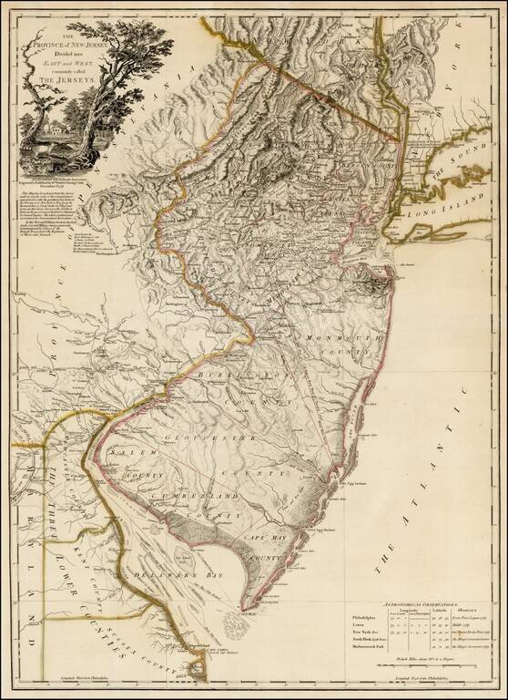
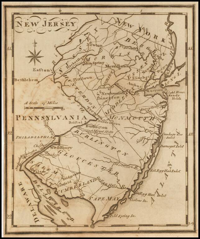
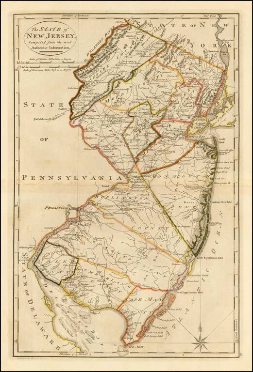
Rare second state of Faden's map of New Jersey, based upon Bernard Ratzer's surveys in 1769, as significantly revised and improved by Faden in December 1778. This rare second state of the map, issued 12 months after the first edition, is based upon...
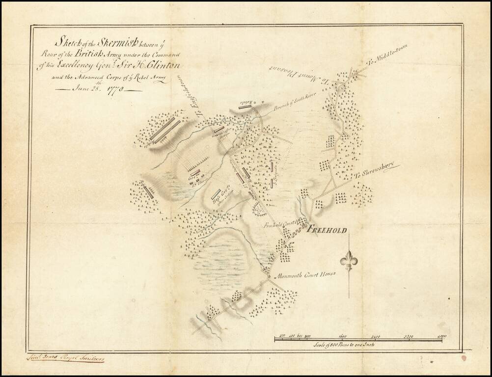
Unique Contemporary Manuscript Plan of Battle which Secured George Washington’s Role as “Father of the Nation” Finely-executed contemporary manuscript map of the Battle of Monmouth, the last major engagement of the Northern Theater of the...
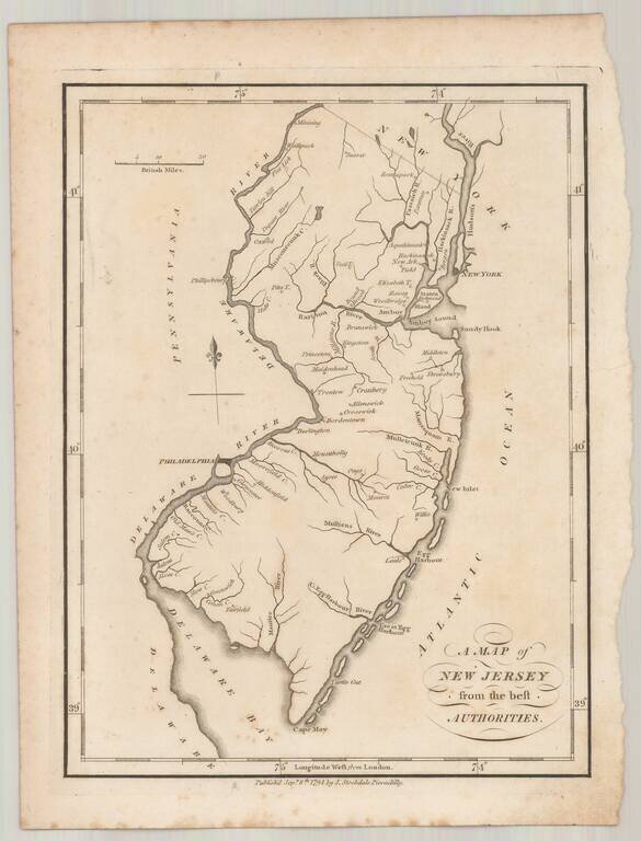
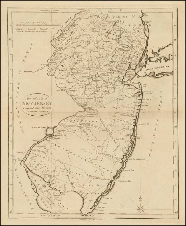
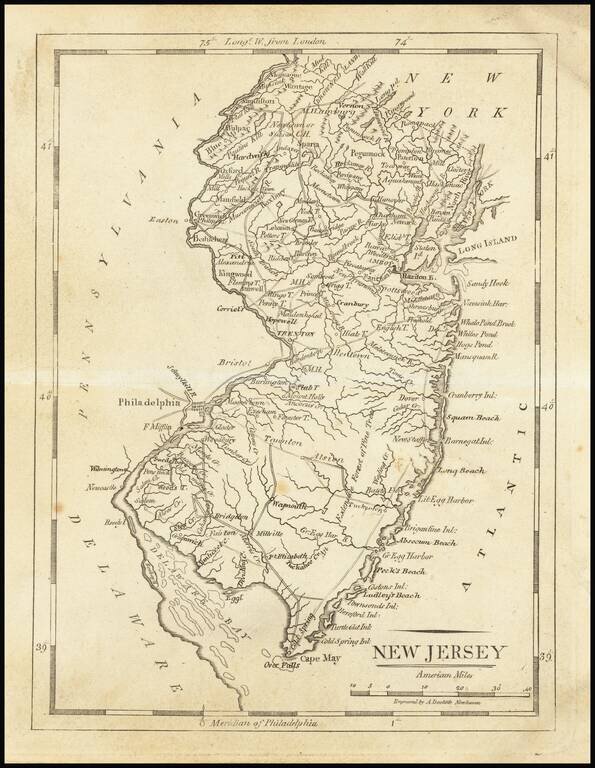
Rare example of John Stockdale's map of New Jersey from the London edition of Morse's Geography. This map is quite possibly the first English language map of New Jersey published following the conclusion of the American Revolution and one of only a...
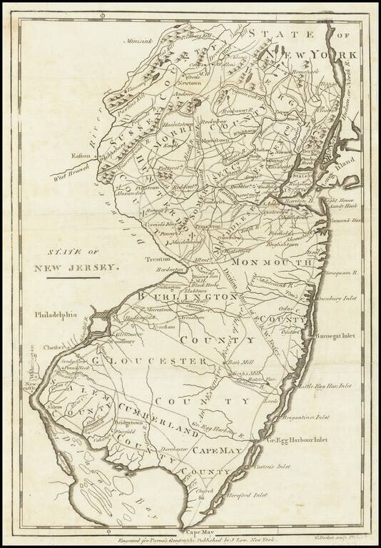
One of the earliest American maps of the state of New Jersey from the first American gazetteer. Joseph T. Scott, a Philadelphia engraver and publisher, issued his gazetteer during the early days of American cartography. Scott included much detail of...
Nice example of John Reid's map of New Jersey, the second folio map of the state to appear in a commercial atlas. The map is drawn largely from Carey's map by Samuel Lewis, issued the prior year. An excellent topographical map, showing the counties,...
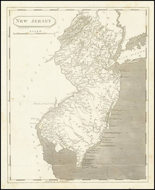
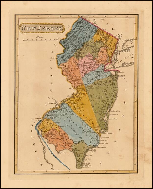
One of the earliest obtainable maps of the state of New Jersey. Shows counties, towns, roads, rivers, lakes, islands, churches, court houses, and other early details. Includes topographical details. The map is reduced from the Reid map, which in...
Early map of the state of New Jersey, from Arrowsmith & Lewis's Atlas. Tanner was the engraver of the map and signed it under the title "Tanner, Sc."
Fine Early Map of the State of New Jersey Nice example of Mathew Carey's map of New Jersey, first published in Carey's General Atlas in 1814. The map is exceptionally detailed for the period, being one of the earliest maps to show in detail the road...
Nice example of Mathew Carey's map of New Jersey. A highly detailed map, which includes towns, roads, rivers, mountains, and many other details.
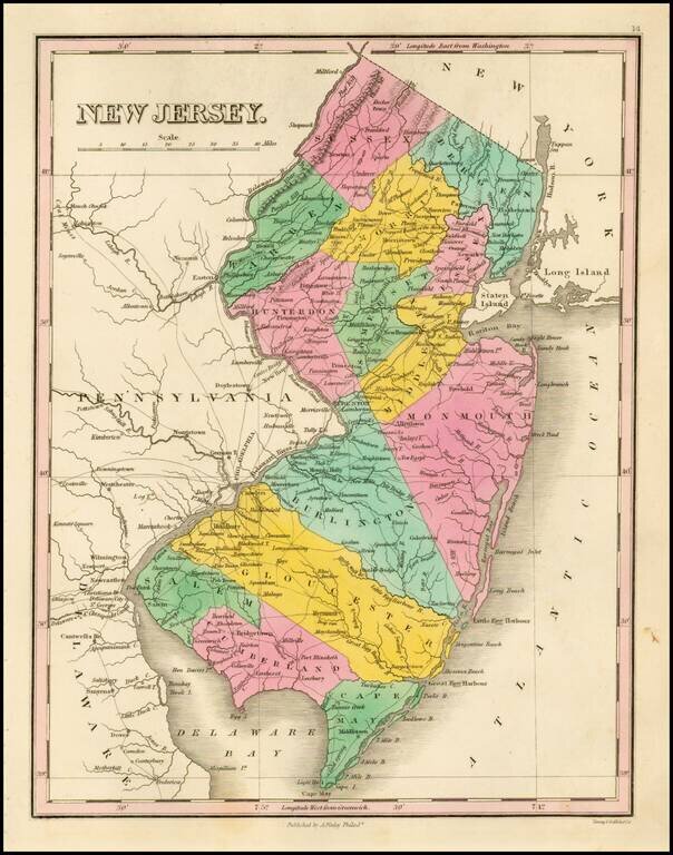
Rare First Edition of The Lucas Map of New Jersey Nice example of Fielding Lucas' early map of New Jersey, from his New & Elegant General Atlas of the United States . . . Hand colored by counties, this is one of the first maps of New Jersey...
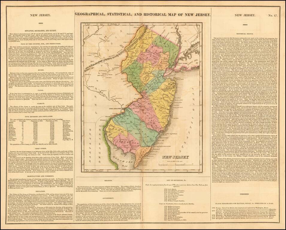
Fine old color map of this early map of New Jersey, from the first edition of Carey & Lea's Atlas. Size includes text surrounding map, which includes wonderful contemporary details concerning the topography, indigenous lands, rivers, climate,...
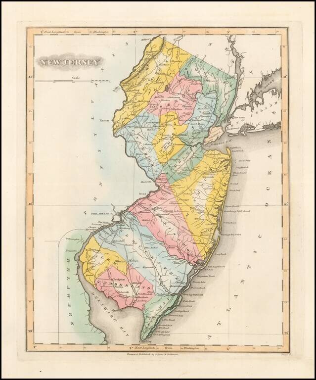
Nice example of Fielding Lucas' rare map of New Jersey, hand colored by counties. Shows towns, roads, rivers, lakes, islands, etc. One of the rarest atlas maps of the early 19th Century and one of the first finely engraved American printed maps of New...
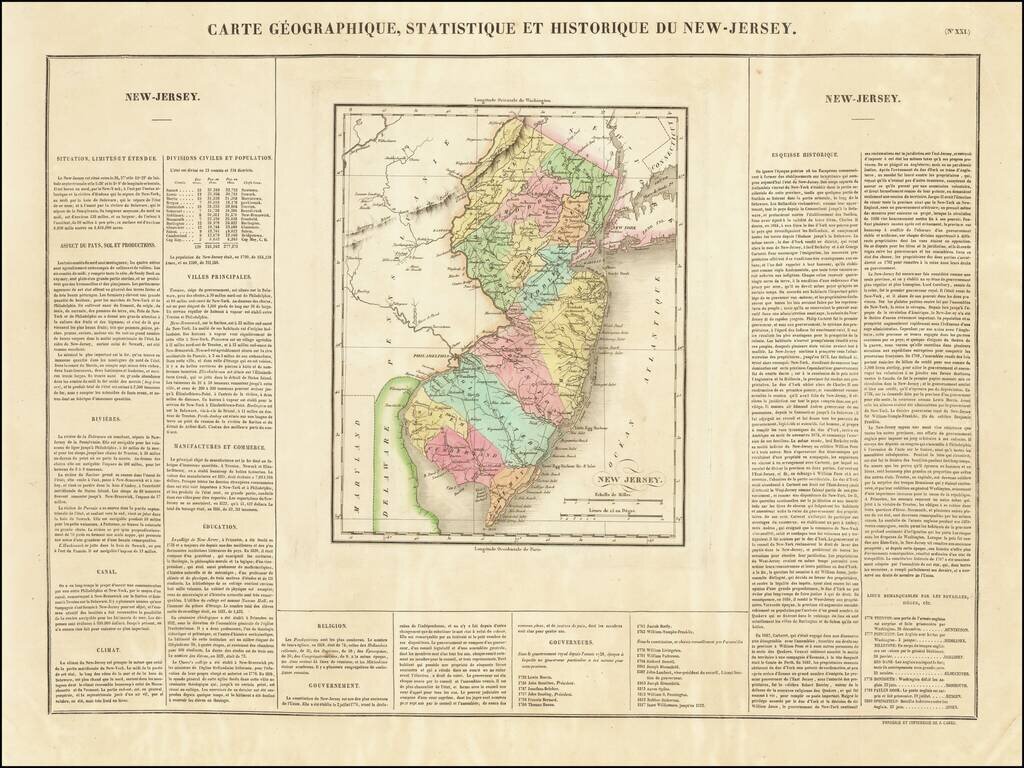
First Map of New Jersey Printed in France One of the earliest obtainable maps of the State of New Jersey published outside of the United States. The map appeared in Buchon's edition of Carey & Lea's Atlas, which was highly prized not only for its...
Striking map of the state of New Jersey, from Finley's New General Atlas. The map is hand colored by counties and showing towns, roads, rivers, mountains and other geographical features.
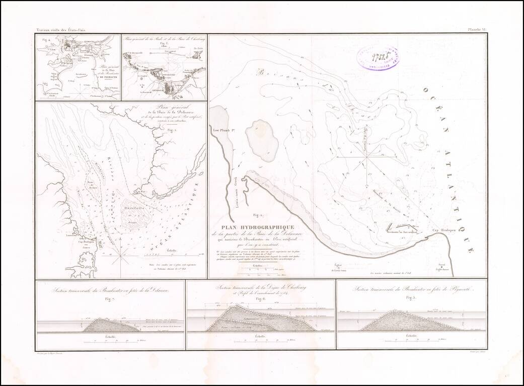
Building the First Breakwater and Artificial Port of Its Kind in America. Rare engraved map by Guillaume-Tell Poussin, related to the construction of the Delaware Breakwater in the Delaware Bay in the 1820s. The sheet features a map of the mouth of...