
Rare old maps of the United States.
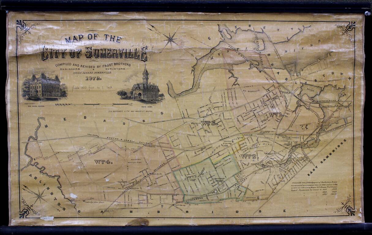
Wonderful separately issued map of Somerville, Massachusetts, in the Boston metropolitan area. Tufts College is shown on the border between Somerville and Medford. The Mystic Reservoir is named and illustrated. College Hill Station is labeled....
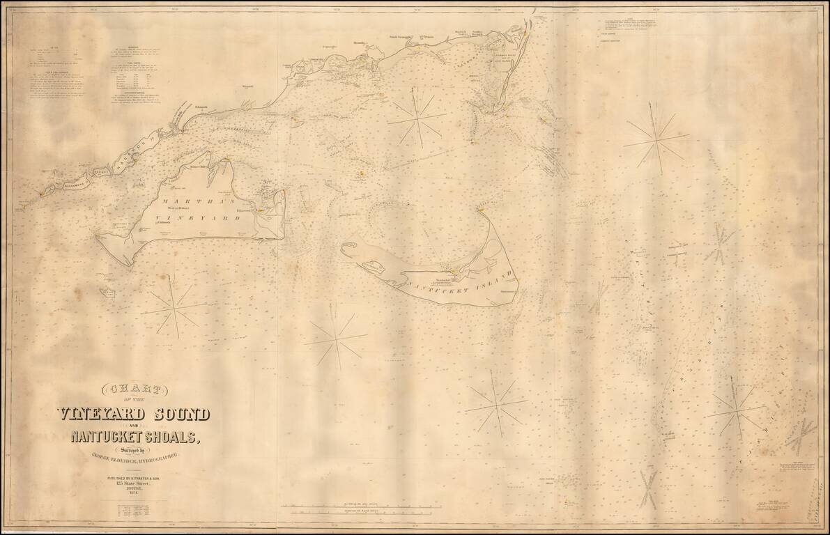
Fine large format sea chart of the waters around Martha's Vineyard and Nantucket, by George Eldridge, the leading private American chartmaker of the era. This mammoth chart depicts, in detail, the waters around the Elizabeth Islands, Martha's...
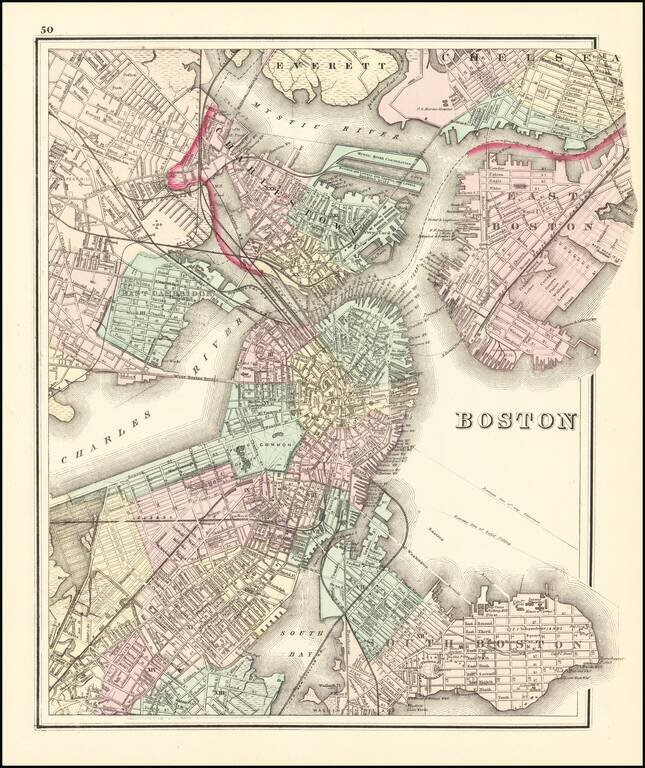
Fine example of OW Gray's map of Boston and the neighboring cities, showing marvelous local details throughout. Extends to Brookline, Cambridge, Somerville, Everett, Chelsea, etc. From one of the leading American map publisher's of the 1870s.
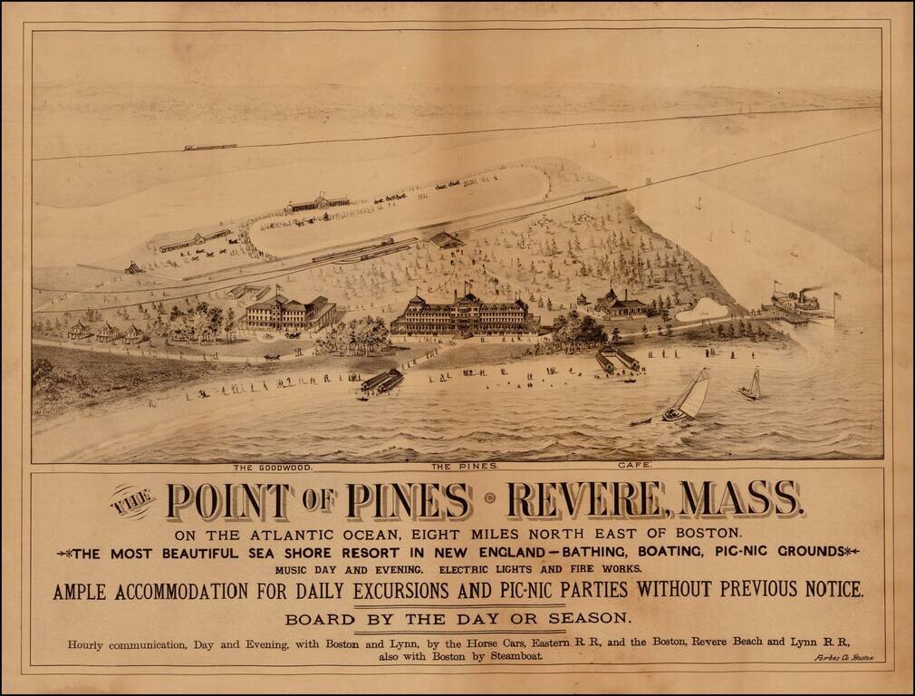
Rare view of The Point of Pines, in Revere Massachusetts, promoting this beach resort 8 miles northeast of Boston. The view shows two hotels (The Pines and the Goodwood) and a Cafe, along with the a horse racing track, the local train depot and scenes...
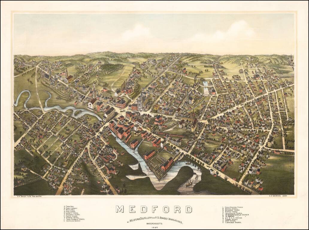
Rare bird's-eye view of Medord, Massachusetts, published by O.H. Bailey in Boston. The view shows a booming commercial town on the banks of the Mystic River, looking northward from the general direction of Tufts University (which would be just below...
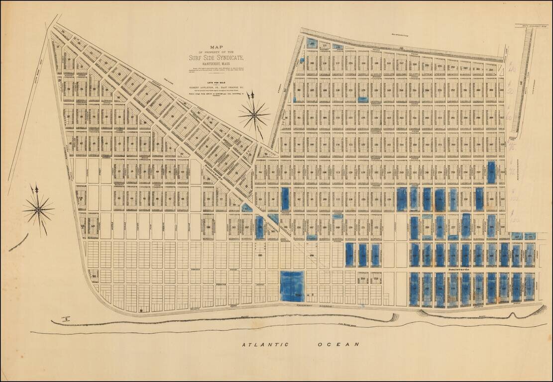
An extremely rare 1880s plat of lots for sale in Surfside on Nantucket’s South Shore. Note: This plat was acquired in partnership with Boston Rare Maps as part of an archive of some 150 Nantucket real estate maps and plats. The group includes...
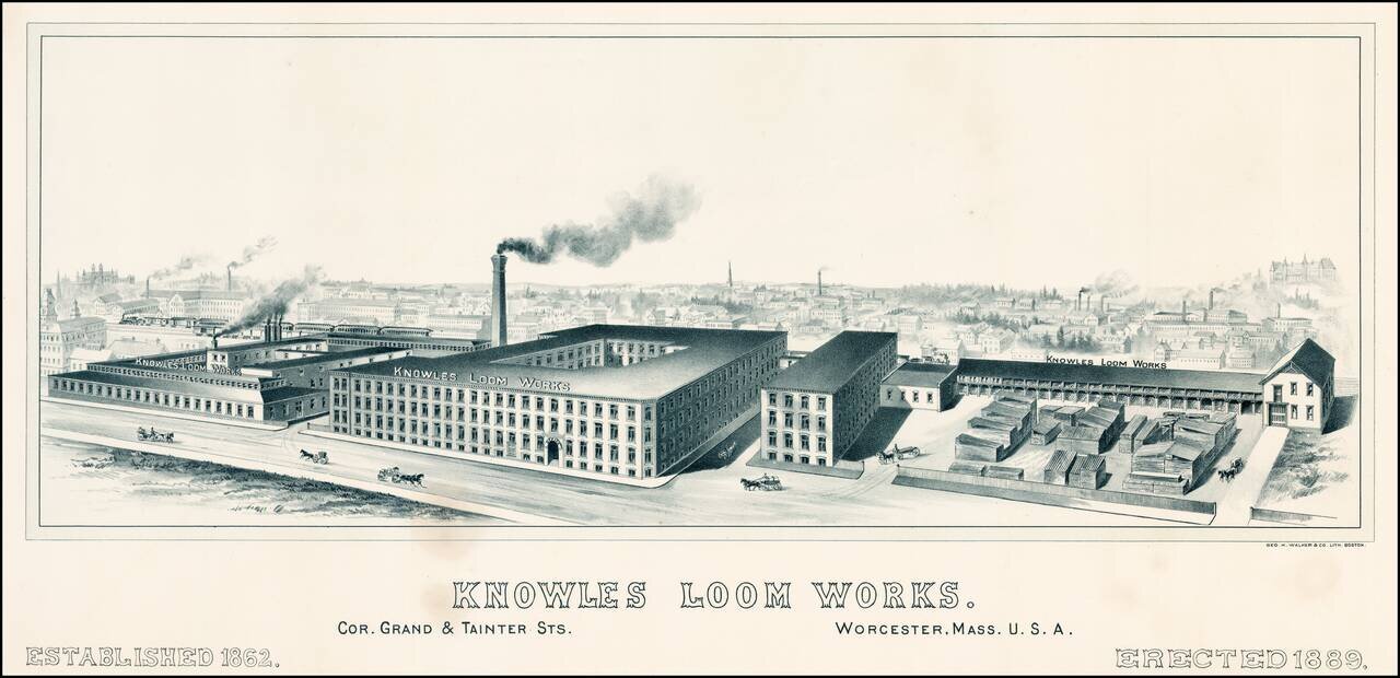
Rare view of the Knowles Loom Works in Worcester, Massachusetts, with the town and rail road line in the background. OCLC locates no other examples of the view.
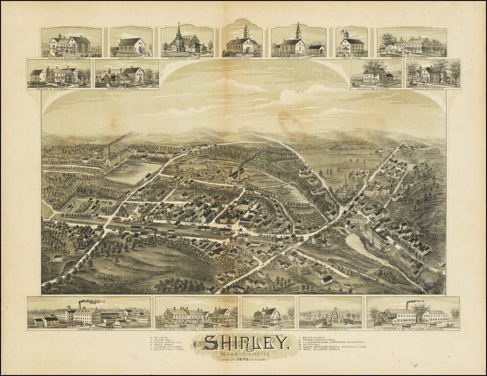
Fine antique birdseye view of Shirley, Massachusetts, published in Boston. Below the view, smaller images of Sampson Cordage Works, Conant Brothers General Store, and C.A. Garton & Son Suspenders Manufactory. At the top are images of churches,...
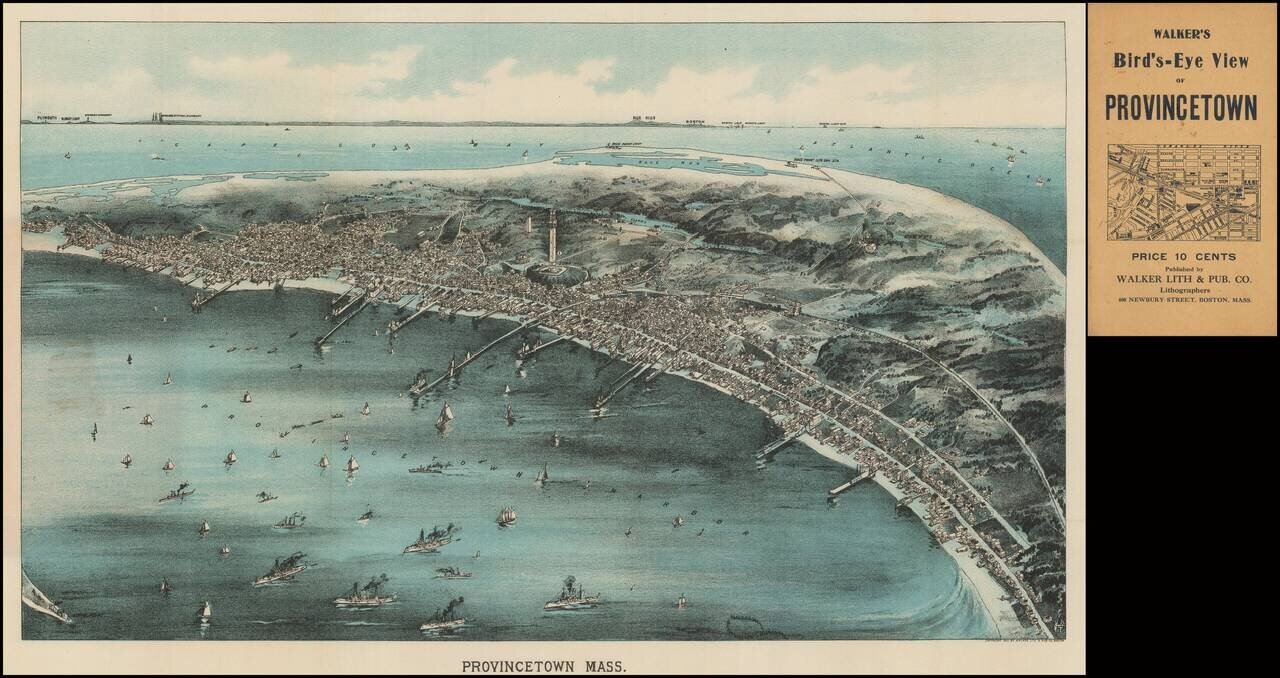
Rare pocket map version of Walker's view of Provincetown, published in Boston in 1910. As noted on the Leventhal Center website: Looking in a northwesterly direction toward Cape Cod Bay and the distant Boston shoreline, this bird's eye view portrays...
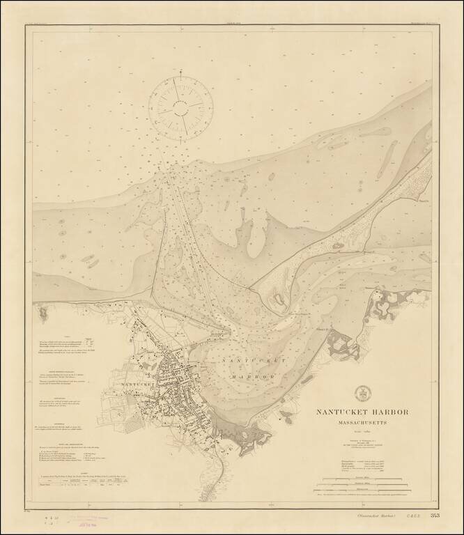
Rare Separately Published Harbor Chart of Nantucket -- Early Appearance of The Completed Jetties Fine example of rare first state of this early 20th Century Chart of Nantucket, published by the United States Coast & Geodetic Survey. Perhaps the...
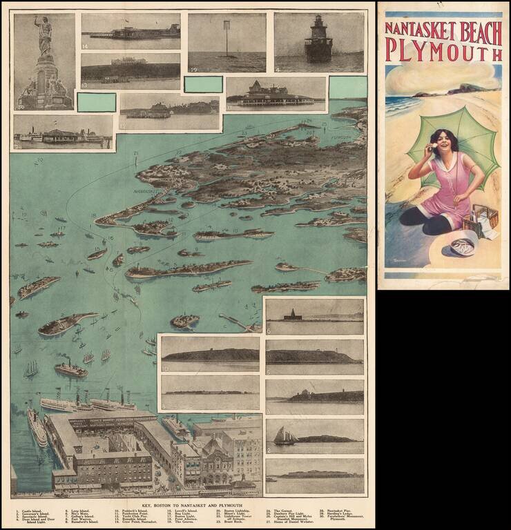
Fine view of the coastal region from Boston to Nantasket and Plymouth. A key references the 30 photographic inset images. Comes with 10 pages of text and illustrations.
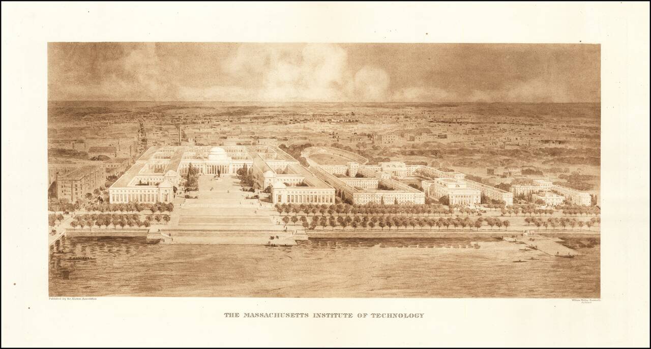
Rare Early View of MIT Fine example of William Welles Bosworth bird's-eye view of the Massachusetts Institute of Technology (MIT) campus in Cambridge, Massachusetts, published by the Alumni Association. Bosworth's view shows MIT from across the...
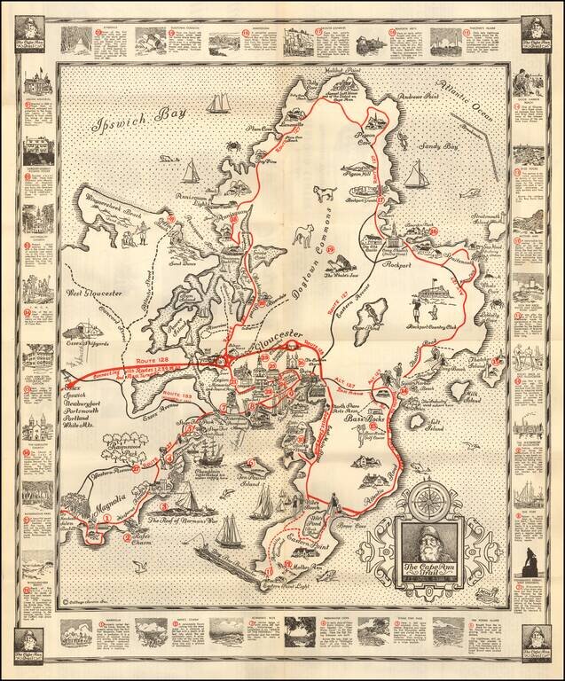
Pictorial map of the Cape Ann Trail, published by the Glocester Chamber of Commerce. The map is centered on Gloucester and extends north to Ipwsich Bay, Halibut Point and Andrews Point and south to Eastern Point Light The primary Roads (Routes) are...
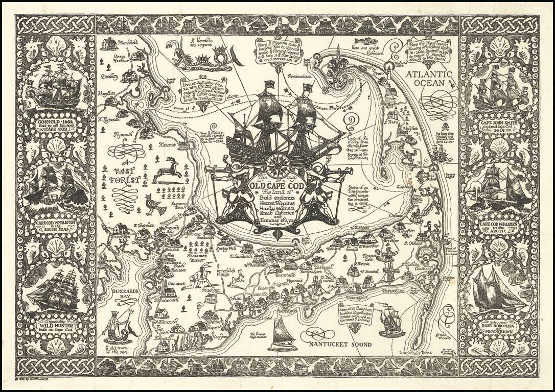
Fine example of Waugh's 1930 pictorial map of Cape Cod and part of the South Shore of Massachusetts including Plymouth, Buzzard Bay, and Duxbury. Waugh elegantly illustrate important towns and roads, while integrating a host of historical vignettes,...
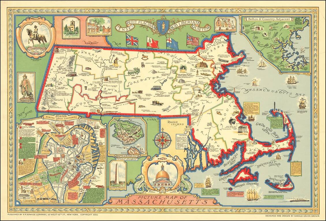
Decorative pictorial map of Massachusetts designed and drawn by Harold Haven Brown. Inset maps include: Boston During Three Centuries (a map of the centre of Boston, with detailed commentary) Battle of Bunker Hill ("After and Old Map Published in...
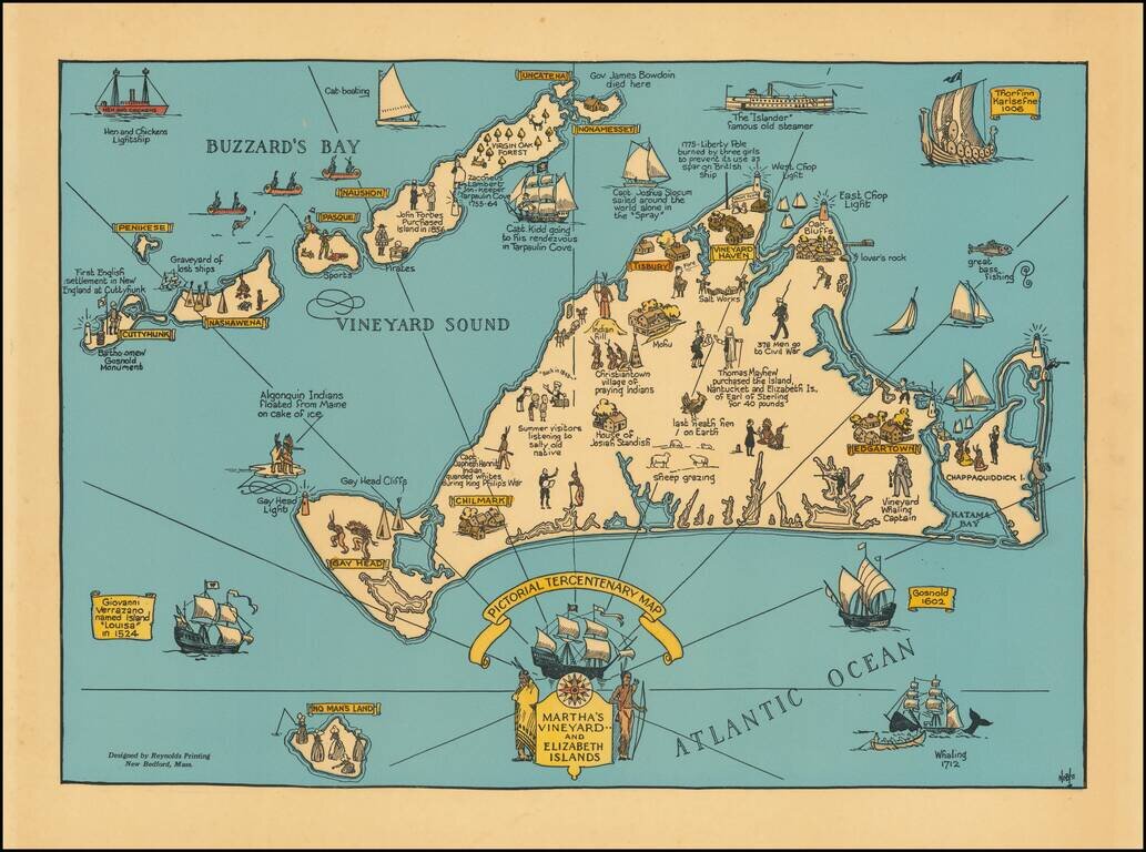
Decorative map of Martha's Vineyard and the Elizabeth Islands, celebrating is 300 year anniversary in 1630. Includes a number of lively historical vignettes and drawings and explanatory text. The maker is listed as Noble. We note several...