logo

1930. Pictorial Tercentenary Map Martha's Vineyard and Elizabeth Islands

  • Pictorial Tercentenary Map Martha's Vineyard and Elizabeth Islands

Pictorial Tercentenary Map Martha's Vineyard and Elizabeth Islands information:

Year of creation: 
Resolution size (pixels): 
 12012x8934 px
Disk Size: 
 30.0479MiB
Number of pages: 
 1
Place: 
 New Bedford
Author: 

Print information. Print size (Width x height in inches):
Printing at 72 dpi 
  166.83 х 124.08
Printing at 150 dpi 
 80.08 х 59.56
Printing at 300 dpi 
 40.04 х 29.78

An example of detailing the file of this map of in a printable high-resolution:

Click to open in high resolution (open in new tab).
Attention! this is just the central piece (central area 960x960 px) of the map file!
This is an example, so that you can see and study the level of detail of a given map. The entire Map will be fully available after payment!

Pictorial Tercentenary Map Martha's Vineyard and Elizabeth Islands

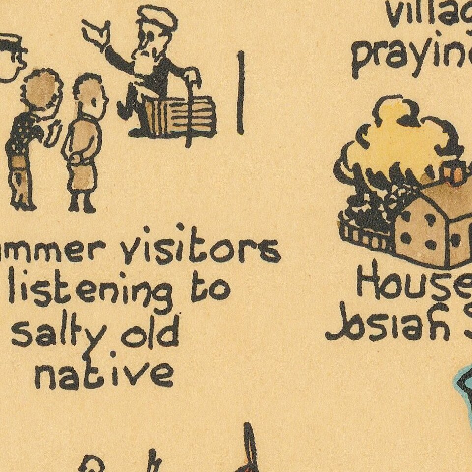
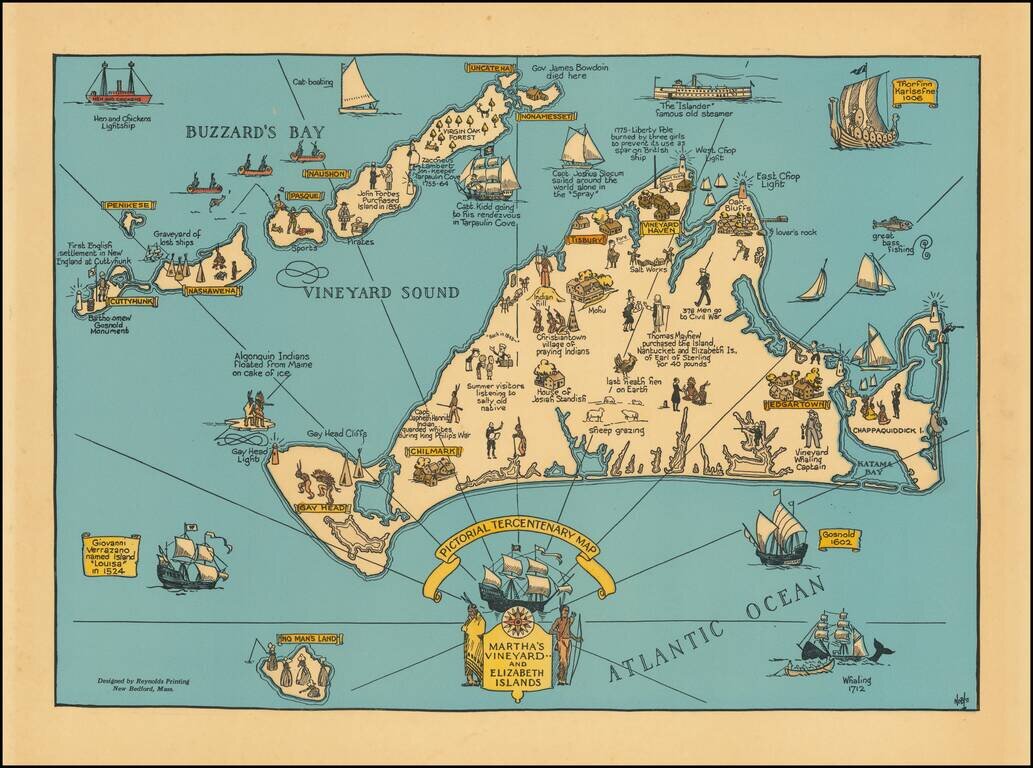
Decorative map of Martha's Vineyard and the Elizabeth Islands, celebrating is 300 year anniversary in 1630.

Includes a number of lively historical vignettes and drawings and explanatory text.

The maker is listed as Noble.

We note several editions of the map, including one with a date in the title (1630-1930) and another which is entirely green.


Special conditions for students!

If you are a student, write to us in telegram: @antiquemaps and indicate what material you need and for what work you need a map in high detail. We are ready to provide material on special terms. For students only!

Item information:

Year of creation:
Size:
12012x8934 px
Disk:
30.0479MiB
Number of pages:
1
Place:
New Bedford
Author:
Noble.
$14.99

Related item