logo

1930. The Cape Ann Trail

  • The Cape Ann Trail
  • The Cape Ann Trail

Map size in jpg-format: 32.161MiB

Download "The Cape Ann Trail", in high resolution.

The Cape Ann Trail information:

Year of creation: 
Resolution size (pixels): 
 12425x14977 px
Disk Size: 
 32.161MiB
Number of pages: 
 2
Place: 
 Gloucester, MA
Author: 

Print information. Print size (Width x height in inches):
Printing at 72 dpi 
  172.57 х 208.01
Printing at 150 dpi 
 82.83 х 99.85
Printing at 300 dpi 
 41.42 х 49.92

An example of detailing the file of this map of in a printable high-resolution:

Click to open in high resolution (open in new tab).
Attention! this is just the central piece (central area 960x960 px) of the map file!
This is an example, so that you can see and study the level of detail of a given map. The entire Map will be fully available after payment!

The Cape Ann Trail

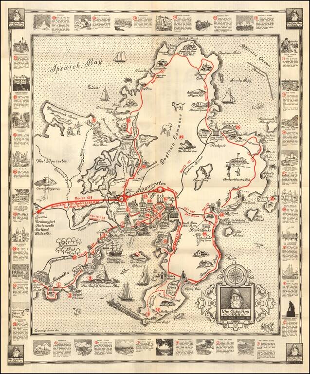
Pictorial map of the Cape Ann Trail, published by the Glocester Chamber of Commerce.

The map is centered on Gloucester and extends north to Ipwsich Bay, Halibut Point and Andrews Point and south to Eastern Point Light

The primary Roads (Routes) are located, along with various points of interest.

Around the map are noted for the various numbered entries within the map, representing 28 points of interest, each with an illustrated vignette.


Special conditions for students!

If you are a student, write to us in telegram: @antiquemaps and indicate what material you need and for what work you need a map in high detail. We are ready to provide material on special terms. For students only!

Item information:

Year of creation:
Size:
12425x14977 px
Disk:
32.161MiB
Number of pages:
2
Place:
Gloucester, MA
Author:
Edward Ambler Ambler.
$14.99

Related item