
Rare old maps of the United States.
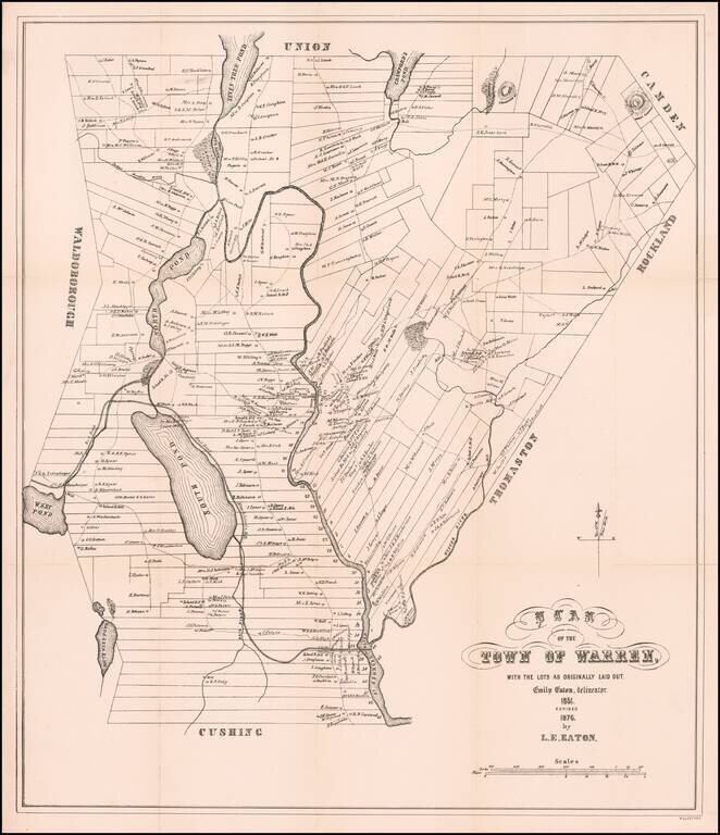
Revised edition of Emily Eaton's plan of Warren, Maine originally published in 1851 by B.W. Thayer & Co. in Boston. Emily Eaton was almost certainly one of the first women in America to create a town plan. This revised edition by L.E. Eaton does...
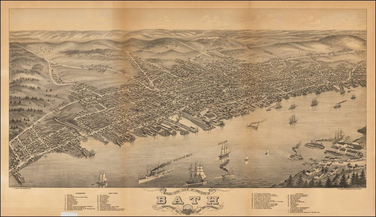
Rare Birdseye View of Bath, Maine, engraved by J.J. Stoner and lithographed by The Shober & Carqueville Litho. Co., in Chicago in 1878. The map presents a thriving image of the City of Bath on the Kennebec River, with steamships and sailing...
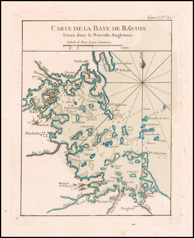
Boston Harbor at the end of the French & Indian War An excellent map of the Harbor of Boston, from Bellin's Le Petit Atlas Maritime.
![[Salem, Massachusetts] Salem Eine Stadt im Engellandischen America, in der Grafschafft Essex, welche von den Engellandern 1629 erbauet worden, und 2 Havfen hat einen fur den Sommer, und einen fur den Winter](/map/small/70175.jpg)
Scarce early Vue Optique showing the wharf at Salem, Massachusetts, by the German artist and engraver Balthasar Friedrich Leizelt. View of Salem showing a harbor and shipyard with ships with British flags and boats. On the docs ae warehouses. Men in...
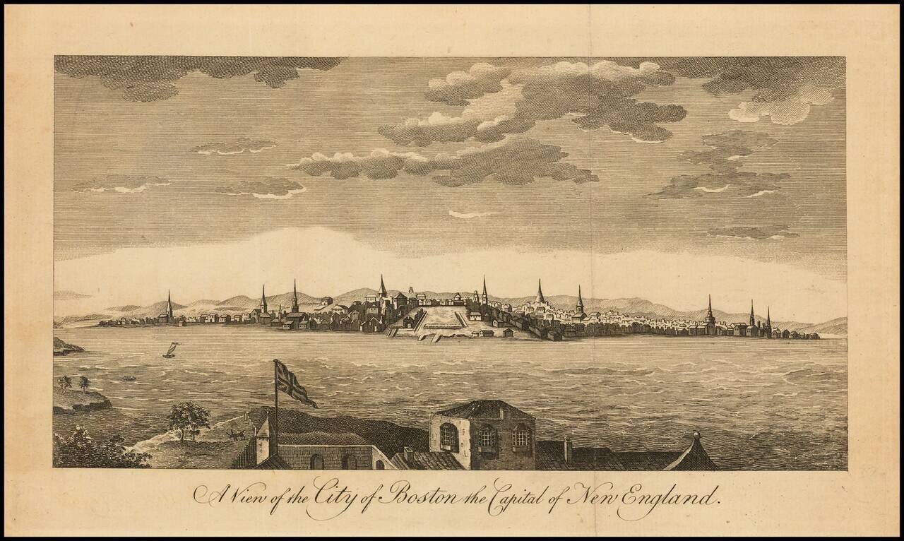
A View of Boston at time of the firing of the first shots of the American Revolution. Fine early view of Boston, published in the Universal Magazine, which also comes with the relevant text section describing the ongoing revolt in the British...
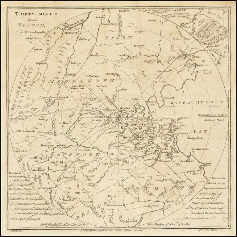
One of the Very First American Revolutionary Maps and Battle Plans. Including a Reference to the Boston Tea Party. An unusual map of the Theater of War in Massachusetts, centered on Boston, which appeared in the Scots Magazine in 1775. The circles...
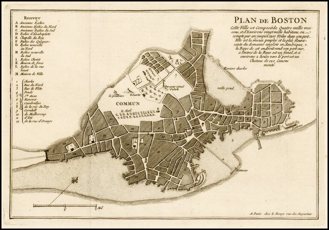
Fine example of Le Rouge's plan of Boston, issued at the beginning of at the outset of the French & Indian War in his Recueil des plans de l'Amerique septentrionale. Le Rouge's plan has been reduced French from John Bonner's New Plan of ye Great...
![[Massachusetts Bay, with Boston and Part of Cape Cod]](/map/small/59282.jpg)
Exceptional Revolutionary War Era Chart of Massachusetts Bay. One of the better charts from Des Barres' Atlantic Neptune, extending from Cape Ann in the north, through Boston, to Plymouth in the south, and showing Cape Cod from Wellfleet north. This...
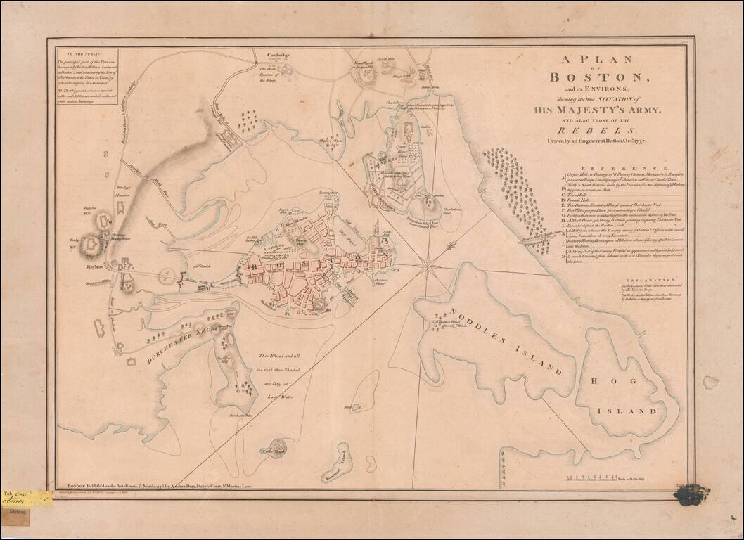
An Early Revolutionary War Battle Plan From An German Archive Nice example of perhaps the finest contemporary plan of the Siege of Boston at the outset of the American Revolution, drawn by Lieutenant Richard Williams. Williams' remarkable...
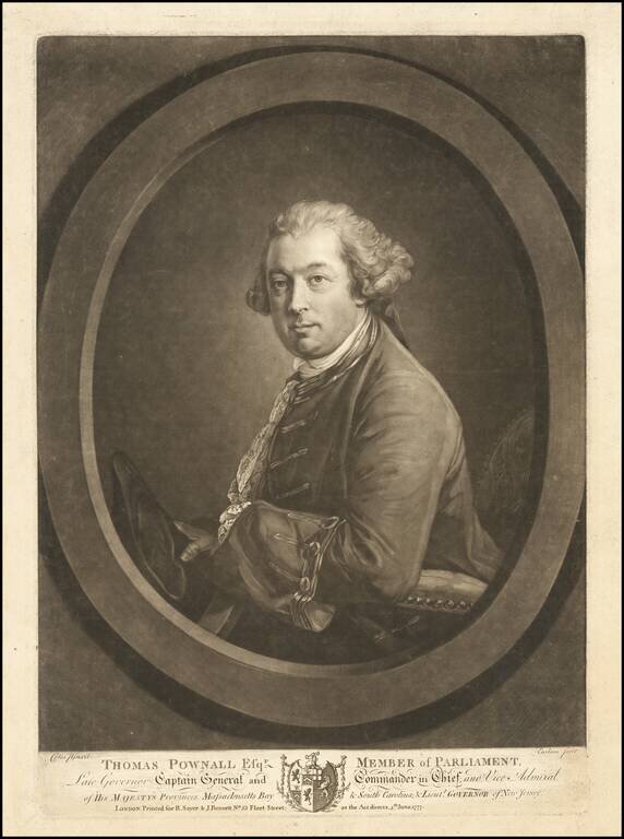
Rare mezzotint portrait of Thomas Pownall, one of the most important figures in the later Colonial history of the British Colonies in North America. Mezzotint portrait engraved by Richard Earlom after a painting by Francis Cotes. Thomas Pownall was...
![[Boston -- 4 Views From The Harbor]](/map/small/65118.jpg)
Sailing Into Boston Harbor During The American Revolution Large aquatint and engraved sheet with four profile views of Boston, which were published by J.F.W. Des Barres, which appeared in his Atlantice Neptune. This sheet of views would have used by...
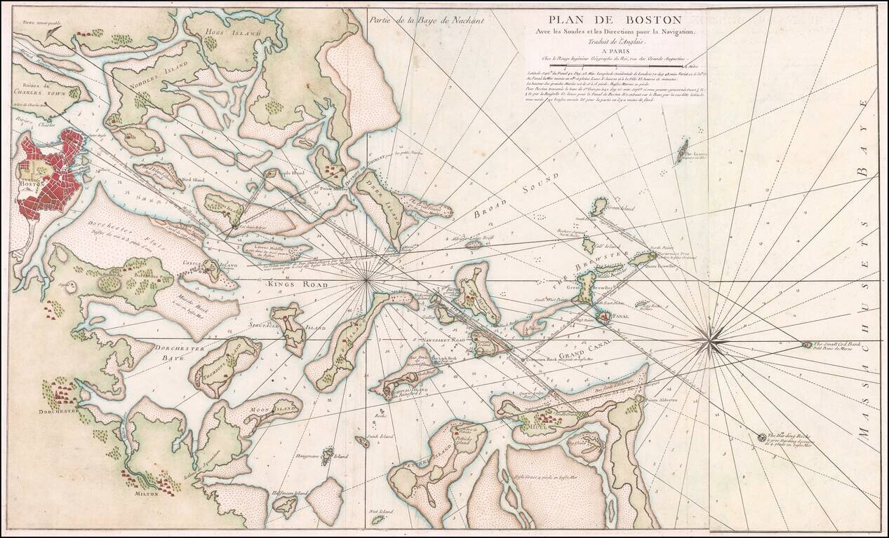
Rare French edition of Sayer & Bennett's rare chart of Boston Harbor revised and issued in Le Rouge's Pilote Americain Septentrionale, which was compiled specifically for use by the French Navy during the American Revolution. A note following the...
![[Boston] Carte Particuliere Du Havre De Boston . . . 1780](/map/small/61227.jpg)
Boston & Environs During The American Revolution Finely hand-colored example of this scarce Revolutionary War era plan of Boston Harbor, issued by the Depot General des Cartes, Plans et Journaux de la Marine, based on Des Barres' chart of Boston...
![[Plymouth Bay, Cape Cod Bay, Duxbury Bay]](/map/small/51249.jpg)
Des Barres Chart of Plymouth Bay, Cape Cod Bay and Duxbury Bay Fine detailed sea chart of the area around Plymouth and Duxbury, Massachusetts, and covering Cape Cod Bay, Duxbury Bay and Plymouth Bay, published in London by Des Barres. The map shows...
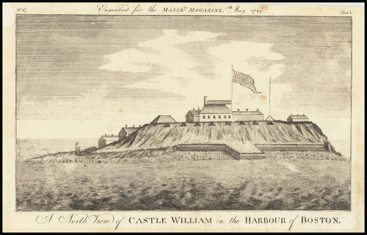
Rare Early American View Early American view of Castle William in Boston Harbor. Castle William's history dates to 1634 when cannons were first deployed to defend Boston Harbor. British officials used the fort as a refuge in the year prior to the...
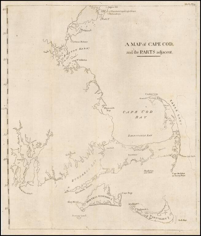
The first map printed in America to focus on the area around Cape Cod and illustrating an early attempt to create a canal from Barnstable Bay to Buzzard Bay. This rare map appeared in the Massachusetts Magazine, published by one of America's most...