
Rare old maps of the United States.
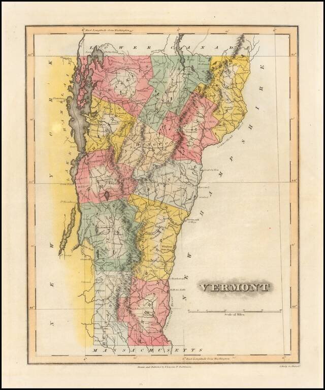
Rare example of Fielding Lucas' fine map of Vermont, which distinguished him as the best publisher of the era. Lucas's maps are printed on a higher quality paper than contemporary maps by Carey & Lea and demonstrate a superior engraving quality...
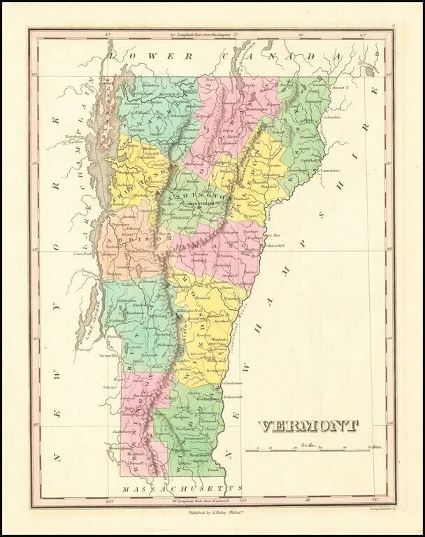
Detailed map of the state of Vermont, from Finley's New General Atlas. The map is hand colored by county, showing towns, roads, railroads, lakes, rivers, mountains, etc. One of the best maps of the state during the period. Anthony Finley was the...
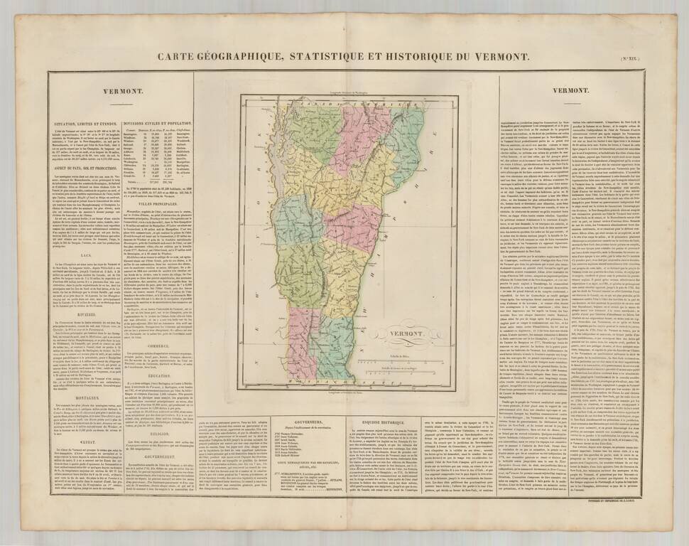
Excellent wide margined example of the French edition of this map of Vermont from Carey & Lea's Atlas. One of the first maps of the state of Vermont published outside of America. Size includes text surrounding map, which includes wonderful...
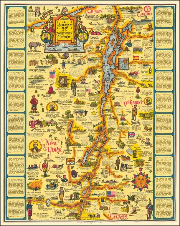
This is the second state of Eleanor Hall's map of the area centered on Lake Champlain, showing the region from northwesternmost Massachussetts to Quebec. The map abounds with pictographs representing historical events, famous figures, industries, and...
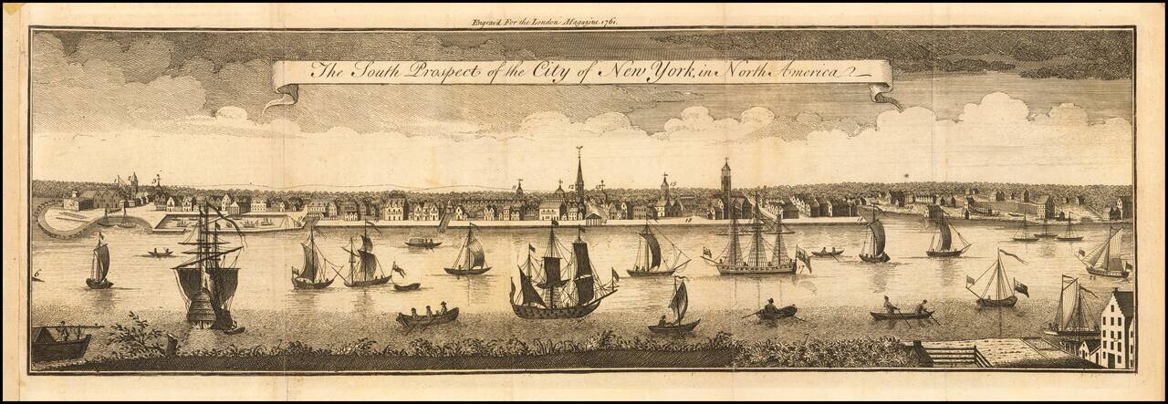
One of the Earliest Obtainable Printed Views of New York City Scarce early view of New York City, first published in 1761.. Beginning in 1716, William Burgis stood at the Brooklyn Heights shore and drew the waterfront along the east side of...

The Earliest Obtainable Plan of New York. This map of the Fortress of New York was prepared by Bellin based upon an inset on Jean Baptiste-Louis Franquelin's map of 1693, which was originally prepared when France and England were at war and New...
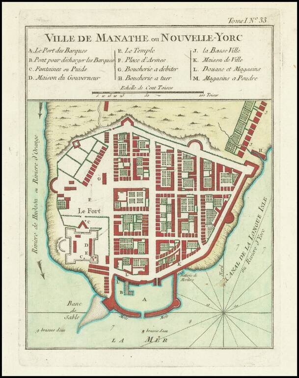
The Earliest Obtainable Plan of New York. This map of the Fortress of New York was prepared by Bellin based upon an inset on Jean Baptiste-Louis Franquelin's map of 1693, which was originally prepared when France and England were at war and New...
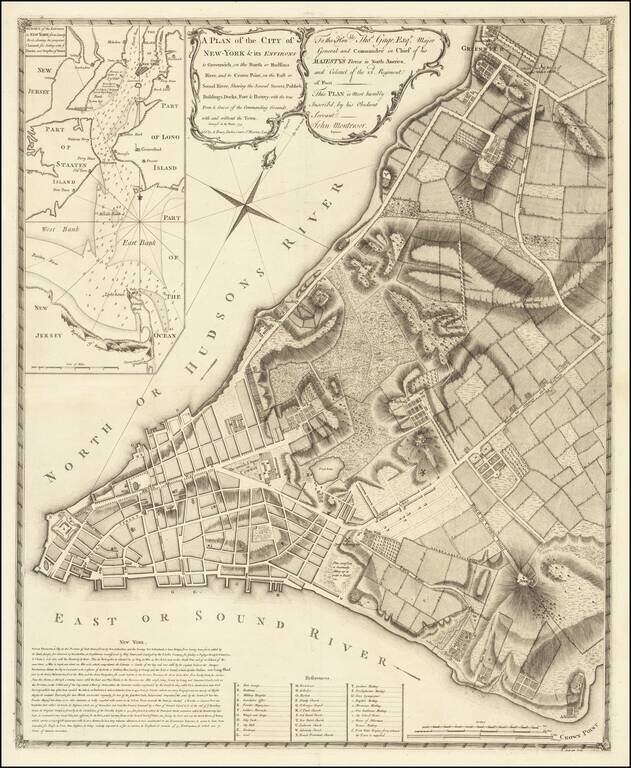
The First Large Scale Plan of New York City Fine example of John Montresor's map of lower Manhattan, the first large scale plan of New York City. Following the conclusion of the French & Indian War, the British introduced a number of measures in...
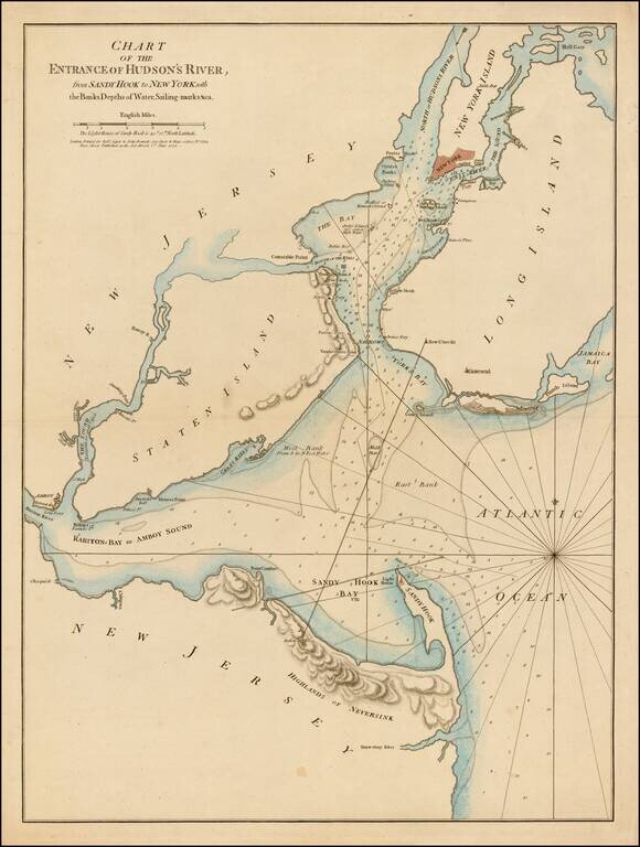
First state of this rare sailing chart of the area around New York Harbor and Long Island, which was issued separately and in the first edition of Sayer & Bennett's North American Pilot. This finely detailed chart is centered on Staten Island,...
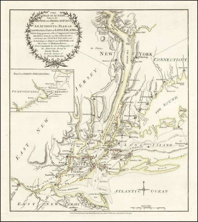
One of the Best Revolutionary War Battle Plans of New York City. Fine old color example of Sayer & Bennett's rare battle plan of the area around New York City, depicting one of the most important early battles of the American Revolution....
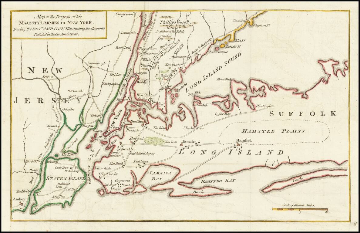
Revolutionary War Battle Map for New York City &c. Detailed early Revolutionary War battle plan of the area around New York City, depicting the battles of Long Island and White Plains in 1776. The map shows battle details of General George...
![[A chart of New York Island & North River: East River, showing passage through Hell Gate, and the North Shore of Long Island: Flushing Bay, Hampstead Bay, Oyster and Huntington Bay, Cow Harbor]](/map/small/51531.jpg)
Des Barres's rare general chart of New York and Long Island Sound. Large hand-colored engraved chart of New York City and the water route from New York Harbor to the middle of Long Island Sound, by way of the East River. Des Barres's map was the...
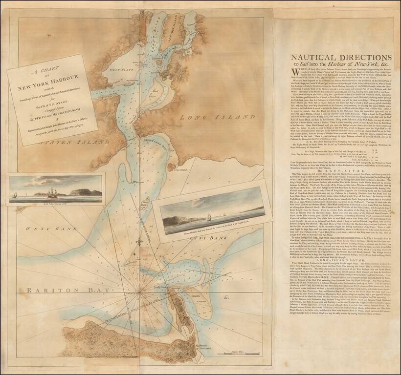
Des Barres's Map of New York Harbor. The Definitive Revolutionary War Era Chart of the Harbor. Highly important Revolutionary War Era chart of New York Harbor, published in the most important collection of nautical charts of the age: Des Barres's...
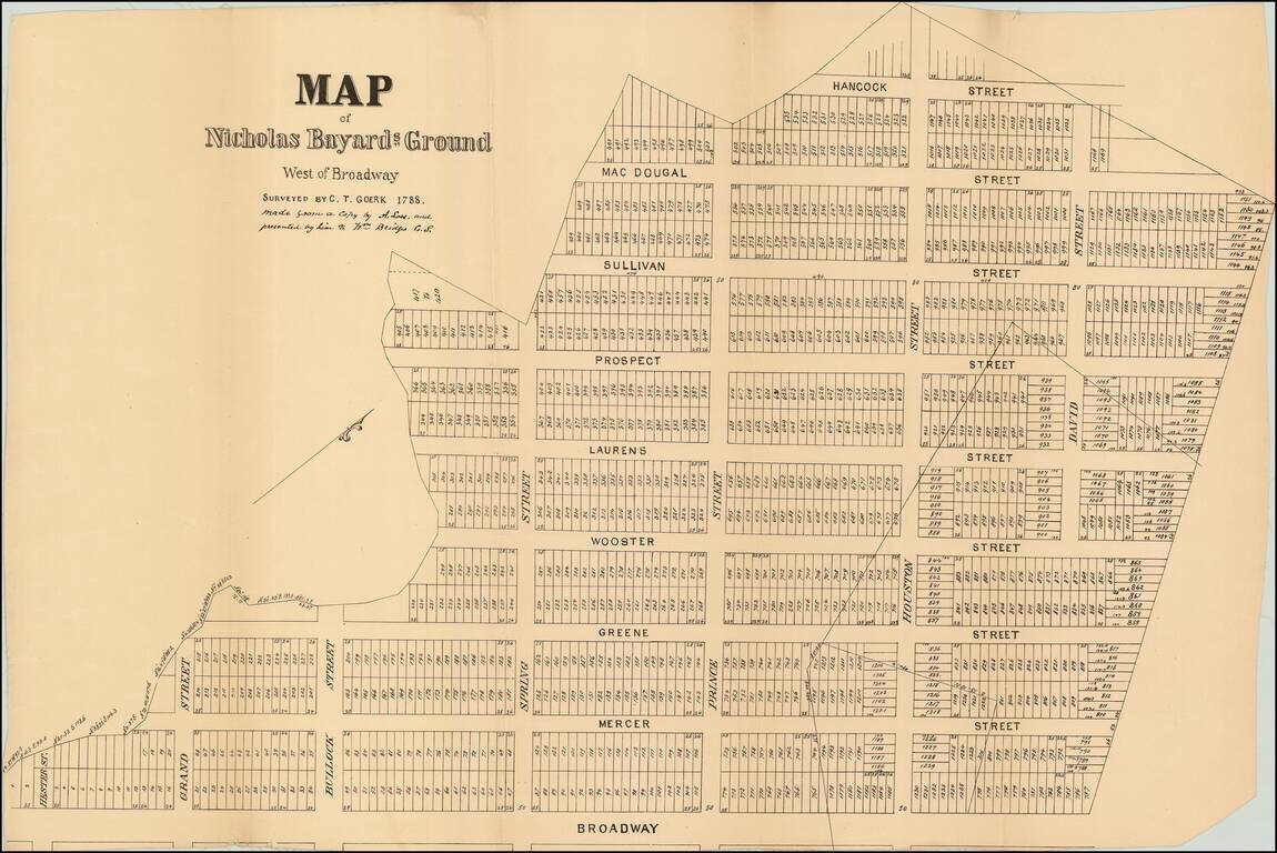
This map is a turn of the century facsimile of a 1788 map of the Bayard Farm by Casimir Goerck. This map shows one of the first examples of the now ubiquitous street grids of Manhattan. Goerck surveyed the farm so that the area could be as individual...
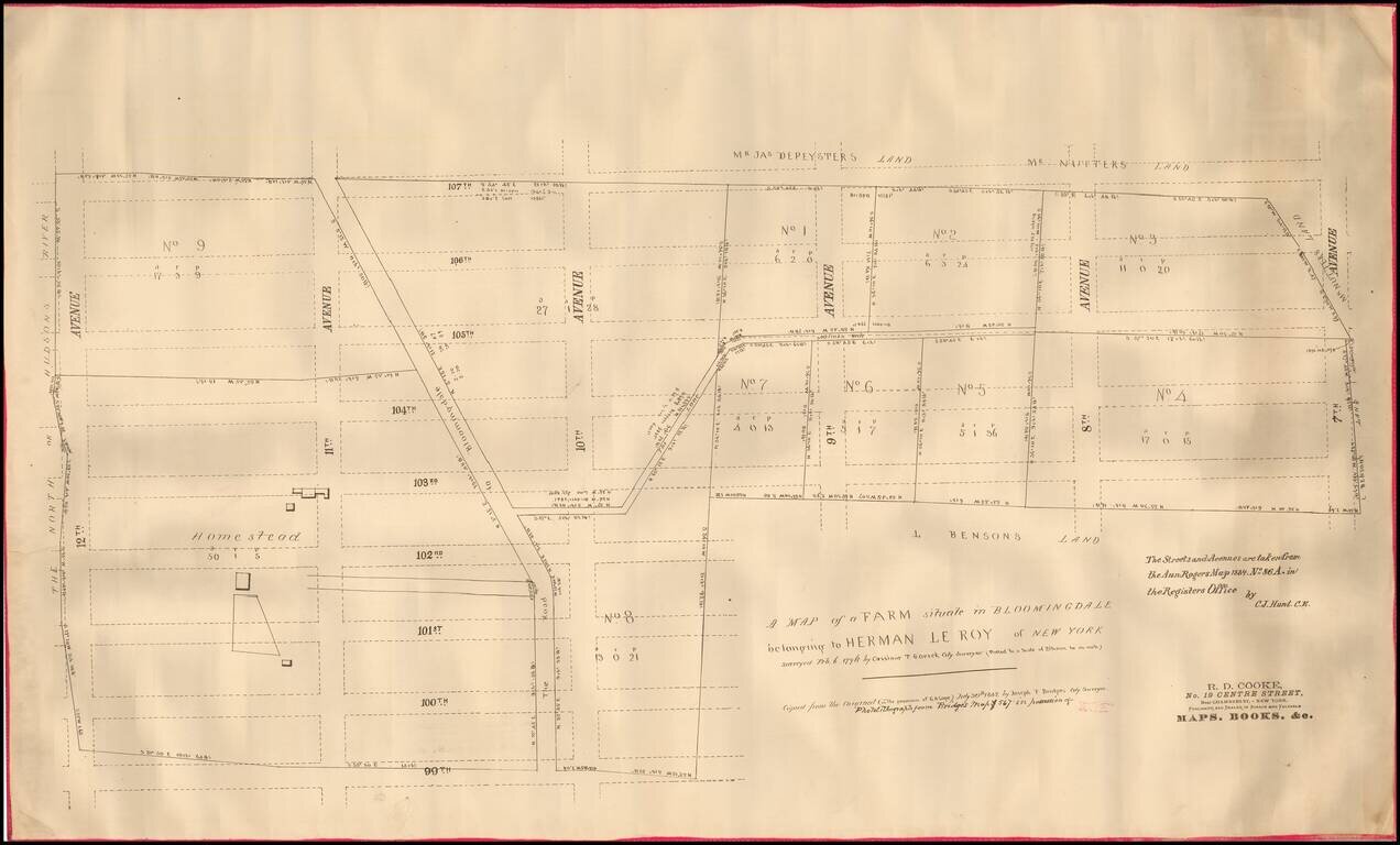
Rare, separately-issued, circa 1885 photolithographed copy of an 18th-century survey of the Upper West Side of Manhattan. The present map incorporates the work of two of Manhattan's greatest surveyors: Casimir Goerck and Joseph Bridges. The map shows...
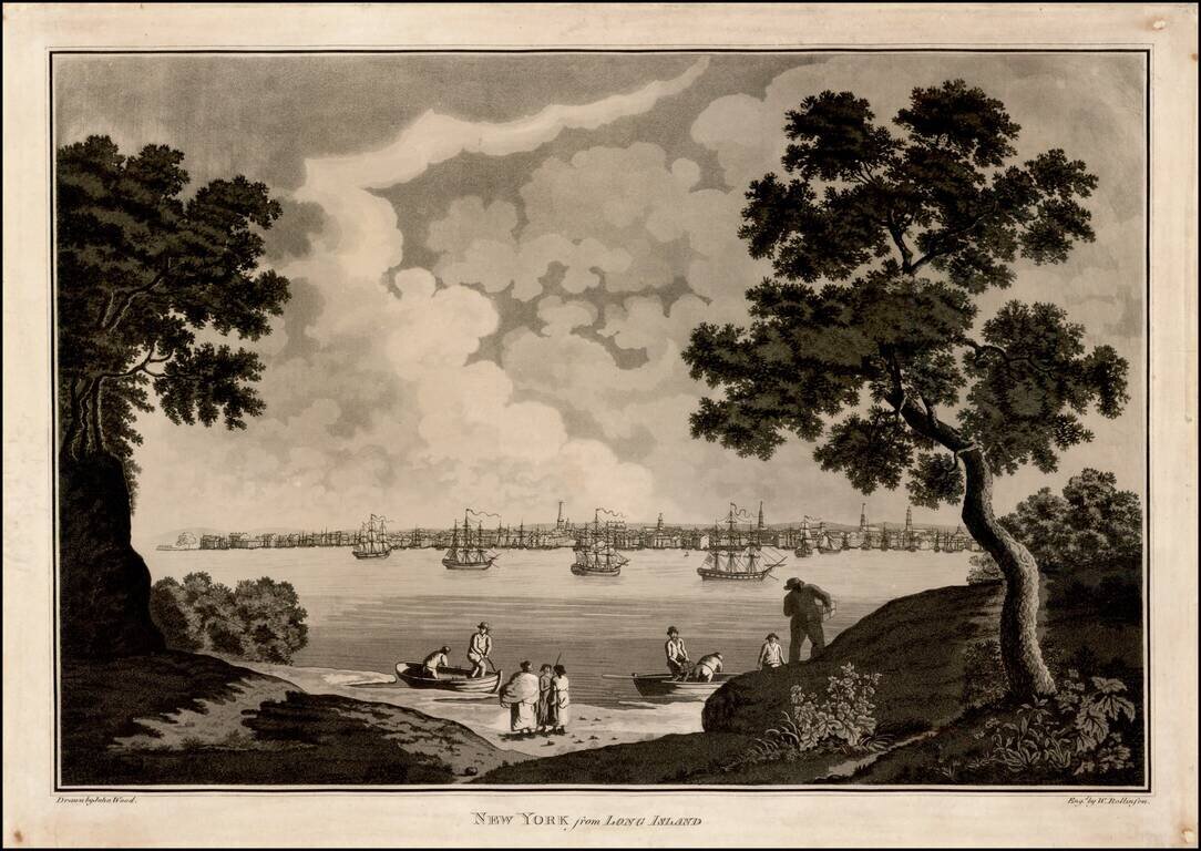
Fine early Acquatint view of New York City, engraved by William Rollinson. In this fine view, the artist, John Wood, records the city from the Battery to about Chambers Street as seen across the East River from Long Island. The horizon is punctuated...