Map size in jpg-format: 2.21535MiB
Click to open in high resolution (open in new tab).
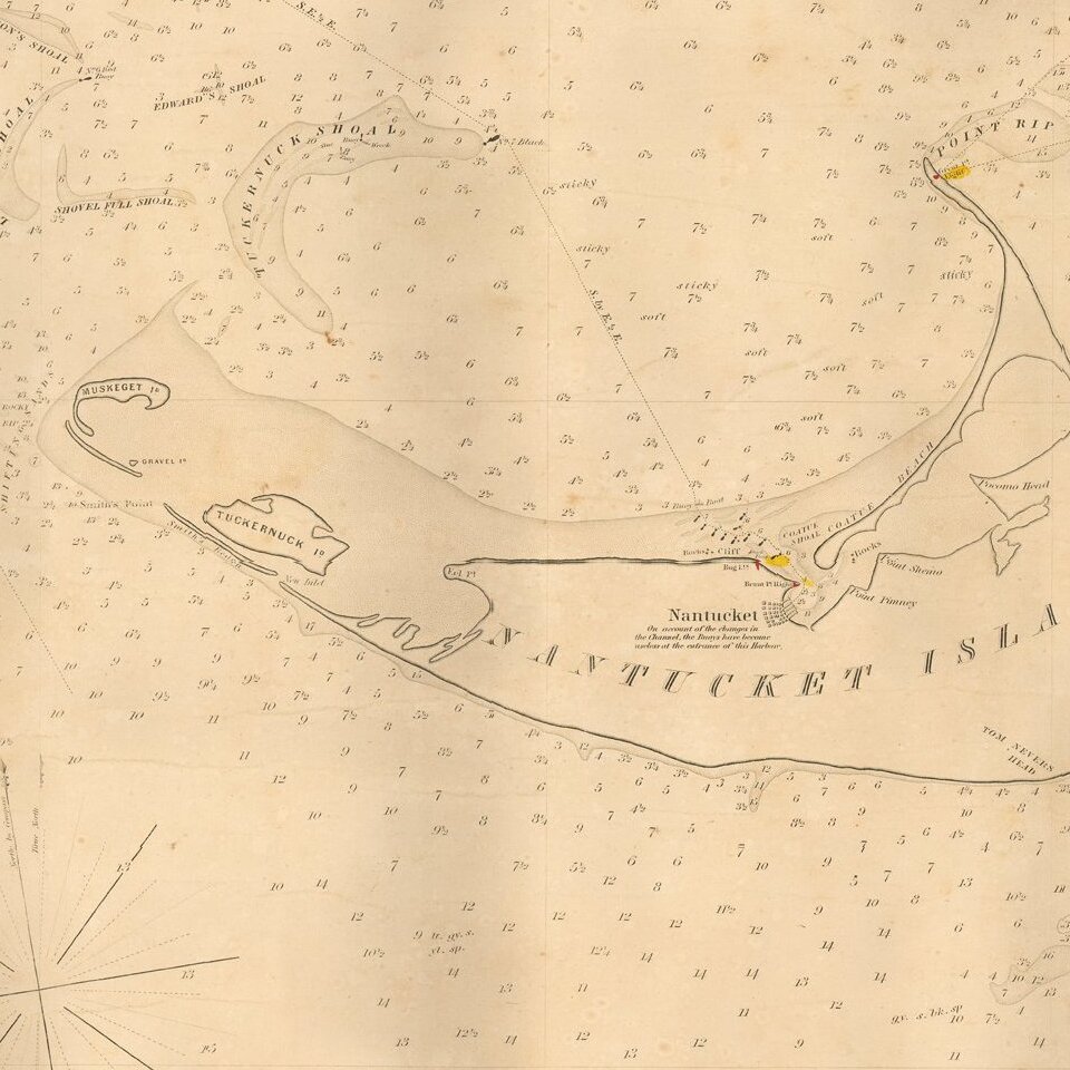
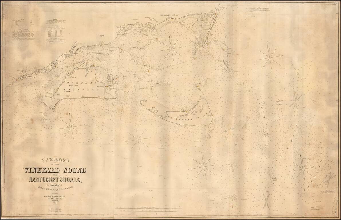
Fine large format sea chart of the waters around Martha's Vineyard and Nantucket, by George Eldridge, the leading private American chartmaker of the era.
This mammoth chart depicts, in detail, the waters around the Elizabeth Islands, Martha's Vineyard, Nantucket and Monomoy. Hundreds of soundings are given, along with notations about shoals and other hazards, lighthouses and other aids to navigation, sailing directions, & c. In line with Eldridge's other work, the whole is executed in a style that, while attractive, is functional and free of unnecessary information or adornment. As noted by Peter Guthorn:
"Although based upon the official Coast Surveys, the Eldridge charts were unsubsidized and more expensive. They survived because of good design, simplicity, omission of extraneous shore topography, legible sounding and notes, and the use of compass courses only.… Their loyal public, fishermen, coaster, tug masters, and yachtsmen, often continued to use obsolete Eldridge charts until the beginning of World War II." (Guthorn, p. 12).The first edition of this chart was issued in 1865, and was the improved successor to Eldridge's earlier Chart of Vineyard Sound, From Chatham Lights to Gay Head. Surveyed in 1850, 51, 52, 53 (1854). The present chart remained authoritative for almost 40 years, until it was succeeded by Eldridge's Chart C Vineyard Sound Lt. Ship to Chatham (1902).
George Eldridge (1821-1900) of Chatham, produced his first chart (of Monomoy shoals) in 1851 and over more than four decades issued numerous charts and pilot books covering the coast from New York to Maine. Guthorn offers a nice account of the beginning of his long and productive career:
"[Eldridge] had gone to sea with his fisherman father at an early age, and continued as a fisherman, coaster and local pilot, until an injury at sea in 1850 forced his convalescence ashore. He observed the effects of a new inlet which was formed during a furious storm in April 1851, creating new and dangerous shoals, in the path of vessels. He explored and sounded the new bar in his dory and drew a chart which was lithographed by Tappen [sic] & Bradford in Boston, [which] was an immediate success. Encouraged, he compiled a Chart of Vineyard Sound…" (p. 12).Eldridge's son George W. (1845-1914) later took over the business, and the family firm continued issuing charts through 1932.
A key chart for any collection of maps of coastal Massachusetts.
If you are a student, write to us in telegram: @antiquemaps and indicate what material you need and for what work you need a map in high detail. We are ready to provide material on special terms. For students only!