Map size in jpg-format: 26.1881MiB
Click to open in high resolution (open in new tab).
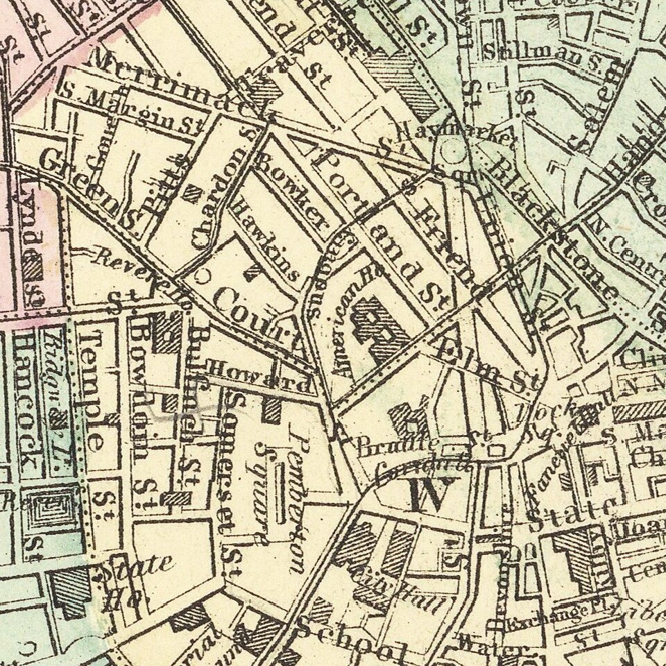
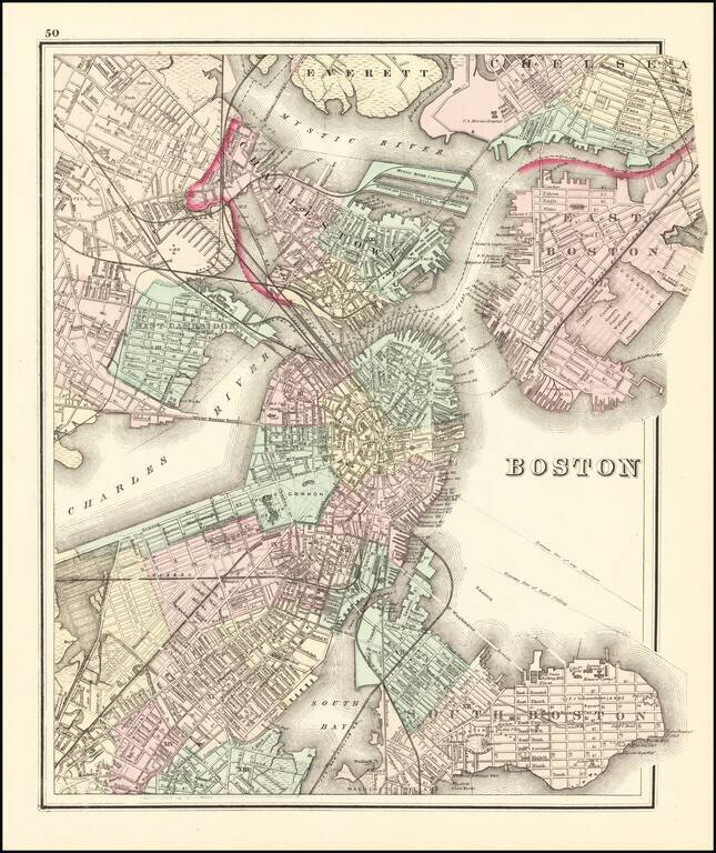
Fine example of OW Gray's map of Boston and the neighboring cities, showing marvelous local details throughout.
Extends to Brookline, Cambridge, Somerville, Everett, Chelsea, etc.
From one of the leading American map publisher's of the 1870s.
O. W. Gray was a publishing firm based in Philadelphia. Later, they published as O. W. Gray & Son. They published atlases in the late nineteenth century. Gray's National Atlas was one of the most successful commercial ventures of the 1870s and one of the last to employ hand coloring on maps.
If you are a student, write to us in telegram: @antiquemaps and indicate what material you need and for what work you need a map in high detail. We are ready to provide material on special terms. For students only!