Map size in jpg-format: 2.37102MiB
Click to open in high resolution (open in new tab).
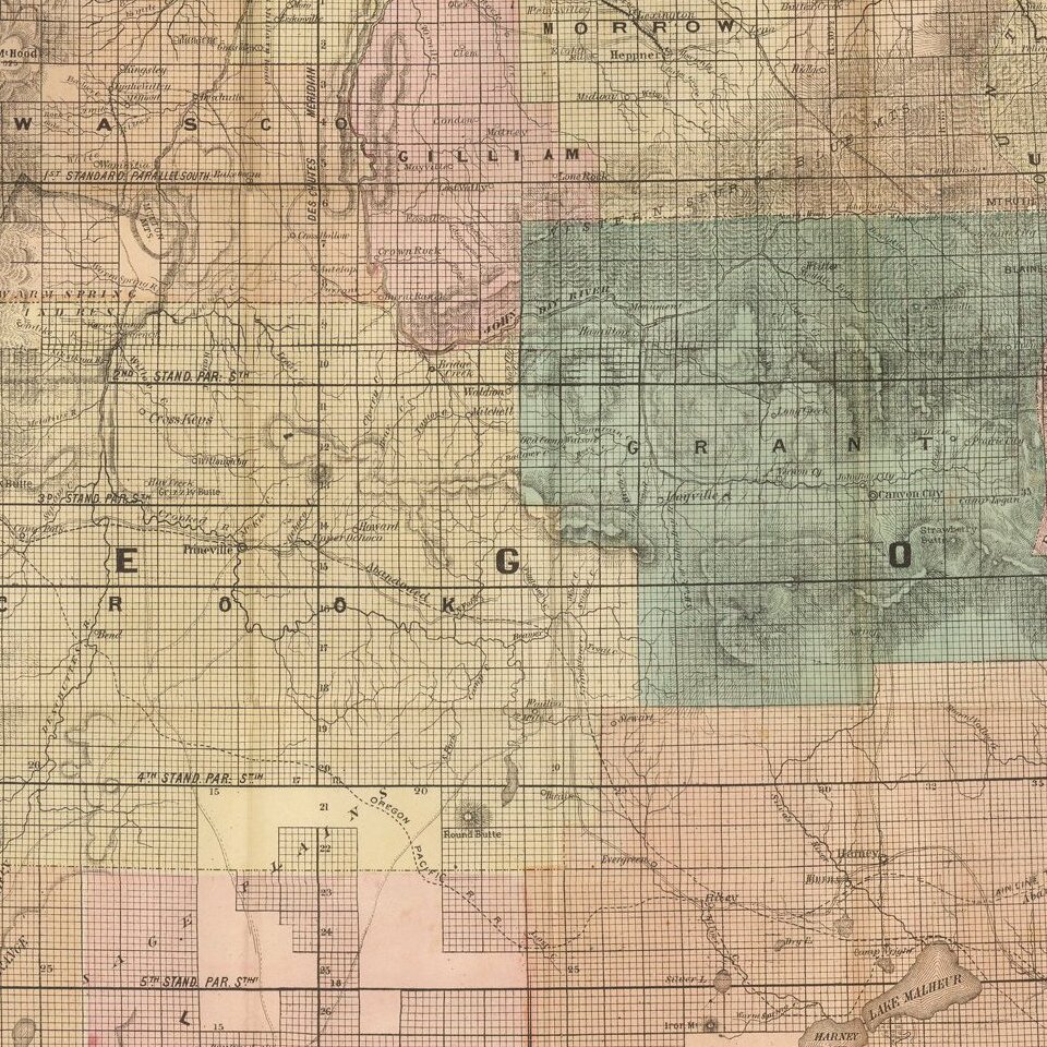
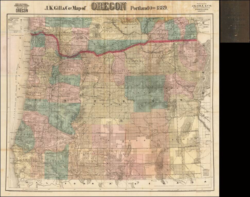
The Most Popular Separately Published Map of Oregon of Its Time -- Portland Publisher
Scarce separately issued map of Oregon by J.K. Gill, the leading local seller of books and stationary in Portland at the time.
Gill's maps were frequently updated. This map notes that it was "compiled and drawn by W.H. Galvani Civil Engineer US surveys, Railroads and other Corrections to April 1st 1889, by Geo. Stowell and John Gill."
Shows county boundaries, military and Indian reservations, railroads, lighthouses, stage routes, and wagon roads and trails.
Gill's maps of Oregon and Washington are highly prized for their detail and accuracy, being by far the best separately issued maps of these areas available to collectors.
If you are a student, write to us in telegram: @antiquemaps and indicate what material you need and for what work you need a map in high detail. We are ready to provide material on special terms. For students only!