logo

1950. Really see San Francisco by Grayline

  • Really see San Francisco by Grayline
  • Really see San Francisco by Grayline
  • Really see San Francisco by Grayline

Really see San Francisco by Grayline information:

Year of creation: 
Resolution size (pixels): 
 9759x5467 px
Disk Size: 
 24.4084MiB
Number of pages: 
 3
Place: 
 San Francisco
Author: 

Print information. Print size (Width x height in inches):
Printing at 72 dpi 
  135.54 х 75.93
Printing at 150 dpi 
 65.06 х 36.45
Printing at 300 dpi 
 32.53 х 18.22

An example of detailing the file of this map of in a printable high-resolution:

Click to open in high resolution (open in new tab).
Attention! this is just the central piece (central area 960x960 px) of the map file!
This is an example, so that you can see and study the level of detail of a given map. The entire Map will be fully available after payment!

Really see San Francisco by Grayline

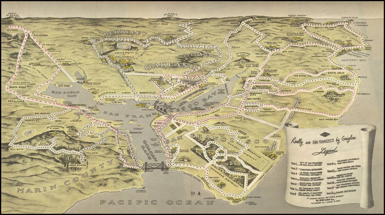
Birdseye view style map of the Bay Area, publisehd by the Gray LIne.

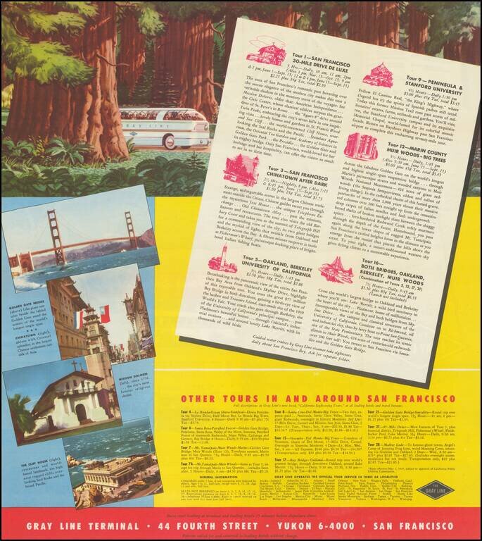
The map illustrates 13 Gray Line sightseeking tours around the Bay area, extending out to Napa Valley, Mt. Diablo, Yosemite, Monterey, Carmel by the Sea, Half Moon Bay and the Muir Woods, as well as tours in San Francisco and the South Bay and East Bay.

Centered on San Francisco Bay, with images of Stanford, Berkeley, several Missions and other points of interest.


Special conditions for students!

If you are a student, write to us in telegram: @antiquemaps and indicate what material you need and for what work you need a map in high detail. We are ready to provide material on special terms. For students only!

Item information:

Year of creation:
Size:
9759x5467 px
Disk:
24.4084MiB
Number of pages:
3
Place:
San Francisco
Author:
Gray Line.
$14.99

Related item