Map size in jpg-format: 166.518MiB
Click to open in high resolution (open in new tab).
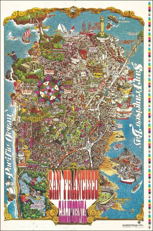
Decorative vintage pictorial map of San Francisco, published by Funny Funny World.
The map shows the city in an absolute hustle and bustle; a game is being plaid at Candlestick Park, ships are lined up all along the waterfront, certain important buildings and stadiums are named, as are major thoroughfares and neighborhoods. The map goes as far south as Lake Merced and as far north as the Golden Gate Bridge.
The map was illustrated by Henry Hinton.
This example was possibly a proof-print, with the color registration bars unremoved.
If you are a student, write to us in telegram: @antiquemaps and indicate what material you need and for what work you need a map in high detail. We are ready to provide material on special terms. For students only!
![[Signed Political Satire Artwork] Vietnam ... Vietnam ... Vietnam ...](/map/small/68726.jpg)

