
Rare old maps of the United States.
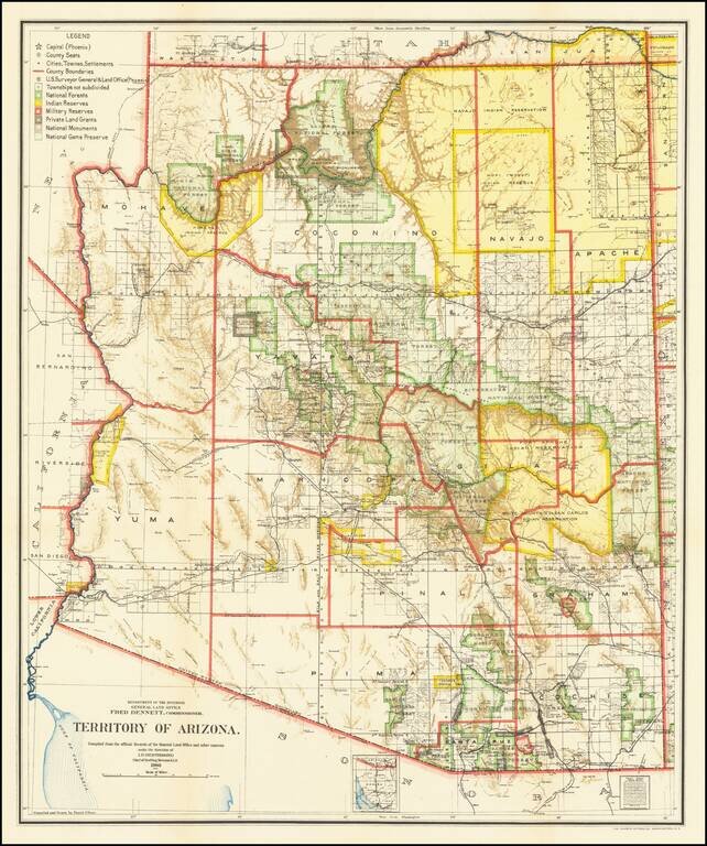
Fine Arizona Territorial Map One of the best and most highly detailed map of Arizona Territory of the period. The map was produced by the Dept. of the Interior, under the Supervision of Harry King. This edition is revised and reconstructed by R.H....
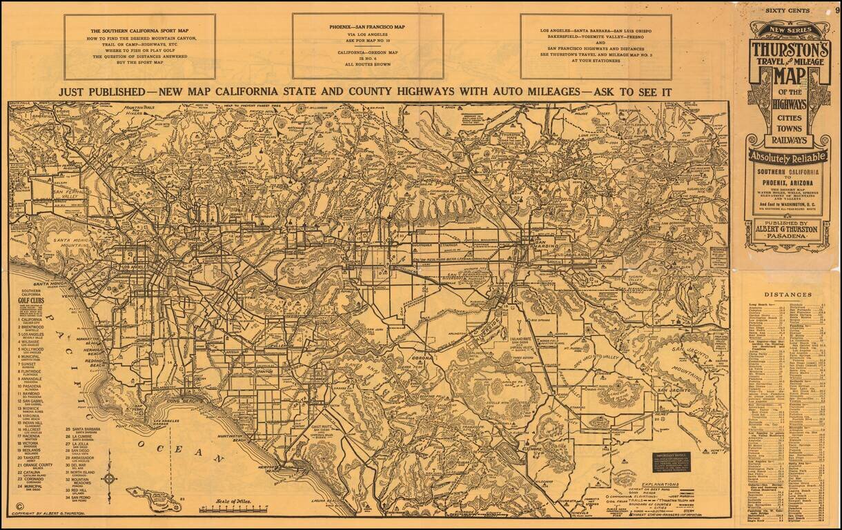
An Early Road Map of the Southwest Fantastic early automobile map of the Desert Regions between Southern California and Phoenix, published in 1915 by Albert G. Thurston and drawn by D.C. McClain. The desert map is quite extraordinary, providing a...
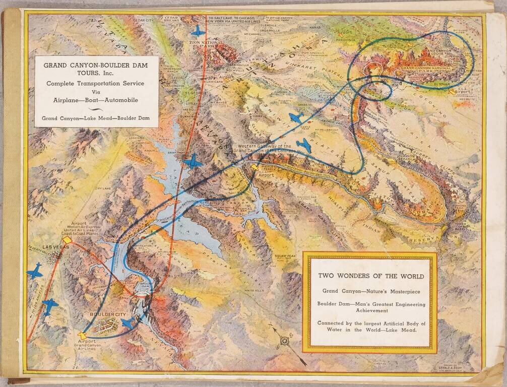
Pioneer Air Tours For The Grand Canyon July 1936 booklet outlining the services of the recently created Grand Canyon - Boulder Dam Tours Inc., with illustrated covers by famed pictorial map artist Gerald Eddy. The booklet outlines the tours offered...
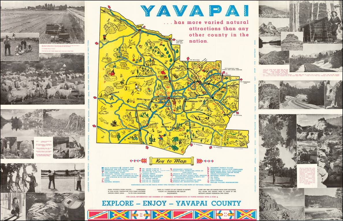
Lively promotional map of Yavapai County, Arizona, produced by the Yavapai Board of Supervisors. Centered on Prescott, Arizona, the map illustrates landmarks, tourist attractions, roads nd railroads, and is surrounded by photographs promoting the...
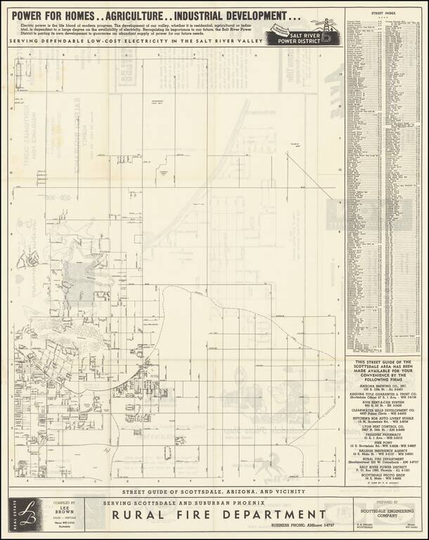
"The West's Most Western Town." Scarce promotional map of the area around Scottsdale, copyrighted by R.S. Knight in 1955. The Salt River Power District promotional text at the top of the map is especially insightful into the mindset of the region in...
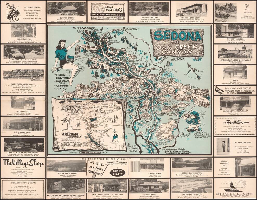
Bring Your Camera -- This is A Photographers Paradise! Rare pictorial promotional map, advertising Sedona and the Flagstaff area. The Sedona side provides a marvelous whimsical look at Sedona and Oak Creek Canyon, with its tourist attractions and...
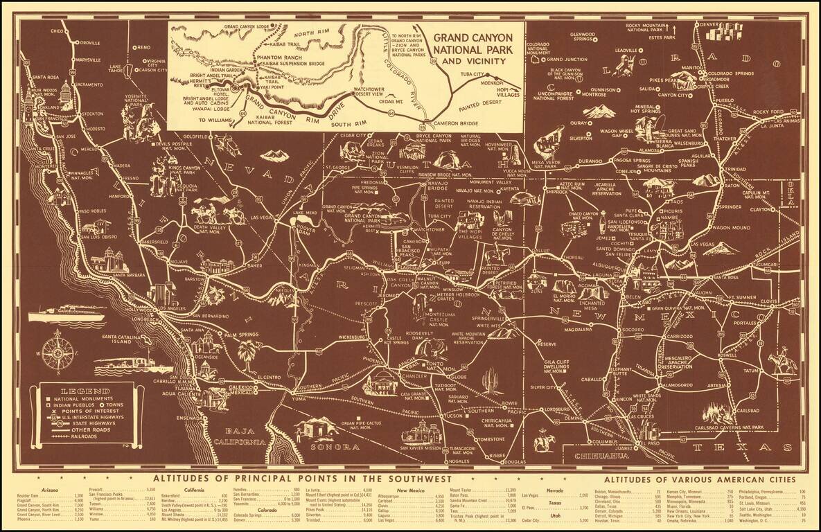
Scarce pictorial map of the American Southwest, published by Fred Harvey. The map provides a detailed pictorial image of the American Southwest, with an inset of the Grand Canyon. The verso includes a table of Indian Signs and Symbols, along with...
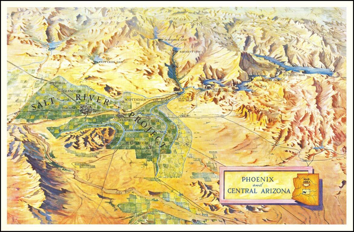
Scarce birdseye view style map of the area around Phoenix, highlighting the Salt River Project and the lands irrigated by the various canals in the area. The map shows a number of important early dams, including: Granite Reef Dam (built 1906-1908)...
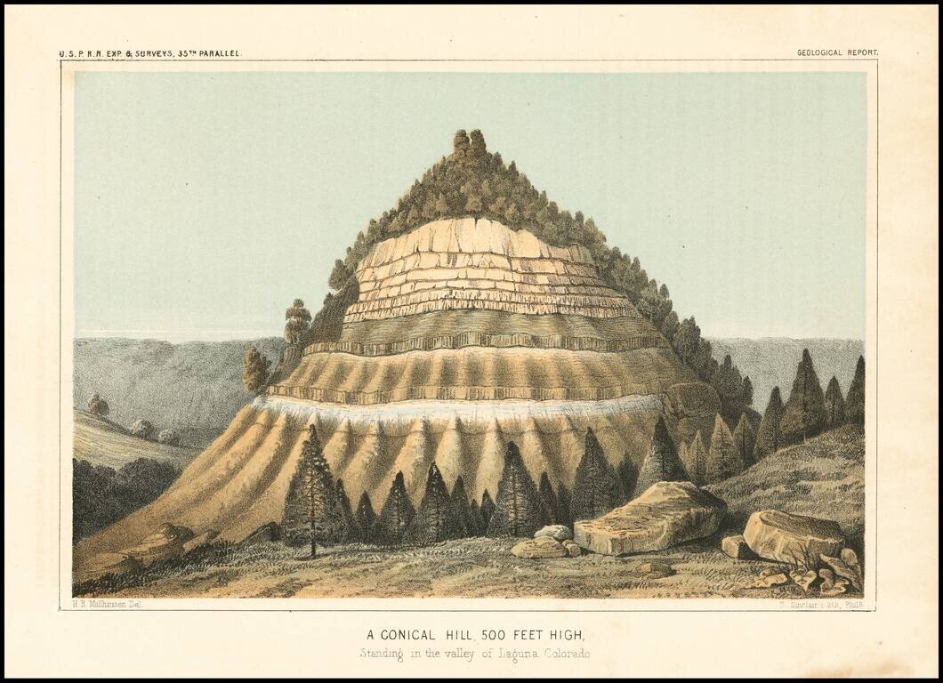
Detailed view of the Valley of the Kah Wee Yah River (Tulare River) and the Kings River. The expedition surveying the southern route along the 35th parallel, led by Lieutenant Amiel Weeks Whipple, explored from Little Rock, Arkansas, through Oklahoma,...
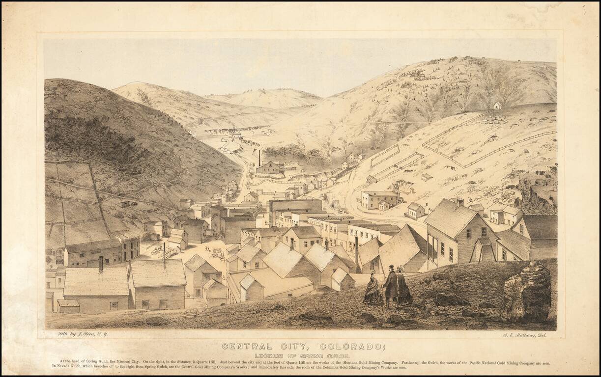
Nice example of this important early birdseye view of Central City, Colorado, from Alfred Edward Mathews Pencil Sketches of Colorado, published in 1866. The map shows Central City during its early boom period, looking toward Missouri City and Quartz...
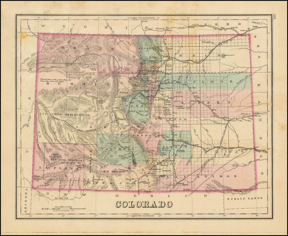
Interesting early map of Colorado, colored by counties. Shows towns, rivers, lakes, roads, mountains, and other details. In Southwestern Colorado, there is still no evidence of the coming mining boom which would be centered in areas such as...
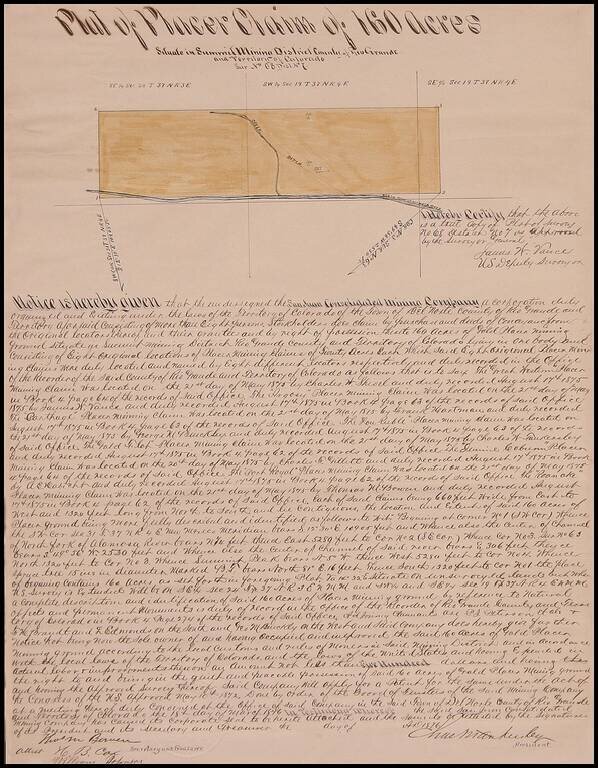
Fascinating manuscript survey issued by the San Juan Consolidated Mining Company, showing a plat of 160 acres north of the North Fork of the Alamosa River in Rio Grande County, Colorado Territory, signed by Thomas Meade Bowen, H.B. Cox and William...
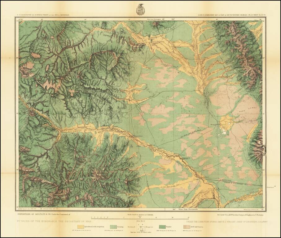
Detailed topographical map showing the region centered on Saguache County, Colorado. Shows towns, roads, mountains, rivers, lakes, hydrographical details, etc. The map was generated during the Wheeler Survey. The Wheeler Survey was a survey of a...
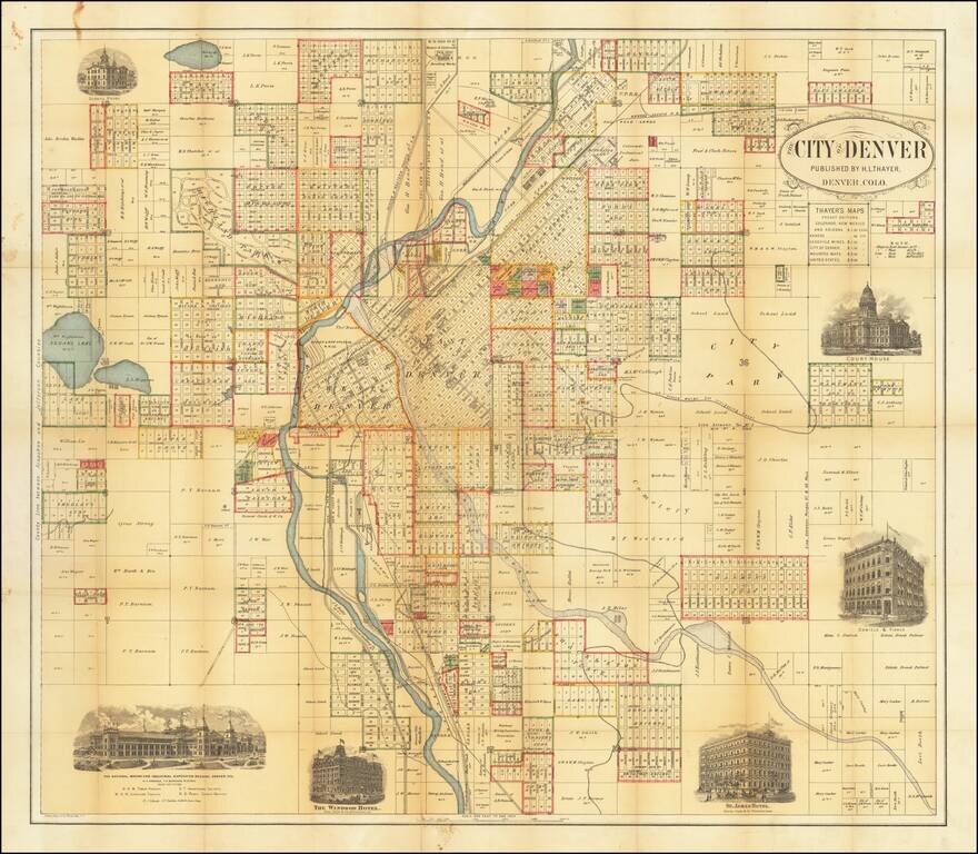
Rare Early Map of Denver Highly detailed map of the city of Denver, published by H.L. Thayer. The map is centered on the Platte River and includes the names of dozens of land owners, subdivisions and other details. In east Denver, the location of a...
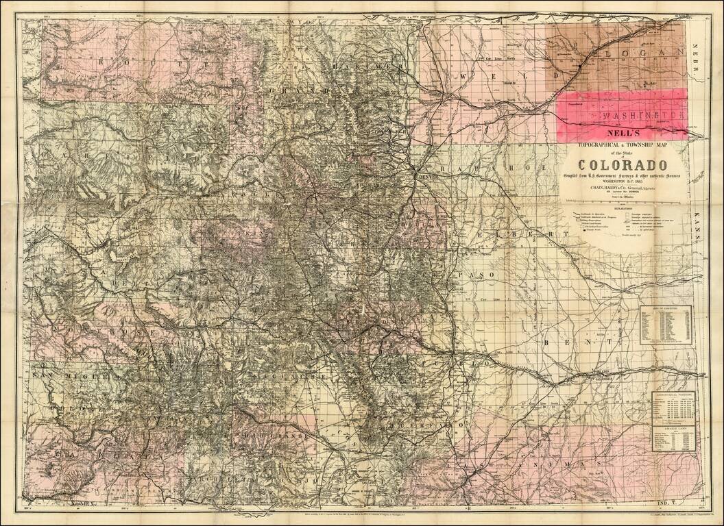
The rare 1885 edition of Nell's map of Colorado. A remarkably detailed map, certainly the most complete of Colorado to appear after statehood (1876). The map meticulously depicts the geographical and topographical details of the state, including...
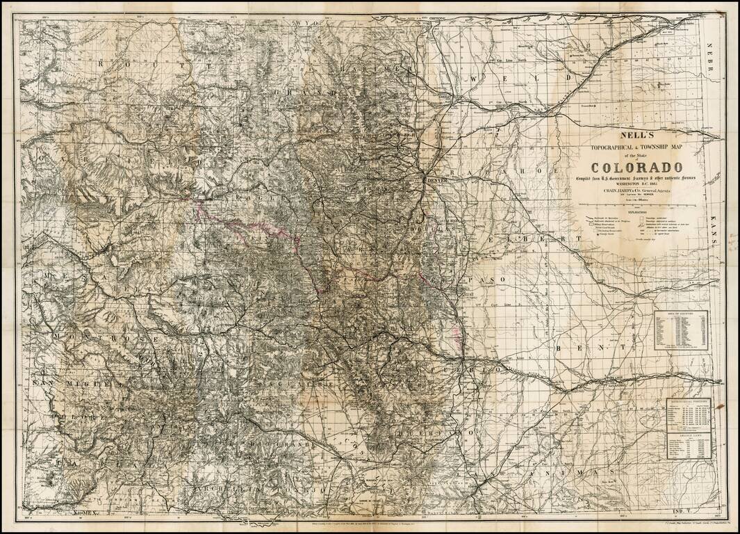
The rare 1885 edition of Nell's map of Colorado. A remarkably detailed map, certainly the most complete of Colorado to appear after statehood (1876). The map meticulously depicts the geographicaland topographical details of the state, . including...