
Rare old maps of the United States.
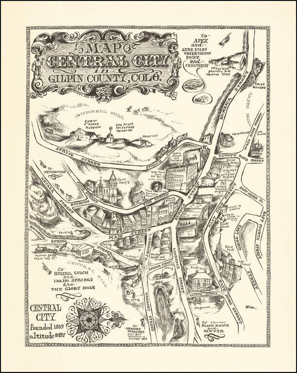
An Early Barbara Remington Illustration Attractive pictorial map of Central City, Colorado, drawn by Barbara Remington. The map is oriented with west at the top, showing the town spreading out along Eureka and Main Streets. Includes a decorative...
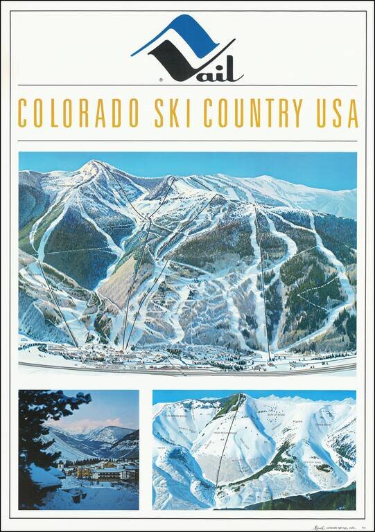
Fine early Hal Shelton Poster, promoting Vail, Colorado. Iconic promotional poster of Vail, published shortly after the addition of Gondola #2. The top image is a large traditional trail map, identifying ski lifts, trails, bowls, etc. with the...
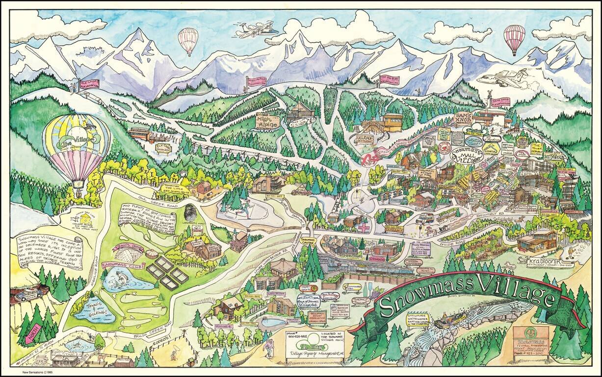
Decorative pictorial map of Snowmass Village, Colorado, drawn by artist James Giattino. The map promotes the recreational industries of Snowmass, both summer and winter. The ski mountain can be seen across the top, highlighting the four peaks...
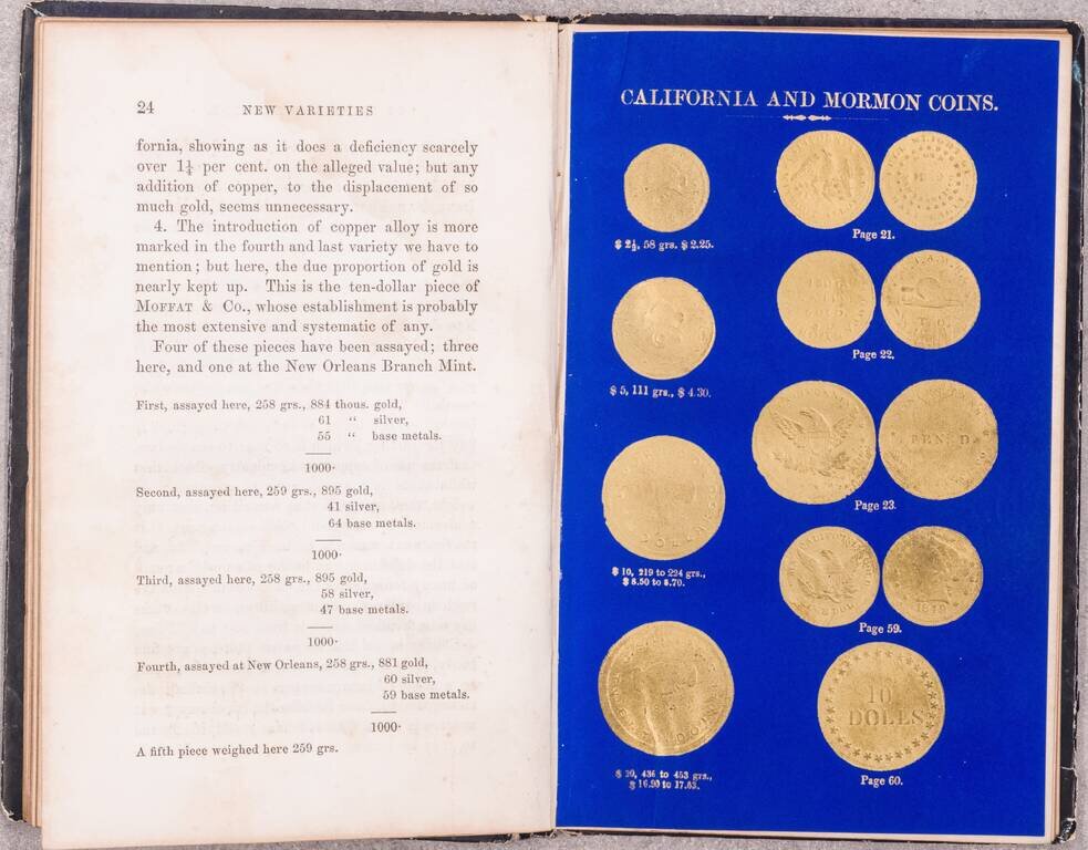
One of the Great American Numismatic Books of All Time, with Special Relevance for the California Gold Rush and Mormon Coins. Superb book on gold and coinage, by the official assayers of the Philadelphia Mint, Jacob R. Eckfeldt and William E. Du Bois....
![[Mormon State of Deseret] Nord America mit Westindien](/map/small/69513.jpg)
Detailed map of North America, published in Weimar in 1852. The map identifies the newly formed Territories of the western United States. Most notable is the location of the massive Utah oder Deseret Terr. (Utah or Deseret Territory). To the south,...
![Map of the Great Salt Lake and Adjacent Country in the Territory of Utah [with] The Great Salt Lake (Mormon) City And Surrounding Country](/map/small/67084.jpg)
The Earliest Atlas Map To Focus on The Salt Lake City Region and Mormon Settlements Two excellent early regional maps of the Salt Lake area. The upper map extends a bit west of the Lake to the Uintas and South to Lake Utah, as well as considerably...
![[Salt Lake City] La Nouvelle Jerusalem, ou La Grande Ville du Lac Sale (Amerique) . . .](/map/small/63205.jpg)
Large panoramic view of Salt Lake City, which appeared in a French Newspaper in 1863.
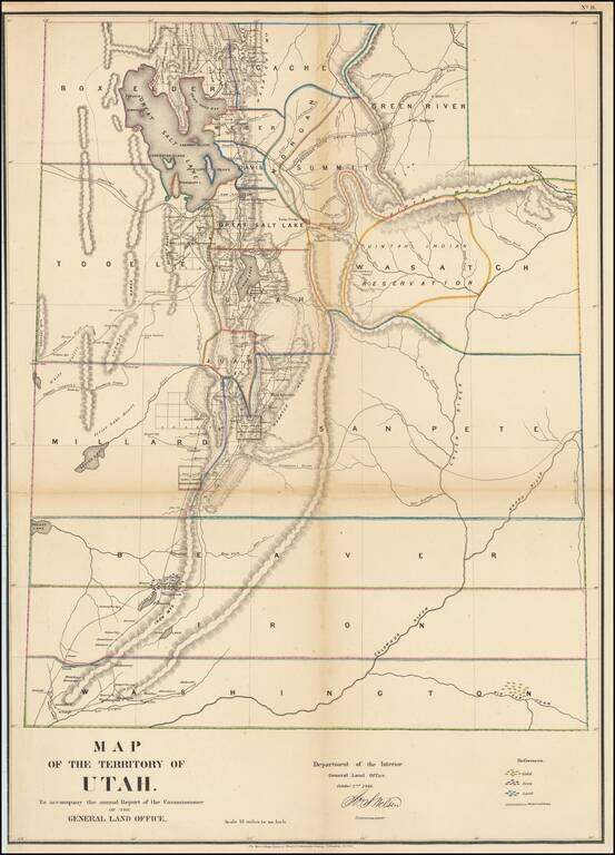
Important early map of Utah engraved by Major & Knapp for the General Land Office. This is perhaps the most detailed and accurate of all early Utah maps. The extent of the township surveys are noted. Gold, Iron & Lead mines are noted. Very...
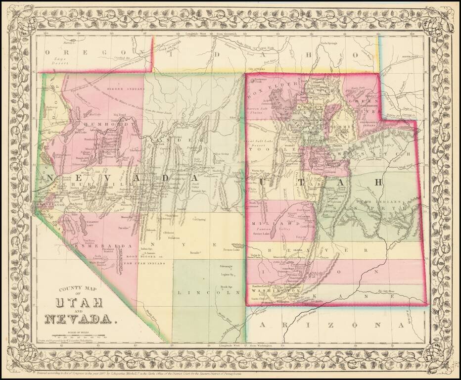
Detailed map of Nevada and Utah, colored by counties and showing towns, mountains, rivers, railroad lines, Indian Tribes, mining districts, etc. The first map of the region to appear in a commercial atlas. Decorative floral border.
![Map of the Territory of Utah [with] Great Salt Lake Valley [with] Plat of Salt Lake City Utah](/map/small/50620.jpg)
Scarce early promotional map of Utah, published shortly after the completion of the Transcontinental Railroad on May 10, 1869. The map includes large insets of the Salt Lake Valley and early Plat of the town, including a key locating 12 points of...
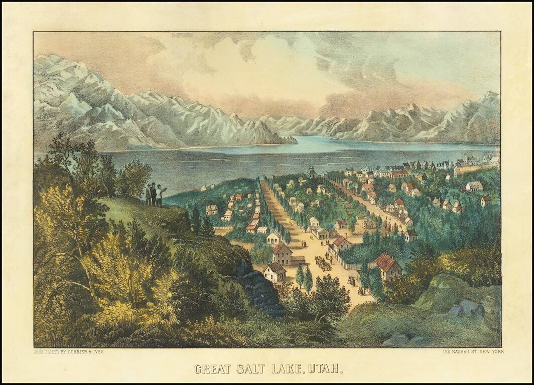
Interesting lithographic view of Salt Lake City, published by America's most famous 19th Century print makers. The town of Salt Lake unfolds in the foreground, published a bit more than 20 years after it was first settled.
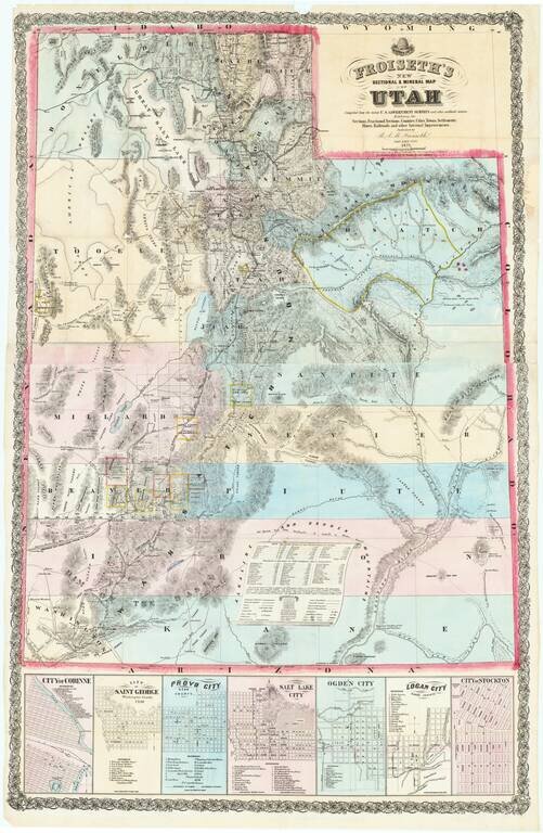
"A Pioneer Masterpiece -- Wonderful In Its Detail" (Carl Wheat) An exceptional large map of Utah, published by B.A.M. Froiseth in Salt Lake City and printed by A.L. Bancroft in San Francisco. The map is remarkably detailed, with particular artistry...
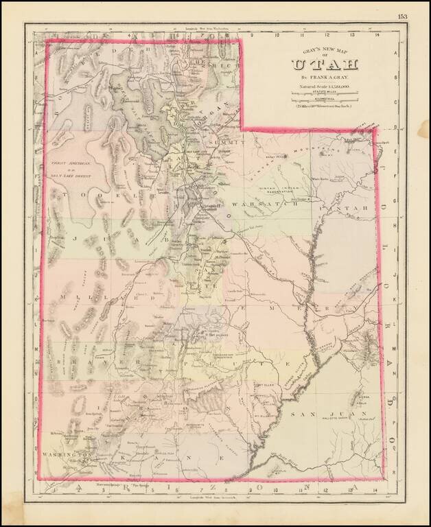
The First Atlas Map of Utah Territory in its Modern Configuration. Historically important early map of Utah, published by OW Gray. The map is colored by counties and showing early roads, rivers, mountains, railroads, mines, Indians, forts, etc....
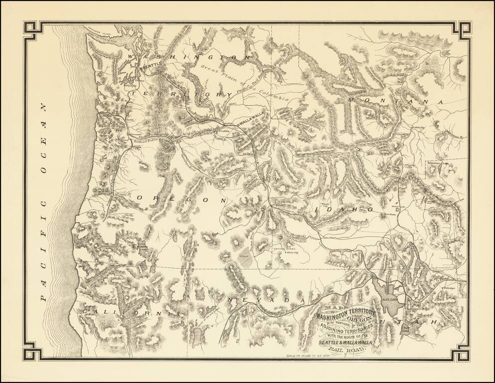
The First Map Printed in Seattle -- Seattle & Walla Walla Rairoad Map With Manuscript Corrections Likely In the Hand of the Maker Fine example of this rare map of the Pacific Northwest, illustrating the proposed route of the Seattle & Walla...
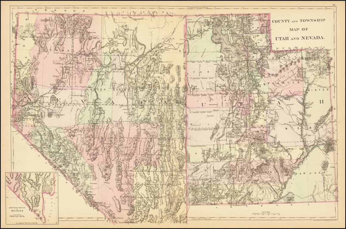
A detailed map of Utah and Nevada, colored by counties and showing towns, roads, railroads, rivers, lakes, and a host of other details. While earlier editions of the map include all of Utah but lack the southern tip of Nevada, this 1884 edition adds...
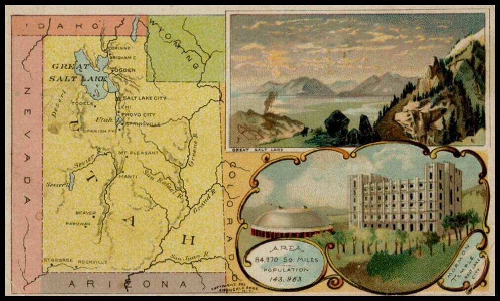
Decorative and unusual trading card map from this famous series. Map is surrounded by decorative vignette, showing Great Salt Lake and Mormon Temple. Includes population statistics.