Map size in jpg-format: 29.7763MiB
Click to open in high resolution (open in new tab).

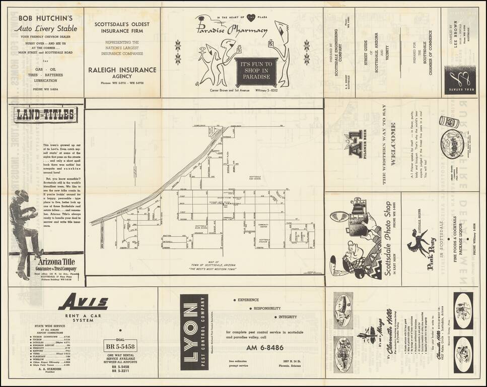
"The West's Most Western Town."
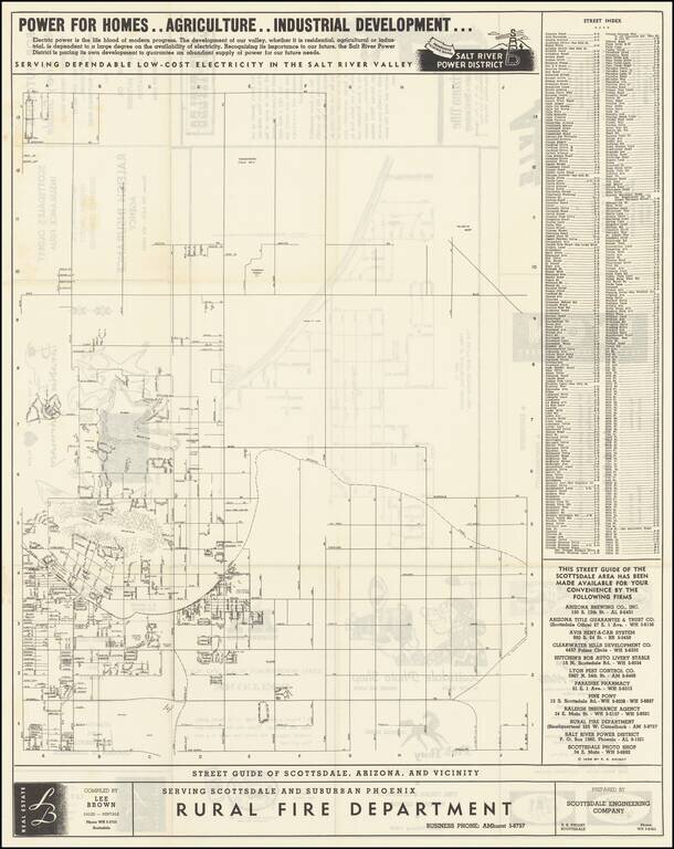
Scarce promotional map of the area around Scottsdale, copyrighted by R.S. Knight in 1955.
The Salt River Power District promotional text at the top of the map is especially insightful into the mindset of the region in 1955.
Power For Homes ... Agriculture .. Industrial Development
Electric power is the life blood of modern progress. The development of our valley, whether it is residential, agricultural or industrial, is dependent to a large degree on the availability of electricity. Recognizing its importance to our future, the Salt River Power District is pacing its own development to guarantee an abundant supply of power for our future needs.
On the verso is a map of the Town of Scottsdale, "The West's Most Western Town," surrounded by advertising.
Scottsdale
The map was issued only 4 years after the incorporation of Scottsdale in 1951, at a time when the population was 2,000, booming to 10,000 by 1960.
At the beginning of the 20th century, the development of ranching operations in the area would later inspire the “West’s Most Western Town” moniker.
The Depression Era saw an influx of artists and architects to Scottsdale, including the renowned Frank Lloyd Wright. In 1937, Wright and his wife purchased 600 desert acres at the foot of the McDowell Mountains and built Taliesin West, which became Wright's winter home and his architectural firm’s Southwestern headquarters.
During World War II, the Thunderbird II Airfield opened in 1942, where 5,500 pilot cadets received their primary flight training before the war’s end.
In 1947, the Scottsdale Chamber of Commerce was formed and Scottsdale made a conscious effort to promote a special identity, linked to the Old West, as a reflection of the city’s roots and as a draw for tourists. The chamber established a Western design theme for the downtown and adopted the “West’s Most Western Town” as Scottsdale’s slogan.
Rarity
Our records indicate this is the only map of Scottsdale that we have ever offered for sale.
If you are a student, write to us in telegram: @antiquemaps and indicate what material you need and for what work you need a map in high detail. We are ready to provide material on special terms. For students only!

![Mexique par Th. Duvotenay…1843 [Republic of Texas]](/map/small/67925.jpg)
