logo

1954. Yavapai

  • Yavapai
  • Yavapai

Map size in jpg-format: 119.595MiB

Download "Yavapai", in high resolution.

Yavapai information:

Year of creation: 
Resolution size (pixels): 
 22165x14328 px
Disk Size: 
 119.595MiB
Number of pages: 
 2
Place: 
 Prescott, AZ
Author: 

Print information. Print size (Width x height in inches):
Printing at 72 dpi 
  307.85 х 199
Printing at 150 dpi 
 147.77 х 95.52
Printing at 300 dpi 
 73.88 х 47.76

An example of detailing the file of this map of in a printable high-resolution:

Click to open in high resolution (open in new tab).
Attention! this is just the central piece (central area 960x960 px) of the map file!
This is an example, so that you can see and study the level of detail of a given map. The entire Map will be fully available after payment!

Yavapai

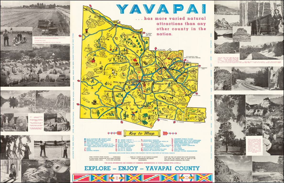
Lively promotional map of Yavapai County, Arizona, produced by the Yavapai Board of Supervisors.

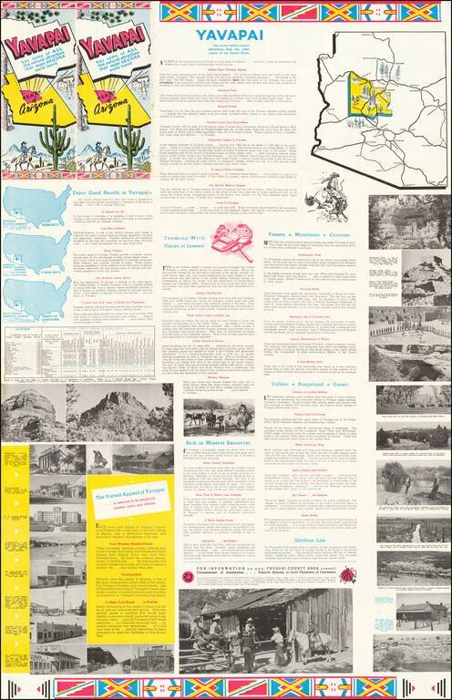
Centered on Prescott, Arizona, the map illustrates landmarks, tourist attractions, roads nd railroads, and is surrounded by photographs promoting the region. The verso of the map includes promotional information promoting the local economy and the climate and health benefits of the region

Artwork produced by Arnold La Benz, with the map drawn by Lester Bierbaum.


Special conditions for students!

If you are a student, write to us in telegram: @antiquemaps and indicate what material you need and for what work you need a map in high detail. We are ready to provide material on special terms. For students only!

Item information:

Year of creation:
Size:
22165x14328 px
Disk:
119.595MiB
Number of pages:
2
Place:
Prescott, AZ
Author:
Lester Bierbaum.
$21.99

Related item