Map size in jpg-format: 1.54785MiB
Click to open in high resolution (open in new tab).
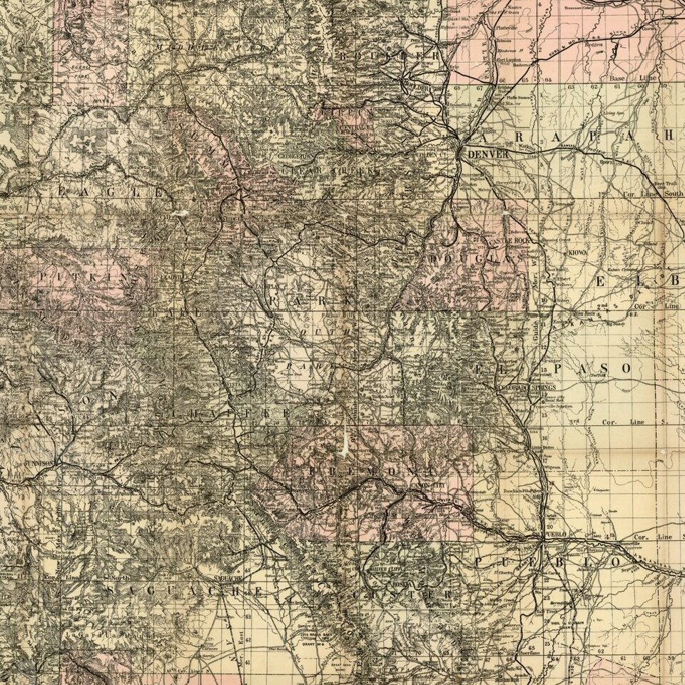
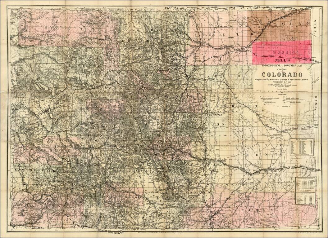
The rare 1885 edition of Nell's map of Colorado. A remarkably detailed map, certainly the most complete of Colorado to appear after statehood (1876). The map meticulously depicts the geographical and topographical details of the state, including mountain elevations. Wagon roads, trails, and railroads both existing and proposed are depicted. Counties are shown in different colors. Nell was worked on the 1871-1879 Wheeler Surveys and gained a significant amount of information from this work, which he ultimately employed in producing what is without doubt the best large format map of the state of the period and became a huge commercial success. Nell notes railroads, proposed railroads, wagon roads, proposed wagon roads, trails, county seats, post offices, villages, townships subdivided and surveyed, contour lines, military reservations, private grants, areas of each county, astronomical positions, arable lands, and a host of other details. Nell succeeded Thayer as the most important map maker in Colorado and continued publishing maps until the early 1900s. An essential map for Colorado collectors.
If you are a student, write to us in telegram: @antiquemaps and indicate what material you need and for what work you need a map in high detail. We are ready to provide material on special terms. For students only!
![Mexique par Th. Duvotenay…1843 [Republic of Texas]](/map/small/67925.jpg)
