Map size in jpg-format: 37.1424MiB
Click to open in high resolution (open in new tab).
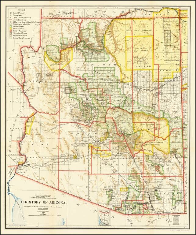
Fine Arizona Territorial Map
One of the best and most highly detailed map of Arizona Territory of the period.
The map was produced by the Dept. of the Interior, under the Supervision of Harry King. This edition is revised and reconstructed by R.H. Morton. The legend notes the various US Surveyor General's offices in the Territory, US Land Offices, Indian Reservations, Military Reservations, Private Claims Confirmed, Private Claims Unconfirmed, and Townships not yet subdivided.
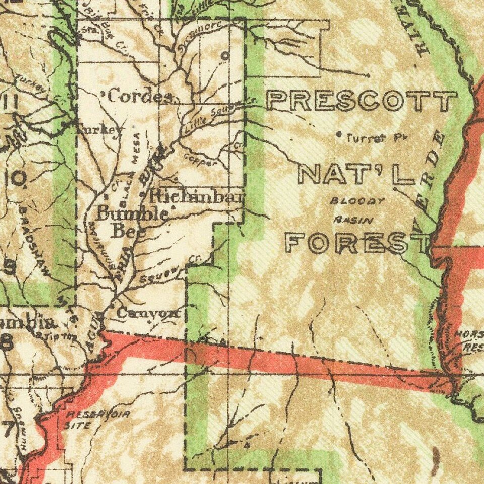
The map notes towns, roads, railroads, railway and stagecoach stations, mines, wells, mountains, rivers, and a host of other details.
The General Land Office (GLO) refers to the independent agency in the United States that was in charge of public domain lands. Created in 1812, it assumed the responsibilities for public domain lands from the United States Department of the Treasury. The Treasury had overseen the survey of the Northwest Territory, but as more area was added to the United States, a new agency was necessary to survey the new lands.
Eventually, the GLO would be responsible for the surveying, platting, and sale of the majority of the land west of the Mississippi, with the exception of Texas. When the Secretary of the Interior was created in 1849, the GLO was placed under its authority. Until the creation of the Forest Service in 1905, the GLO also managed forest lands that had been removed from public domain. In additional to managing the fees and sales of land, the GLO produced maps and plans of the areas and plots they surveyed. In 1946, the GLO merged with the United States Grazing Service to become the Bureau of Land Management.
If you are a student, write to us in telegram: @antiquemaps and indicate what material you need and for what work you need a map in high detail. We are ready to provide material on special terms. For students only!

![Mexique par Th. Duvotenay…1843 [Republic of Texas]](/map/small/67925.jpg)
