Map size in jpg-format: 29.5798MiB
Click to open in high resolution (open in new tab).

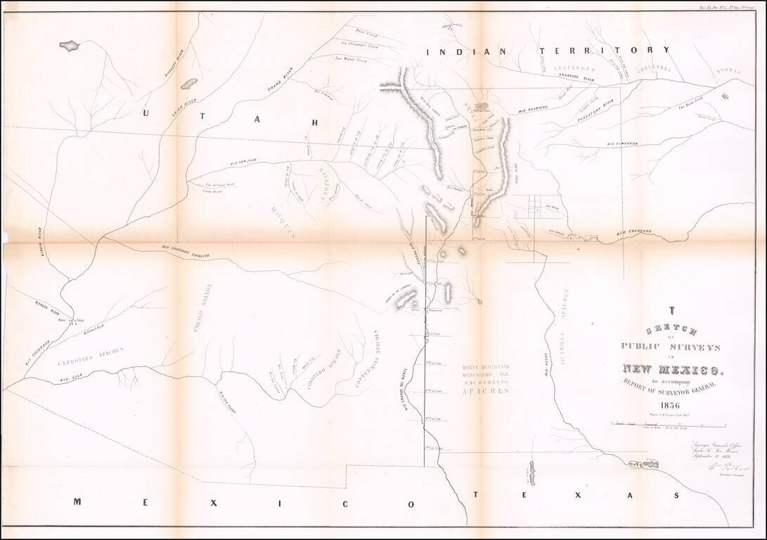
Interesting early map of New Mexico and Arizona, published by the General Land Office.
The map extends from the confluence of the Colorado and Gila Rivers to Nicollet River in the northwest, the Rio Pecos in the southwest and Bent's Fort, the Arkansas, Cimmaron and Canadian Rivers in the northwest.
The focus of the surveys is along the Rio Grande in the Santa Fe and Taos area. Many Indian tribes named, including the Apaches Tontos, Coytero Apaches, Garotero Apaches, Copper Mine Appaches, White Mt. Meszcalero and Sacremento Apaches, Jicarillo apaches, Moquis, Navajoes, Arapahoes, Cheyennes and Kiowas.
If you are a student, write to us in telegram: @antiquemaps and indicate what material you need and for what work you need a map in high detail. We are ready to provide material on special terms. For students only!
![Carte Du Mexique et de la Floride des Terres Angloises et des Isles Antilles du Cours et des Environs de la Riviere Mississipi . . . Rue Des Canettes . . . 1703 [1st State]](/map/small/66307op.jpg)