logo

1856. Map No. 5 From The Humboldt Mountains To The Mud Lakes; from Explorations and surveys made under the direction of the Hon. Jefferson Davis Secretary of War by Capt. E.G. Beckwith 3d. Artillery E.W. Egloffstein Topographer for the Route 1855.

  • Map No. 5 From The Humboldt Mountains To The Mud Lakes; from Explorations and surveys made under the direction of the Hon. Jefferson Davis Secretary of War by Capt. E.G. Beckwith 3d. Artillery E.W. Egloffstein Topographer for the Route 1855.

Map No. 5 From The Humboldt Mountains To The Mud Lakes; from Explorations and surveys made under the direction of the Hon. Jefferson Davis Secretary of War by Capt. E.G. Beckwith 3d. Artillery E.W. Egloffstein Topographer for the Route 1855. information:

Year of creation: 
Resolution size (pixels): 
 2216x2524 px
Disk Size: 
 1.063MiB
Number of pages: 
 1
Place: 
 Washington, D.C.

Print information. Print size (Width x height in inches):
Printing at 72 dpi 
  30.78 х 35.06
Printing at 150 dpi 
 14.77 х 16.83
Printing at 300 dpi 
 7.39 х 8.41

An example of detailing the file of this map of in a printable high-resolution:

Click to open in high resolution (open in new tab).
Attention! this is just the central piece (central area 960x960 px) of the map file!
This is an example, so that you can see and study the level of detail of a given map. The entire Map will be fully available after payment!

Map No. 5 From The Humboldt Mountains To The Mud Lakes; from Explorations and surveys made under the direction of the Hon. Jefferson Davis Secretary of War by Capt. E.G. Beckwith 3d. Artillery E.W. Egloffstein Topographer for the Route 1855.

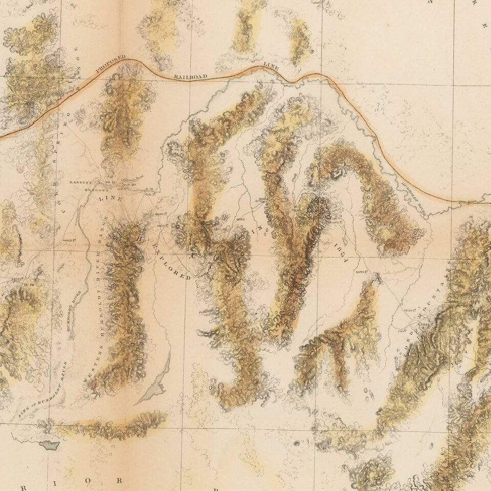
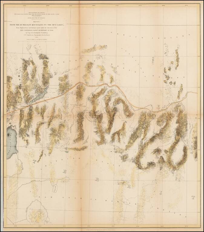
A detailed map of Northwestern Nevada, showing Pyramid Lake, the Carson River, Walker River and northern part of Walker Lake and extended East to the Elko area and the south fork of the Humboldt River.

Wheat considers this an excellent map "due in large part to Egloffstein's work as Topographer for the Route."


Special conditions for students!

If you are a student, write to us in telegram: @antiquemaps and indicate what material you need and for what work you need a map in high detail. We are ready to provide material on special terms. For students only!

Item information:

Year of creation:
Size:
2216x2524 px
Disk:
1.063MiB
Number of pages:
1
Place:
Washington, D.C.
Author:
U.S. Pacific RR Surveys.
$14.99

Related item