Map size in jpg-format: 7.58336MiB
Click to open in high resolution (open in new tab).

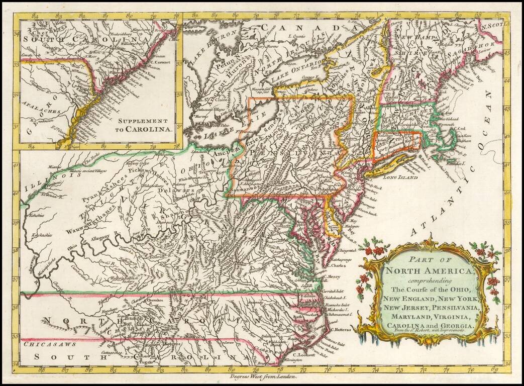
Detailed map of the British Colonies in North America during the French & Indian War.
The map is based on Robert de Vaugondy's folio map of the same period and is filled with detail of early settlement, Indian villages and topography. The colonies are shown extending to the Illinois and Mississippi Rivers. Large inset of South Carolina and part of Georgia is at upper left. Virginia and the Carolinas extending to the Mississippi River.
If you are a student, write to us in telegram: @antiquemaps and indicate what material you need and for what work you need a map in high detail. We are ready to provide material on special terms. For students only!
![[The First Maps in a la poupée Printed Color] Cartes en Couleur des Lieux Sujets aux tremblements de Terre Dans toutes les parties du Monde Selon le Sisteme de l’impulsion Solaire](/map/small/52293op.jpg)

