Map size in jpg-format: 1.06727MiB
Click to open in high resolution (open in new tab).
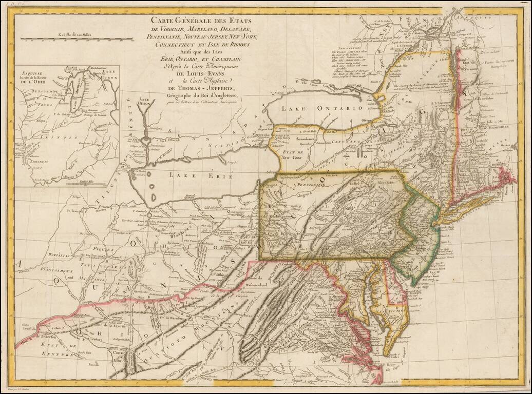
Nice example of the French edition of the scarce Lewis Evans' map of the Middle British Colonies, one of the most important maps of the British Colonies published in the 18th Century.
Evans' map provides a dramatic update in the region covered, based upon his first hand explorations and compilations undertaken prior to the French & Indian War.
Along with Mitchell's map of North America issued in the same year, the Evans is considered the most important American map of the 18th Century. Both maps were intended to spur western expansion into the Trans-Allegheny, Ohio Valley and regions westward and were issued in response to French encroachments into the region, prior to the French & Indian War. Evans worked with a number of the great frontiersman and guides of the period in compiling the map. Evans' map became the standard for nearly 50 years, being re-issued in a number of pirated editions, by Jefferys, Sayer Kitchen, Bowles and others.
The map is a milestone both for its political significance and extension of cartographic knowledge in the region. The present example appeared in the French edition of Crevecouer's Letters From An American Farmer.
If you are a student, write to us in telegram: @antiquemaps and indicate what material you need and for what work you need a map in high detail. We are ready to provide material on special terms. For students only!
![[Wall Map] West-Indische Paskaert waer in de graden der breedde over weder zyden vande middelyn wassende so vergrooten dat die geproportioneert syn tegen hunne nevenstaende graden de lengde.](/map/small/60169.jpg)

![[The First Maps in a la poupée Printed Color] Cartes en Couleur des Lieux Sujets aux tremblements de Terre Dans toutes les parties du Monde Selon le Sisteme de l’impulsion Solaire](/map/small/52293op.jpg)