Map size in jpg-format: 1.21067MiB
Click to open in high resolution (open in new tab).

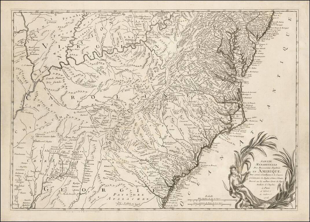
One of the Earliest Regional Maps of The Southern Theater of War Published in Paris.
Rare separately published map of the Southern British Colonies, shown at a time when the French were just beginning to actively join the American Rebel cause in 1778. The map is one of the first maps published following the alliance formed between France and the American Colonies, in February 1778.
The map extends along the Atlantic coast from Philadelphia to Jekyll Island, Georgia, and inland to the Mississippi River, including excellent details in the Ohio Valley.
Among the more unusual features is a Welsh settlement shown near Craven County and "Palatines," near present-day New Bern.
The map was created by Verrier and Perrier, who assumed management of Roch-Josèphe Julien's establishment in 1777, which has been called "the first true map shop in Paris." The map was created in response to the French public's demand for maps of the American Colonies, following France's formal entry into the Revolutionary War, pursuant to the Treaty of Alliance of February, 1778, a resulted of the relentless efforts of Benjamin Franklin.
The present map was drawn largely from John Mitchell's A Map of the British & French Dominions in North America (1755), which was by far the era's most influential map of the subject. At the time of the creation of the map, a French expeditionary force led by Comte D'Estaing was then in route to join the Americans in contesting the British Royal Navy. The British had effective control of Canada, New York City and Newport, Rhode Island, but were preparing a dramatic southern offensive which would see them seizing Savannah, Georgia, in December, 1778.
Ambrose Verrier and Francoise Perrier were apprentice engravers who succeeded their employer, Roch-Joseph Julien in his Paris map shop, located at the Hotel de Soubise in 1777.
If you are a student, write to us in telegram: @antiquemaps and indicate what material you need and for what work you need a map in high detail. We are ready to provide material on special terms. For students only!
![[Wall Map] West-Indische Paskaert waer in de graden der breedde over weder zyden vande middelyn wassende so vergrooten dat die geproportioneert syn tegen hunne nevenstaende graden de lengde.](/map/small/60169.jpg)

![[The First Maps in a la poupée Printed Color] Cartes en Couleur des Lieux Sujets aux tremblements de Terre Dans toutes les parties du Monde Selon le Sisteme de l’impulsion Solaire](/map/small/52293op.jpg)