logo

1880. General Map of the Lead Region Showing the Distribution of the Lodes . . . By James Wilson, Jr. 1880

  • General Map of the Lead Region Showing the Distribution of the Lodes . . . By James Wilson, Jr.  1880

General Map of the Lead Region Showing the Distribution of the Lodes . . . By James Wilson, Jr. 1880 information:

Year of creation: 
Resolution size (pixels): 
 19302x15838 px
Disk Size: 
 58.0889MiB
Number of pages: 
 1
Place: 
 n.p.

Print information. Print size (Width x height in inches):
Printing at 72 dpi 
  268.08 х 219.97
Printing at 150 dpi 
 128.68 х 105.59
Printing at 300 dpi 
 64.34 х 52.79

An example of detailing the file of this map of in a printable high-resolution:

Click to open in high resolution (open in new tab).
Attention! this is just the central piece (central area 960x960 px) of the map file!
This is an example, so that you can see and study the level of detail of a given map. The entire Map will be fully available after payment!

General Map of the Lead Region Showing the Distribution of the Lodes . . . By James Wilson, Jr.  1880

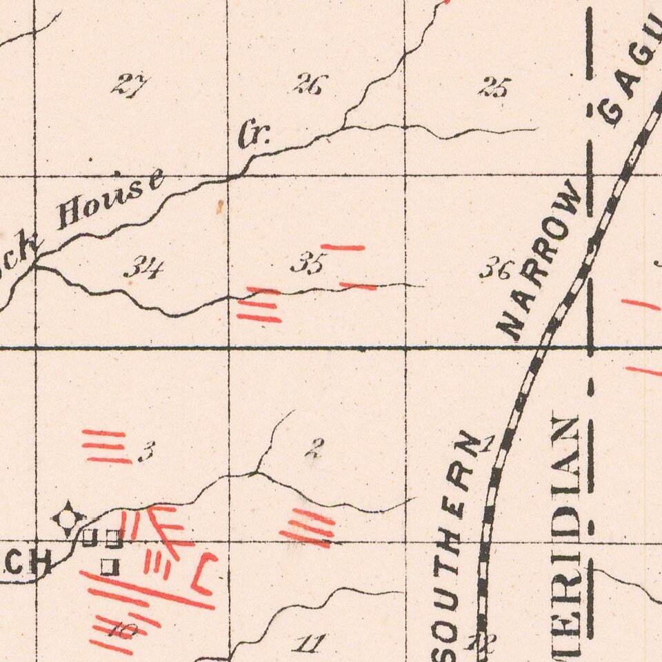
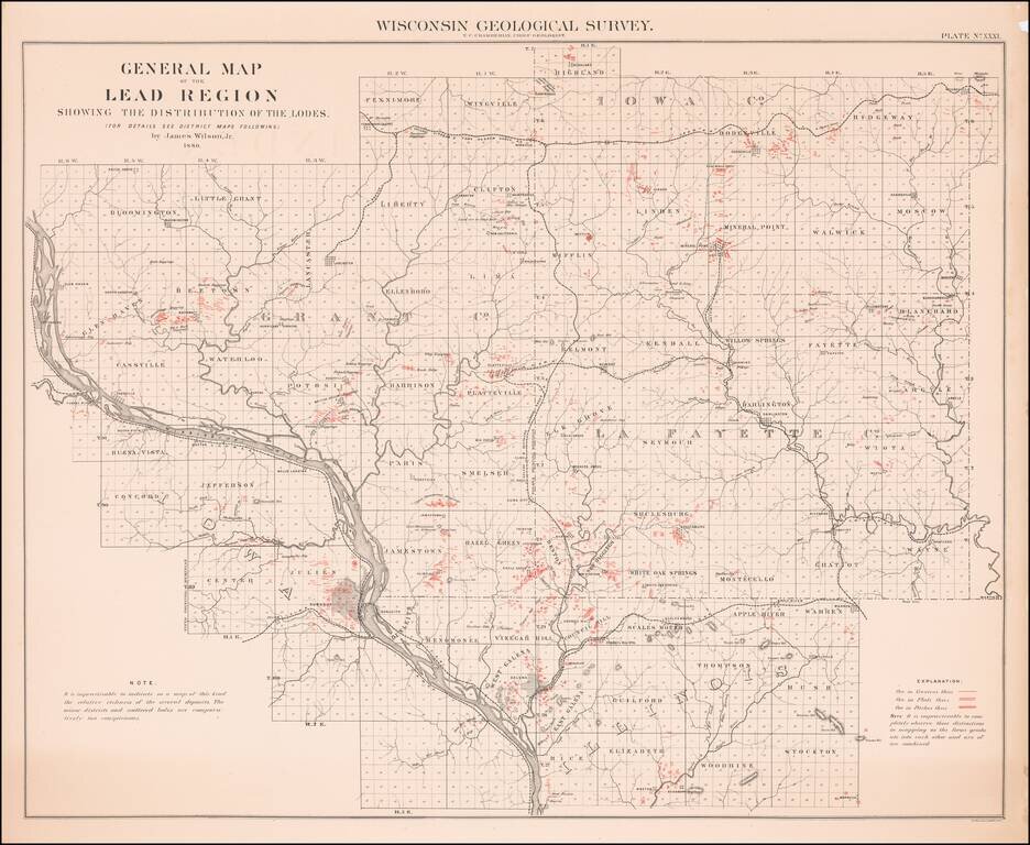
Scarce map of the Lead Region, including parts of Wisconsin, Illinois and Iowa, from the 1880 Geological Survey of Wisconsin.

The map was included in a Geological Atlas by T.C. Chamberlin and Chief Geologist R.D. Irving.


Special conditions for students!

If you are a student, write to us in telegram: @antiquemaps and indicate what material you need and for what work you need a map in high detail. We are ready to provide material on special terms. For students only!

Item information:

Year of creation:
Size:
19302x15838 px
Disk:
58.0889MiB
Number of pages:
1
Place:
n.p.
$14.99

Related item