Map size in jpg-format: 1005.33KiB
Click to open in high resolution (open in new tab).
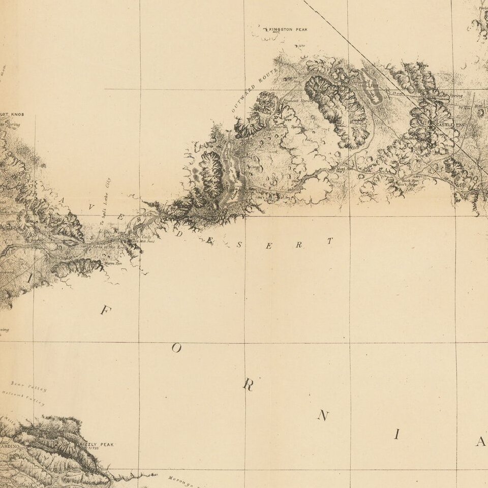
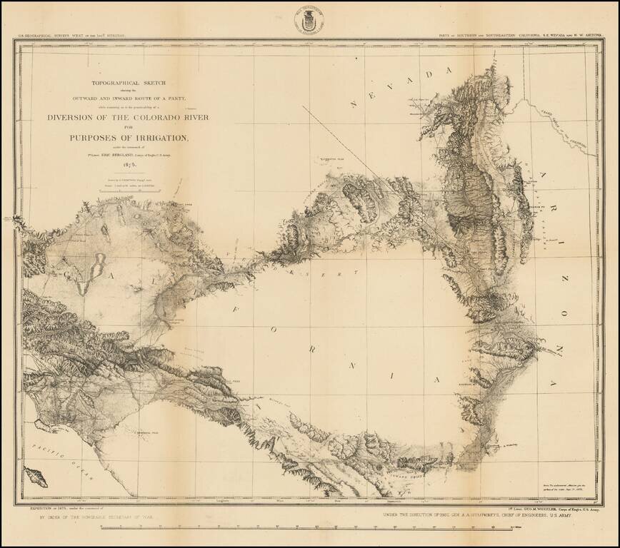
Highly detailed US Geographical Survey Map, tracing the expedition route from Ehrenberg and the Willow Spring area to Los Angeles, via the Coachella Valley and San Bernardino, the North into the Mojave Desert and on toward modern day Las Vegas.
The map is one of the earliest obtainable detailed maps of the Los Angeles Basin, Inland Empire, Mojave Desert and Las Vegas areas.
The purpose of the expedition, as noted by the title of the map, was to investigated the prospect of diverting water from the Colorado River, in order to promote farming in the Imperial Valley, etc., one of the earliest investigations of the feasibility of this concept.
The map provides a very early look at the road system and topographical features of Southern California, on the eve of Southern California's first big land boom in the 1880s.
If you are a student, write to us in telegram: @antiquemaps and indicate what material you need and for what work you need a map in high detail. We are ready to provide material on special terms. For students only!
![Carte Du Mexique et de la Floride des Terres Angloises et des Isles Antilles du Cours et des Environs de la Riviere Mississipi . . . Rue Des Canettes . . . 1703 [1st State]](/map/small/66307op.jpg)