
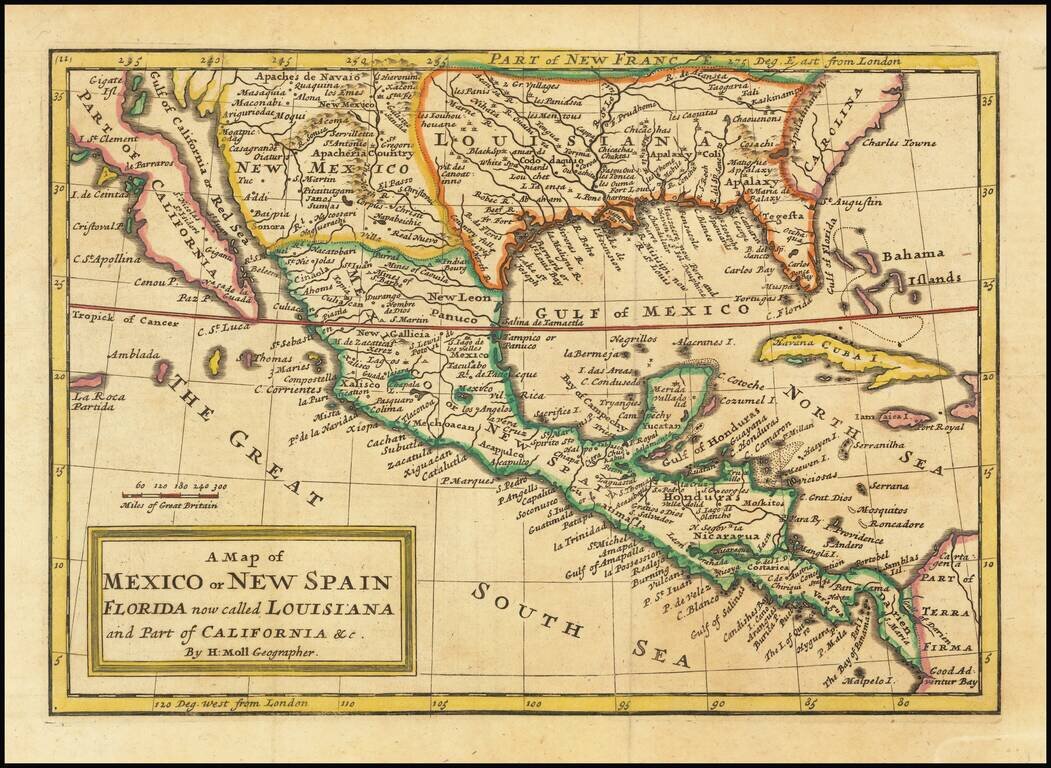
Antique map of the southern half of North America, from the Island of California to Florida by London's most famous cartographer of the early 18th Century. The map shows remarkable detail for a map of its size, including very nice detail in modern-day...
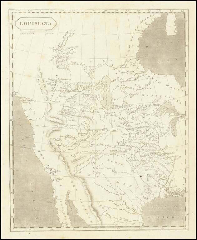
The First American Map of Louisiana Territory Nice example of Arrowsmith & Lewis's map of Louisiana Territory, first published shortly after the completion of the Louisiana Purchase and about the time Lewis & Clark set out to explore the...
![[United States, Texas & Upper California] Central America](/map/small/69646.jpg)
Scarce coast to coast map of the United States, showing a massive Texas and Upper California, both recently part of the United States, published in London in 1848. Texas is shown 2 years prior to statehood, with a massive oversized northwestern...
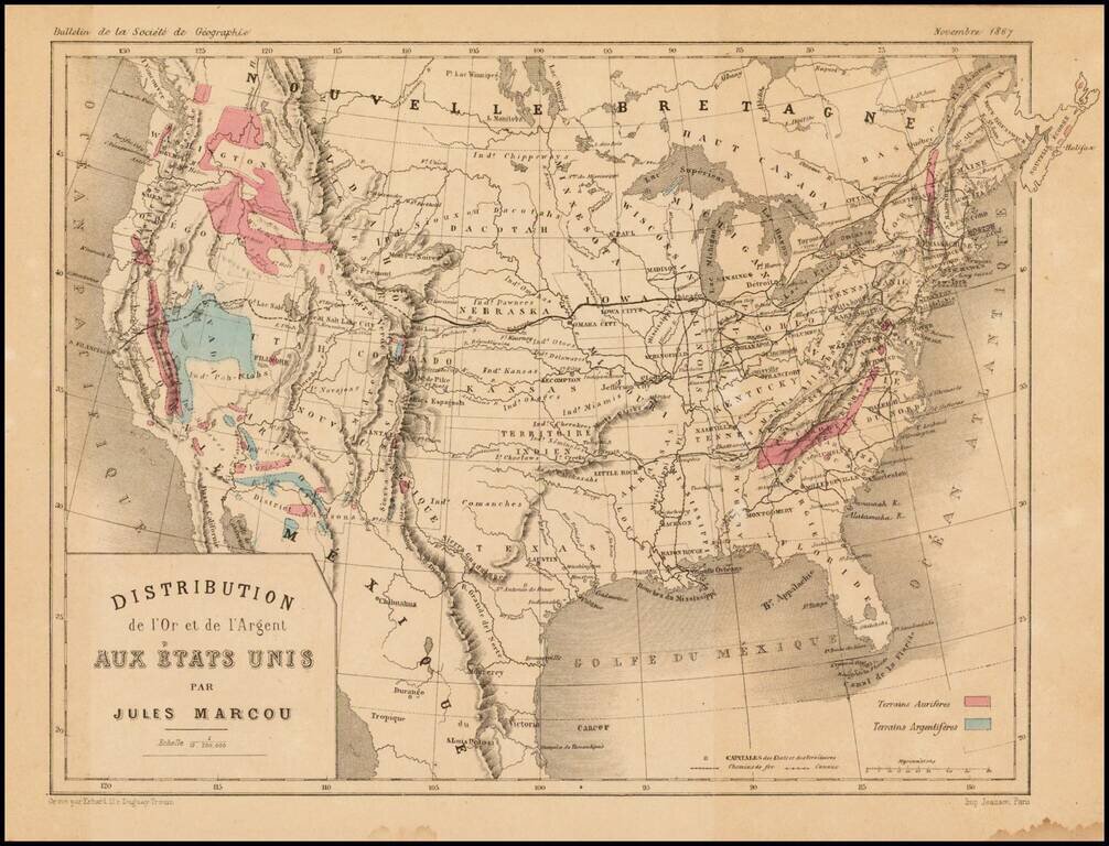
Scarce map of the United States, showing the distribution of Gold (red) and Silver (blue) in the United States. The map appeared in the November 1867 edition of the Bulletin de la Societe de Geographie, published in Paris. Jules Marcou was perhaps...
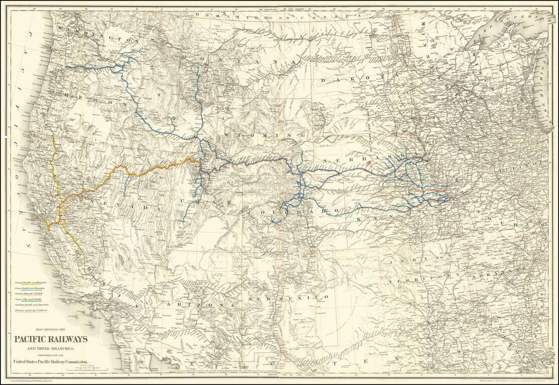
Mapping the Railroads of the Transmississippi West. Highly detailed map of the Western United States, illustrating the railroads in operation and under construction west of the Mississippi River. The key at the lower left identifies the Central...
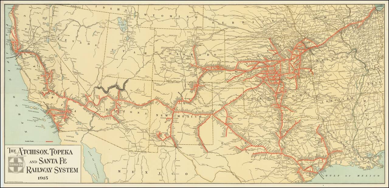
Fine example of The Atchison, Topeka and Santa Fe Railroad's general promotional map for 1915. Includes all the routes and train stations along the route in fine detail.

The First Sea Chart Focused on the Coast of California Rare first edition of the earliest map to focus on the California Coast, published in Florence by Robert Dudley. The map appeared in Dudley's landmark sea atlas, the Arcana del mare, the first...
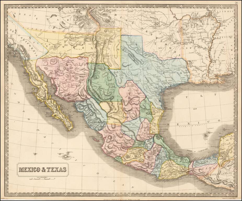
Rare map of Mexico, Texas and the Southwest, from an early edition of Philip's Imperial Atlas. This map is issued shortly before the Gadsden Purchase, and shows a very oddly configured Texas, bounded by a massive Indian Territory and New Mexico...
The Most Important Map of North America Published in England in the Seventeenth Century Fine example of Henry Briggs’ famous map of North America, one of the most important and influential printed maps of the seventeenth century. It was included in...
![Americque Septentrionale Par le Sr. Sanson d'Abbeville Geographe du Roy . . . 1705 [Rare Peninsular California edition, with unusual Mississippi River depiction]](/map/small/61024.jpg)
Antique Map of North America -- California as an Island Old color example of Sanson's revised map of North America. In 1705, Pierre Moullart Sanson radically revised this map of North America, modifying perhaps the three most significant features of...
![Nuovo Messico appartiene alla Spagna [with] A. Luisiana Inglese B. Luisiana Francese](/map/small/7075.jpg)
Extremely rare pair of miniature maps on one sheet, from a miniature Italian Atlas. The first example we have ever seen. The upper map extends from Baja California and the Pacific to Texas, centered on the Rio Grande. Full of very curious place names....
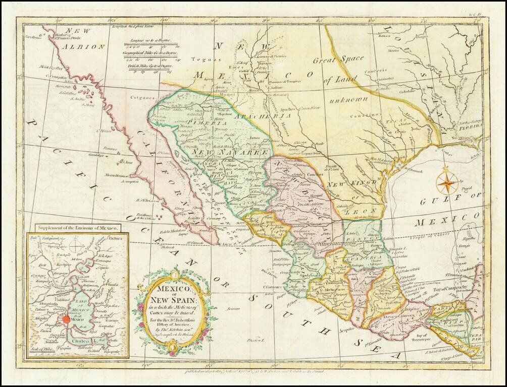
Nice example of the map of Texas, the Southwest, Upper California and Mexico, from Doctor Robertson's History of America. Extends from the Harbor of Sir Francis Drake (San Francisco) and the Farallones to New Orleans in the North and to Guatimala,...
![[California & The Southwest] La Parte Occidentale Dell'Antico, E Nuovo Messico Con Florida E La Bassa Luigiana…. 1798](/map/small/18560.jpg)
Striking full color example of Cassini's map of California, Arizona, New Mexico, part of Texas, Baja California and Mexico. This is perhaps the only 18th Century map of the region to feature a decorative cartouche and vignette. The Rio Grande extends...
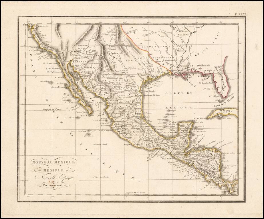
The West at the Time of the Louisiana Purchase Detailed map of Mexico and the American West, published in Paris. The map shows the limits of the United States at the Mississippi River, with Louisiana shown to the west, albeit somewhat vaguely. The...
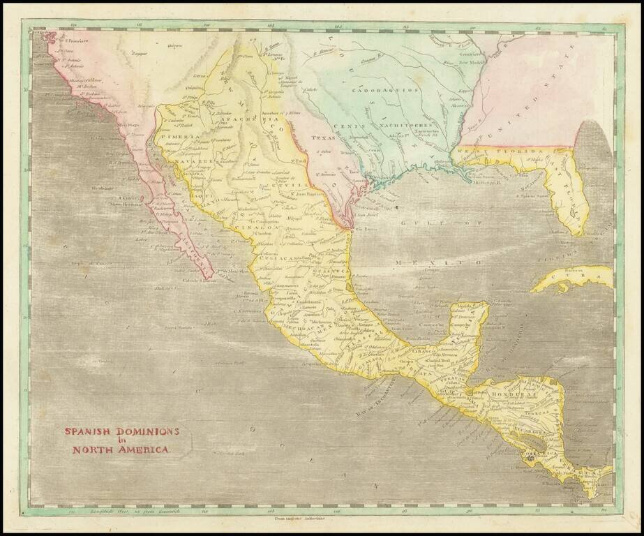
A Fascinating Pre-Louisiana Purchase Map of Texas and the Southwest Scarce early map of Mexico, Upper California, Texas and Louisiana Territory. The map extends on the west coast from San Francisco to Cabo San Lucas, with a detailed account of the...
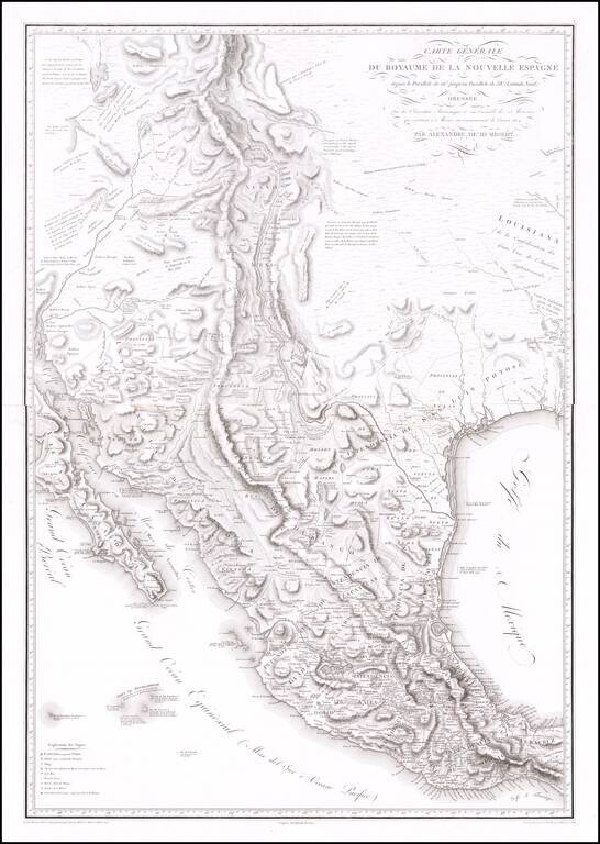
The Most Important Map of the Mexico From The Early 19th Century, By The Father of Modern Geography Nice example of Alexander von Humboldt's monumental 2-sheet map of New Spain. Humboldt's map of New Spain is the first modern geographical treatment...