Map size in jpg-format: 1.13135MiB
Click to open in high resolution (open in new tab).
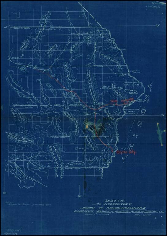
Detailed map of part of Southeastern California (Eastern Imperial and San Bernardino Counties), showing the projected railroad lines connecting Blythe City, Parker, Arizona, and Bengal, on the main line of the Santa Fe Railroad between San Bernardino and Needles.
The map shows a number of towns that were never established or no longer exist.
If you are a student, write to us in telegram: @antiquemaps and indicate what material you need and for what work you need a map in high detail. We are ready to provide material on special terms. For students only!

![Mexique par Th. Duvotenay…1843 [Republic of Texas]](/map/small/67925.jpg)
