
![[San Diego & San Diego Bay]](/map/small/45945.jpg)
Scarce map of the San Diego Bay & Vicinity, prepared during the time period when San Diego was actively soliciting the US Government to consider San Diego for future military installations. The names of many of the original landowner's of the...
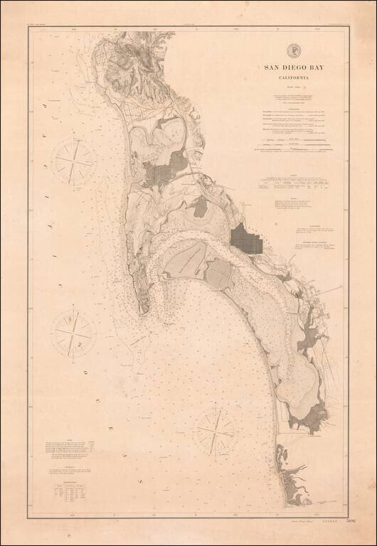
Rare 1895 Coast & Geodetic Survey Chart of San Diego Bay, published February 1895. The map extends north to La Jolla, La Hoya Valley (La Jolla Shores) and Rose Canyon and south to Otay Valley, the Tijuana River and the monument locating the...
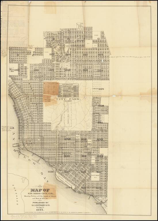
A San Diego Rarity Extremely rare large format separately published map of San Diego, published by S.E. Hoffman & Co. in 1895. The map includes a number of pencil and pen annotations, including: Florence Heights Add. No #2 New $50,000...
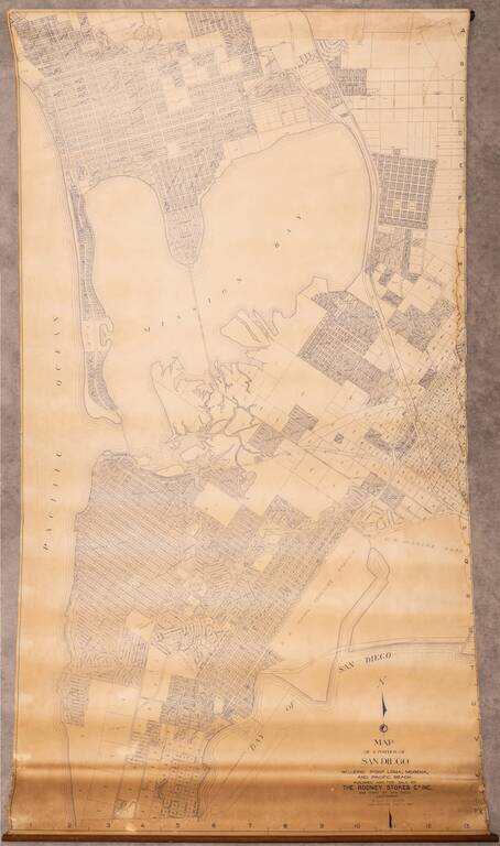
Large wall map of the San Diego neighborhoods of Point Loma, Mission Bay, Mission Beach, Pacific Beach, and Bay Park. This is a very large and detailed wall map of these neighborhoods, depicting them at 1:400 feet. One of the most interesting aspects...
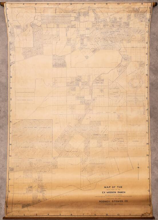
Large wall map of eastern San Diego, showing parts of Lemon Grove and La Mesa. In the west, the map is bounded by Lake Chollas, and the Chollas Heights Naval Radio Station, which is now military housing. There is plot level detail in the areas that...
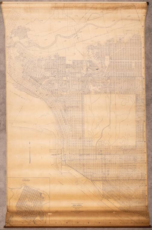
Large wall map of San Diego, showing Downtown, Balboa Park, and the neighborhoods of North Park, Banker's Hill, Little Italy, Mission Hills, and with an inset of Coronado. This is a very large and detailed wall map of central San Diego, shown at 1:400...
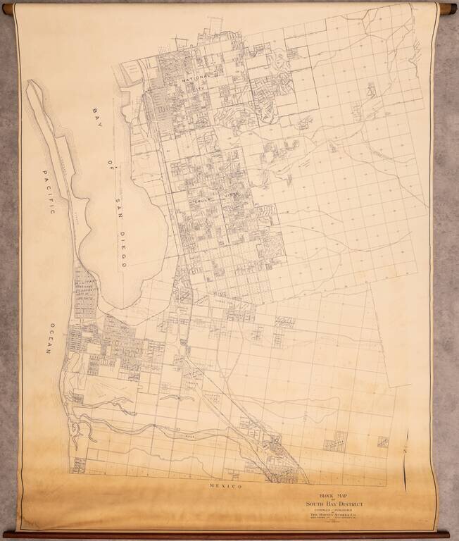
Rare Wall Map of the South Bay Interesting map of the area south of San Diego, extending from National City to Tijuana, centered on Chula Vista. The map covers what is today Imperial Beach, National City, Chula Vista, San Ysidro, and Bonita, however,...
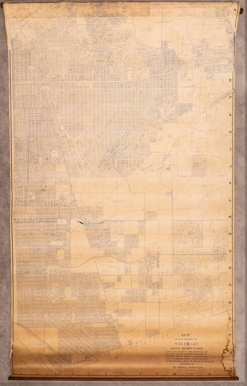
Very large wall map of a portion of San Diego, centered on City Heights and extending through the Mountain View and Southcrest neighborhoods to San Diego Bay in the lower-left corner of the map. At the top edge of the map is Kensington and Kensington...
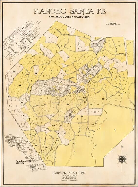
The First Plan of Rancho Santa Fe Fine example of the original subdivision map for Rancho Santa Fe, California, published in January of 1929. The map Includes lot and tract numbers, with acreage, street names, At the center is the "Civic Center",...
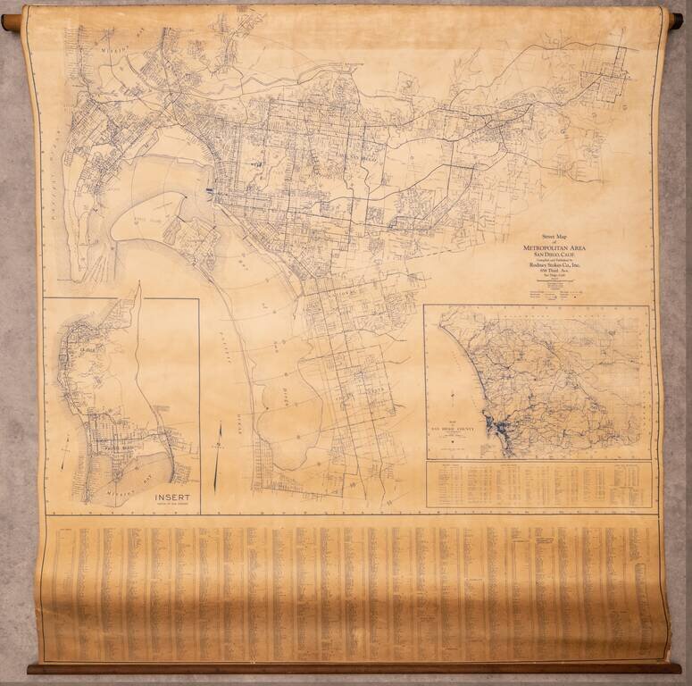
Large wall map of the San Diego Metropolitan Area, from Coronado to El Cajon, with an inset of Pacific Beach and La Jolla, and a further inset of the County of San Diego. This is a very large and detailed wall map of central San Diego, shown at 1:4000...
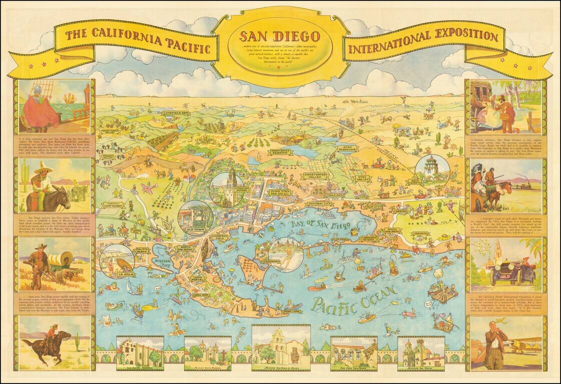
This is one of the great California caricature maps, showing San Diego on one side and Balboa Park on the verso. This edition was prepared by Shell Oil Company for the 1935 California Pacific International Exposition. The map was drawn by Don...
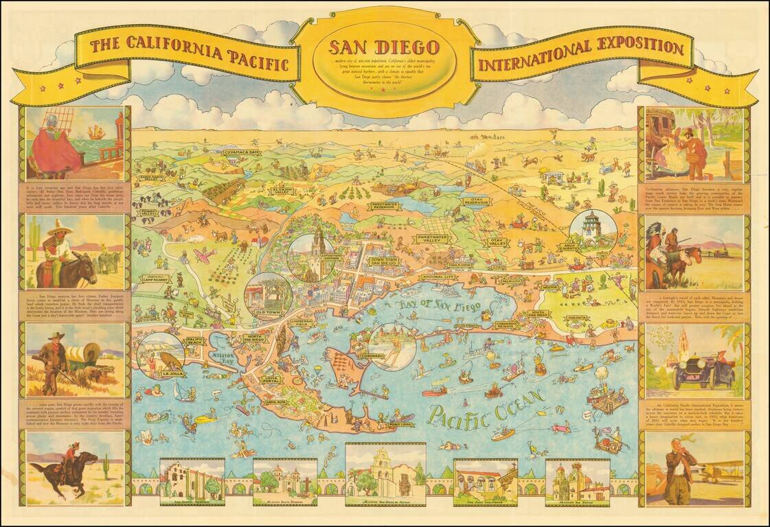
Decorative illustrated map of San Diego on one side and Balboa Park on the verso, prepared by Shell Oil Company for the 1935 California Pacific International Exposition. One of the great California caricature maps. The map was drawn by Don Bloodgood,...
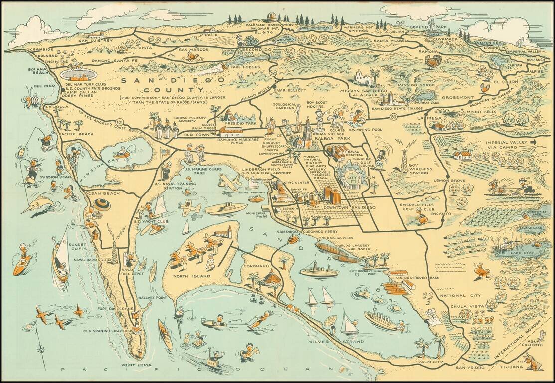
Whimsical map of San Diego County, showing a host of activities throughout, with a larger city street map. Among the more timely inclusions in the map are the Baseball field next to the County Administrative offices and Balboa Stadium, next to San...
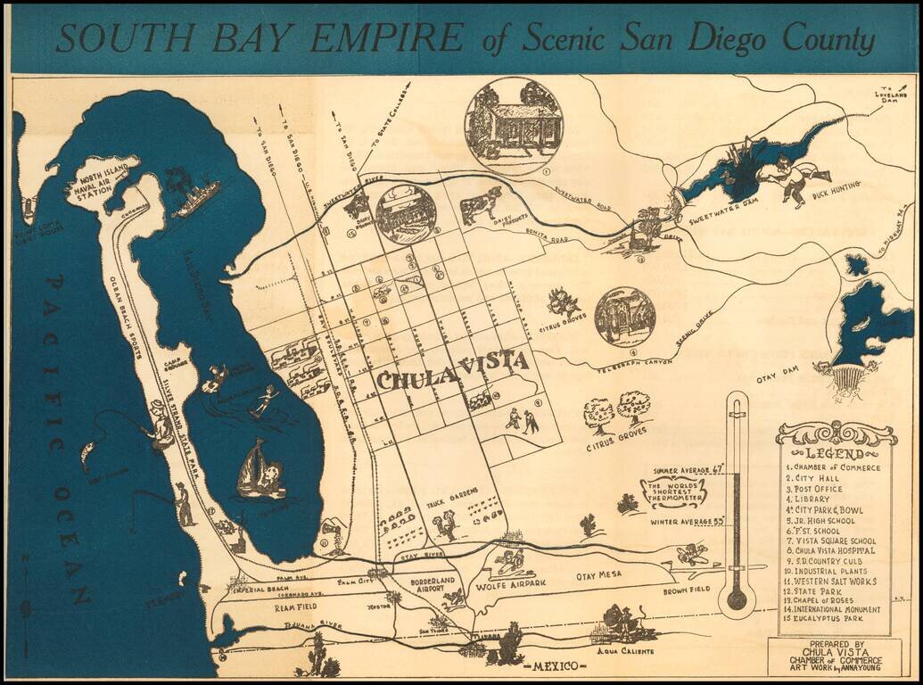
Rare promotional brochure map of San Diego's South Bay, drawn by Anna Young for the Chula Vista Chamber of Commerce. The map extends north to Point Loma and and the Sweetwater Dam area, centered on Chula Vista. Rarity The map is apparently very...
![[Restricted Military Map of San Diego] The City of San Diego Including The Cities of Chula Vista Coronado El Cajon La Mesa National City . . .](/map/small/69860.jpg)
Restricted Military Map of San Diego Restricted Armed Forces edition of this World War II era map of San Diego, published by the Automobile Club of Southern California. As noted below the map, the map was "issued for the exclusive use of the Armed...
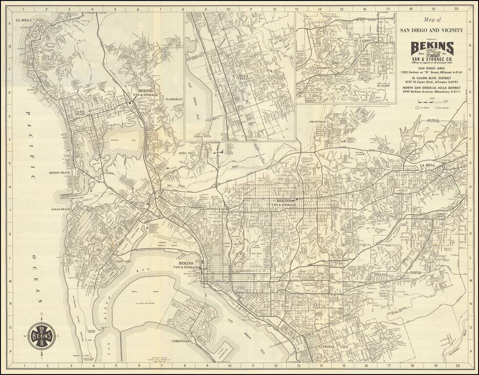
Detailed vintage map of San Diego, by the famous Bekins Van & Storage Co., published in 1958. The map shows Mission Bay before it was fully dredged and developed into the recreational area it is today. La Jolla has considerably more development...