
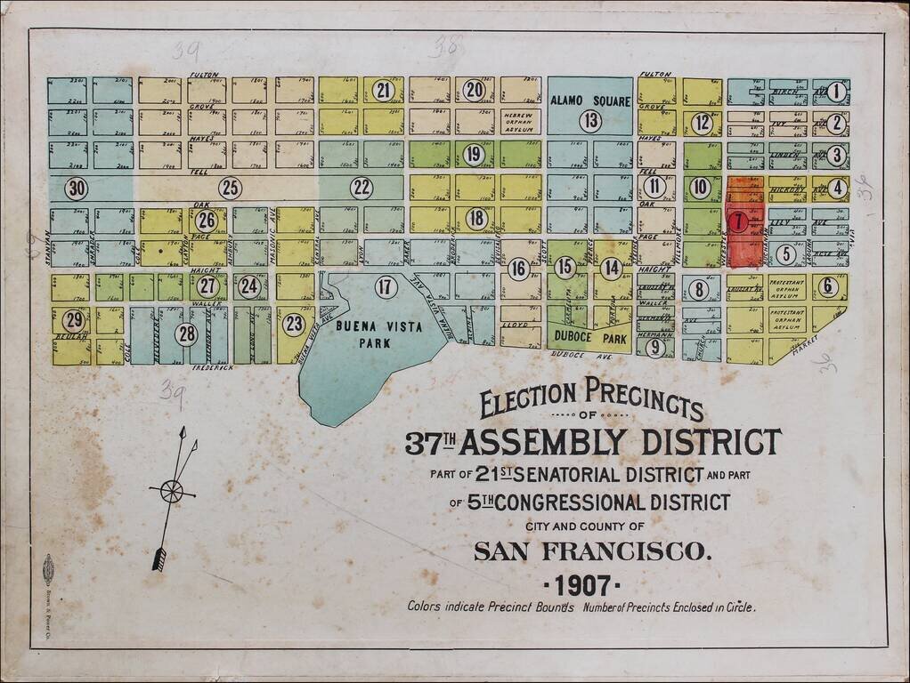
Rare Election Precinct Map for San Francisco, centered on Buena Vista Park. The map is bounded by Stanyan at the west, Fulton at the north, Octavia Street on the east and Frederick and Dubose Avenues in the south. Places shown include: Panhandle...
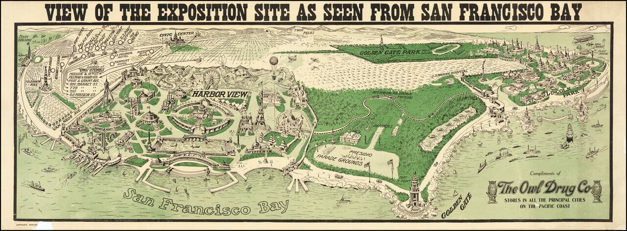
With Early Airplanes and Hot Air Balloon and Early Dirigible Rare panoramic view of the proposed site of the Panama Pacific International Exposition, published by The Owl Drug Company. The image provides an interesting Bird's-eye view of site of...
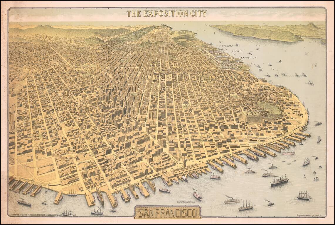
Important Early 20th Century View of San Francisco -- Antique Map Promoting the Site of the Future Panama Pacific Exposition Rare Birdseye View of San Francisco, "The Exposition City," copyrighted by North American Press Ass'n 1912 Hearst Bldg. S.F.,...
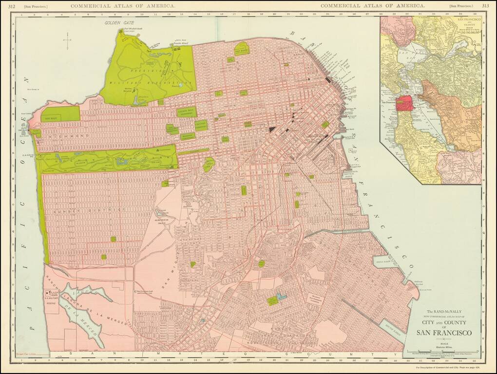
This is a great large-format, highly detailed map of San Francisco, showing towns, wharfs, rail lines, street car lines, roads, buildings, and more. The map includes a large inset of San Francisco Bay, attractively colored according to the county....
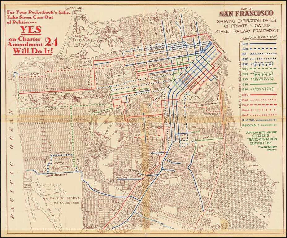
Rare political pamphlet map, promoting a campaign supporting the Yes on Charter Amendment 24, regarding the regulation and renewal of Private Street Railway in the city. The map shows the routes of privately-owned streetcar lines in San Francisco and...
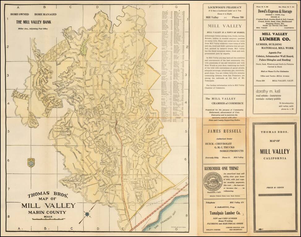
Scarce map of the Mill Valley, published by George C. Thomas. The map includes a detailed city plan, along with advertising.
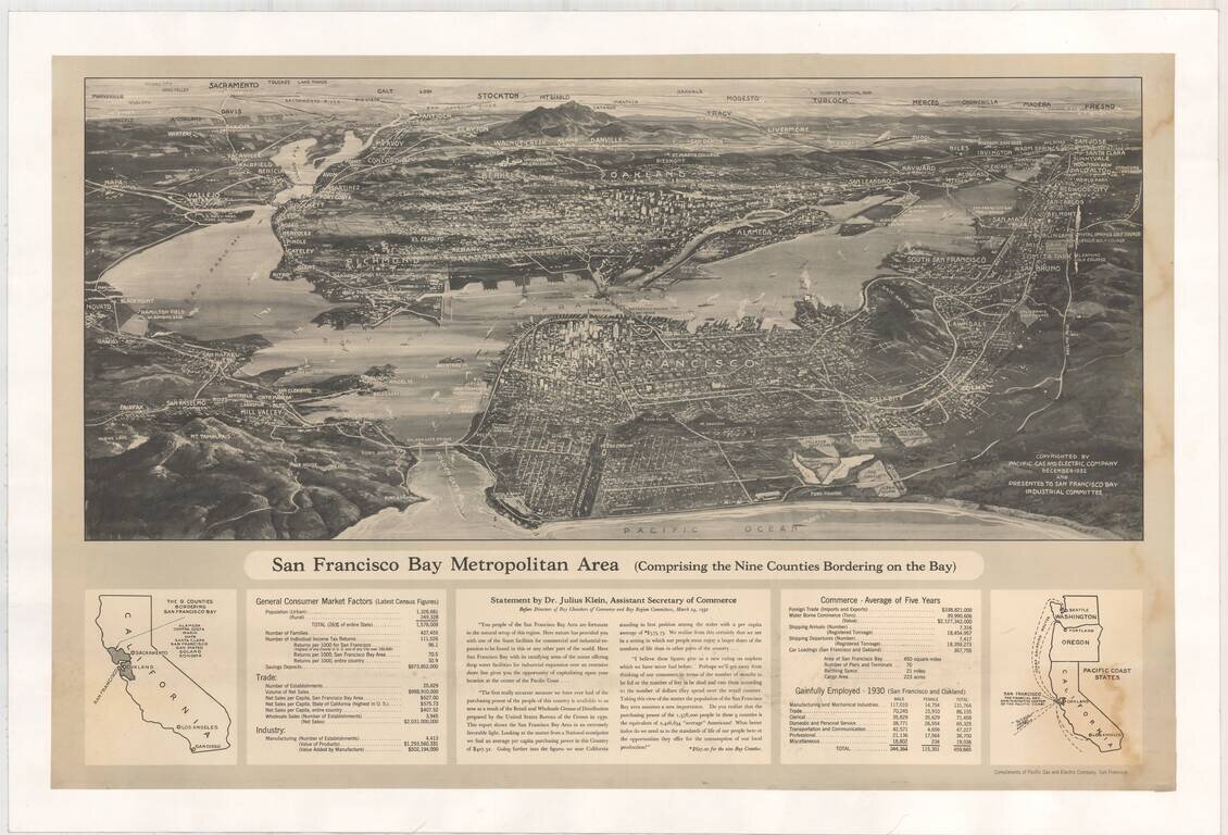
Fine birdseye view of the Bay Area, published by Pacific Gas & Electric Company. The view notes that it was presented to the San Francisco Bay Industrial Committee. In the section below the map is a Statement by Dr. Julius Klein, Assistant...
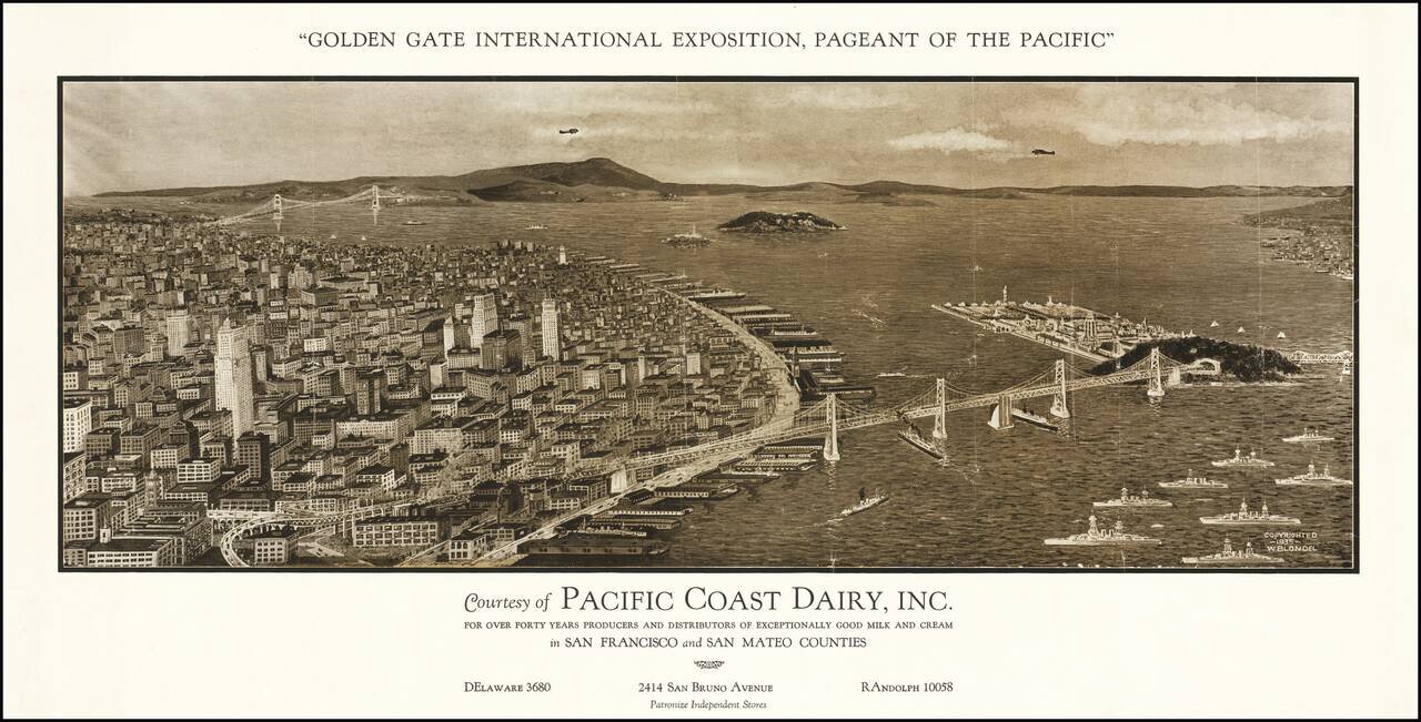
Rare early view of San Francisco, "Courtesy of Pacific Dairy, Inc." for the Golden Gate International Exposition. The map provides a remarkable view of San Francisco, with the Golden Gate Bridge in the distance, the San Francisco Bay Bridge in the...
![[Hand Drawn Map By The Father of Modern Space Art] A Plan For The East Bay Prepared by Chesley Bonestell for the Purpose of Creating Interest in the Solution of that Problem. 1945.](/map/small/68505.jpg)
Waterfront Improvement Plan of the East Bay Drawn By The Father of Modern Space Art Hand drawn map illustrating a shoreline improvement plan of the East Bay, centered Berkeley, drawn by renowned American space and science fiction illustrator Chesley...
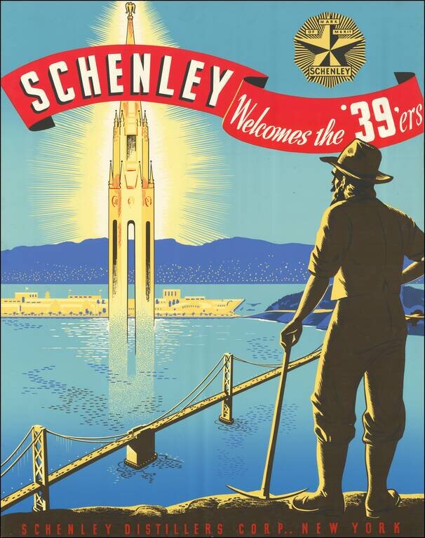
Unrecorded Poster for the 1939 Golden Gate Exposition. Beautiful and extremely rare color-printed poster prepared by the Schenley Distillers Corporation of New York as a promotional for the 1939 Golden Gate Exposition. The map features a '49er gold...
Sports Playland of America Detailed birdseye view style map of San Francisco, prepared by the Convention & Tourism Bureau for the 1939 World's Fair. A view of the Fair Grounds in the mIddle of San Francisco Bay is shown in an oval, with a larger...
![[San Francisco] A cartograph of Treasure Island in San Francisco Bay Golden Gate International Exposition](/map/small/70375.jpg)
Fine example of Ruth Taylor White's large format map of Treasure Island and the San Francisco Golden Gate Exposition Fairgrounds, published in 1939. The map provides an aerial panorama of the exposition grounds, with a portion of San Francisco in the...
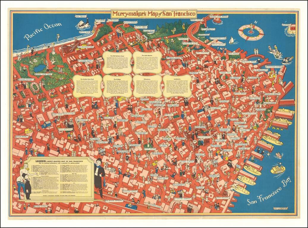
A Pilot for Pixilated Philanderers with a Penchant for Getting Pickled Scarce map of San Francisco, intended for tourists, sailors and other revelers. The map includes a guide noting Restaurants (including Joe Di Maggios), Foreign Atmosphere...
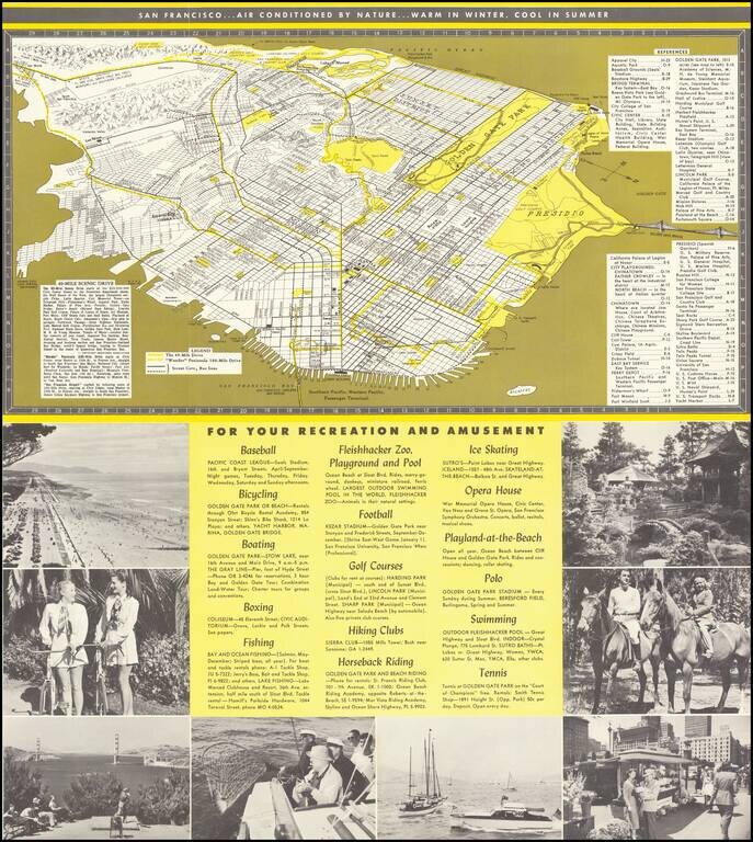
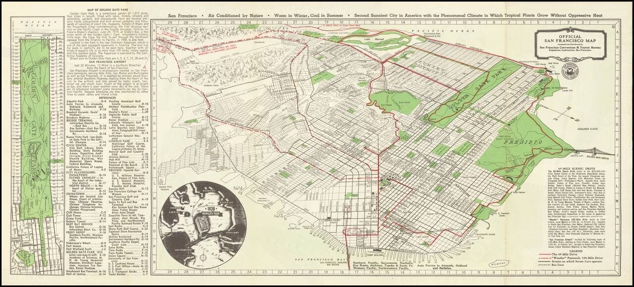
Interesting tourist map and promotional brochure of San Francisco, published in the early 1950s by the San Francisco Convention and Visitors Bureau. The map illustrates "The 49-Mile Drive" and the "'Wonder' Peninsula 100-Miles Drive", with a detailed...
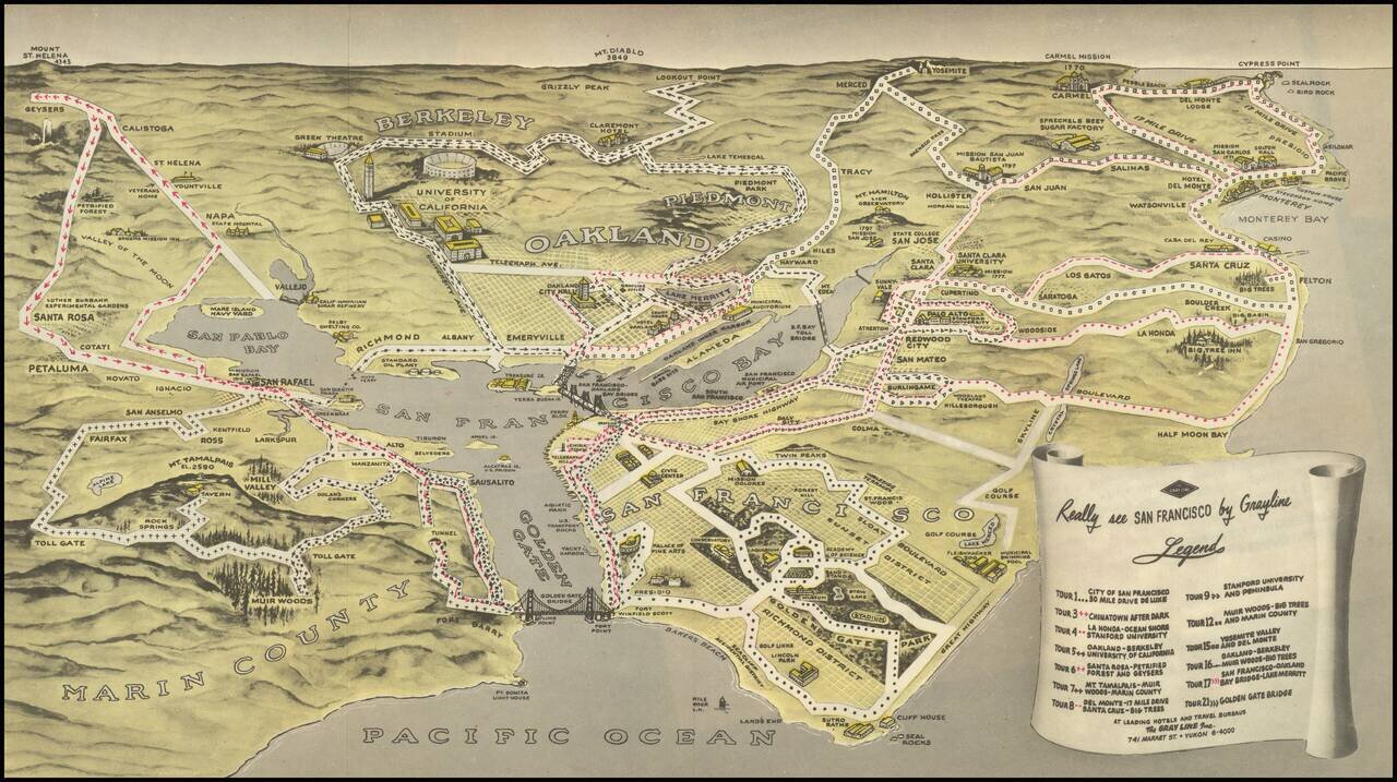
Birdseye view style map of the Bay Area, publisehd by the Gray LIne. The map illustrates 13 Gray Line sightseeking tours around the Bay area, extending out to Napa Valley, Mt. Diablo, Yosemite, Monterey, Carmel by the Sea, Half Moon Bay and the Muir...
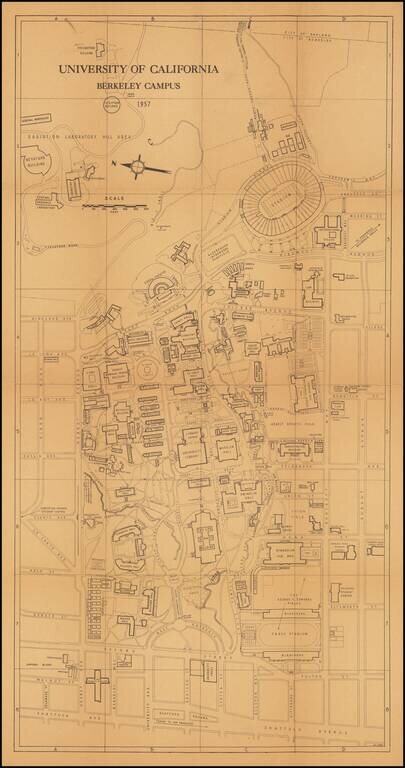
This is a great 1950s map of Berkeley, showing the campus in detail as it stood at the time. Many dozens of buildings on campus are named, as well as some features from the surrounding neighborhood. The verso includes an extensive index of places on...