
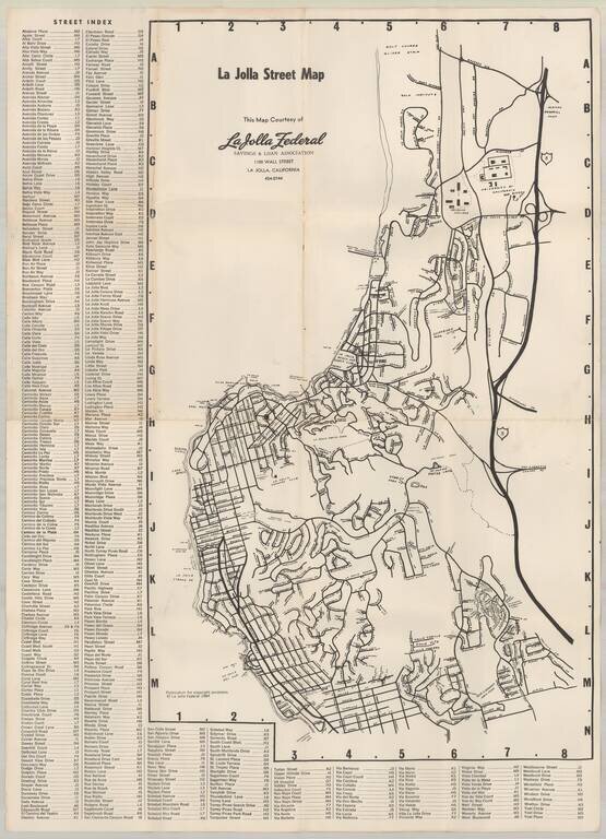
Early map of La Jolla, published by La Jolla Federal Savings. Early points of interest include: UC San Diego Revelle College Mt. Soledad Easter Cross Salk Institute Scripps Institute of Oceanography Spindrift Pitch & Putt (LJ Beach &...
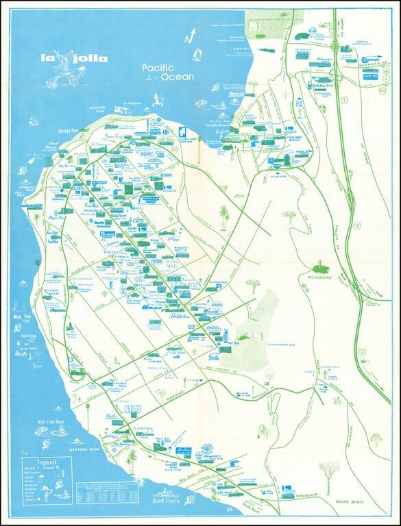
Rare separately issued map of La Jolla, California, published by the La Priscilla Publications of San Diego (Pacific Beach). The map locates dozens of businesses, with a legend noting Churches Golf Courses (including Torrey Pines) Schools...
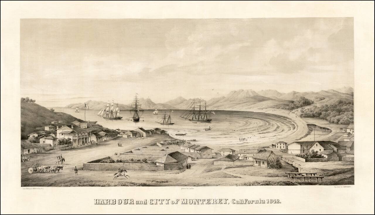
Monterey -- Mexican Capital of Alta California Nice example of one of the earliest bird's-eye views of California, published by Charles Gildemeister, and printed by D'Avignon in New York, for Thomas O. Larkin. The view depicts Monterey at the height...
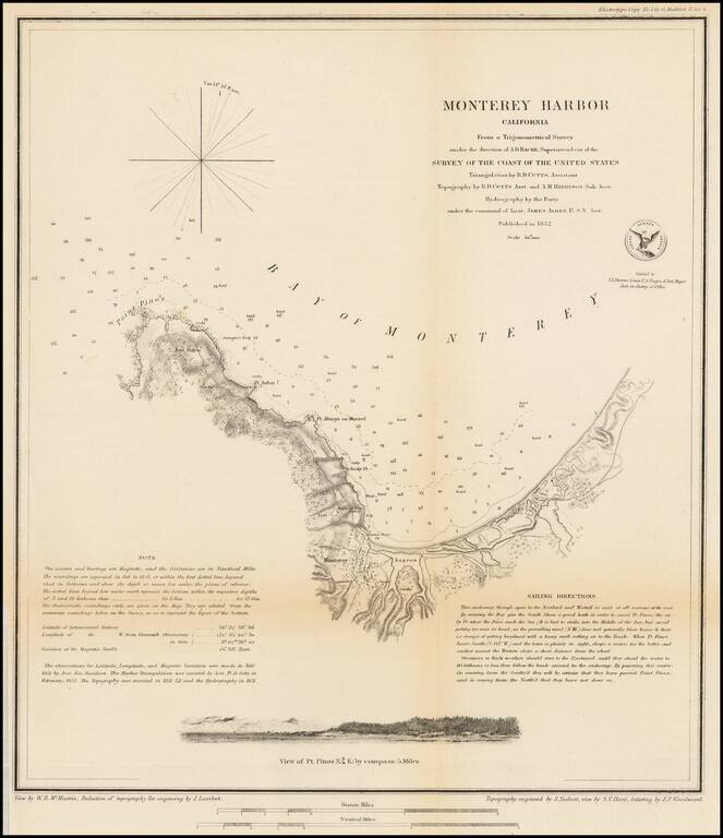
Nice example of this important early survey of Monterey Bay, published by the United States Coast Survey. Incudes a profile view of Pt. Pinos. Shows a Monterey town plan, Point Pinos, Pt. Anlon, Pt Almejor Mussell, the Lagoon, Fort, Ruins of the old...
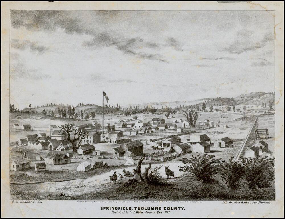
Early lettersheet birds eye view of the town of Springfield, Tuolumne County, California published in Sonora, California and engraved in stone by George H. Goddard, who would go on to become one of California's most important early surveyors. The view...
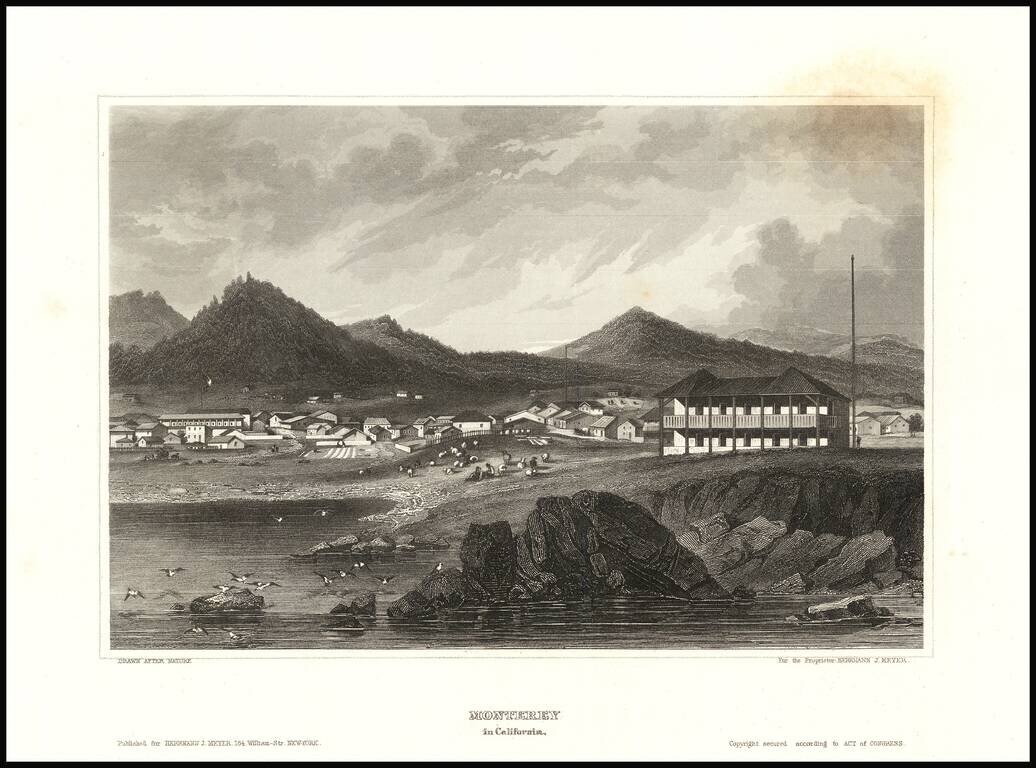
Detailed view of the town of Monterey, from Meyer's Universum. One of the view obtainable views of a city in Spanish California
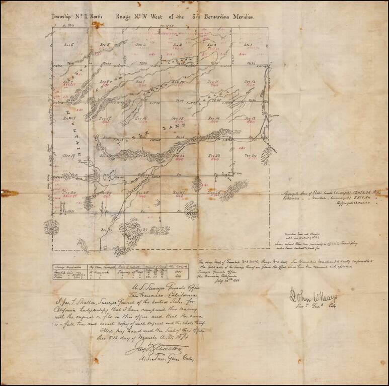
San Bernardino High Desert - Hesperia area manuscript map Manuscript copy of an original survey, signed by California Surveyor General John W. Hays. The present example was drawn by James T. Stratton, U.S. Surveyor General in California. The area...
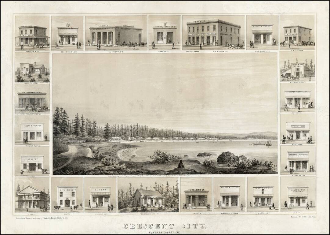
Decorative example of Kuchel & Dresel's view of Crescent City, published in San Francisco in 1857. Charles C. Kuchel & Emil Dresel were among the earliest western view makers. The pair published approximately 50 views between 1855 and 1859, of...
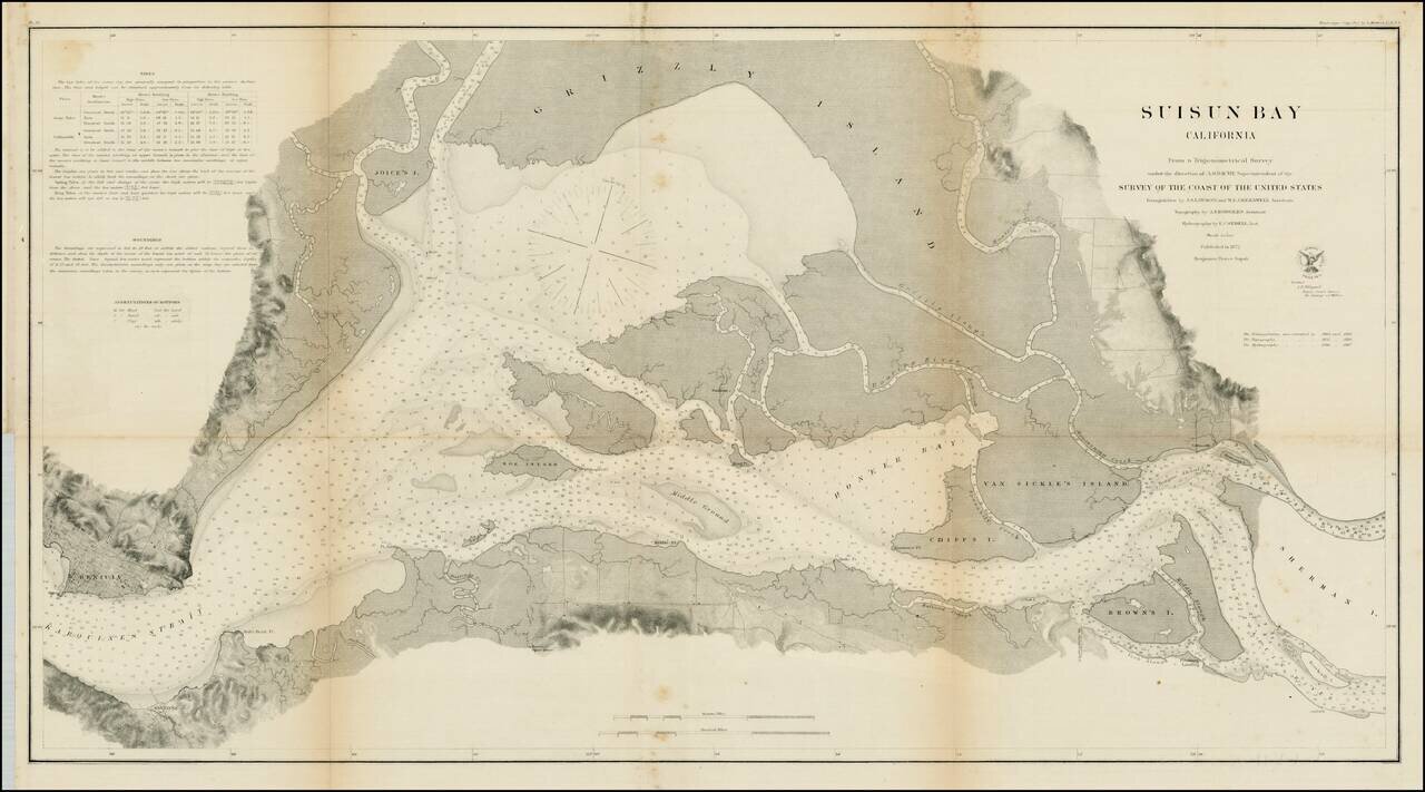
Detailed view of Suisun Bay, from Benicia to Sherman's Island and Brown's Island. Includes soundings, tides and other details. One of the earliest detailed surveys of the region.
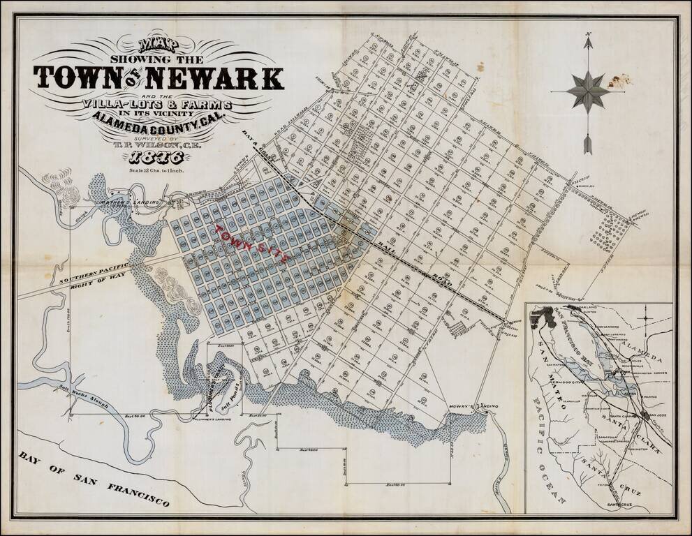
Manuscrpt Map of Newark, California, Pre-Dating The First Printed Map of the City Finely executed manuscript map of Newark, California, which would appear to be the manuscript protype for Britton & Rey's manuscript map of Newark, the earliest...
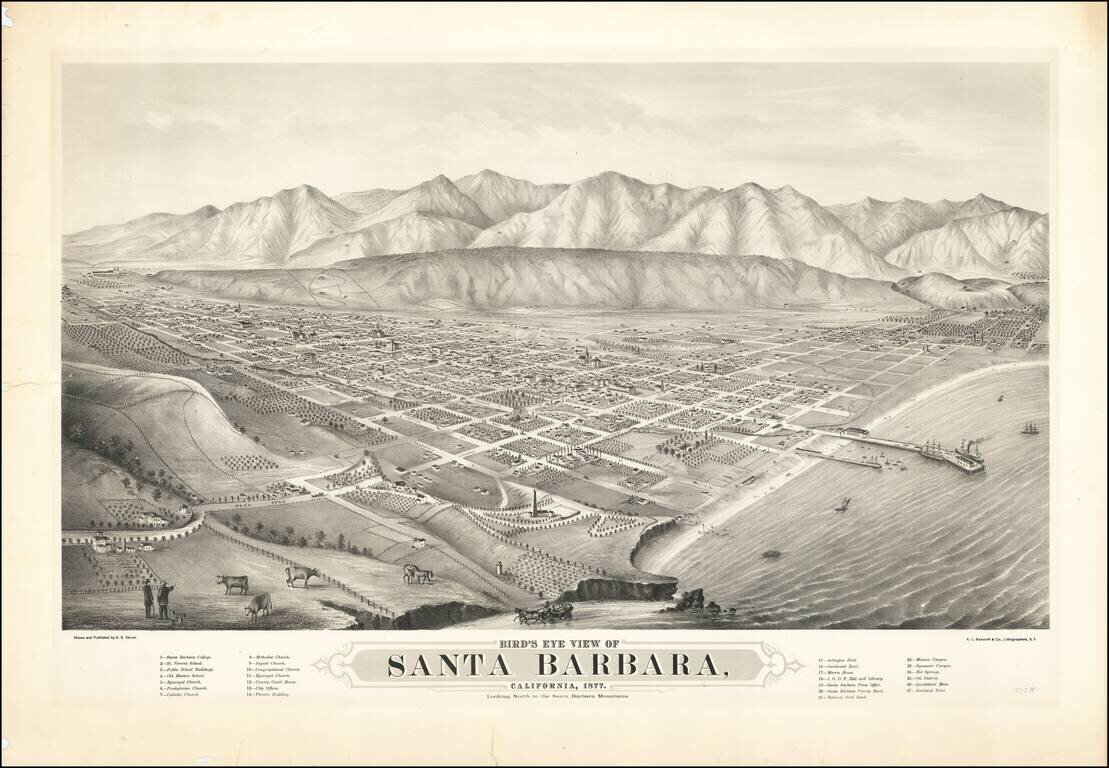
The First Large Scale View of Santa Barbara Rare early two-stone lithographed view of Santa Barbara, drawn and published by E.S. Glover and printed in San Francisco by A.L. Bancroft & Co., lithographers. Published in 1877, Glover's view of Santa...
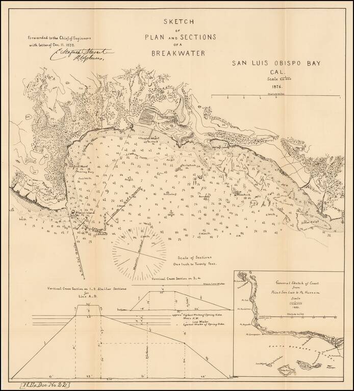
Scarce early map of San Luis Obispo area. Shows topographical contour lines and other details. Includes a model elevation for the breakwater and regional map. One of the earliest obtainable plans of San Luis Obispo.
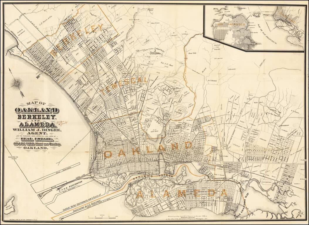
Published Shortly After Incorporation of the Town of Berkeley -- Early Map Promoting William Jackson Dingee Antique map of Oakland, Berkeley and surrounding areas, published in the first year of the real estate career of William Jackson Dingee and...
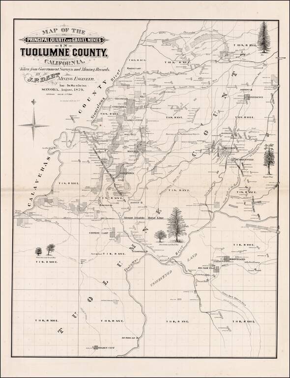
Scarce large format map of Tuolumne County. Includes extensive Mining and Government Survey Information and illustrations of the various types of Oak and Pine trees indigenous to the region. Shows towns, rivers, mining claims and other details. A...
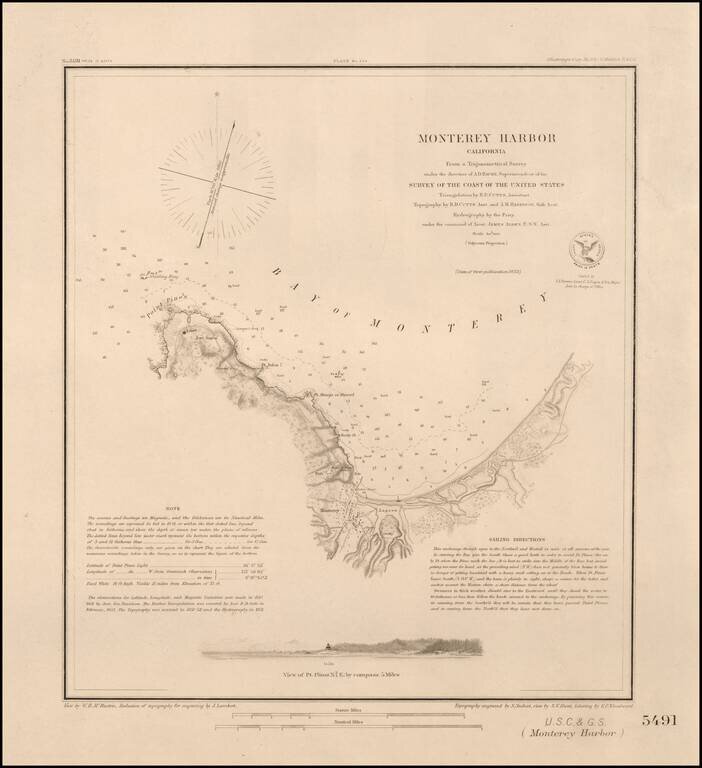
Nice example of this important early survey of Monterey Bay, published by the United States Coast & Geodetic Survey. Incudes a profile view of Pt. Pinos. Shows a Monterey town plan, Point Pinos, Pt. Anlon, Pt Almejor Mussell, the Lagoon, Fort,...
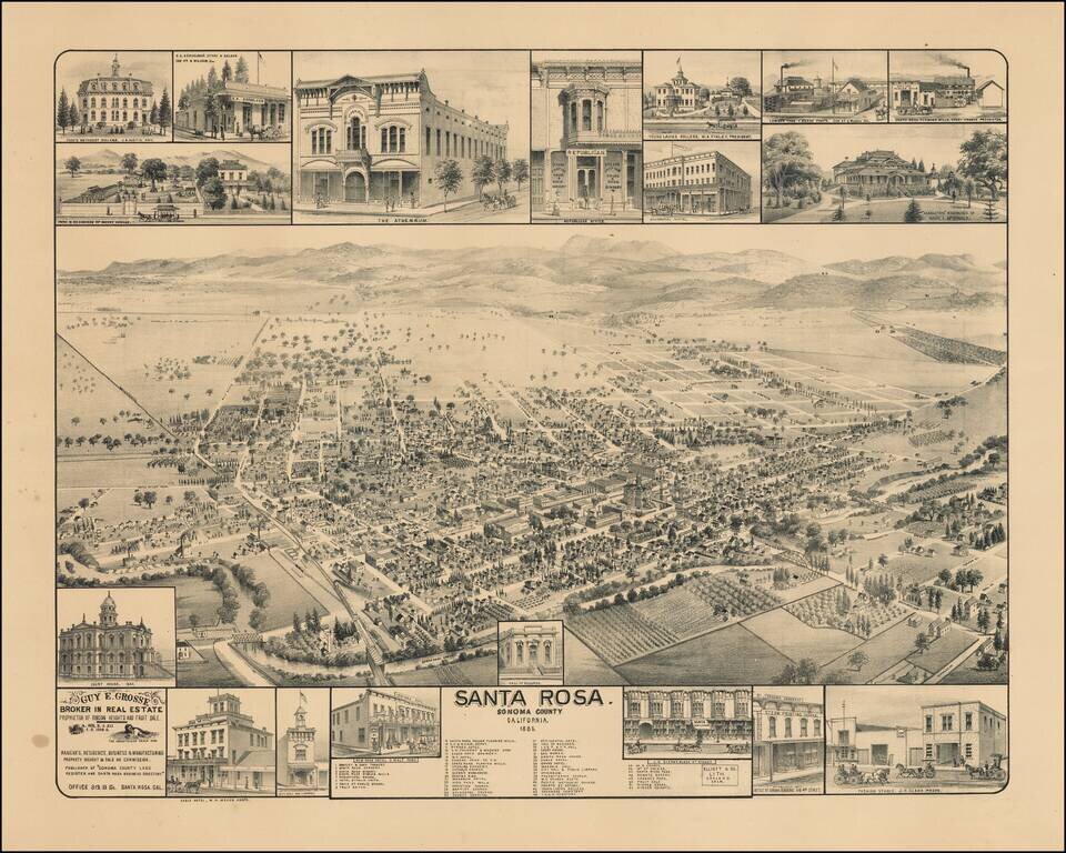
Scarce birdseye view of Santa Rosa, California, published by Elliott & Co. in Oakland, California. Rare bird's-eye view of Santa Rosa, north of San Francisco, produced for Guy E. Grosse, "Broker in Real Estate, Proprietor of Rincon Heights and...