
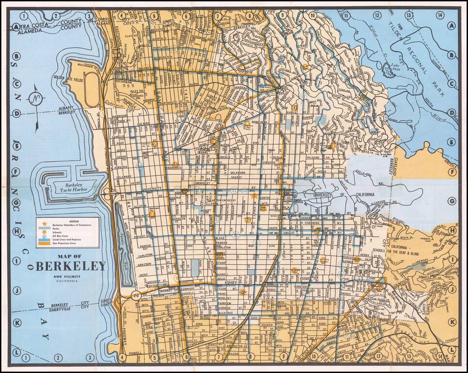
Detailed map of Berkeley, with emphasis on public transit and public works. The map locates the Chamber of Commerce, Parks, Schools, AC Bus Lines, Local and Express Bus Lines and San Francisco Bus Lines.
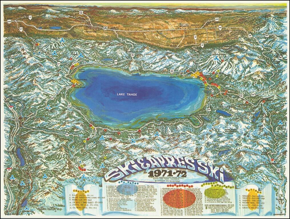
Attractive vintage pictorial bird's-eye view map, depicting Lake Tahoe as viewed from west to east. Truckee is shown at the far left; Kings Beach, Crystal Bay, Incline Village, Zephyr Cove, Stateline, South Lake Tahoe, Tahoe keys, Emerald Bay, Meeks...
![[Placerville, California]](/map/small/63008.jpg)
Lively pictorial advertising map for Placerville, California, issued in the mid-1970s. We dated the map based upon the Master Charge logo (1969-1979). The map provides a whimsical look at Placerville, in the foothills of the Sierra Mountains, with...
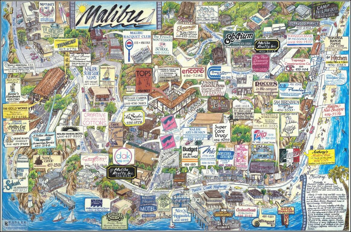
A great pictorial map of Malibu, the famed California beach community of the rich and famous. Taken from the south, the map shows the community in bright colors, with the ocean visible in the foreground. The map was produced through a model that asked...
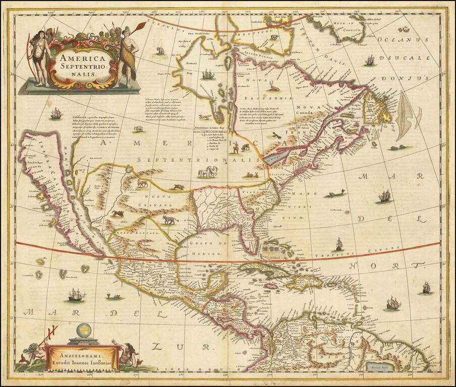
Hondius and Jansson’s Map of North America, A Map Central to the Myth of California as an Island Striking example of the first state of Henricus Hondius’ and Jan Jansson’s map of North America, called by Burden the single most influential map in...
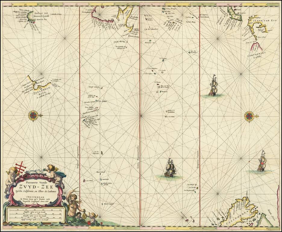
Rare Dutch Sea Chart of the Pacific Fine old color example of Pieter Goos' sea chart of the Pacific Ocean, extending from Australia, New Zealand and Japan to California. Oriented with west at the top, Goos's chart is among the earliest regional maps...

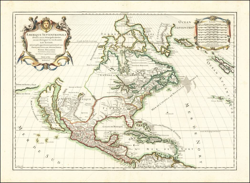
First edition of the Sanson-Marriette map of North America, first issued in 1669. Produced by Guillaume Sanson and Pierre Mariette, after the death of Guillaume's father Nicolas in 1667, this map is a reduced-size copy of Nicolas Sanson's 4-sheet wall...
![A Chart of the South Sea [1st English Map of the Pacific Ocean]](/map/small/47376.jpg)
Unrecorded state of John Seller's map of the Pacific Ocean, the first English map of the Pacific. John Seller's map of the Pacific Ocean is the first English map of the Pacific. First issued in 1675, it is a map of exceptional rarity and importance...
Striking map of North America, published in 1689 by Jaillot. A scarce map of California as an Island, which derives from Sanson's earlier maps of North America. The Great Lakes are shown as open ended. Florida and the Southeast have not yet been...
![L'Amerique Septentrionale [Unrecorded map showing California as an Island]](/map/small/70283.jpg)
Unrecorded map of North America, showing California as an island, with a very curious shape. A close study of the lower part of California suggests a knowledge of De L'Isle's 1700 map of North America, which was one of the first maps to show...
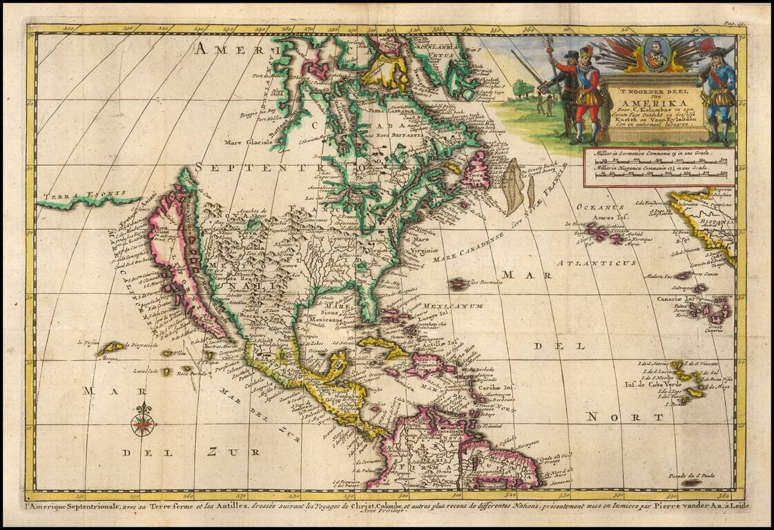
Decorative map of North America, which appeared in the Dutch translation of the Narrative of Columbus' first voyage to the New World. The map shows California as an Island, highly inaccurate Mississippi River and open Great Lakes, with no sign of the...
![A New Map of North America. According to the Newest Observations [California as an Island]](/map/small/70205.jpg)
Handsome example of Moll's miniature map of North America. California is shown as an Island. The map features a curious depiction of the Florida coastline. The Mississippi is west of its correct location, with a rudimentary illustration of its major...

Terrific map of the North Polar region, which shows the Northeast Passage, but no definite Northwest Passage. California is shown as an Island, along with the River systems of North America. Nice detail in the Polar regions, especially New Denmark and...
![[Yosemite / Half Dome Photo] Tasayac, The Half Dome 5000 ft.](/map/small/62639.jpg)
Carelton Watkins photo showing the Merced River in the foreground and Half Dome in the distance.
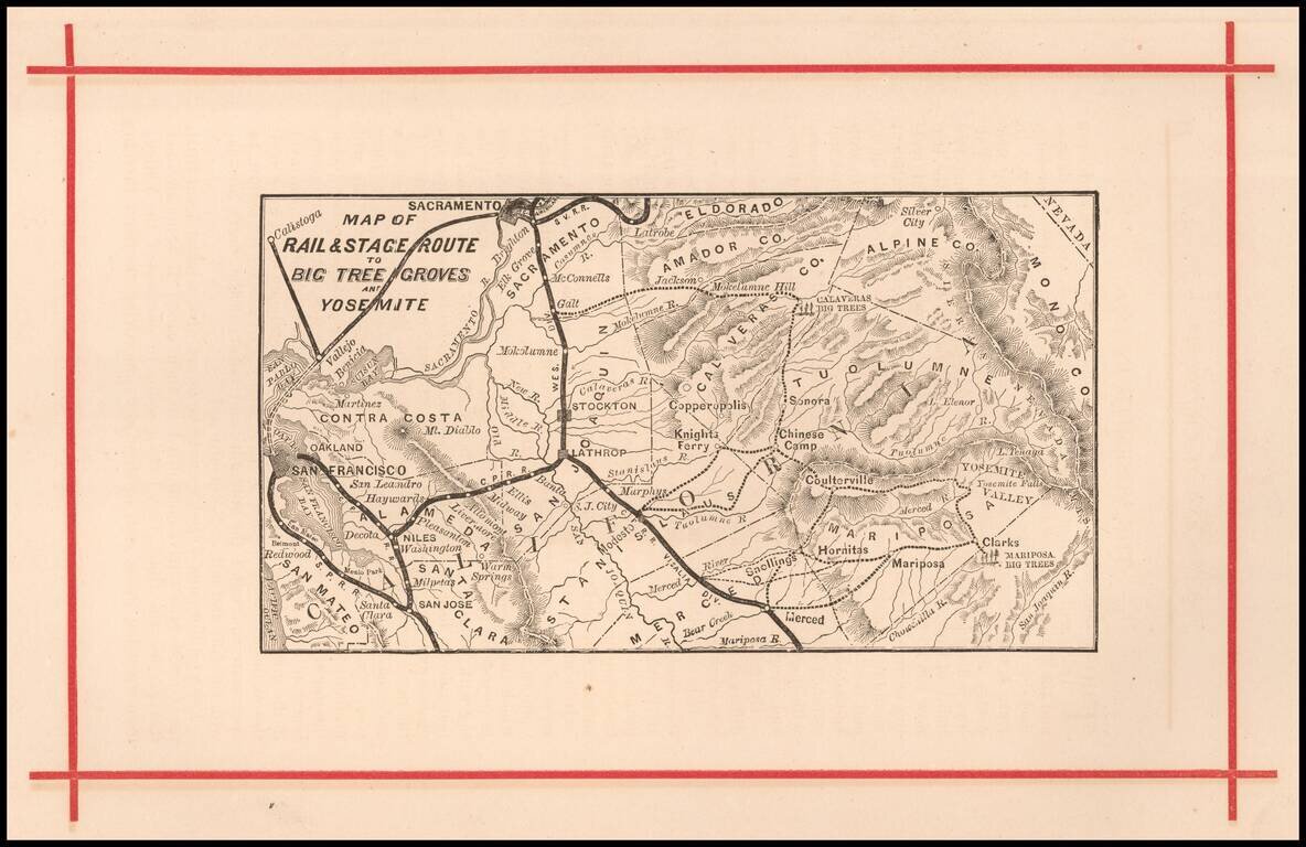
Rare early map of the routes to Yosemite and the Redwood Groves to the south, which would become Sequoia National Park. Versions of this map are known to have been published as early as 1872, in The Wonders of the Yosemite Valley, and of California...
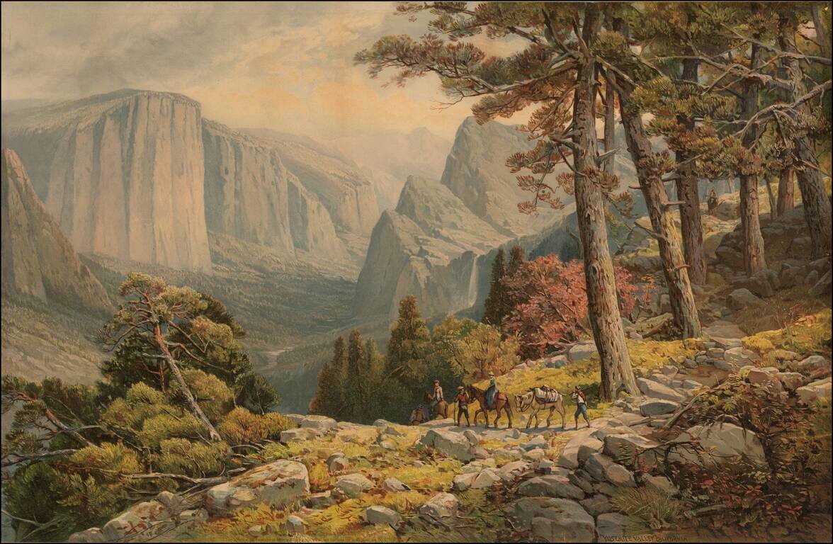
Fine large chromolithographic view of Yosemite Valley, looking from the Mariposa Trail in the Southwest corner of the valley toward El Capitan, the Three Brothers and Bridal Veil Falls. The image is drawn from a painting by Andrew Melrose.