
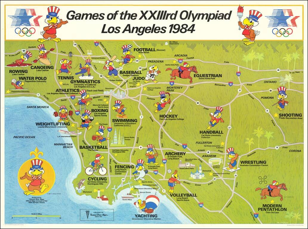
Los Angeles Olympics - 1984 Fine example of the official map of the 1984 Summer Olympics in Los Angeles. Each of the Olympic Sport venues around Southern California are shown, with the official mascot, which also appears on the compass rose.
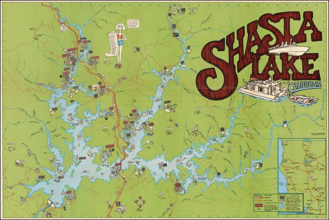
Colorful Recreational Map of Lake Shasta Detailed pictorial map of the area around Lake Shasta, California, published in 1983. The lake is filled with houseboats, motor boats, water skiers and sail boats. The map locates a number of islands, inlets...
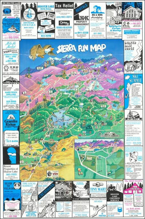
Lively pictorial map of the area centered on Shaver Lake. Attractions include Sierra Summit Ski Resort, John Muir Wilderness, Edison Lake, Ansel Adams Wilderness, Mammoth Lake, Huntington Lake, etc. The map is surrounded by local advertising. On the...
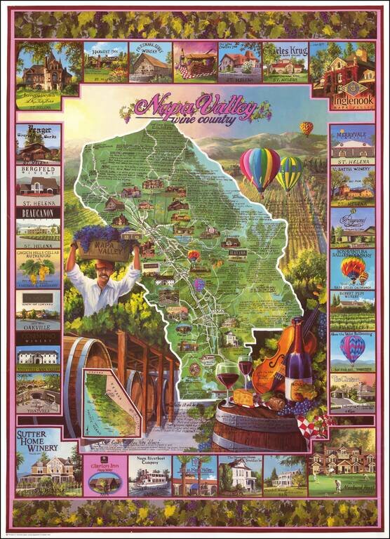
Decorative map of Napa Valley, focused on the locations of the major Wine producers and landmarks in the Valley. The map is surrounded by vignettes alternatively showing Valley landmarks and Wine producers.
![[Northern California] North Bay Horse Country](/map/small/62940.jpg)
Detailed promotional map of Northern California, advertising the horse riding facilities in the region. The map extends from Stockton and the South Bay to Clear Lake and Lake Sonoma, with illustrated advertising for riding schools, stables, hotels,...
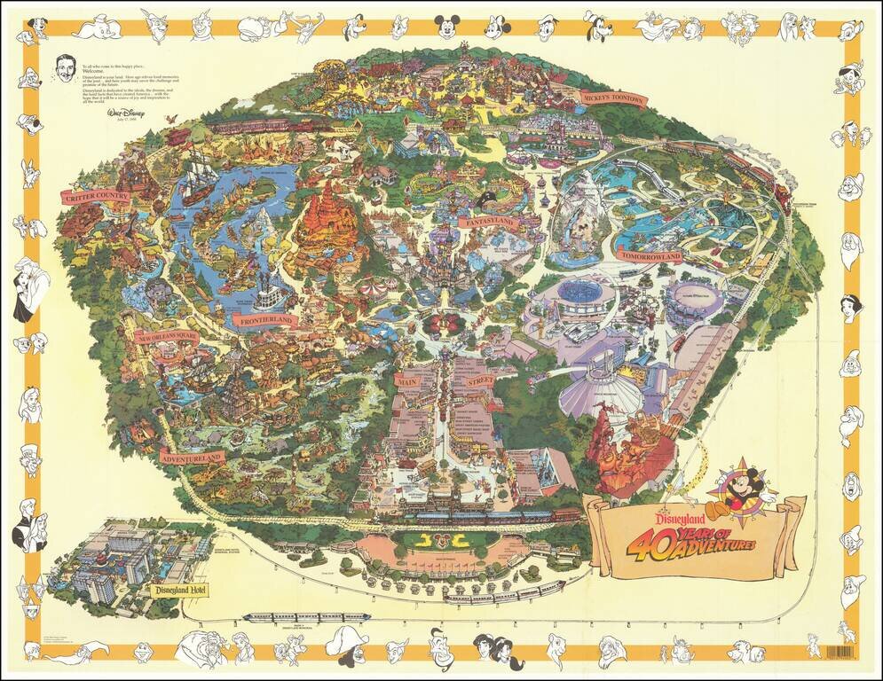
![[Rare Variant] Disneyland 40 Years of Adventure](/map/small/65639.jpg)
The Rare First State of the 1995 Map Finely illustrated map of the Magic Kingdom, celebrating its 40th anniversary. This is one of two nearly identical maps from 1995. The difference between the two maps relate to various errors, which were...
Second State of the 1995 Map Finely illustrated map of the Magic Kingdom, celebrating its 40th anniversary. This is one of two nearly identical maps from 1995. The difference between the two maps relate to various errors, which were discovered after...
![[San Francisco Bay] Plan of Port St. Francisco, in California, Point de Reyes in 37°59' of Latitude North & 124°54' Longitude West](/map/small/67853.jpg)
The Earliest Obtainable Map of San Francisco Bay Highly desirable map of San Francisco from the La Perouse's Voyages, the first obtainable map of San Francisco Bay. During his round the world voyage, La Perouse coasted southward along the California...
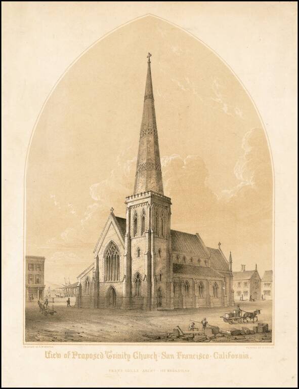
Rare early view of the proposed design for Trinity Church, as proposed by Architect Frank Gills, drawn by G.W. Burton and lithographed by Michelin in San Francisco. The Trinity Episcopal Church was organized in 1849, and first held services in a...
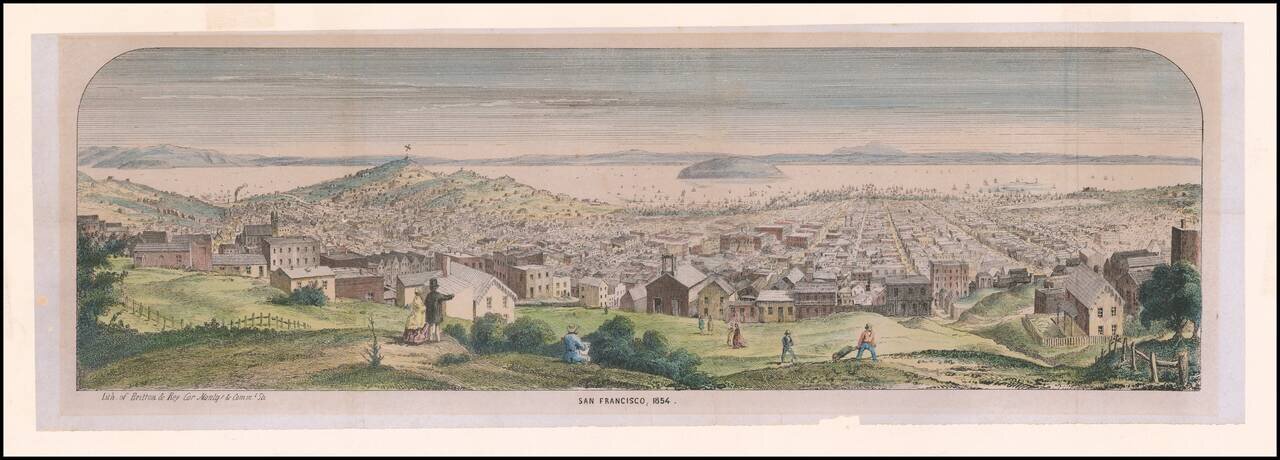
Rare Early Lettersheet View of San Francisco Panoramic view from Pacific Heights of densely populated city and harbor; Telegraph Hill and Russian Hill at left; Yerba Buena Island and bay in distance; artist sketching, onlookers and workers in...
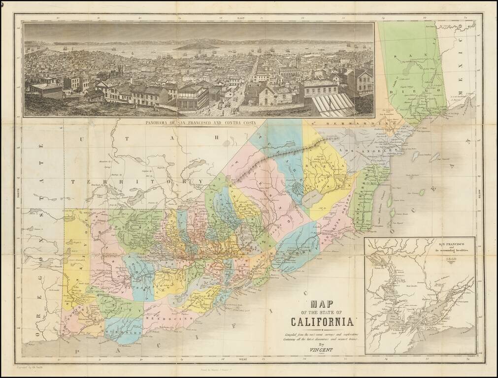
The Thomas Winthrop Streeter Copy Rare hand-colored engraved map of California with east at the top. The map includes a very nice inset view of San Francisco ("Panorama of San Francisco and Contra Costa") and a further inset of "San Francisco and its...
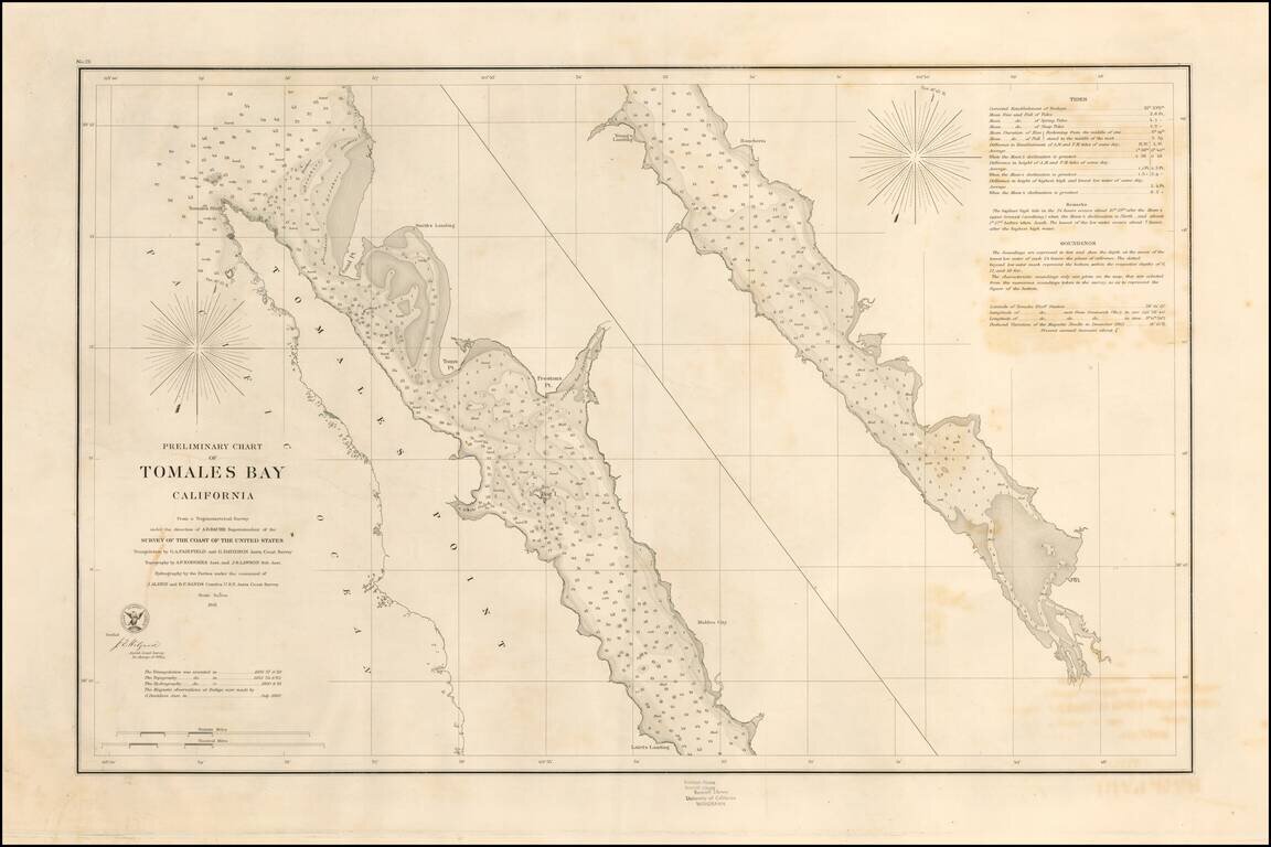
Rare separately pubilshed thick paper example of George Davidson's copy of the US Coast Survey Chart of Tomales Bay, first published in 1861. Tomales Bay's history is quite interesting, having been discovered by the English in the 16th Century,...
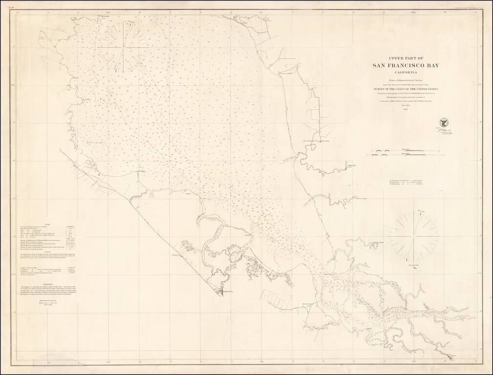
Rare separately issued chart of "Upper San Francisco Bay," published by the United States Coast Survey in 1862. The most northerly point on the map is Pt. Avisadero, just north of Candlestick Point and extending south to San Jose. The chart provides a...
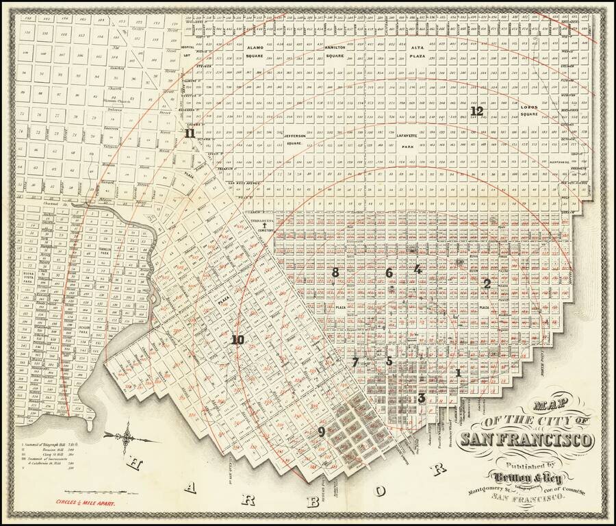
Presentation Copy! -- One of the Earliest Maps of San Francisco published in the City. Finely detailed map of the populated areas of San Francisco, oriented to the west. The map extends west to Divisadero; south to Alta. The present example is...
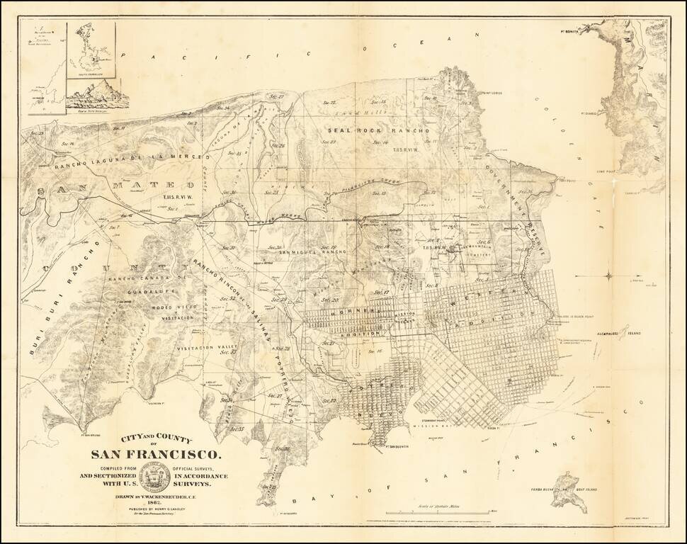
San Francisco at the Height of The Litigation over Land Ownership Claims Rare early map of the City and County of San Francisco, prepared by San Mateo County Vitus Wackenreuder and printed by Britton & Co in San Francisco. This is one of the...
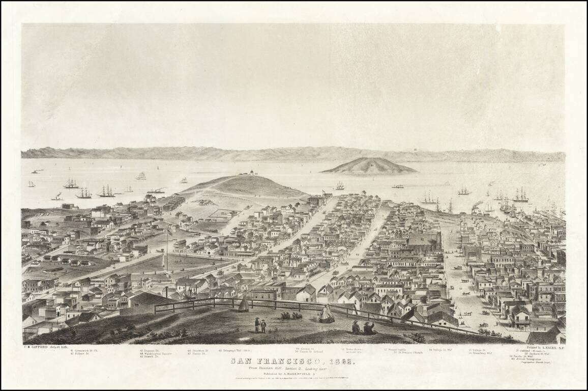
Sheet 3 of Gifford's rare 5-sheet (9 foot) panorama of San Francisco, published by A. Rosenfield in San Francisco, in 1862. The present sheet is centered on Telegraph Hill and Yerba Buena or Goat Island, with Oakland and the East Bay in the distance...