
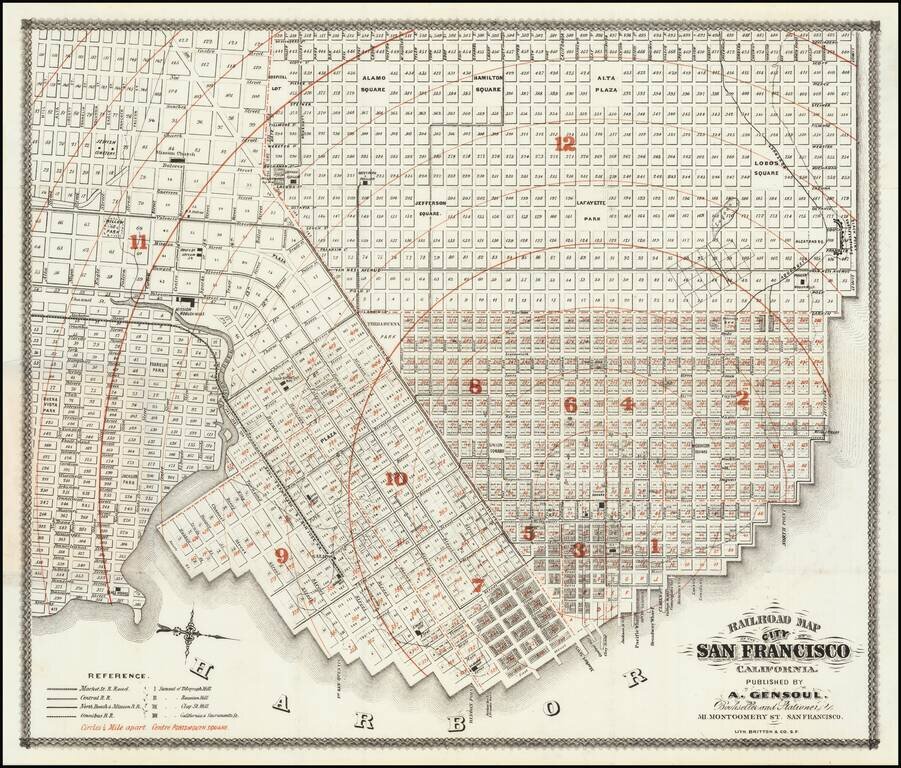
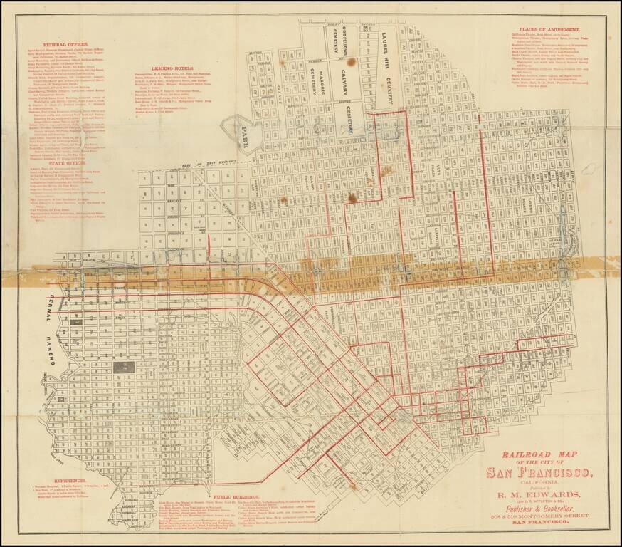
First state of "one of the rarest maps of the City of San Francisco" and one of the earliest printed in the city. The map shows the city in remarkable detail. Rumsey notes: Norris: "Very scarce railroad map of San Francisco." Streeter purchased the...
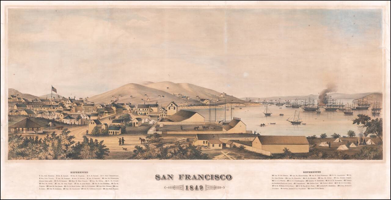
Fine Early View of San Francisco on the Eve of the Gold Rush An important San Francisco view, showing the city just a few months before the explosion in population which came with the Gold Rush. As noted by Deak: "A wide-ranging portrait of San...
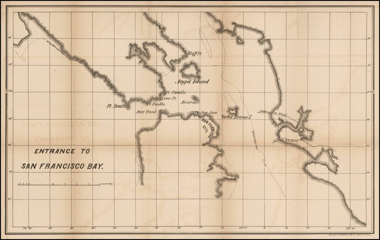
Rare map of the San Francisco Bay, published in New York, using Osborne's Process. The empahsis seems to be on the Railroad Wharves in Oakland and Alameda in the East Bay. We have been unable to determine the source of this map and have never...
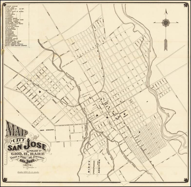
One of the Earliest Printed Maps (and Guides) for San Jose Fine early map of San Jose, lithographed in San Francisco by Britton & Rey in 1872. The map provides a fine early look at San Jose, including street names, early buildings, railroad...
Scarce folding map of San Francisco, with west at the top, printed in black and red, focusing on the city's budding urban rail system. Rumsey (258) dates his example to 1874 on the basis of the "new mint" at 5th and Mission. The first successful San...
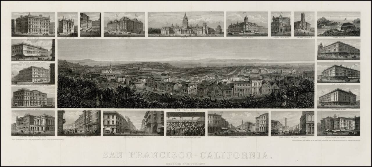
Unrecorded 1875 edition of Frederick Hess's fine steel engraved view of San Francisco, with 22 vignettes of San Francisco buildings. Very rare steel-engraved view of San Francisco with surrounding vignettes of various architectural landmarks of the...
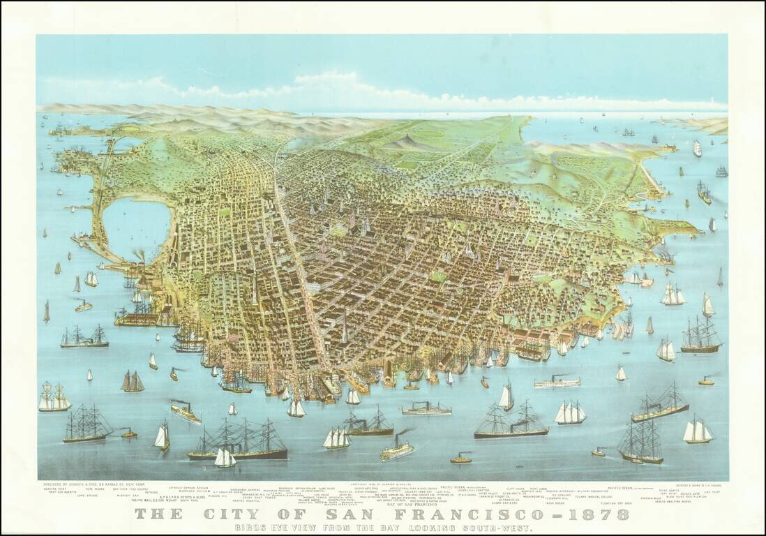
An early reproduction of Currier & Ives famous view of San Francisco, likely printed about 1920.
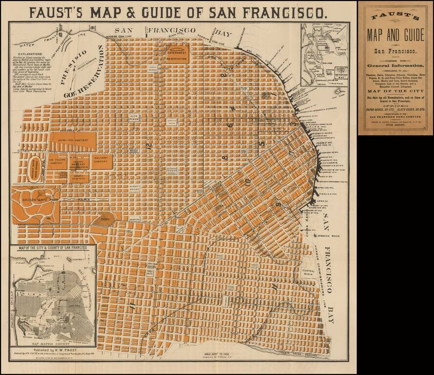
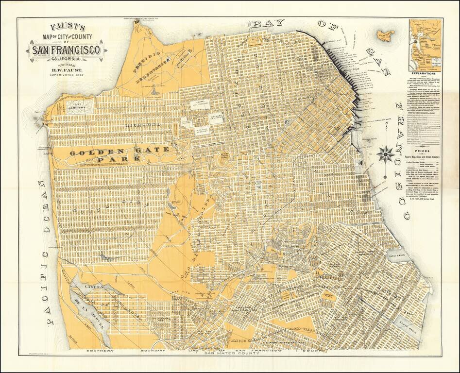
Very good example of Faust's map of the City of San Francisco. Not to be confused with his similar, but more common, map of the City and County of San Francisco, which extended to the Pacific in the west, and shows slightly less detail. The map...
![[Illustrated San Francisco Advertising Map] Map Business Portion San Francisco Showing Location of Hotels, Theaters, Etc. Etc.](/map/small/50207.jpg)
Rare Illustrated San Francisco Advertising Map Rare illustrated 19th Century San Francisco advertising map, which incorporates a map of the San Francisco Business District with finely illustrated advertisements on the front and back of the map. The...
![[Untitled Map of Pittburg, California & Vicinity] Pittsburg Chamber of Commerce Trade Card](/map/small/19402.jpg)
An interesting trade card map, with promotional info for the Pittsburg Chamber of Commerce on the verso. See verso here: /gallery/enlarge/19402a
Nice example of this early edition of Faust's map of San Francisco, one of the most striking maps of the period, surrounded by promotional information for local merchants, etc. Faust's map provides a highly detailed look at San Francisco at the end of...
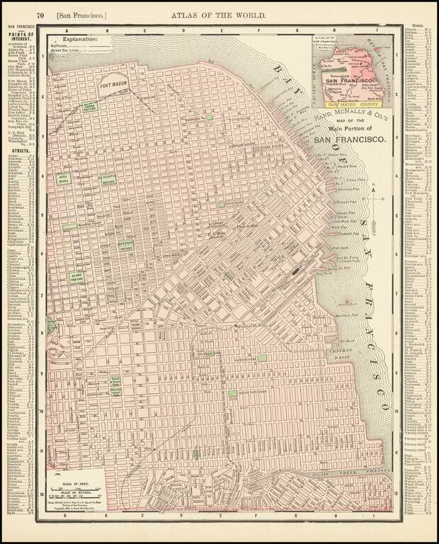
Detailed map of San Francisco, showing towns, wharfs, rail lines, street car lines, roads, buildings, etc. Includes a key with points of Interest, Streets, etc.
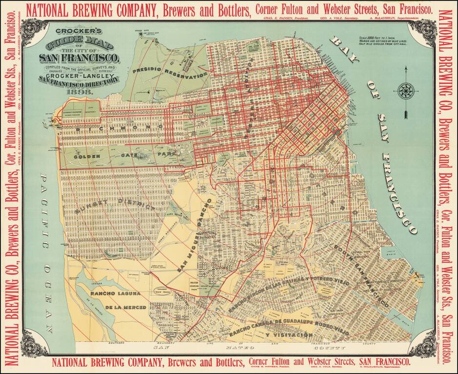
A Gorgeous Late 19th Century Map of San Francisco with Brewery Advertising Striking map of San Francisco, published by Crocker in 1898. The map provides a highly detailed look at the city, with marvelous contrasting color. The map is surrounded by...
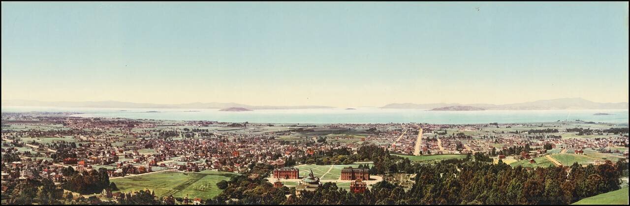
An Early Color Photographic View of UC Berkeley and the Bay Area. Attractive photochrome view of Berkeley, California, taken by one of the West's greatest photographers, William Henry Jackson. In the immediate foreground, the first buildings of the...
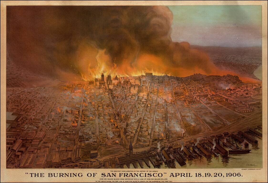
Striking Cityscape of San Francisco on Fire Detailed and dramatic view of San Francisco on fire after an earthquake in 1906. On the wharf, the lithographic print shows steam ships ready to depart the docks. A crowd is gathered nearby, presumably to...
![Map of City and County of San Francisco. H.A. Candrian, Copyright 1906 -- [Promotional Map for California Art Glass Works] [Map of Oakland, Alameda & Berkeley on verso]](/map/small/69224.jpg)
Striking map of San Francisco, published in 1906. The map includes advertising for California Art Glass Works and Hanson Co. Printing. Includes a fine large map of Oakland, Berkeley and Alameda on the verso.