Scarce map of America, published in Amsterdam by Gerard Valk. Valk's map of California shows many of the most fascinating myths of the 17th Century. California is shown as an island on the so-called "second Sanson Model." A massive land bridge extends...

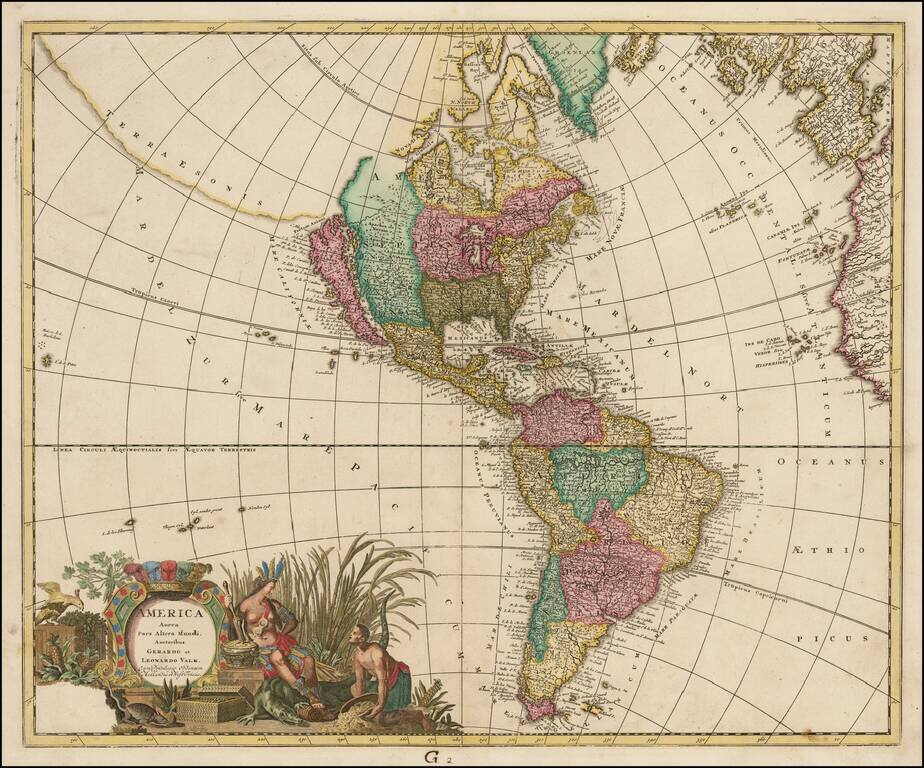
Rare map of the Western Hemisphere in mirror image format, from a very rare work by Pierre Moullart Sanson, the grandson of Nicolas Sanson the Elder. The map is part of a series of maps intended to depict the various ways of depicting the Globe. The...
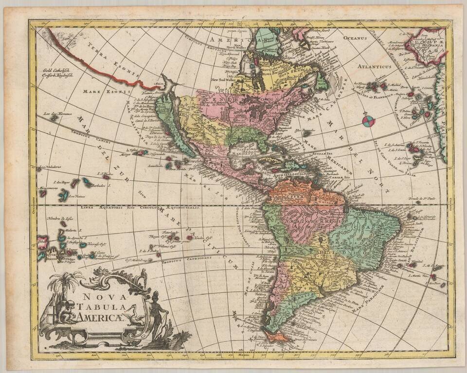
Decorative example of this striking map of America, showing California as an Island based upon the Second Sanson Model, published by the Valk family. Terrae Esonis and Fretum Anian shown in the Northwest. Intriguing detail in the interior. Mississippi...
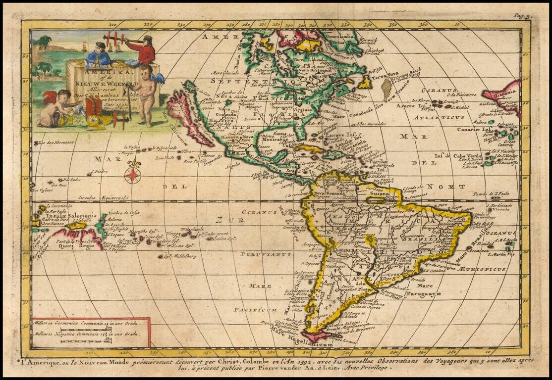
Decorative map of America, illustrating the voyage of Christopher Columbus to then New World in 1492. Includes and incomplete Great Lakes, unknown Northwest Coast of America, highly inaccurate mapping of the Mississippi River, the 7 Cities of Cibola...
Scarce Zurner Map of America -- California shown as an Island. Fine old color example of this scarce map of America, showing California as an island, published by Zurner and engraved by Pieter Schenk. Zurner's map is a fascinating compilation of up...
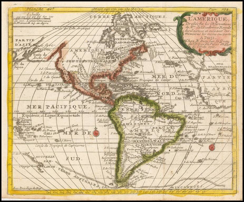
Scarce map of America with a fascinating treatment of the Northwest Coast of America. The map shows a very unusual "est fort Inconu" and "Terre de Jesso," a curious marriage between the treatment of the region from the mid-17th century and more...
![[California as an Island - First State!] Totius Americae Septentrionalis et Meridionalis Novissima Representatio . . .](/map/small/69781.jpg)
Nice example of the first edition of Johann Baptiste Homann's map of America, showing California as an Island on the second Sanson model and pre-dating Homann's privilege. The Straits of Anian are shown forming a Northwest Passage between California...
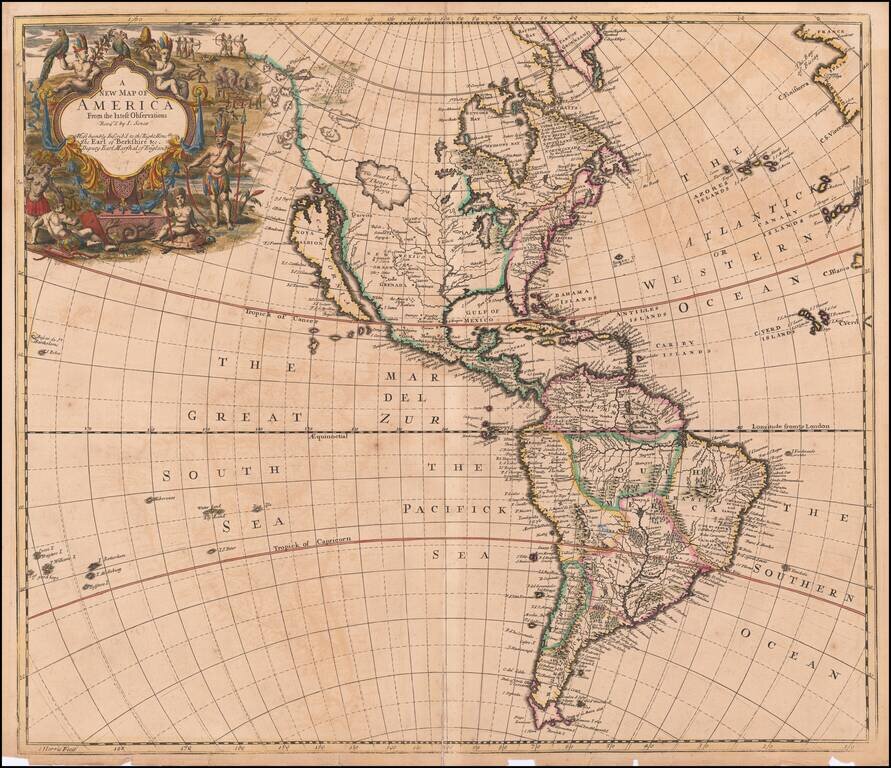
Nice example of John Senex's decorative map of America. Senex's map is curious for several reasons. First, unlike most maps of the period, Senex adds a conjectural Northwest Coastline, which includes a number of islands and several lakes, including...
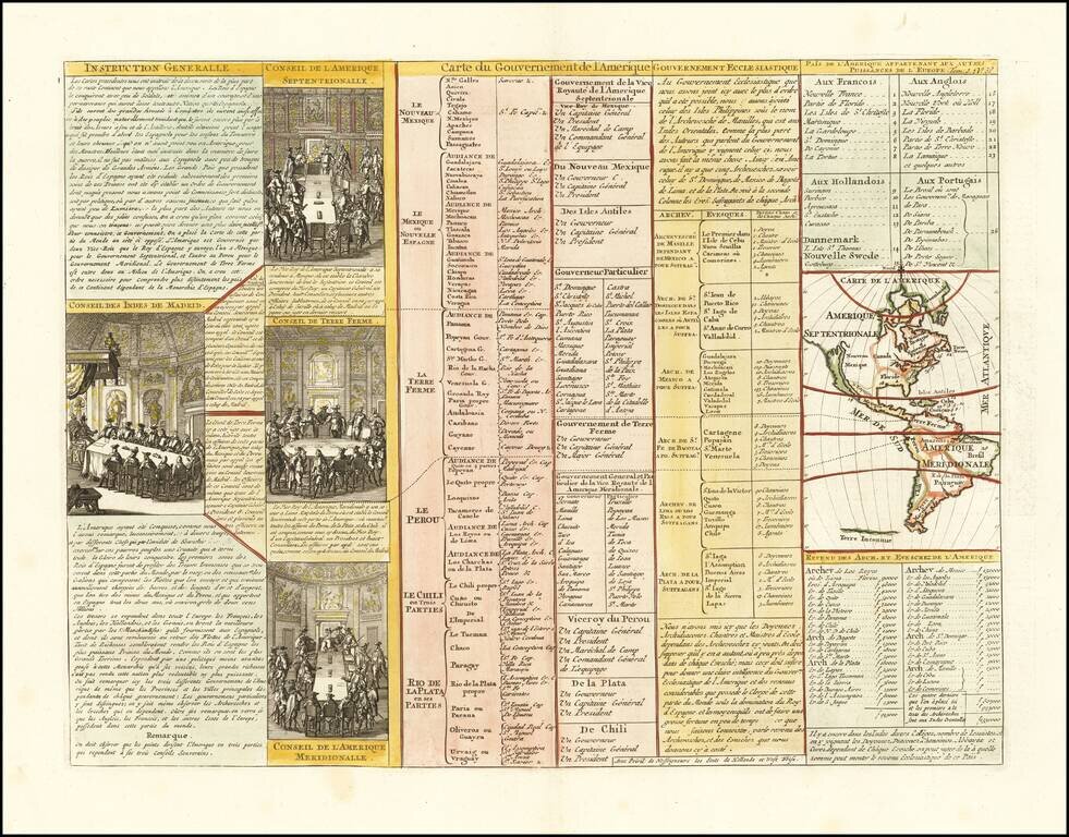
Interesting map of North America, showing California as an island, from Chatelain's monumental 7 volume Atlas Historique. Includes 4 printed views of the counsels of the West Indies, North America, South America and Terre Ferme.
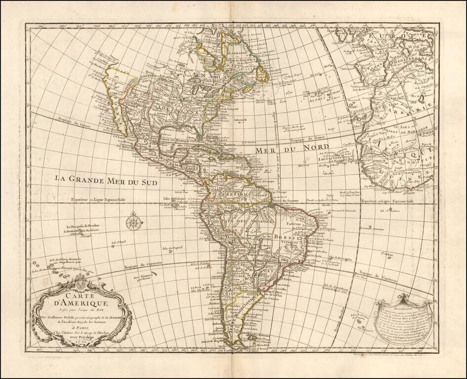
1745 state of this finely engraved map of America, published by Guillaume De L'Isle in Paris. De L'Isle's map of America was compiled from the best available source and includes significant modern cartographic detail for the period. California is...
Scarce map of America, featuring a number of the most famous myths and inaccuracies on contemporary maps of the period. California is shown as an island on the second Sanson model, including over 30 place names. The Mississippi River is shown flowing...

Early Four-Sheet Sea Chart of the Atlantic Ocean Scarce and detailed early eighteenth-century English set of sea charts of the Atlantic Ocean, with a fine, large inset of the area between the Hudson River and the mouth of the Chesapeake Bay. The...
![Americae Aucta Delineatio [California as an Island]](/map/small/67220.jpg)
Decorative map from a scarce A.F. Zurner atlas. Full original color. Shows a unique projection of California as an island, and marvelous Terra Iesso, running from Fretum Anian to Japan. Bits of Australia are shown as Quiri Regio. A nice scarce map.
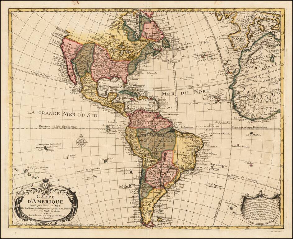
A Rare Map of America By the Royal Belgian Geographer Fine old color example of Eugene Henri Fricx's rare and finely engraved map of America, published by Guillaume De L'Isle in Paris. De L'Isle's map of America was compiled from the best available...
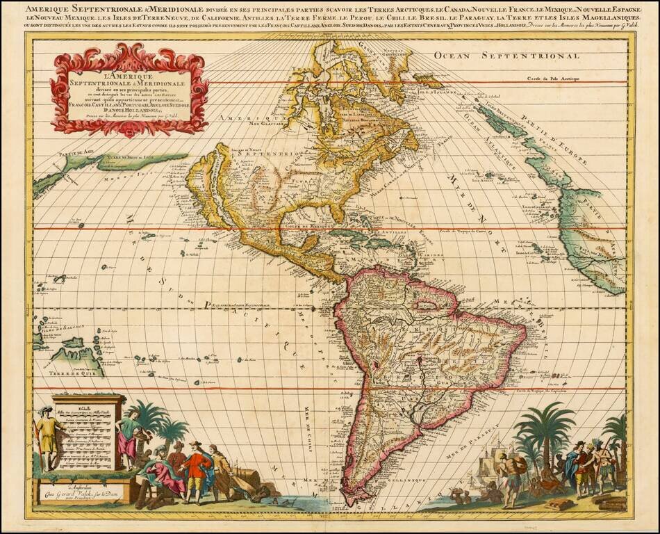
Striking, Richly Engraved Map of the Americas Fine, decorative and detailed map of the Americas, with California as an island and two richly illustrated cartouches. The present map depicts the Americas and parts of France, Spain, Portugal, and...
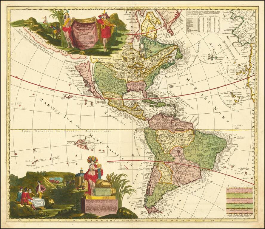
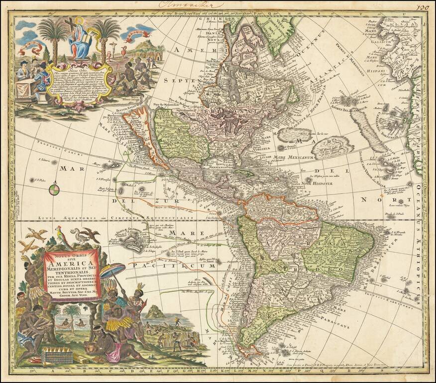
Fascinating map of America, illustrating a number of the great myths of the 17th and early 18th Centuries. The map illustrated the Dutch translation of Father Jean Francois Lafitau's Moeurs des Sauvages Ameriquains, comparées aux moeurs de premiers...