Map size in jpg-format: 158.929MiB
Click to open in high resolution (open in new tab).
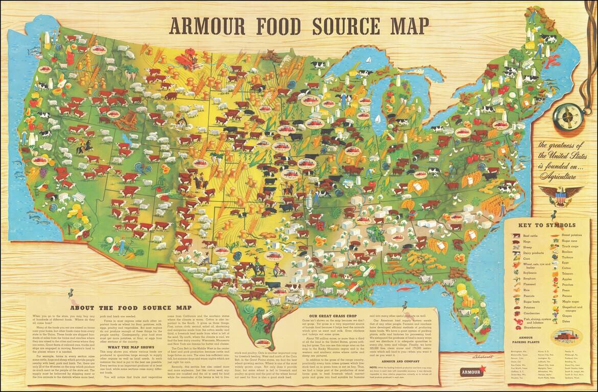
Scarce promotional map published by Armour & Company, displaying and illustrating the agricultural regions of the United States.
This is the second of Armour's food maps, updated from the 1922 edition. It includes a lengthy text explanation of Armour's production chain, from farm to grocery store, with a list of Armour's 27 packing plants.
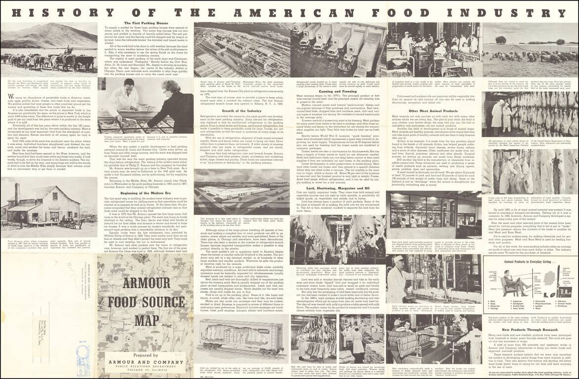
Nice pictorial "History of the American Food Industry" on the verso.
If you are a student, write to us in telegram: @antiquemaps and indicate what material you need and for what work you need a map in high detail. We are ready to provide material on special terms. For students only!

![[Signed Political Satire Artwork] Vietnam ... Vietnam ... Vietnam ...](/map/small/68726.jpg)
