Map size in jpg-format: 166.925MiB
Click to open in high resolution (open in new tab).
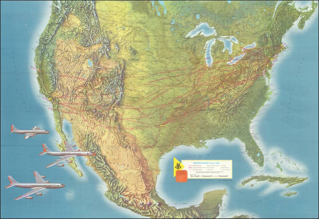
Striking example of this American Airlines promotional map, introducing the upcoming launch of Stage II of the 707 Astrojet.
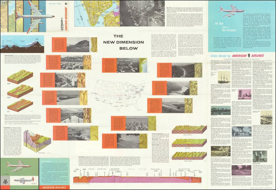
First introduced in 1959, the Boeing 707 "Astrojet" would become the backbone of commercial aviation. The present map was issued in 1961, shortly before American began flying the Stage II model of the 707, as discussed on the text on the verso.
The verso text also includes a detailed explanation of the geological and topographical features over which American was flying in the US and a list of cities serviced by American.
If you are a student, write to us in telegram: @antiquemaps and indicate what material you need and for what work you need a map in high detail. We are ready to provide material on special terms. For students only!

![[Signed Political Satire Artwork] Vietnam ... Vietnam ... Vietnam ...](/map/small/68726.jpg)
