Map size in jpg-format: 63.301MiB
Click to open in high resolution (open in new tab).
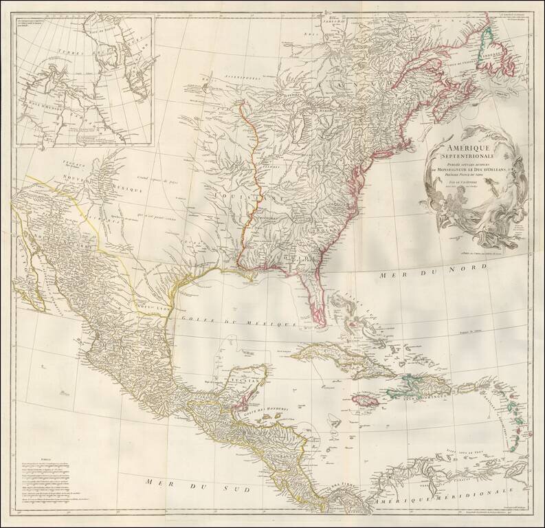
Nice unjoined example of D'Anville's 4 sheet map of North America, one of the best French Maps of North America prior to the French & Indian War.
The map shortly after Bellin's seminal map of the Great Lakes, although the projection of Lake Michigan appears to lean slightly toward the East, unlike Bellin's and subsequent maps. Karpinski notes that D'Anville, who was the foremost of the French Cartographers following De L'Isle, treats there region around the Great Lakes with considerably more accuracy than John Mitchell's map of 1755.
The map provides nice detail along the Rio Grande and an excellent treatment of the Mississippi and Missouri River Valleys for the period. Lahontan's Grande Rivier is retained west of Lac Du Bois. The Trans-Appalachian treatment in the Ohio Valley and below the Great Lakes reflects the superior knowledge of the French in these regions, owing largely to the Jesuit activity from the St. Lawrence to the Great Lakes and down the Mississippi River over the prior 150 years.
The newly formed colony of Georgia appears above Florida, which is in a modest Archipelagic state.
If you are a student, write to us in telegram: @antiquemaps and indicate what material you need and for what work you need a map in high detail. We are ready to provide material on special terms. For students only!


![[Signed Political Satire Artwork] Vietnam ... Vietnam ... Vietnam ...](/map/small/68726.jpg)