Map size in jpg-format: 5904490B
Click to open in high resolution (open in new tab).
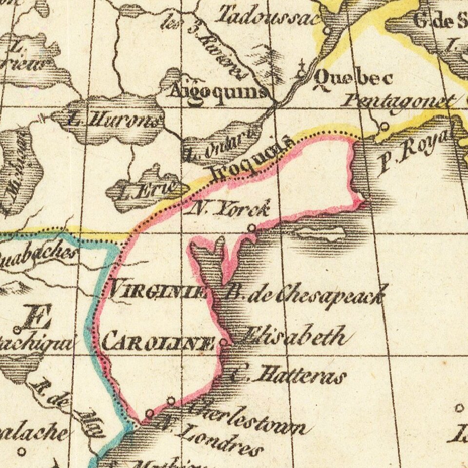
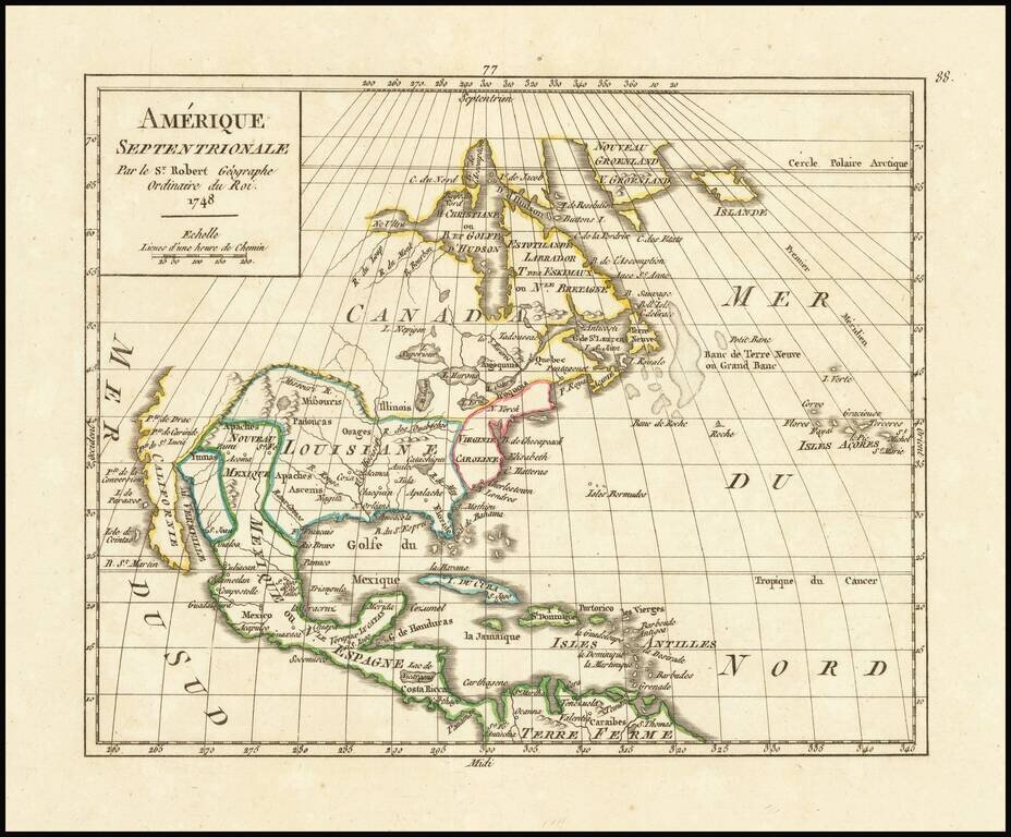
Interesting mid 18th Century map of North America, published by Robert De Vaugondy.
The map shows Quivira, Nouvelle Albion, P. de Drake, etc., on the West Coast of North America, which extends North to C. Blanc and shows the inland river.
A number of western Indian Tribes are named. Floride is shown along the Texas coastline. The Mississippi River is moved considerably west of its correct location. The Great Lakes are shown in a still primitive fashion.
The Florida Peninsula takes on a curious shape. A number of place names along the Rio Grande and in the Southwest.
Gilles Robert de Vaugondy (1688-1766) was the head of a leading family of geographers in eighteenth century France. Gilles got his start when he jointly inherited the shop of Pierre-Moullart Sanson, grandson of the famous geographer Nicholas Sanson. The inheritance included the business, its stock of plates, and a roller press. In 1760 Gilles became geographer to King Louis XV. His son, Didier Robert de Vaugondy (ca. 1723-1786), was also a geographer and the two worked together. They were known for their exactitude and depth of research. In 1757, they produced the Atlas Universel, considered an authority for many years.
If you are a student, write to us in telegram: @antiquemaps and indicate what material you need and for what work you need a map in high detail. We are ready to provide material on special terms. For students only!


![[Signed Political Satire Artwork] Vietnam ... Vietnam ... Vietnam ...](/map/small/68726.jpg)