
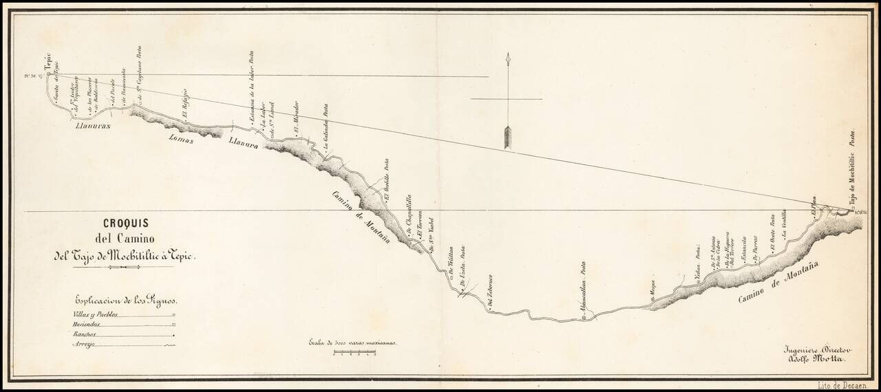
Detailed map of the road from Tepic, southeast toward Guadalajara, published in Mexico City and signed by Ingeniero Director Adolfo Motta. The map is based upon a manuscript map by J.A. Motta, drawn in 1856, as described by Manuel Orozco y Berra, in...
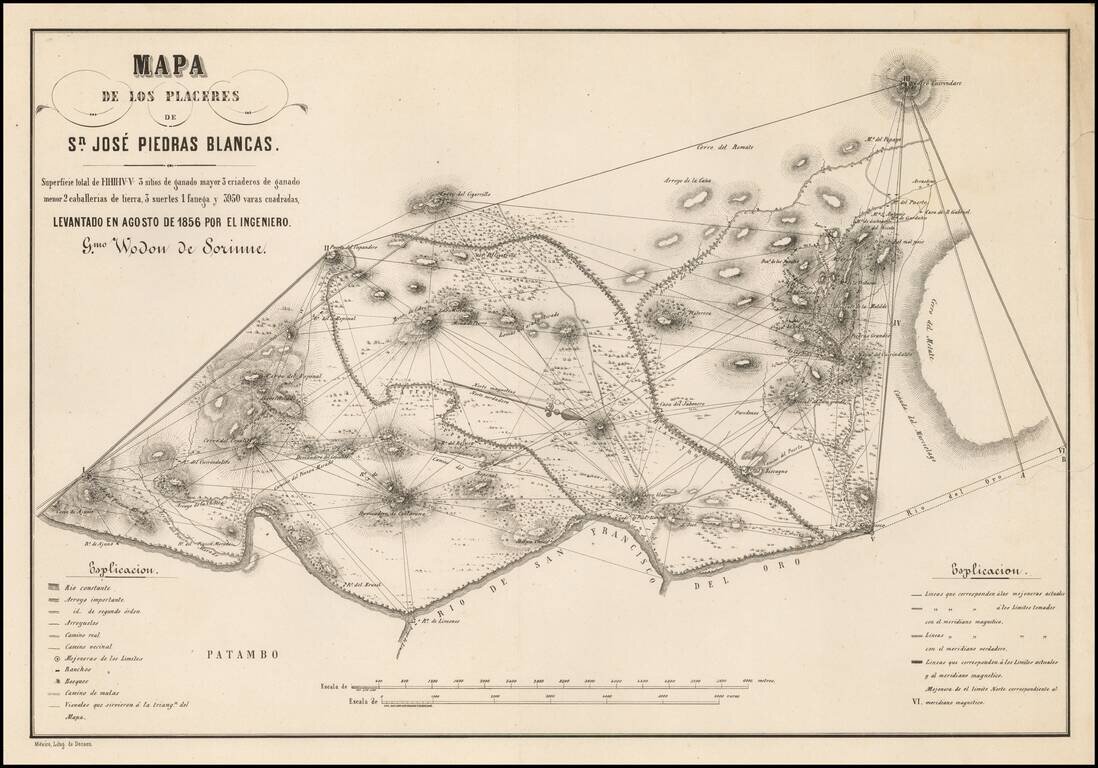
Detailed map of the area around San Jose Piedras Blancas (Michoacan) by the Belgian Engineer Guilermo Wodon de Sorinne, an important observer of regional Mexican culture. The map shows Wodon de Sorinne's triangulation methodology in surveying the...
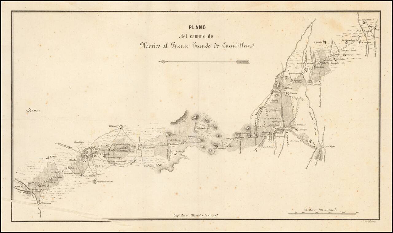
The Southernmost Portion of the Camino Real de Tierra Adentro (Road to Santa Fe). Rare map showing the southernmost portion of the Camino Real, proceeding north from the outskirts of Mexico City toward Santa Fe. The map is oriented with east at the...
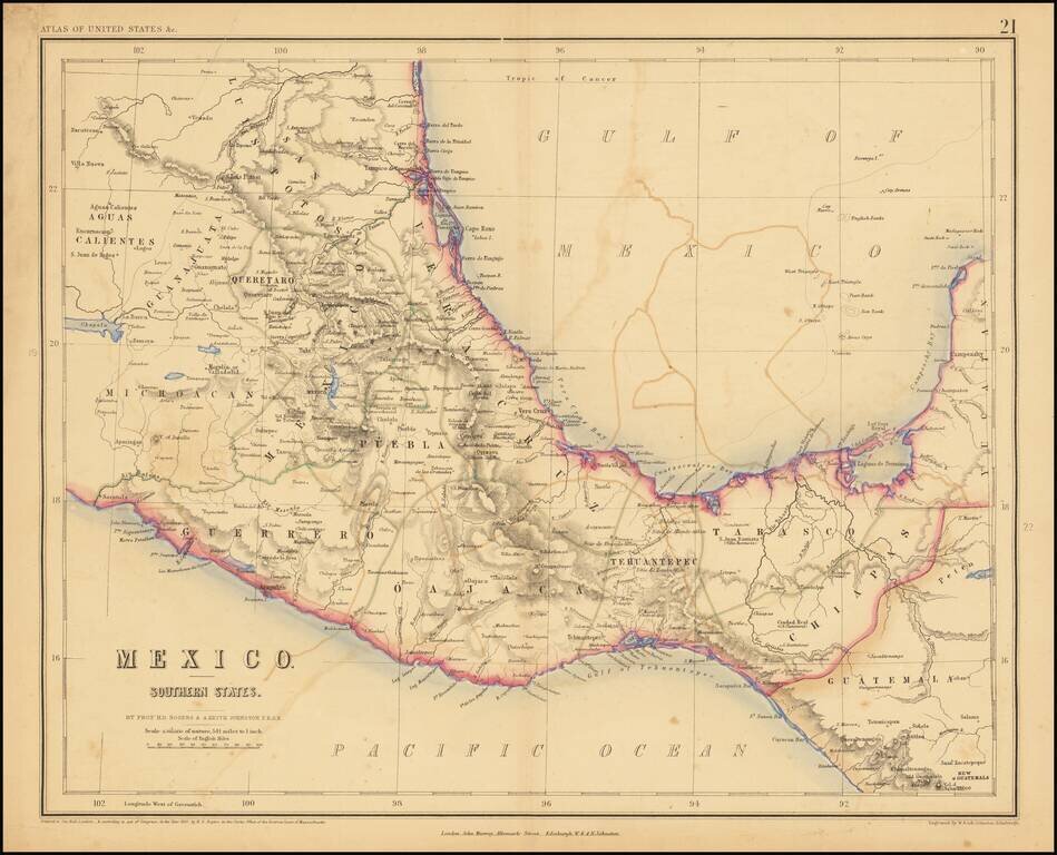
Lithographed map of Southern Mexico by Rogers & Johnston. The map covers the states of Queretaro, Mexico, Puebla, Veracruz, Oajaca, Guerrero, Tehuantepec, Tabasco, Chiapas.
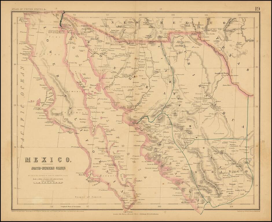
Rare map of Northern Mexico, from Rogers & Johnston's rare Atlas of the United States. The map is part of a wall map of the United States & Mexico, published by Rogers & Johnston. Conceived as a collaborative effort between W & AK...
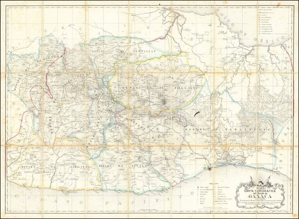
Early Modern Map of the State of Oaxaca Finely executed map of the State of Oaxaca, prepared by C. Manuel Ortega and lithographed by Litog de Salazar, on Calle de la Palma in Mexico City. Drawn from Ortega's original map of Oaxaca (#787 in the...
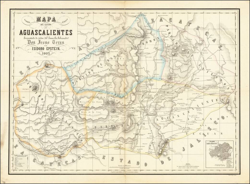
Detailed Map of the State of Aguascalientes Fine map of Aguascalientes, drawn by German mapmaker Isidoro Epstein, under direction by Governor Jesús Terán and published by the lithography shop of Decaen. This is one of the first separately published...
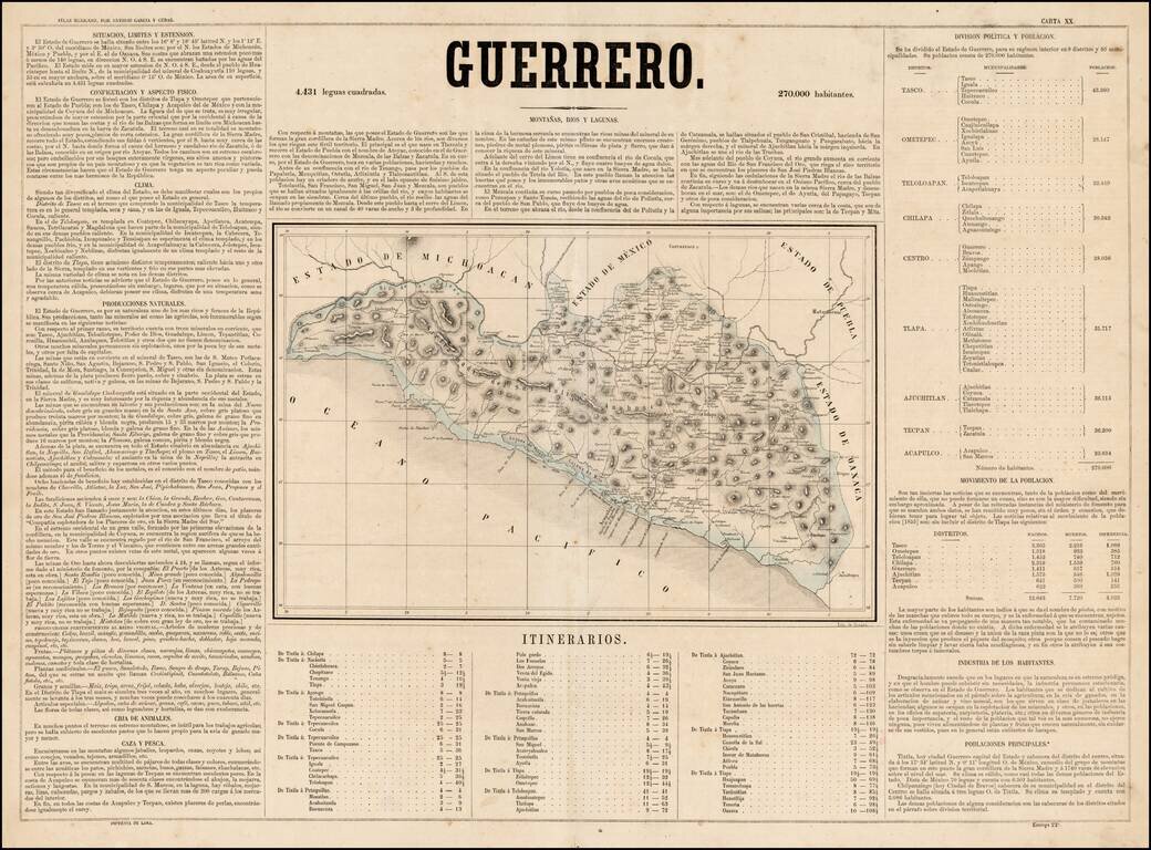
Scarce map of the State of Guerrero in Mexico, from Antonio Garcia y Cubas' monumental Atlas Geographico, Estadistico e Historico de la Republica Mexicana, the first atlas of the Mexican Republic. Garcia Cubas' map of Guerrero is one of the earliest...
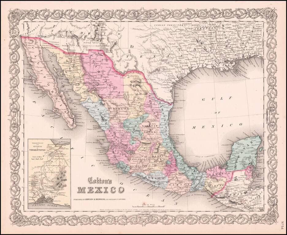
Very detailed map showing towns, counties, Gulf of Mexcico and Gulf of California with lovely decorative border and inset of Territory and Isthmus of Tehuantepec. An excellent pre-Civil War map. From the scarce 1859 edition of Colton's atlas, which is...

Detailed lithographed map of the Mexican State of Campeche on the western side of the Yucatan Peninsula, published in Mexico in 1861. The map differentiates between eight (!) different kinds of settlements, including haciendas, rancherias, villas,...
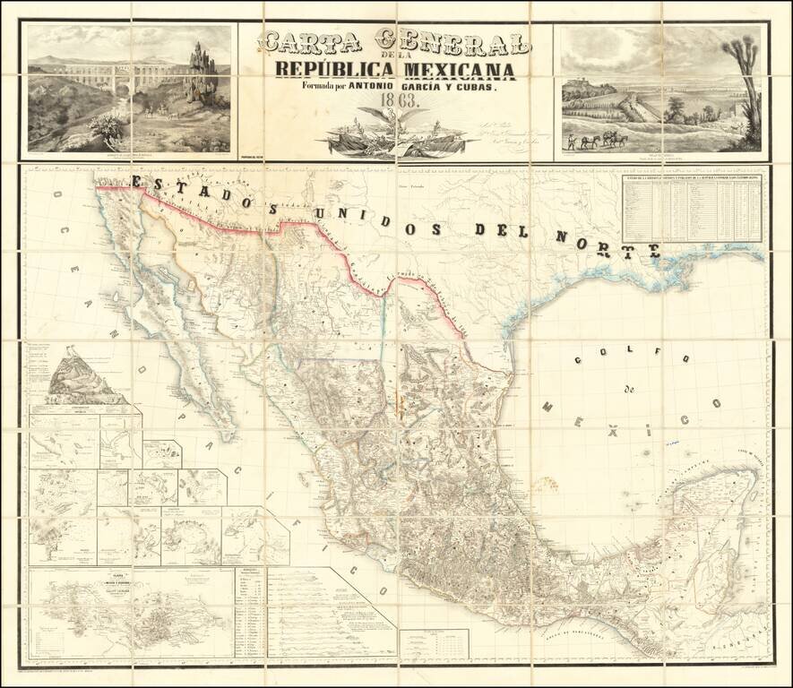
The First Wall Map of The Mexican Republic Published in Mexico Fine example of the first official map of Mexico published in Mexico from indigenous surveys. Antonio Garcia y Cubas' map of Mexico is the first official map of Mexico, printed in Mexico...
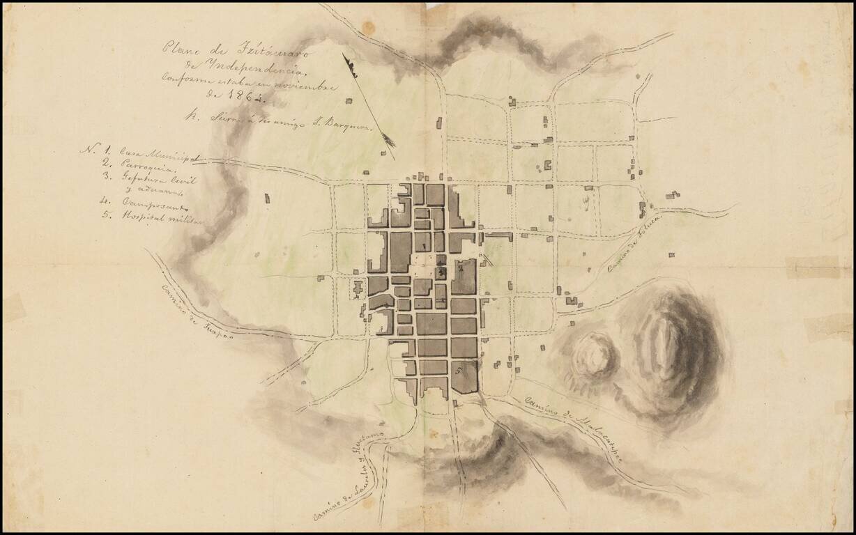
Town Plan of Zitácuaro de Independencia with Manuscript Notes This is a sketch of a plan of Zitácuaro, another copy of which is available at /gallery/detail/49465ba . It is not an exact copy, however, as it has some manuscript notes, including one...
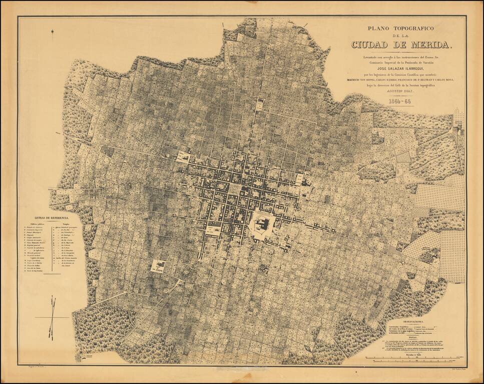
Fine photo-lithographic reproduction of Augustin Diaz's rare plan of Merida, originally published in Paris in 1865 for the Comision Cientifica. The map notes at the bottom center (obliterated on this copy) that it was reproduced by the Engineer...
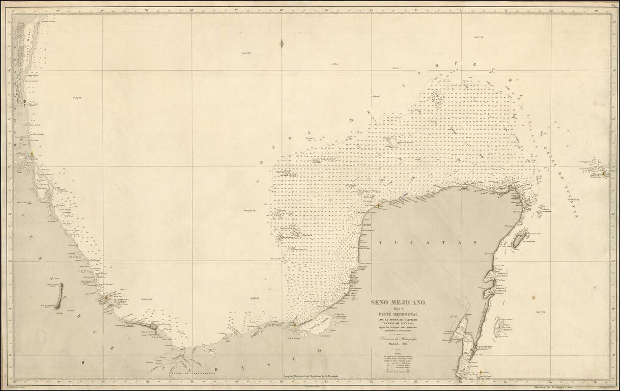
Scarce separately issued Spanish Sea chart of the Coast of Mexico, from Santander to Yucatan. Highly detailed, including soundings and lighthouses.
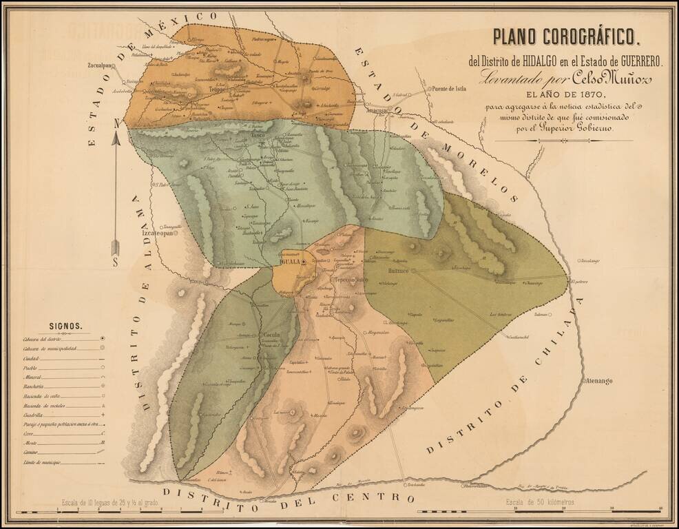
Rare map of the Hidalgo District in the State of Guerrero. showing its divisions and highlighting the cities of Iguala, Cocula, Huitzuco, Taxco and Tetipac. The map shows topographical details, roads, routes, towns, ranches and haciendas.
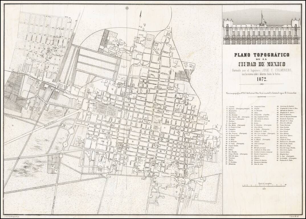
Rare separately issued map of Mexico City, lithographed by V. de Murguia e hijos in Mexico City. The map provides a fine overview of the city, including identifying newly opened streets, as noted in the title of the map. The map includes an inset...