
![[Untitled Map of Baja California & West Coast of Mexico]](/map/small/65439.jpg)
First Printing of Domingo del Castillo's 1541 Map of Baja and the West Coast of Mexico Fine example of Domingo del Castillo's map of Mexico, which appeared in Lorenzana's Historia de Nueva-España, escrita por su esclarecido conquistador Hernan...
![[Volcanos] The Bay of Honduras. By Thos. Jefferys Geographer to His Majesty](/map/small/70861.jpg)
With Volcanos in El Salvador and Guatemala shown Nice example of Thomas Jefferys chart of the coastline from Salamanca de Bacalar to Brewer's Lagoon and the Moskito Coast, centered on the Gulf of Honduras and the Rio Balize. Extends to the Port of...
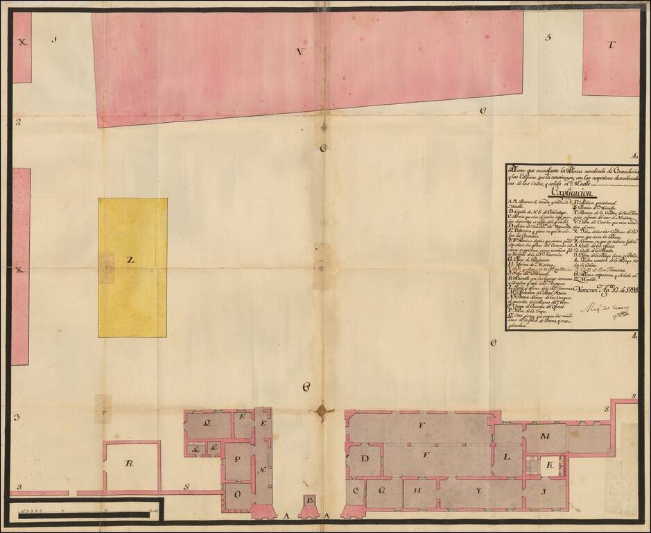
Manuscript Plan of Veracruz's Plaza Contaduria, the Accounting Place of Empire This is a plan of one of Veracruz's plazas. This particular plaza, Contaduria, was used to monitor commerce, as Veracruz was the most important port in New Spain. The plan...
![[Manuscript Map of Part of Morelos]](/map/small/49429ba.jpg)
Manuscript pictographic map of Morelos showing area now partially underwater This is a road and boundary map with pictographic symbols showing area in the modern state of Morelos. At least some of the area is now underwater, inundated by the man-made...
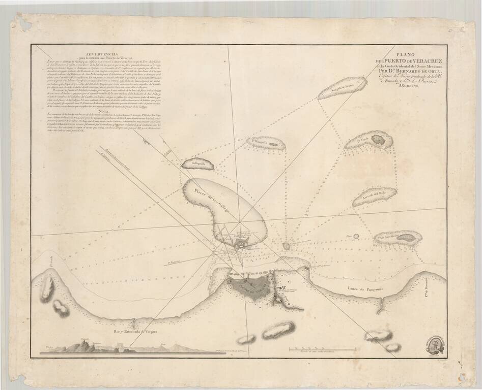
Rare separately issued chart of the harbor at Vera Cruz, as surveyed by Bernardo Orta in 1798. The chart was of such importance that it was later re-issued on a smaller scale by Alexander von Humboldt. Orta's chart shows the coast of Mexico and the...
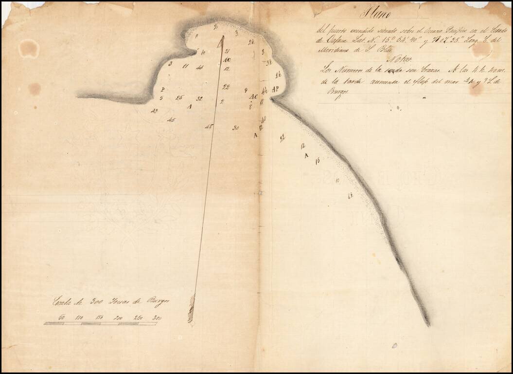
Finely-Executed, Early Manuscript Plan of Puerto Escondido, in the State of Oaxaca Good example of a survey of Puerto Escondido, most likely sketched in the early-nineteenth century. The plan shows the bay with detailed soundings and is one of the...
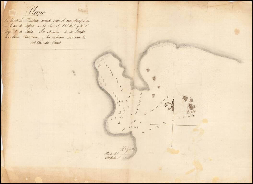
Detailed, Early Manuscript Plan of Huatulco, Oaxaca Finely-executed sketch of the port of Huatulco in the state of Oaxaca, Mexico. The north-oriented plan shows sounding depths and sea-floor quality indications, one of the earliest surveys to show...
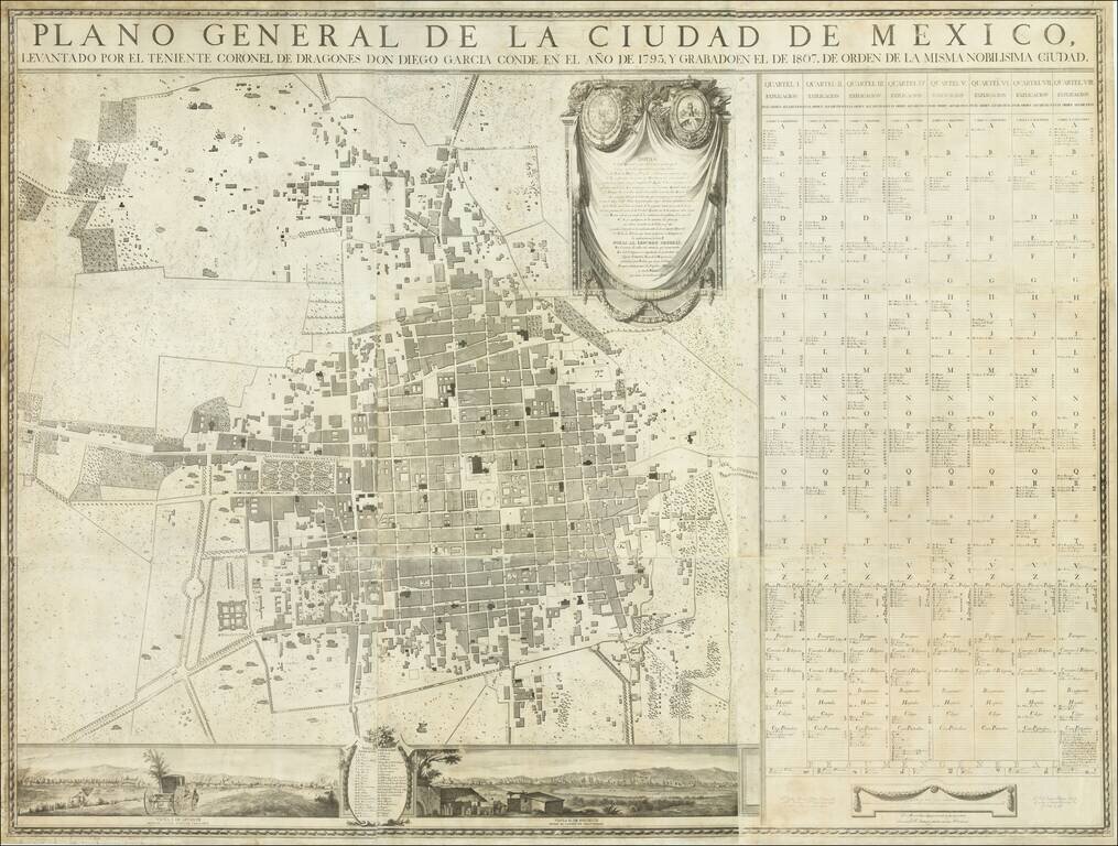
One of the Earliest Printed Maps of Mexico City—Extremely Rare First Edition! Fine nine-sheet plan of Mexico City surveyed by Diego Garcia Conde and compiled by some of Mexico's most important engravers and artists. It was published in Mexico City...
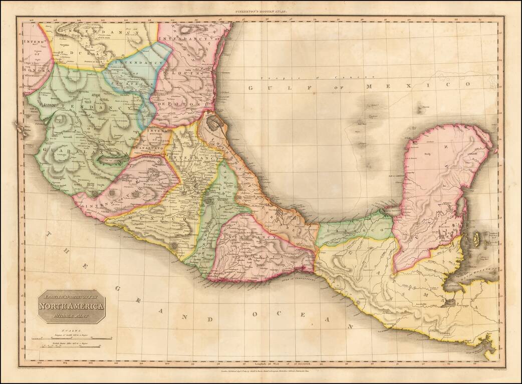
Fine example of John Pinkerton's finely detailed map of Southern Mexico, the Yucatan and Guatemala, published in 1811. The map provides a fine depiction of the heart of Mexico, just months after the Grito de Dolores, on September 16, 1810, and...
![[Gulf Coast, Mexico, Puebla, Vera Cruz, etc] Amer. Sep. No. 65. Partie Du Mexique](/map/small/55042.jpg)
Highly detailed regional map of the east coast of Mexico, extending from Nuevo Santander and Barra de Santander in the North to Pres. De San Felipe and Barra de S. Pedro, and including virtually all of Vera Cruz and Puebla and extending west to include...
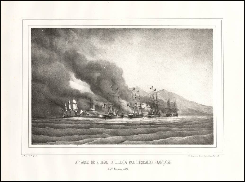
The Decisive Battle of the Pastry War Fine early lithographic view depicting the Battle of Veracruz. Overview During the early years of the new Mexican republic there was widespread civil disorder as factions competed for control of the country....
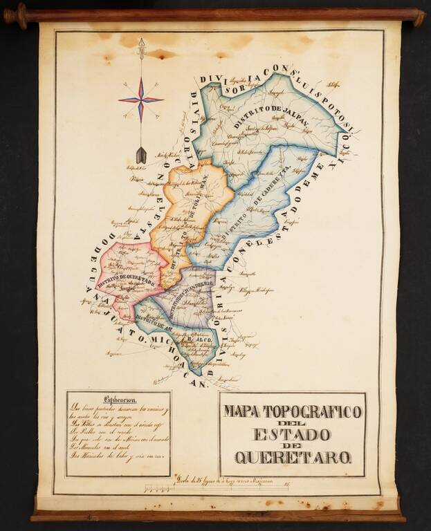
Striking Manuscript Map of the Mexican State of Querétaro Colorful and detailed manuscript map of the state of Querétaro, in central Mexico. The map is drawn is a skilled hand and was likely prepared by an official for government use and possible...
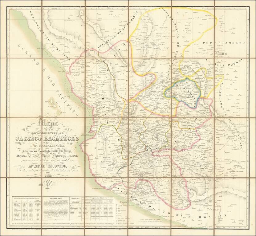
Rare Map of Jalisco, Zacatecas, and Aguascalientes published in Belgium Fine Vandermaelen map of central Mexico. The map is densely detailed, and demographic and coordinates information in the lower left. This map is a collection of the provinces of...
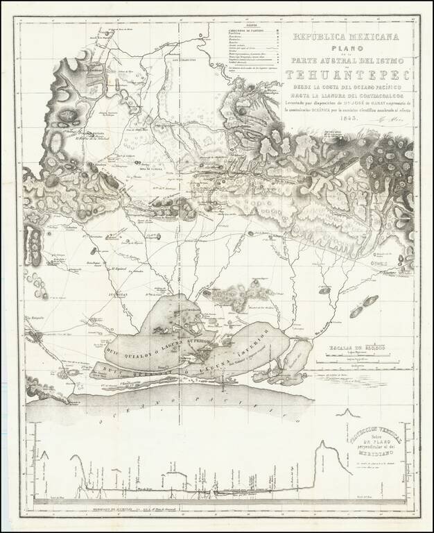
Rare map of the southern portion of the Isthmus of Tehuantepec, with Laguna Superior abutting the Pacific Ocean. At bottom is a profile showing elevations across the isthmus. The map is the result of the surveys undertaken by Don Jose de Garay,...
![El numero 1 q[ue] se haya en la orilla de la ???ya que corre a San Ysidro es el gran ?? de partida siguencio? la numeracion immediata a los puntos amarillos ?on los ?inderos, hasta? el numero 19 con que vierra en el terreno marcados con la letra C.](/map/small/65664ba.jpg)
Resolving a Land Dispute In Temascalcingo, Mexico in 1845 Finely construted map of a large portion of the city of Temascalcingo in the State of Mexico, which officially set the boundary markers (mojoneras, spelled here with an h), for different...
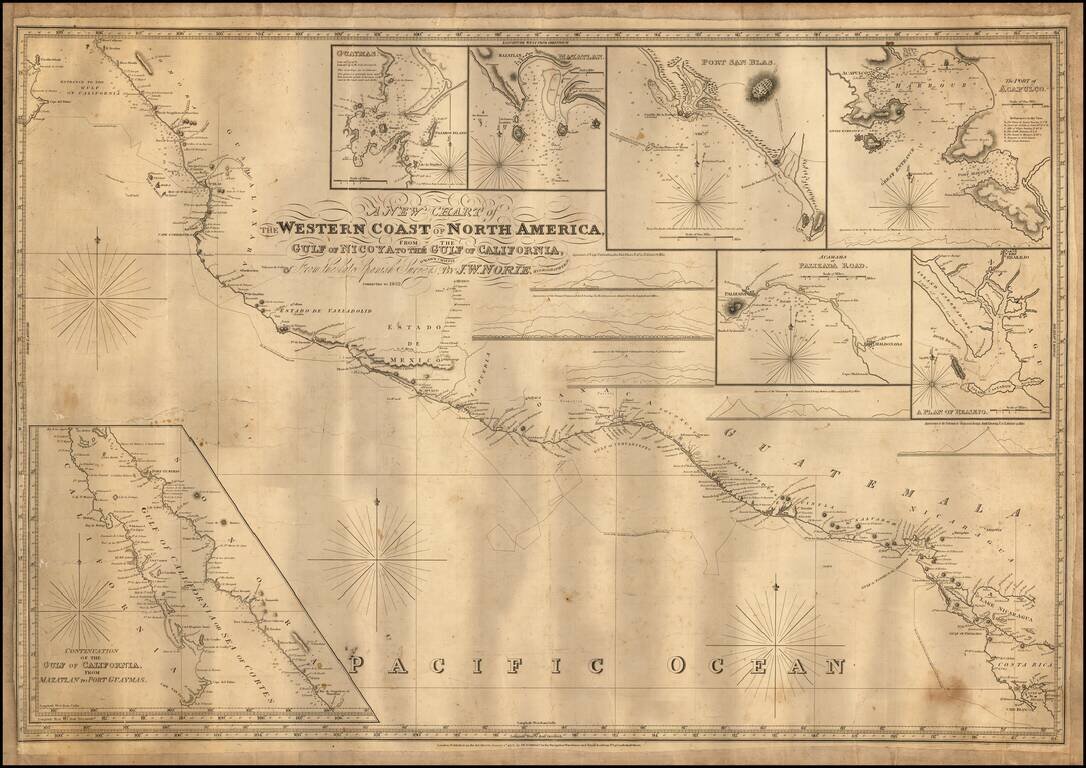
Engraved sea chart covering the area from Cape Blanco, Costa Rica, to the mouth of the Gulf of Mexico, with an inset map titled "Continuation of the Gulf of California, from Mazatlan to Port Guymas." The map includes the following harbor map insets:...