
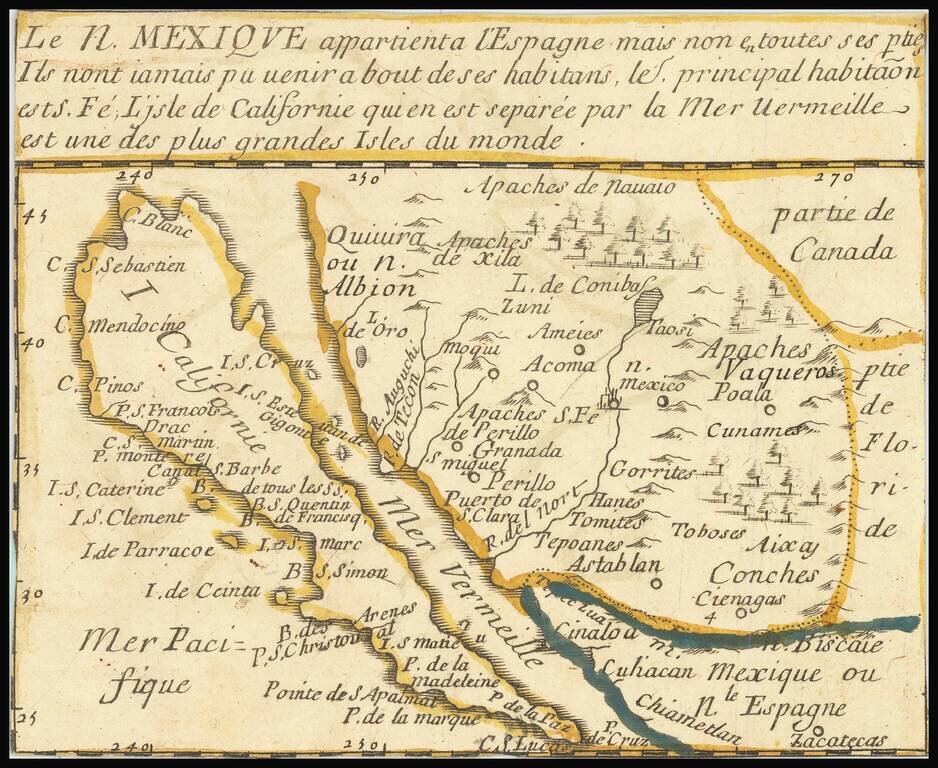
"The first map devoted so much to California"-- Burden A little, very rare, gem of a map of California as an Island, stretching eastwards into lands little known. Many places throughout this region are named, and colonial claims are shown. A long...
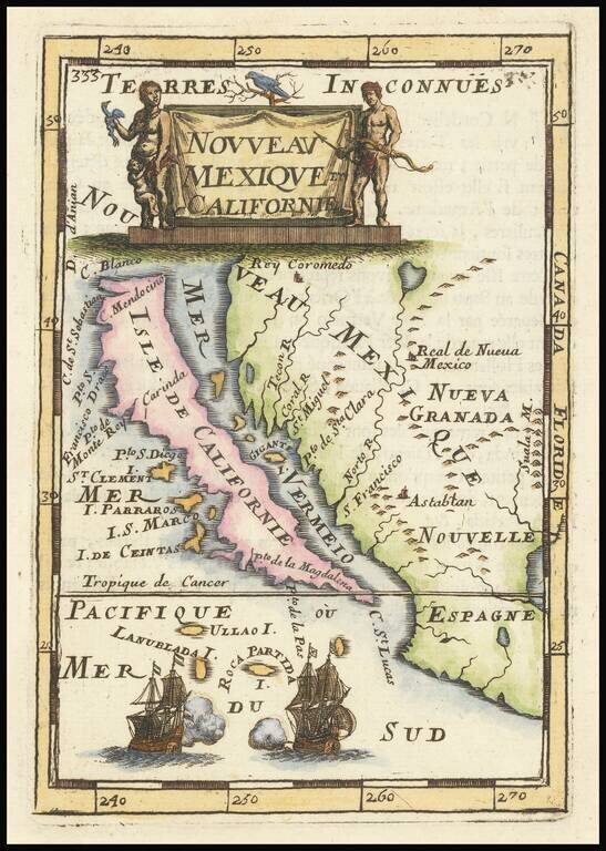
Fine, Distinct Map of the Island of California Striking and exciting map of California as an island, one of the few maps to focus so closely on the California region. First published in Paris in 1683, Mallet’s map is notable because it follows...
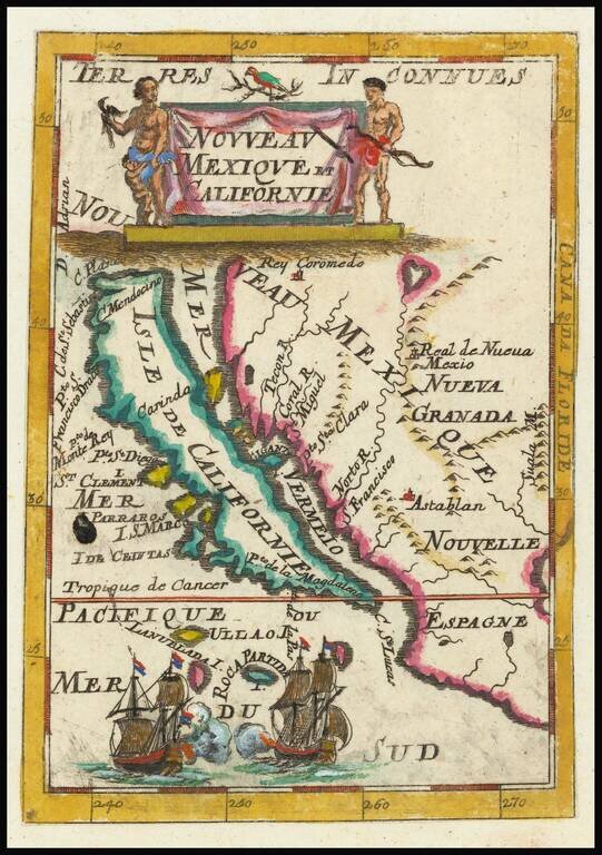
Fine, Distinct Map of the Island of California Striking and exciting map of California as an island, one of the few maps to focus closely on the California region exclusively. First published in Paris in 1683, Mallet’s map is notable because it...
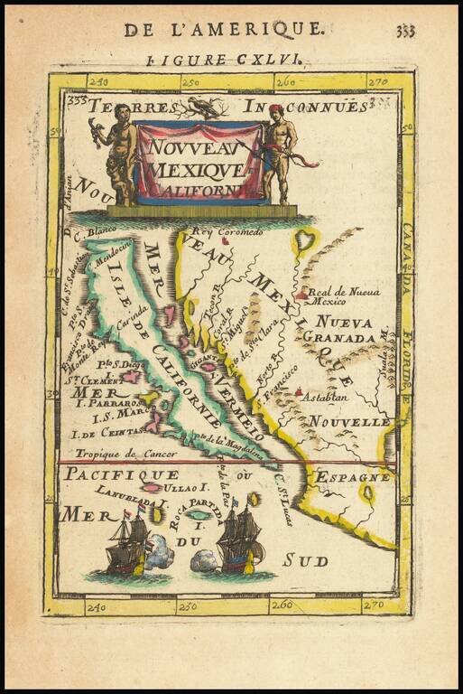
Fine, Distinct Map of the Island of California Striking and exciting map of California as an island, one of the few maps to focus closely on the California region exclusively. First published in Paris in 1683, Mallet’s map is notable because it...

Fine old color example of Braun & Hogenberg's views of Mexico City and Cusco, among the earliest printed views of any American City. This view was the only 2 American views in Braun & Hogenberg's Civitatus Orbis Terrarum, the most influential...
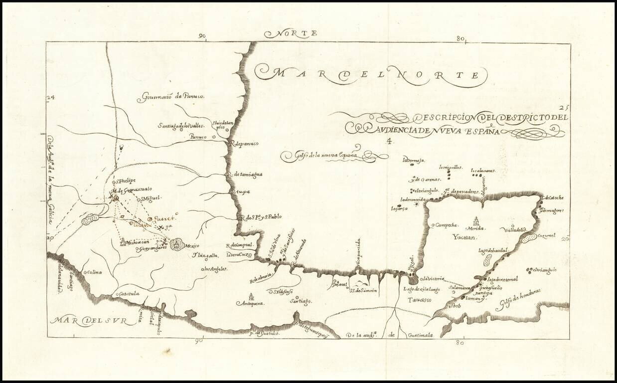
Fine example of the 1726 edition of Herrera's map of Mexico and the Yucatan, which first appeared in Herrera's Descripcion de las Indias Ocidentales, first published in Madrid in 1601. Herrera's 1601 map of Mexico is one of the earliest obtainable...
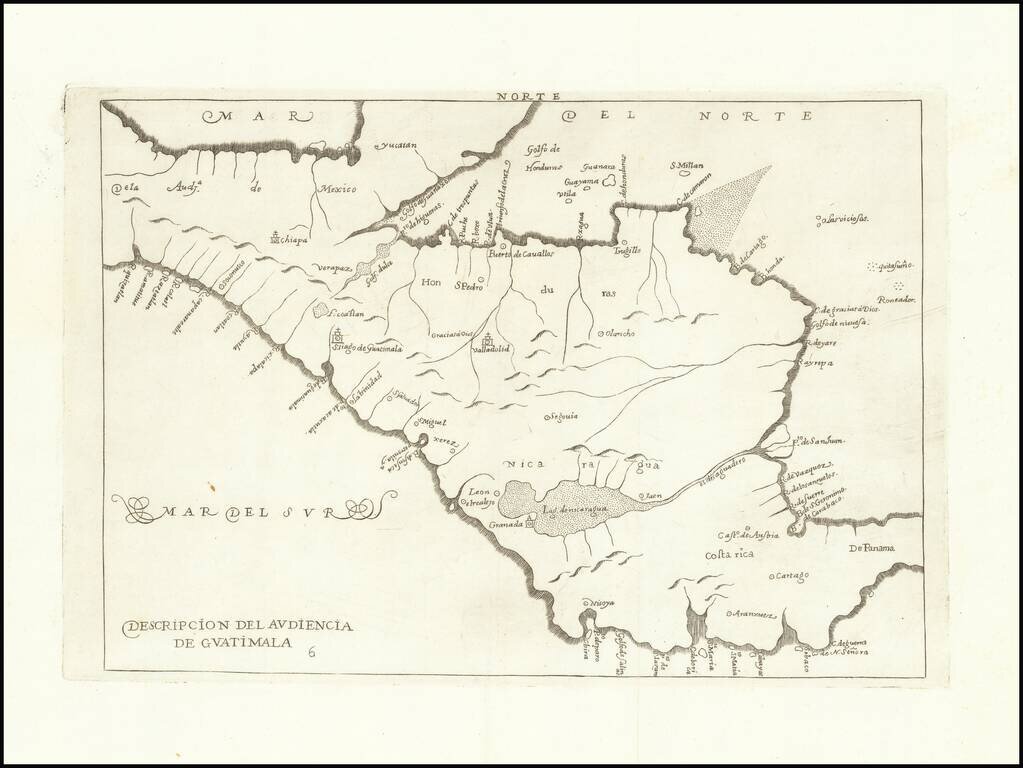
Fine engraved map from Herrera's Descripcion de las Indias Ocidentales, showing part of Central America, including present-day Mexico, Honduras, Nicaragua, Costa Rica, and Panama. The present example is from the second Spanish edition, published in...
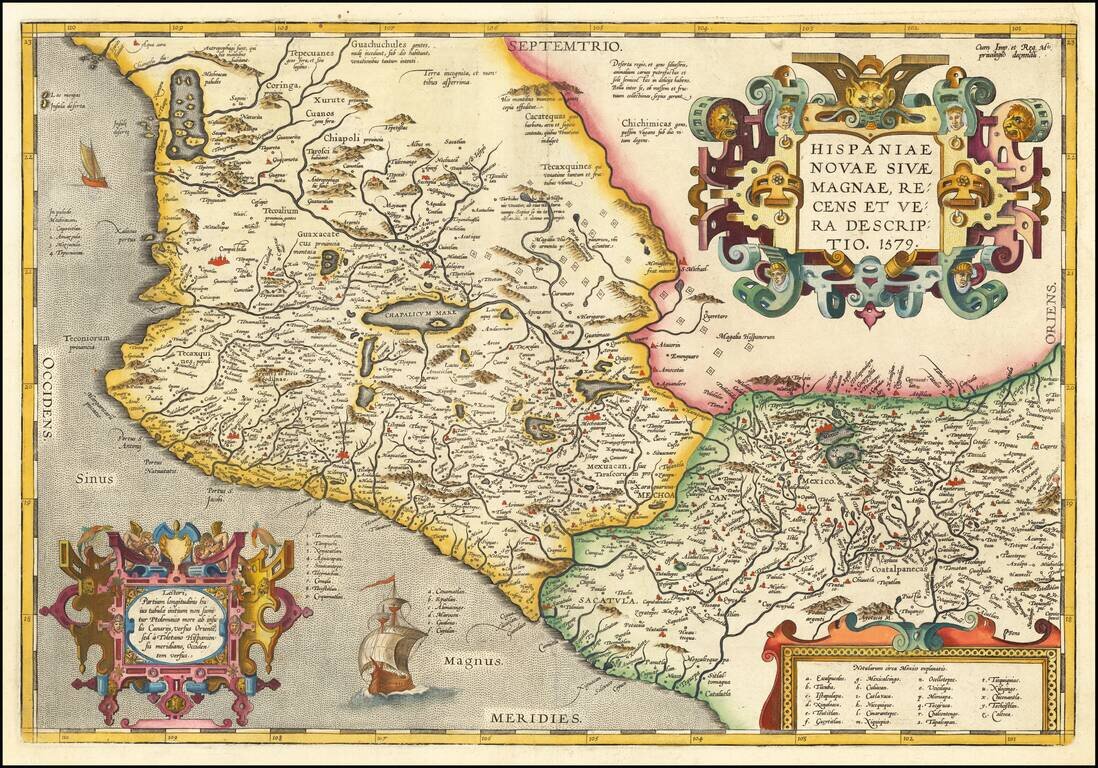
Ortelius' Map of Mexico, One of the Earliest Printed Maps of New Spain Nice example of Ortelius' map of western New Spain, showing the recently-created Spanish settlements, many rivers, and large lakes, including Lake Chapala and a mythical sea with...
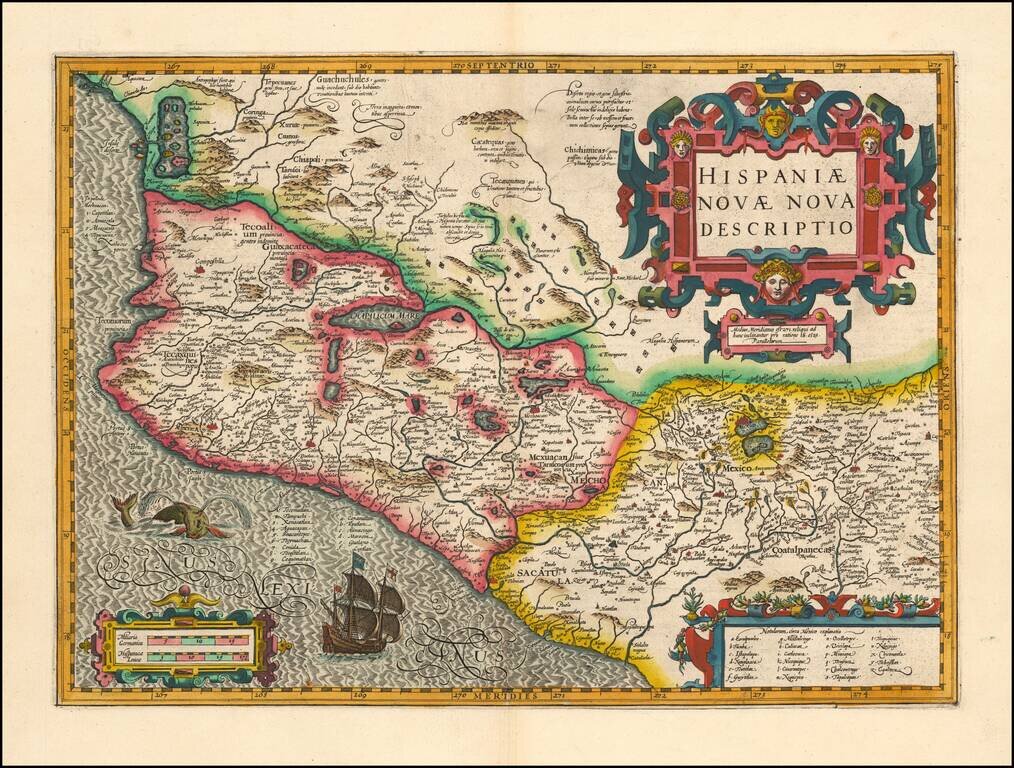
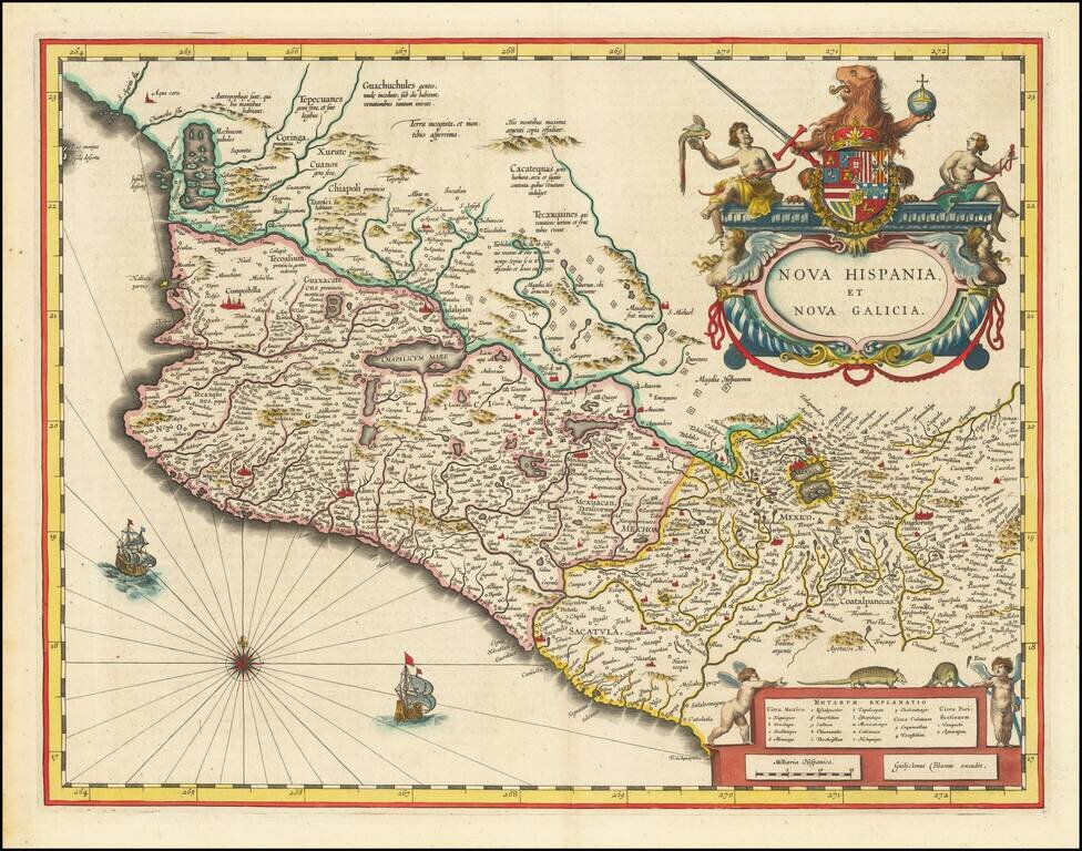
Mercator-Hondius Map of Mexico, a Foundational Map of New Spain Attractive map of Mexico from the Mercator-Hondius Atlas Sive Cosmographicae. This map and Ortelius' map of 1579 were foundational maps for all regional maps of Mexico to follow. The...
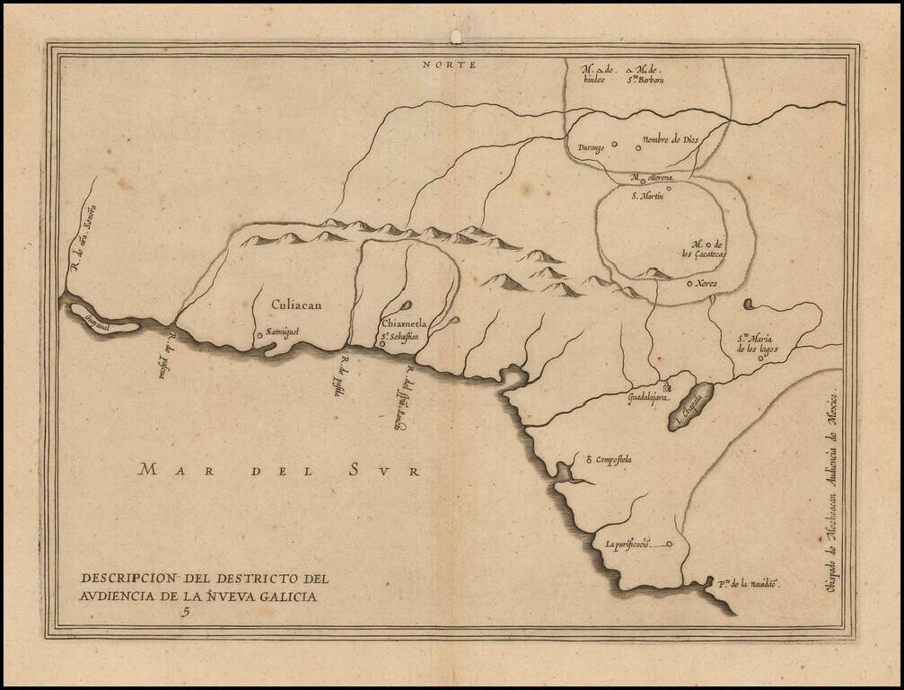
A nice example of the first Dutch edition of Herrera's map of part of Mexico. First issued in 1602, Herrera's work is one of the most influential works on the New World to be published in the 17th Century. This example of the map was re-engraved in...
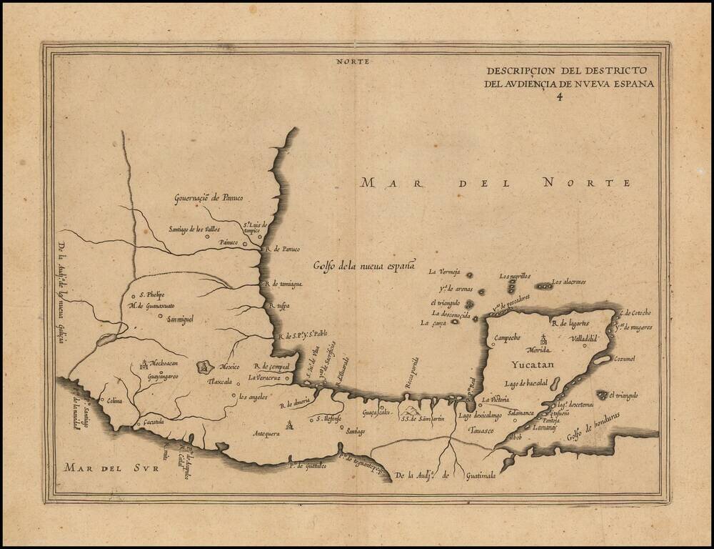
Fine example of Herrera's map of Mexico and the Yucatan, which first appeared in Herrera's Descripcion de las Indias Ocidentales, first published in Madrid in 1601. The present example of the map is from the 1622 edition, published in Amsterdam, the...
Fine old color example of Blaeu's map of Mexico . Gorgeous map of Mexico extending from just north of Mazatlan to Acapulco and from Tehuacan to the Sierra Madres, showing Mexico City, Puebla (Angelorum Civitas), Colima, Campostella, Purificatio and...
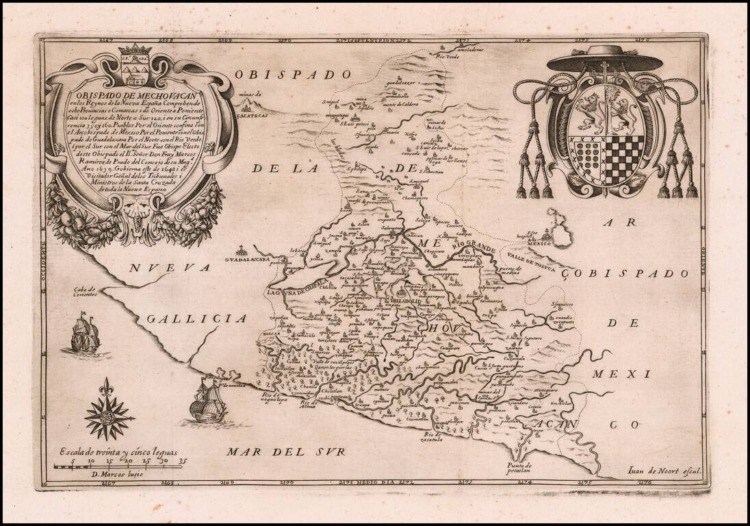
The Earliest Printed Map of Michoacan Rare map of Bishoprick of Michoacan, comprising 8 provinces to the southwest of Mexico City, published in Madrid, in 1649. The map is dedicated to Marcos Ramírez de Prado y Ovando (1592 - 1667), a Roman...
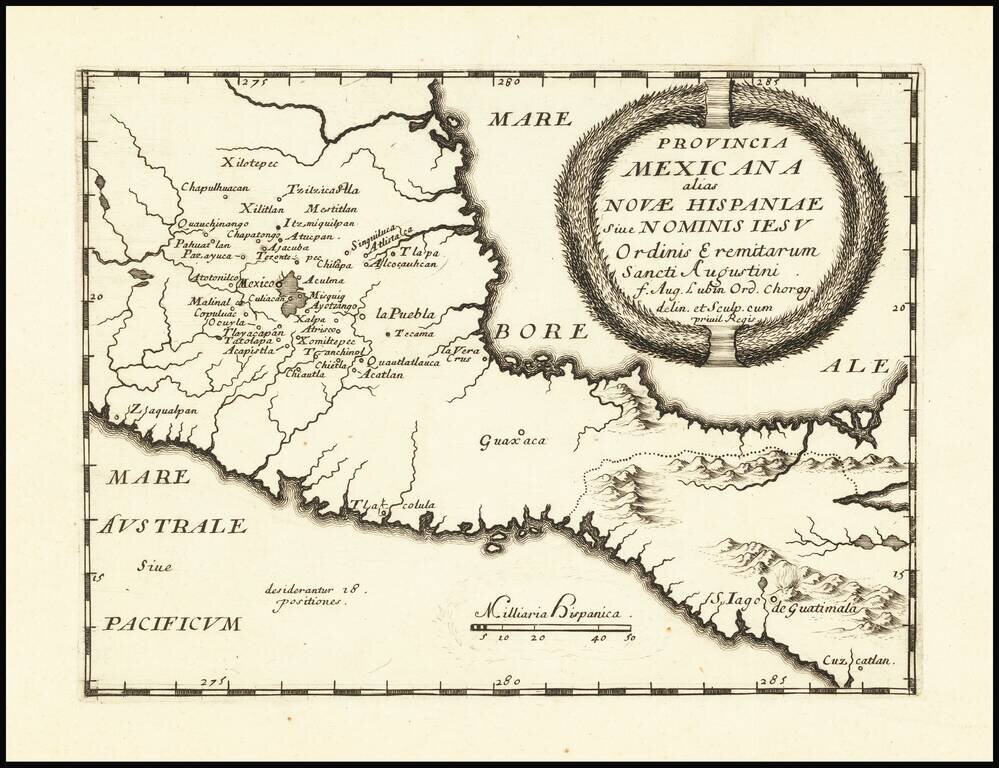
Rare map of the southern part of Mexico and Guatemala, published in Bologna. The map is intended to illustrate the Augustinian Missionary work and influence in Southern Mexico and Central America. The map appeared in a rare Augustian work entitled...
![[Sketch of Río Chacalapa and surrounding hills]](/map/small/49303ba.jpg)
Cartographic Sketch of Mountainous Region and the Chacalapa River This is a partial sketch showing a stretch of land surrounded by hills on two sides. The Río Chacalapa runs through the sketch diagonally, seemingly connecting to another stream...
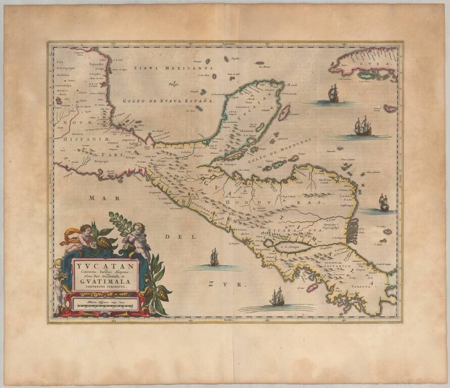
Nice old color example of Blaeu's map of the Yucatan peninsula, which appeared only in the late editions of Blaeu's atlases. This is one of the earliest Dutch maps to focus on the region centered on the Yucatan Peninsula. Includes decorative cartouche...