
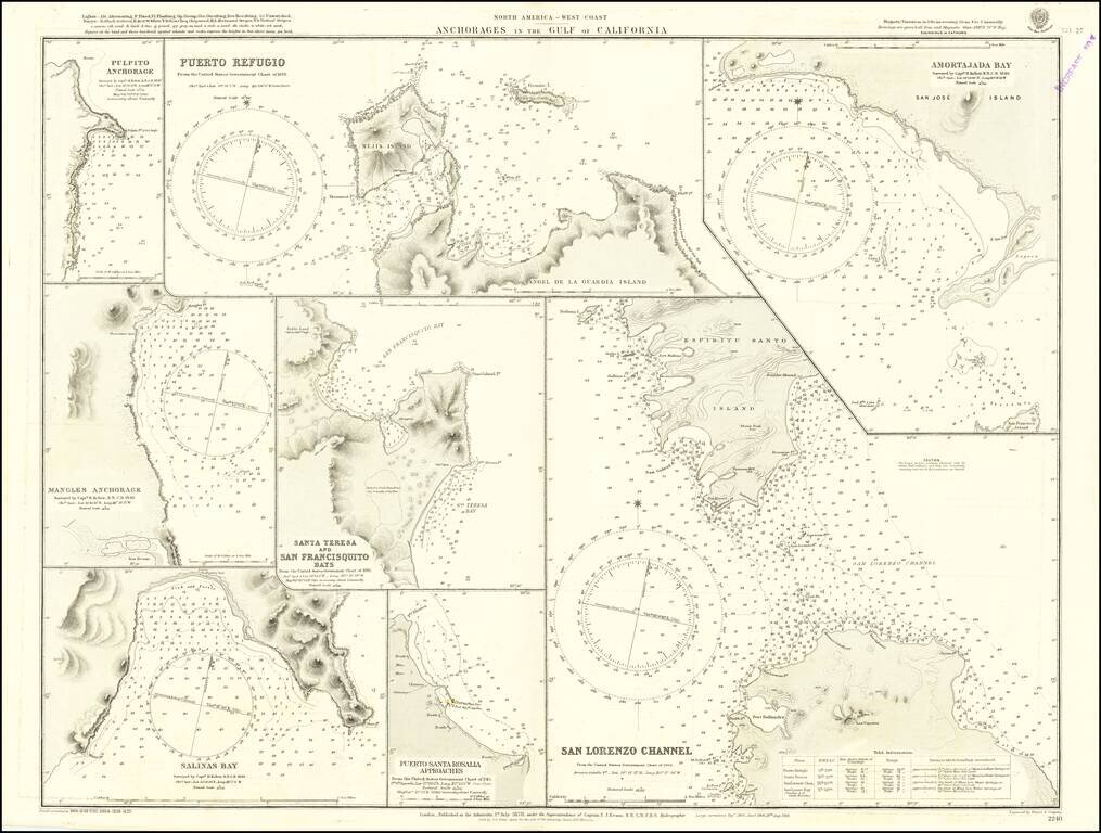
Detailed chart of the anchorages in the Gulf of California, including those on the eastern shores of Baja California. Much of the information comes from Henry Kellett's important 1845 hydrographical survey for the Royal Navy, undertaken on HMS Herald...
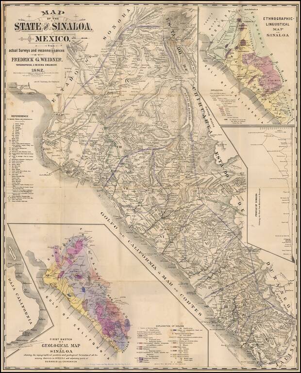
Rare map of Sinaloa in northwestern Mexico, lithographed by W.T. Galloway and published in San Francisco in 1882. While created for the mining industry, the map's most unique features is the large inset "Ethongraphic-Linguistic Map of Sinaloa,"...
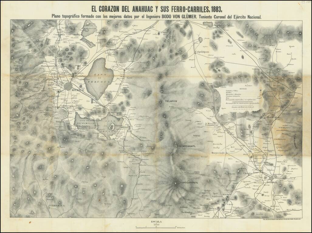
This is a map showing the region around Mexico City, focusing on the railroads of the area. Topography, cities, towns, rivers, and other roads are also shown. The title refers to the Nahuatl name for the Aztec homeland. Mexico City is visible in the...
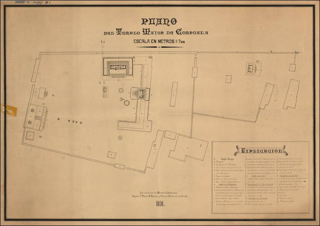
Striking Plan of the Templo Mayor de Cempoala (Zempoala) in the state of Veracruz This late-nineteenth century plan shows the larger temple of Cempoala, also known as Zempoala. It is an important archaeological site for Mesoamerican history, but also...
![A Map of British Honduras... [bound in:] Tratado de Limites Entre Los Estados-Unidos Mexicanos y Honduras Britanica Seguido de los principales documentos que a el se refieren. Edicion Oficial.](/map/small/70984.jpg)
Determining Belize's Northern Limits. Frist official Mexican edition of the treaty with Great Britain establishing the Mexico-Belize border. Belize's borders have long been an issue for the country and its neighbors. The Belize-Mexico and...
![[Mexico City] Reduccion Del Plano Oficial De La Ciudad De Mexico Aumentado y Rectificado Con Todos Ultimos Datos Recogidos De La Direccion De Obras Publicas y de la Oficina Technica del Saneamiento . . . 1900](/map/small/64123.jpg)
Rare separately published map of Mexico City, published by the Compañia Litografica Tipografica S.A. This fascinating and attractive map captures the Mexican Capital when the city had a population of only approximately 500,000. Based on official...
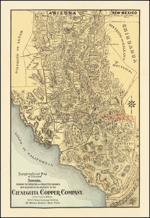
Promoting Copper Mine Investments in Sonora During the Copper Boom in the Early 20th Century Finely executed map showing the transit routes to the Copper Mines of Eastern Sonora in Mexico. While the map is unrecorded, it was likely published in order...
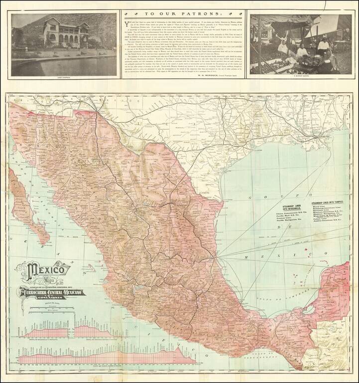
The Mexican Central Railroad Three Years Prior To Its Nationalization Fine early map of the Mexican Central Railway and Connections On the verso are listings of the Steamship Lines into Manzanillo and Tampico and time lines for the major routes. The...
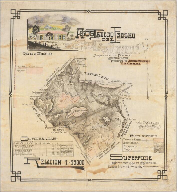
Large and handsome manuscript map of hacienda outside Penjamo, Guanajuato, Mexico, executed in pen and ink with watercolor by engineer Ricardo Gárate. The map is a beautiful example of its kind; being an early-20th century Mexican land survey. It...
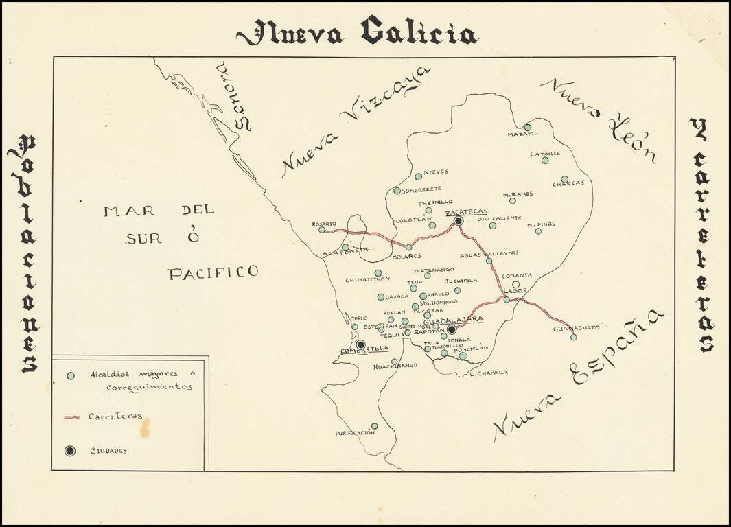
Hand drawn thematic map of the Nueva Galicia, centered on Zacatecas, showing primary roads and population centers. The date is estimated.
![{Central Mexico] Mapa de producciones](/map/small/62148.jpg)
Hand drawn thematic map of the region of Mexico centered on Zacatecas, displaying the agricultural, livestock and mineral producing regions. The date is estimated.
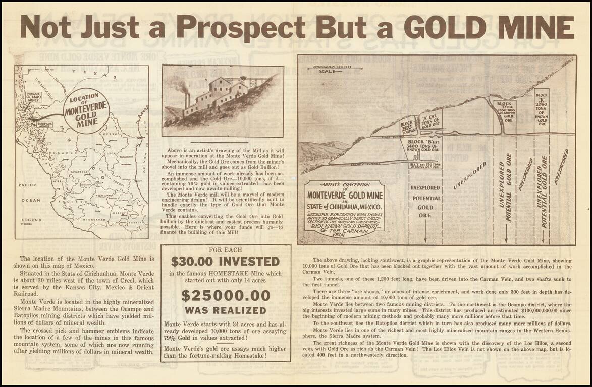
Interesting and very rare promotional map for what was in all likelihood a gold mine scam perpetrated in the early 1930s. In breathless language, the sheet solicits investment in the "Monteverde Gold Mine", supposedly located in southwest Chihuahua,...
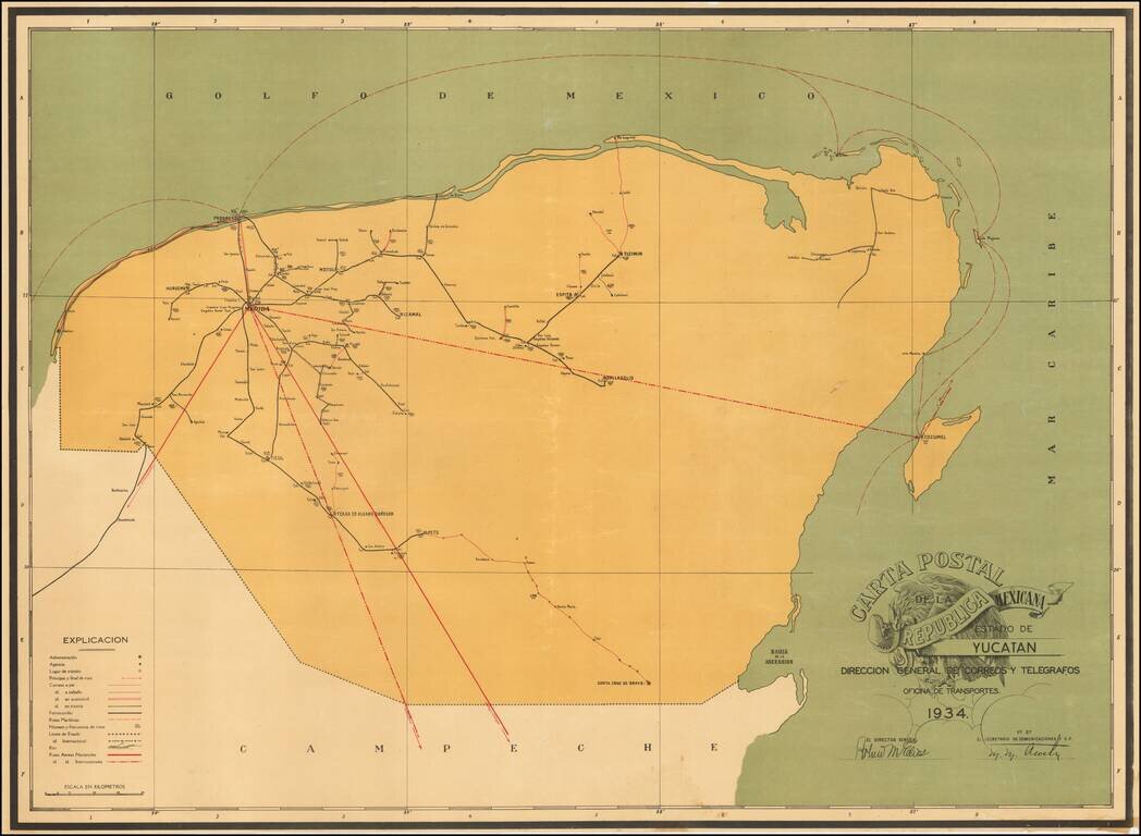
Postal Services In Mexico -- From Air Mail to Horseback Rare separately published map of the Postal Roads within the Mexican State of Yucatan, published in the year following the creation of the Dirección General de Correos y Telegrafos as a...
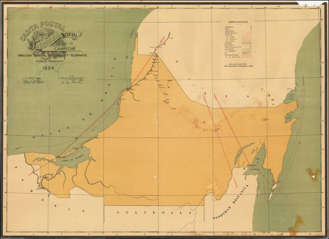
Postal Services In Mexico -- From Air Mail to Horseback Rare separately published map of the Postal Roads within the Mexican State of Campeche, published in the year following the creation of the Dirección General de Correos y Telegrafos as a...
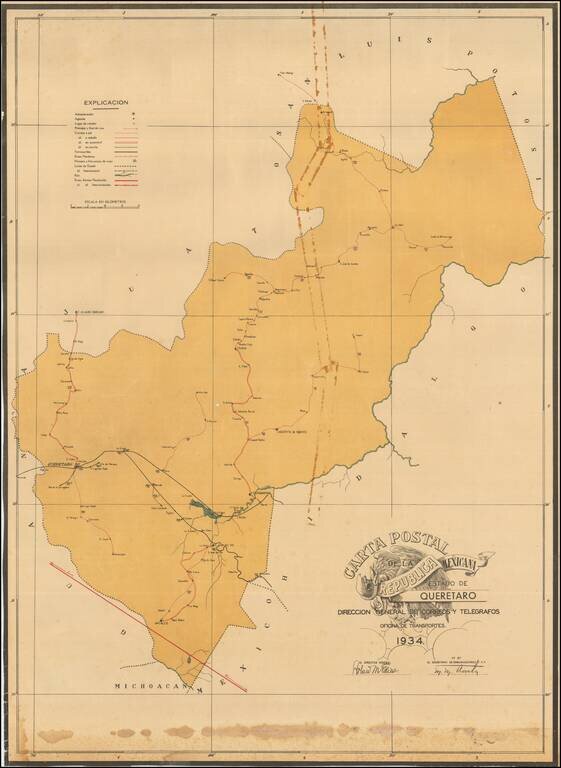
Postal Services In Mexico -- From Air Mail to Horseback Rare separately published map of the Postal Roads within the Mexican State of Queretaro published in the year following the creation of the Dirección General de Correos y Telegrafos as a...
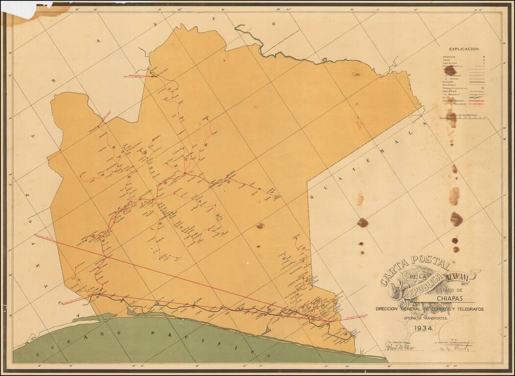
Postal Services In Mexico -- From Air Mail to Horseback Rare separately published map of the Postal Roads within the Mexican State of Chiapas published in the year following the creation of the Dirección General de Correos y Telegrafos as a...