
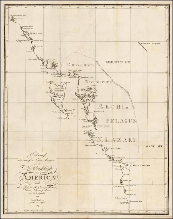
Rare chart of the Northwest coast of America, centered on Queen Charlotte's Island, from Georg Foster's Geschichte der Reisen, die seit Cook an der Nordwest…Amerika. Rare chart of the Northwest Coast of America, illustrating the experiences of Georg...
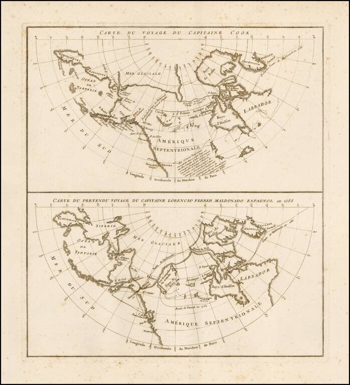
Rare pair of maps on a single sheet, showing the results of various real and apocryphal explorations in the Arctic Regions and the Northwest Coast of America, which appeared in the atlas volume of Jean Benjamin de LaBorde's Histoire Abrégée de la Mer...
![[Eastern Siberia and Alaska]. ‘Vostochnaya Chast Irtkutskoi Gubernii s prilezhashhimi ostrovami i zapadnom beregom Ameriki’ (‘The Eastern Part of the Irkutsk Province with the adjacent islands and the West Coast of America’).](/map/small/38895.jpg)
Fine example of this rare Russian map of the northwest coast of America and northeastern parts of Russia, published by Wilbrecht in his rare 1792 atlas entitled Ross'iiskoi Atlas iz soroka chetyrekh kart sostaiashch'ii I na sorok na dva...
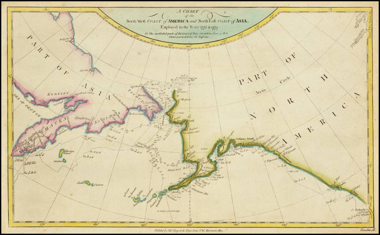
Detailed chart of the coastal regions explored by Captain James Cook, one of the seminal voyages to the Northwest Coast. The map pre-dates the discovery of Vancouver Island and shows Cook's Tracks through Asia and along the Northwest Coast of America,...
![[Anchorage, Valdez and Prince William Sound] Cote Nord-Ouest De L'Amerique Reconnue par le Cape. Vancouver VI. Partie . . .](/map/small/61940.jpg)
Vancouver's Charting of the Region Anchorage, Valdez & Prince William Sound, etc. Highly detailed regional map of Alaska showing the area around Anchorage, Valdez & Prince William Sound, south to Mt. St. Elias. The chart is one of the...
![[Prince Frederick Sound, Ketchickan, Queen Charlotte's Island & Stitka] Cote Nord-Ouest De L'Amerique Reconnue par Cape. Vancouver IVe. Partie . . .](/map/small/62075.jpg)
Highly detailed regional map of Alaska showing the region from Prince Frederick Sound in the North to Queen Charlotte's Island and the contiguous Pacific Coast of Canada in the south, and including Juneau, Sitka, Ketchikan, etc. The chart is one of...
Eastern sheet Wilbrecht's a rare 3-sheet map of the Russian Empire, depicting Alaska, the Northwest Coast of America and the West Coast of Canada, prior to the discovery of Vancouver Island, along with Kamchatka, Northeast Russia and Iezo. The map is...
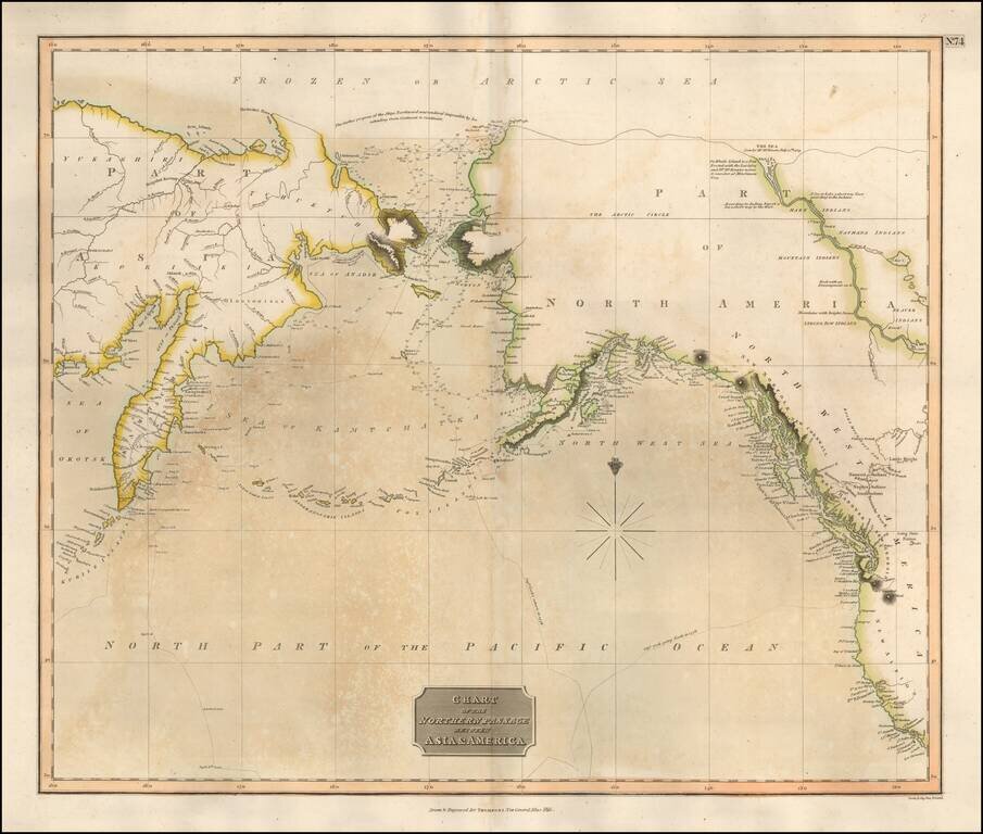
Scarce map of the NW Passage, the NW Coast of America and NE Coast of Asia. The map extensively tracks the voyages of Captain James Cook beyond the Bering Straits on a nearly daily basis in 1778 and 1779. In the Arctic Sea, a note regarding McKenzie's...
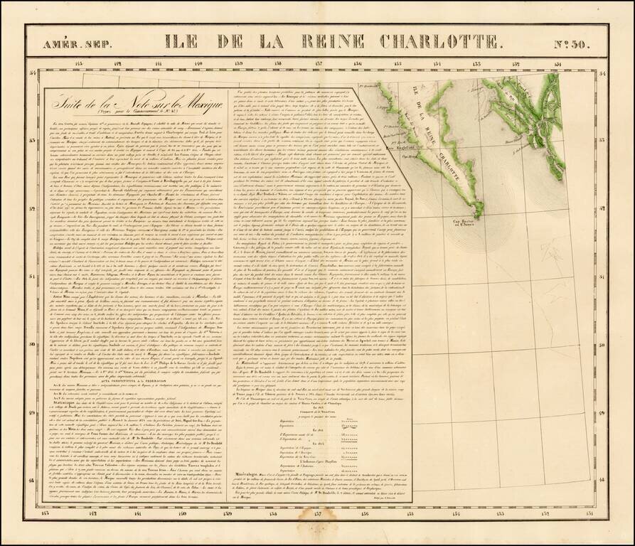
Highly detailed map of the southern portion of Queen Charlotte's Island and the continguous coastline of British Columbia, in the area of Canal de Grenville and Hawkesbury. Detailed and interesting map. From Vandermaelen's remarkable 6 volume atlas,...
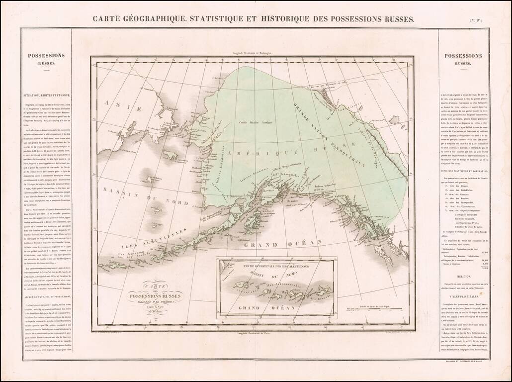
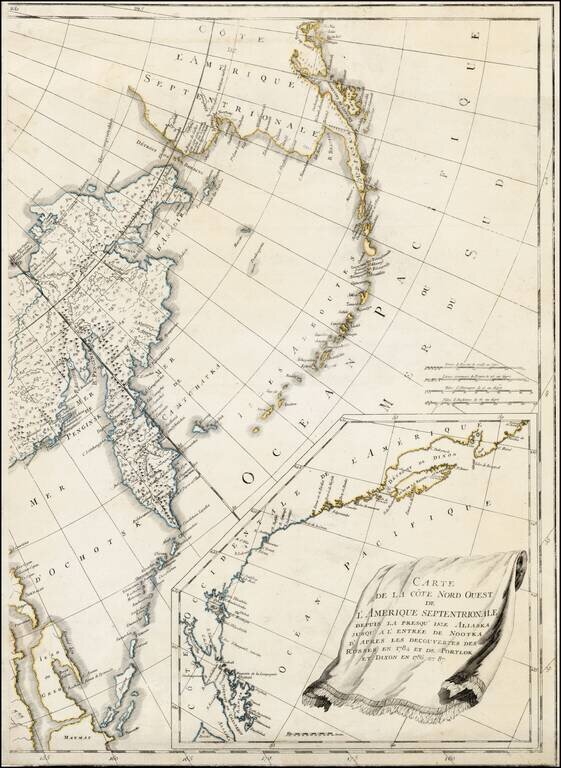
One of the Earliest Antique Maps of Alaska / Russian America -- 42 Years Prior to Its Acquisition by the US Scarce map of Russian America, being perhaps the first separate map of the region which would become Alaska. The region extends south to Queen...
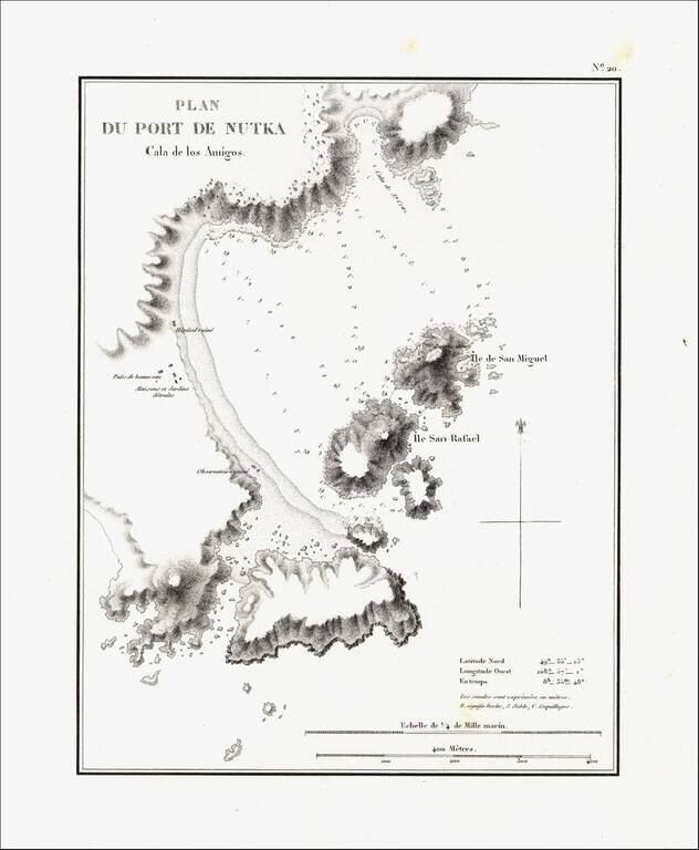
Detailed map of Nootka Bay, from Duflot de Mofras' momumental work. In 1839, Eugene Duflot de Mofras, was assigned to the embassy in Mexico City and instructed to visit the northwestern provinces of Mexico, report on potential commerce, observe U. S.,...

Rare map showing the Northwest Passage, via the Bering Straits, with a fantastic early depiction of Alaska (then Russian America) and contiguous parts of Canada. Philip's map highlights the discoveries of Franklin and Richardson in the Arctic Sea...

Rare map of the Northwest Passage, Northern Canada, part of Alaska (America Russa) and Greenland. The map is quite unusual, being one of the few maps to focus on the known islands of the Northwest Passage, including several partially known...
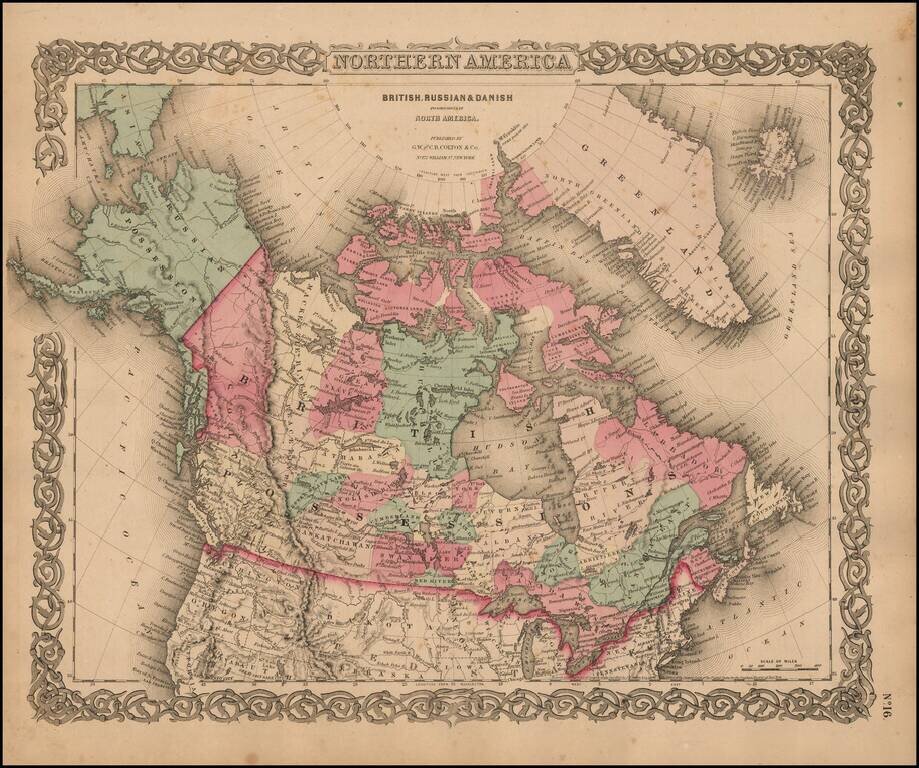
Marvelous map of Canada and Alaska, featuring a host of unusual borders. New Columbia stretches from the US Border to Russian America (Alaska). Lesser Slave Lake, Peace River, Mackenzie's River, Great Slave Lake, Churchill, Athabasca, Nelson, English...

Fine separately issued example of Adolph Lindenkohl's important early map of Alaska, the earliest printed map of lands recently acquired from Russia and the first appearance of the name Alaska on a printed map. Alaska was purchased from Russia for...
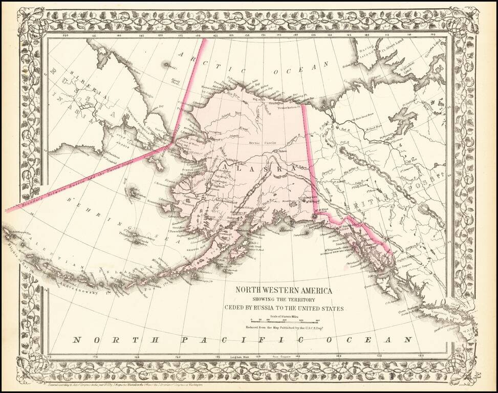
A detailed map of Alaska, showing the territory shortly after it was sold by Russia to America for $7.2 Million in 1867. The map locates towns, mountains (with elevations), rivers, bays, and other details. Cities named include Sitka and Sheshalik. The...