Map size in jpg-format: 33.1474MiB
Click to open in high resolution (open in new tab).
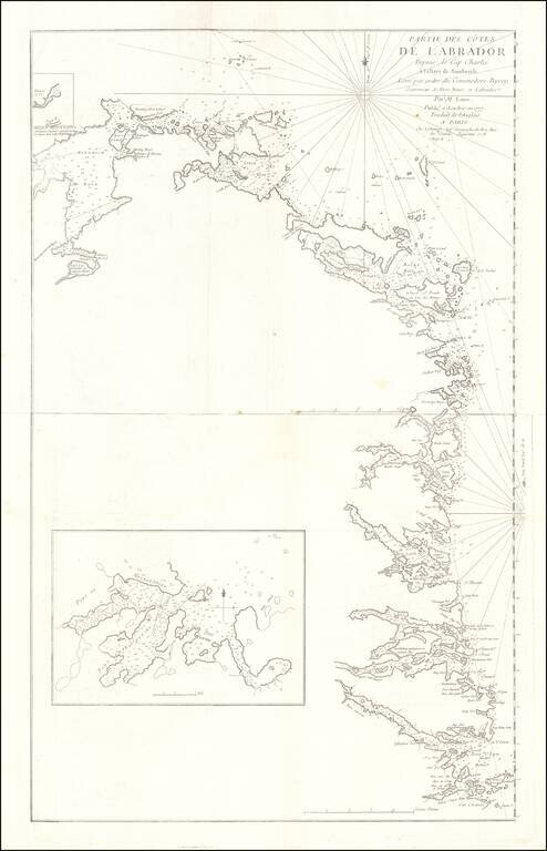
Rare French edition Jefferey's 2-sheet map of part of Labrador, which appeared in Le Rouge's Pilot Americain Septentrionale.
Includes extensive soundings, sailing directions, rhumb lines and many other fine details.
The chart was included in Le Rouge's rare North American Pilot, an atlas of Sea Charts compiled by the French Government and utilized by the French Navy during their participation in aid of the Americans during the American Revolutionary War. A fine wide margined example of this scarce French Naval Chart.
If you are a student, write to us in telegram: @antiquemaps and indicate what material you need and for what work you need a map in high detail. We are ready to provide material on special terms. For students only!
![[The First Maps in a la poupée Printed Color] Cartes en Couleur des Lieux Sujets aux tremblements de Terre Dans toutes les parties du Monde Selon le Sisteme de l’impulsion Solaire](/map/small/52293op.jpg)

