logo

1650. (Fontainebleau) Nouvelle Description de la Forest Royalle de Fontaine Belleau

  • (Fontainebleau) Nouvelle Description de la Forest Royalle de Fontaine Belleau

(Fontainebleau) Nouvelle Description de la Forest Royalle de Fontaine Belleau information:

Year of creation: 
Resolution size (pixels): 
 2002x1510 px
Disk Size: 
 943711B
Number of pages: 
 1
Place: 
 Paris
Author: 

Print information. Print size (Width x height in inches):
Printing at 72 dpi 
  27.81 х 20.97
Printing at 150 dpi 
 13.35 х 10.07
Printing at 300 dpi 
 6.67 х 5.03

An example of detailing the file of this map of in a printable high-resolution:

Click to open in high resolution (open in new tab).
Attention! this is just the central piece (central area 960x960 px) of the map file!
This is an example, so that you can see and study the level of detail of a given map. The entire Map will be fully available after payment!

(Fontainebleau) Nouvelle Description de la Forest Royalle de Fontaine Belleau

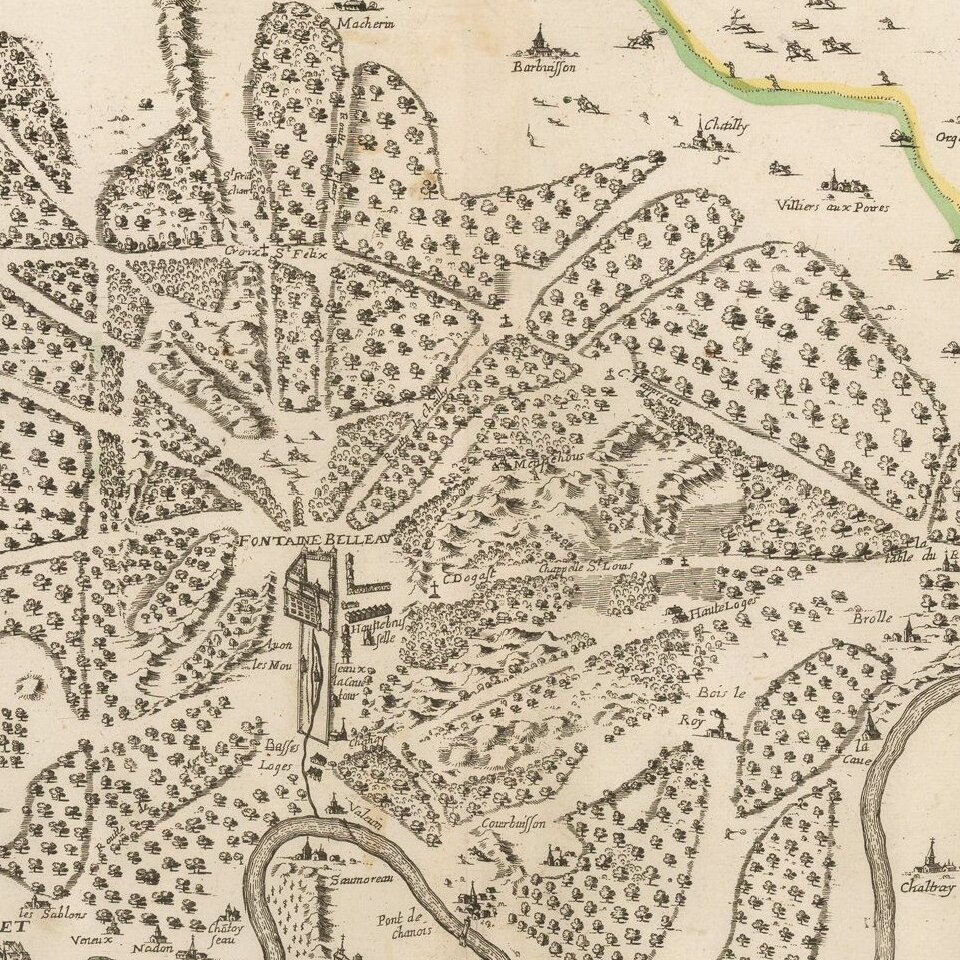
Rare map of the forest of Fontainebleau, published in Paris by Boisseau.

The map shows the castle of Fontainebleau in the center of the map, with two small views of Melun and Moret.

Text in the bottom right notes: "This map represents the forest of Fontaine Belleau with the names of villages, hamlets, chapels, hermitages, routes, mountains and plains. . . This forest contains about 25,975 acres as wood, rocks, . . . to eighteen or nineteen thousand acres whose custody is given to eight officers . . . . "

Not in Pastereau.


Special conditions for students!

If you are a student, write to us in telegram: @antiquemaps and indicate what material you need and for what work you need a map in high detail. We are ready to provide material on special terms. For students only!

Item information:

Year of creation:
Size:
2002x1510 px
Disk:
943711B
Number of pages:
1
Place:
Paris
Author:
Jean Boisseau.
$9.99

Related item