Map size in jpg-format: 1520430B
Click to open in high resolution (open in new tab).
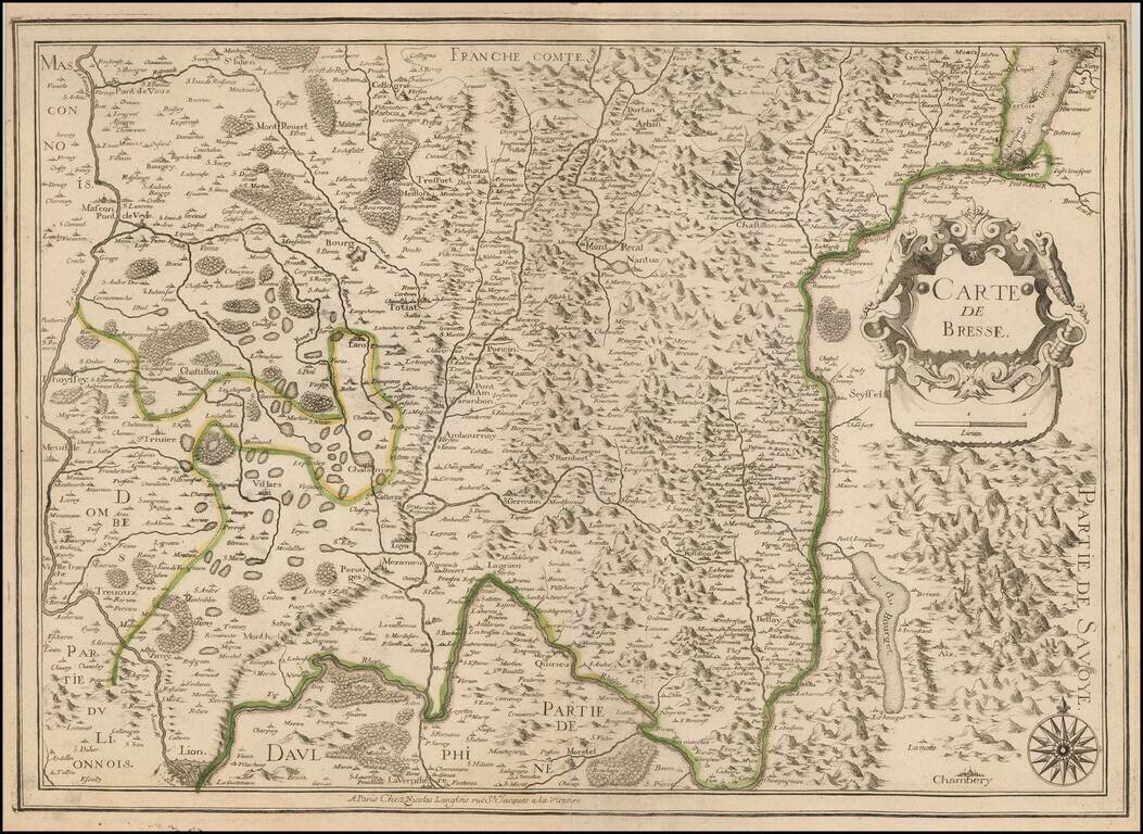
Rare map of the Bresse Region, published by Nicolas Langlois in Paris.
The map shows Lyon and Chambery at the bottom of the map and Lake Geneva at the top right, with Franche-Comte at the top.
The map is crossed by the Rhone River in the south.
If you are a student, write to us in telegram: @antiquemaps and indicate what material you need and for what work you need a map in high detail. We are ready to provide material on special terms. For students only!
![Carte d'Etude [Study Map]](/map/small/66795.jpg)
![Orange [Vauban Style Fortress]](/map/small/62043.jpg)
