logo

1642. Description du Pais de Valois

  • Description du Pais de Valois

Description du Pais de Valois information:

Year of creation: 
Resolution size (pixels): 
 2112x1612 px
Disk Size: 
 1.07012MiB
Number of pages: 
 1
Place: 
 Paris
Author: 

Print information. Print size (Width x height in inches):
Printing at 72 dpi 
  29.33 х 22.39
Printing at 150 dpi 
 14.08 х 10.75
Printing at 300 dpi 
 7.04 х 5.37

An example of detailing the file of this map of in a printable high-resolution:

Click to open in high resolution (open in new tab).
Attention! this is just the central piece (central area 960x960 px) of the map file!
This is an example, so that you can see and study the level of detail of a given map. The entire Map will be fully available after payment!

Description du Pais de Valois

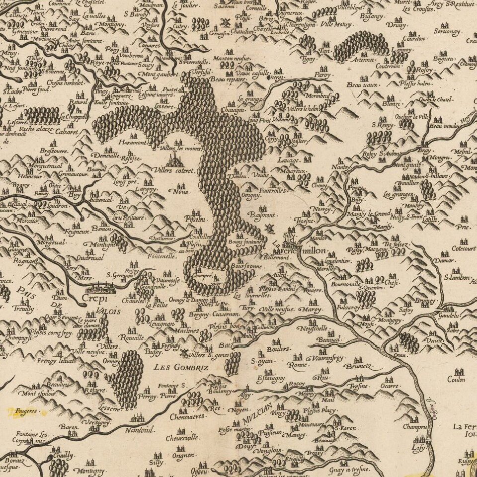
Rare Damien de Templeux map of the region to the northeast of Paris, between the Oise River in the west and the Marne River in the east.

Champagne-sur-Oise is shown in the west, Soissons in the north and Meaux in the east.


Special conditions for students!

If you are a student, write to us in telegram: @antiquemaps and indicate what material you need and for what work you need a map in high detail. We are ready to provide material on special terms. For students only!

Item information:

Year of creation:
Size:
2112x1612 px
Disk:
1.07012MiB
Number of pages:
1
Place:
Paris
Author:
Damien de Templeux.
$9.99

Related item