
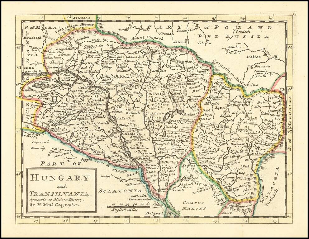
Scarce map of Hungary and Transylvania, published in London by Herman Moll.
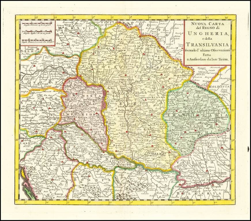
Scare map of Hungary, Slovenia, Transylvania, and parts of Croatia, Bosnia, Serbia, Romania and Bulgaria, from an Italian edition of Thomas Salmon's , Modern History: or, the present state of all Nations. . . entitled Lo Stato Presente... published in...
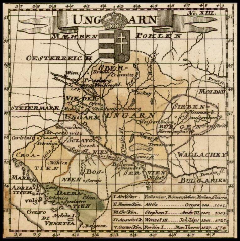
Rare second edition of this small map of Hungary, which appeared in the 11th edition of Kurtze, erlauterung . . . published in Berlin in 1795. Detailed table below.
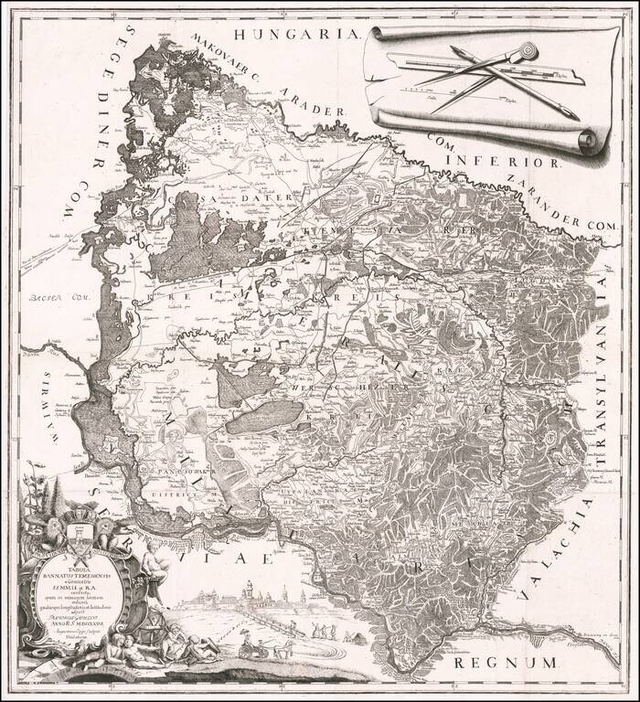
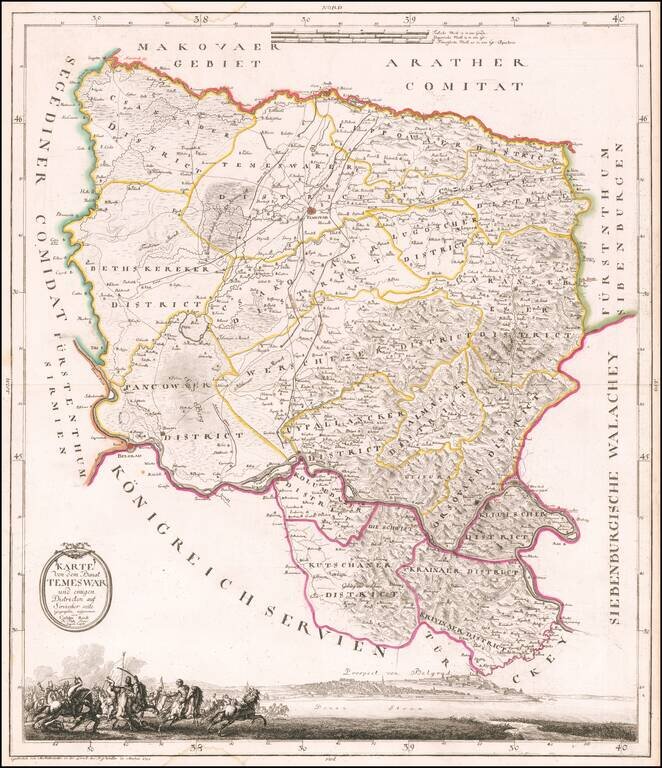
A Map of the Banat of Timisoara by One of its Most Important Historians Rare separately published map of the Banat of Timișoara, created by Francesco Griselini, following his travels to Timișoara with Count Giuseppe Brigido in 1774 and published in...
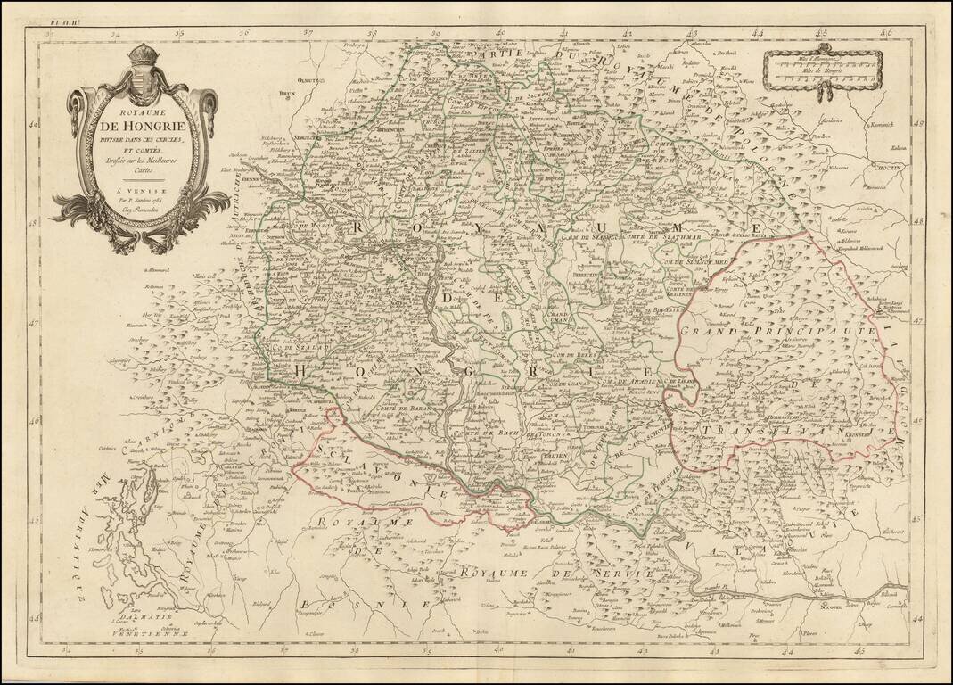
Finely detailed map of Hungary and adjoining regions, published in Venice by Santini. The map follows the course of the Danube from Vienna in the west to Nicopel (Nikopol, Bulgaria), and to the southwest, the Dalmatian Coastline. Includes large parts...
An Early Map of the Banat of Timisoara Rare separately published map of the Banat of Timișoara, published in Munich by Castulus Reidl, The map is centered on Timișoara, and bounded by Zeged in the northwest, the Maros (Mures) River in the north,...
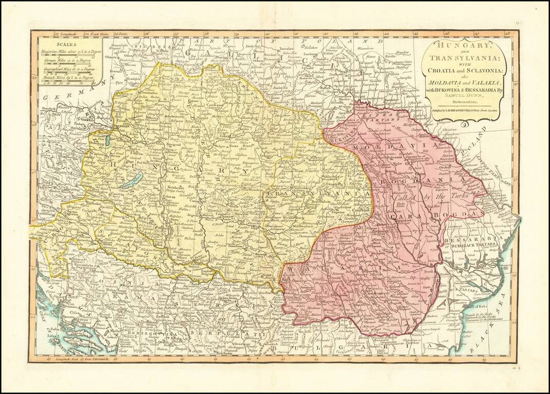
Detailed engraved map of the Balkans and Hungary, by one of the most important mapmaking firms of the end of the 18th century: Laurie & Whittle. The map shows Croatia, Serbia, Bosnia, Slovenia and the region extending east to Romania and the Black...
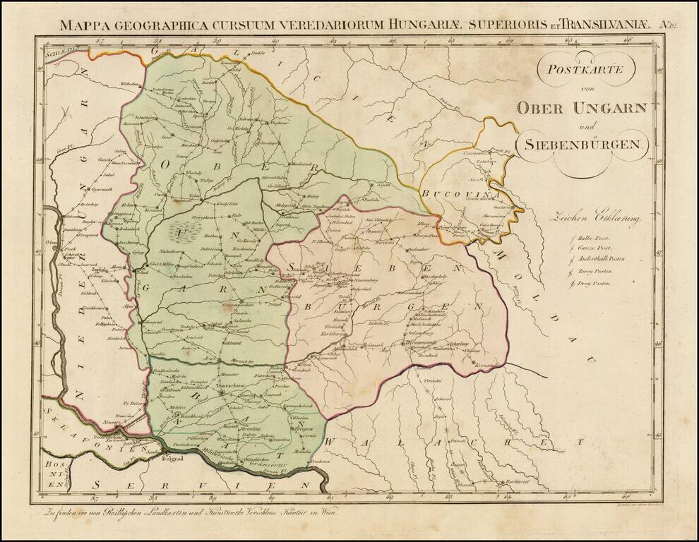
Rare postal map of Hungary, which appeared in Von Reilly and Kuhn's Atlas Universae rei veredariae bilinguis ... Allgemeiner Postatlas von der ganzen Welt . . . , published in Vienna in 1799. Von Reilly & Kuhn's atlas is the first postal atlas of...
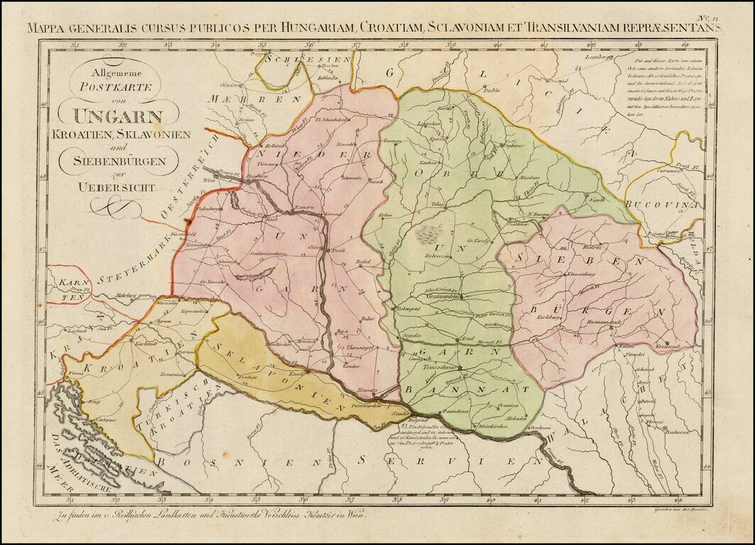
Rare postal map of Eastern Hungary, Slovenia, Croatia, Transilvania, and parts of Romania, Serbia, Bosnia, Galitzia and Bukowina, which appeared in Von Reilly and Kuhn's Atlas Universae rei veredariae bilinguis ... Allgemeiner Postatlas von der ganzen...
![[Part of Hungary]](/map/small/0009gh.jpg)
One sheet from a larger map, covering Hungary in remarkable detail. The map bears the stamp of a German Jesuit Library and may have been from a map of the Austro-Hungarian Empire.
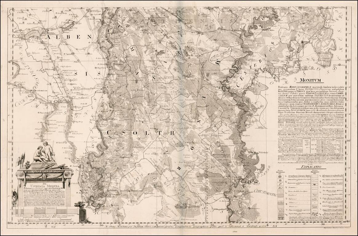
Lower sheet of this rare 2 (?) sheet map focusing on the navigable rivers, post roads and geology of Southern Hungary. The map primarily covers the regions between the Tisza River and Danube River,, to the south of Budapest. The map extends along the...
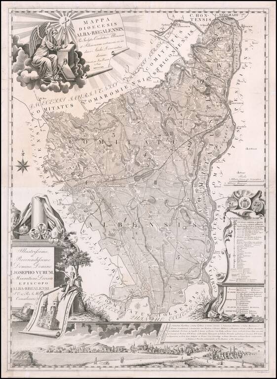
Rare two sheet map of Albensis (Fejér) in Hungary by Janor Pongratz. The map is centered on Székesfehérvár with the Danube River at the right, intersecting the towns of Buda and Pest. The name Stuhlweißenburg appears in pencil in the title....
![[Budapest] Buda s Pesth szabad kiralyi varosoknak s kornyekeiknek Planuma Pesthen, kiada Tomala Ferdinand A Piatzok es Utszak neveik Budan | Plan der koniglichen freyen Staedte Ofen u: Pesth sammt ihren Umgebungen. Pesth im Verlage bey Ferdinand Tomal](/map/small/59867.jpg)
Rare large lithographic plan of Buda and Pest by Jozsef Csintalan published by Ludvig von Landerer in Pesth (Budapest). A rare early lithographic plan and an unusually large lithographic stone. The plan is oriented with west at the top, extending...
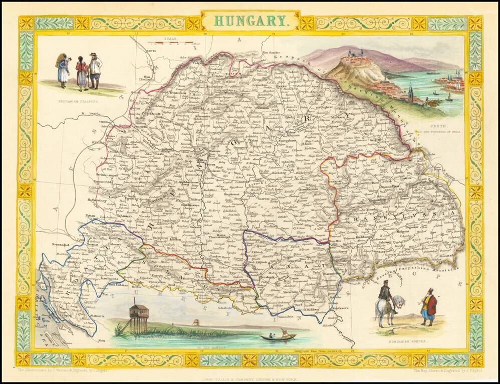
Gorgeous full color example of Tallis's map of Hungary, with vignettes showing Hungarian Nobles, Budapest, Hungarian Peasants and a scene on the Danube. Engraved for R. Montgomery Martin's Illustrated Atlas. Tallis was one of the last great decorative...
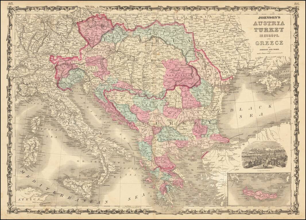
Marvelous map showing Greece, Turkey and a very large Austrian Empire, including all of Hungary, Transylvania, Galitzia, Bohemia, Moravia, etc. Excellent delineation of the Balkans states, at a time when they all had their current names. Plus, a few...
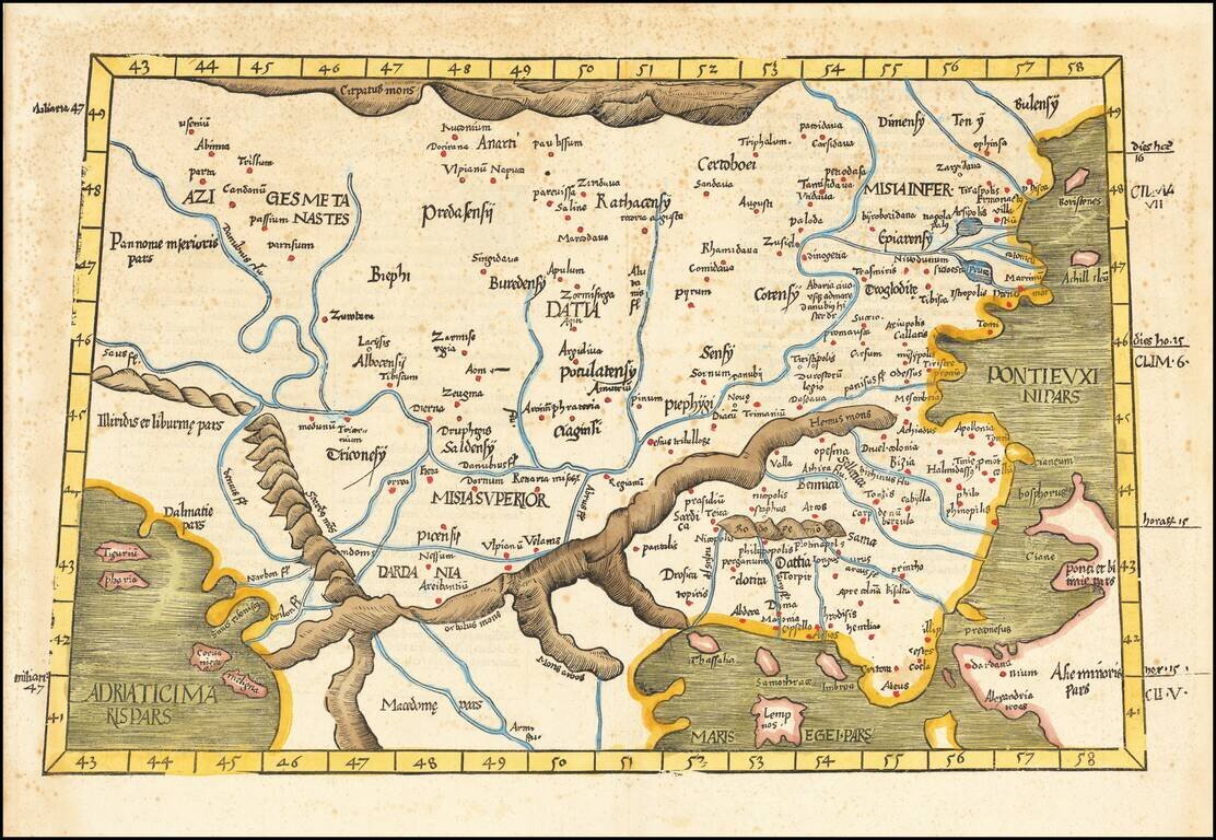
Rare Early Regional Map of Romania, Greece, etc. Nice example of the 1525 edition of Lorenz Fries map of the Balkans, Romania and northern Greece First published in Strasbourg by Johannes Gruninger in 1522, Fries map is based upon Waldseemuller's map...