
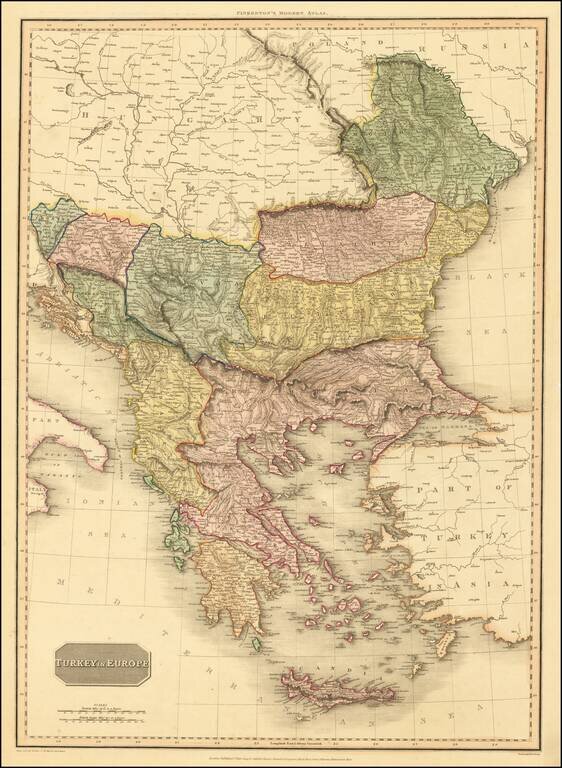
An excellent detailed regional map of the Balkans, Turkey and Greece, showing towns, roads, rivers, mountains, lakes, and other items of interest. Hand colored by regions.
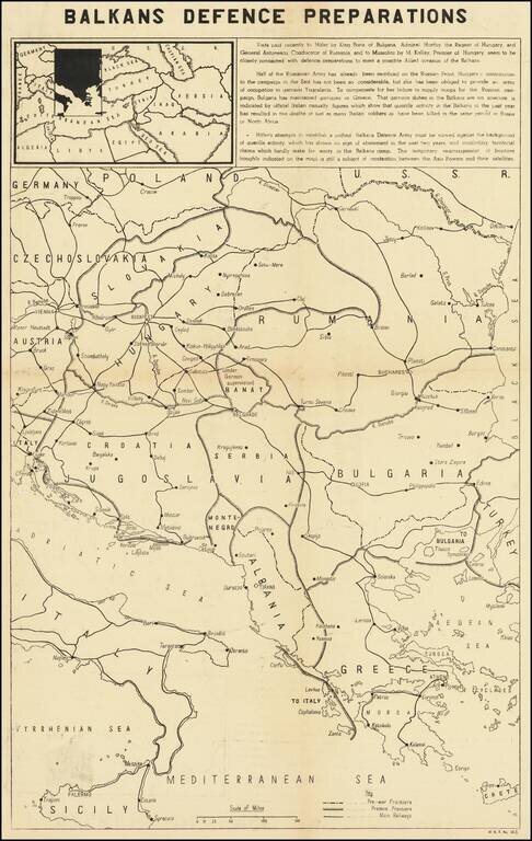
Balkans Related Anti-Nazi Propaganda Broadside Published in the British Empire Fascinating WWII broadside propaganda map, published in India, in order to keep the local populous informed about the War. The map describes Hitler's overtures to Tzar...
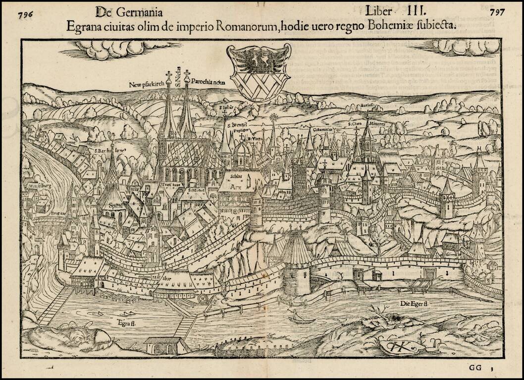
Important early view of the walled town of Eger, or Cheb, in the Czech Republic, including the city's coat of arms and the prominently labeled Church of Saint Nicholas. Munster's Cosmography was one of the most influential geographical works of the...
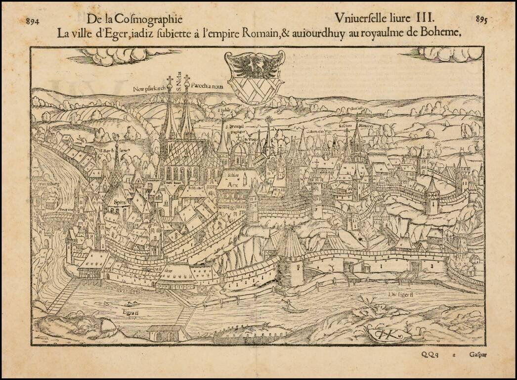
Decorative early view of Eger, in Bohemia, with coat of arms. Munster's Geographia (first published in 1540) and his later Cosmographia, were cartographic landmarks. The Geographia included not only Ptolemaic maps but also a number of landmark modern...
![Praga, Bohemiae Metropolis Accuratissime Expressa [with] Egra urbs a Flumio . . .](/map/small/53971.jpg)
Finely colored example of this striking view of Prague and of Egra, from Braun & Hogenberg's Civitas Orbis Terrarum.. Prague is shown dissected by the River, including three bridges and various watercraft in the river. One of the earliest and most...
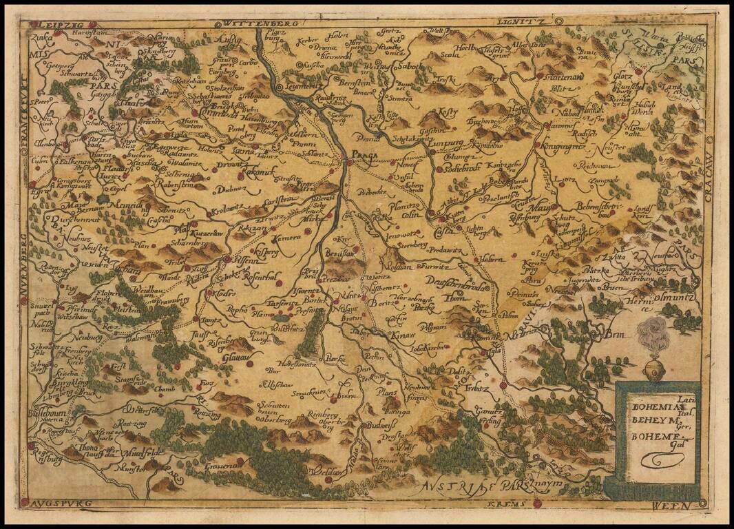
Rare modern map of Bohemia, published in Cologne by Johannes Metellus in 1579 in fine original color. The map is one of the earliest obtainable modern maps published by the so-called Cologne School of mapmakers, which consisted primarily of Flemish and...
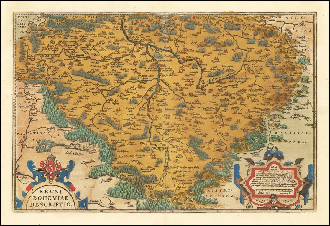
Fine old color example of Ortelius' decorative map of Bohemia, centered on Prague, based upon regional maps by Johann Criginger (1521-1571). The map shows remarkable detail, including towns, rivers, woods and other features. Two gorgeous cartouches...
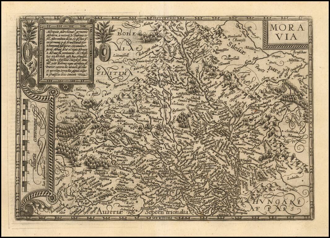
Fine example of Matthias Quad's map of Moravia. One of the few separate maps of Moravia published in the 16th Century.
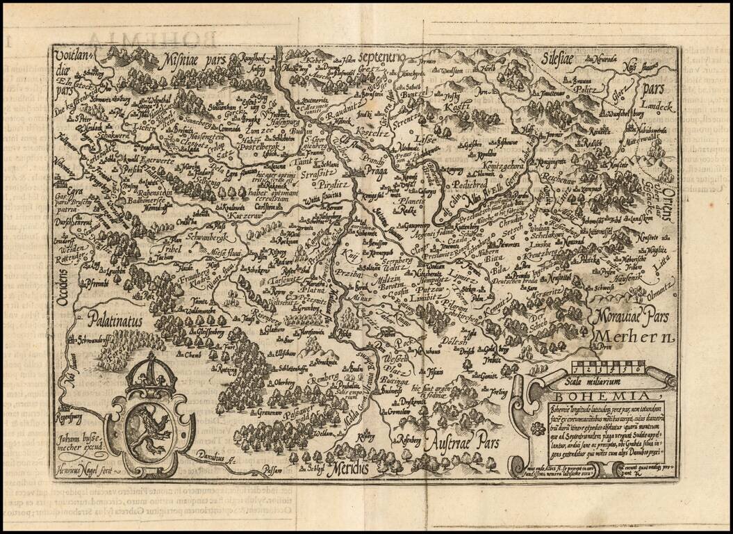
Fine example of Johan Bussemacher's map of Bohemia, engraved by Henricus Nagel. One of the few separate maps of Bohemia published in the 16th Century.
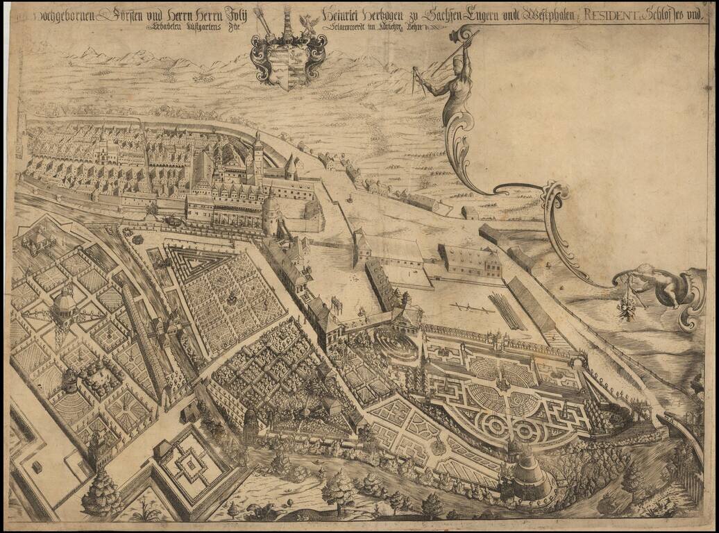
Rare separately published view of Ostrov nad Ohrí (German Schlackenwerth), in northwest Bohemia. We have not been able to locate an example of this view, but we have identified a smaller contemporary view by Merian, which suggests that a portion of...
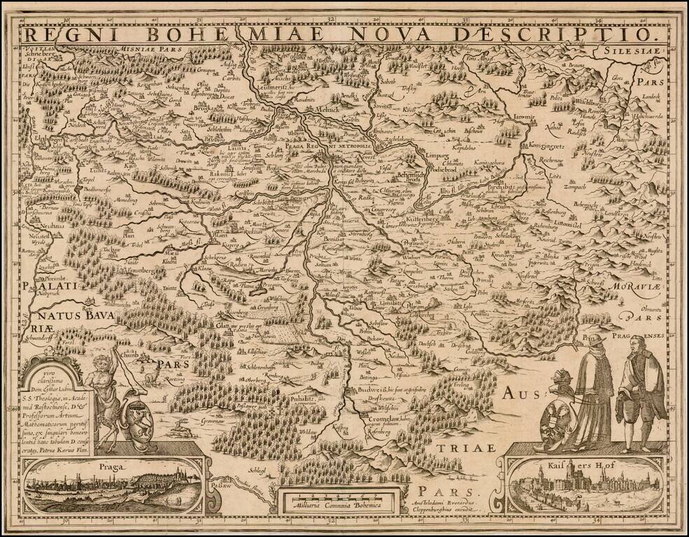
Fine example of the Evert Cloppenberg edition of Pieter Karius' map of Bohemia, with the additional view of Kaiserhof. Engraved by P. Kaerius, after E. Lubin. Insets: View of Prague; view of "Kaisers Hof".
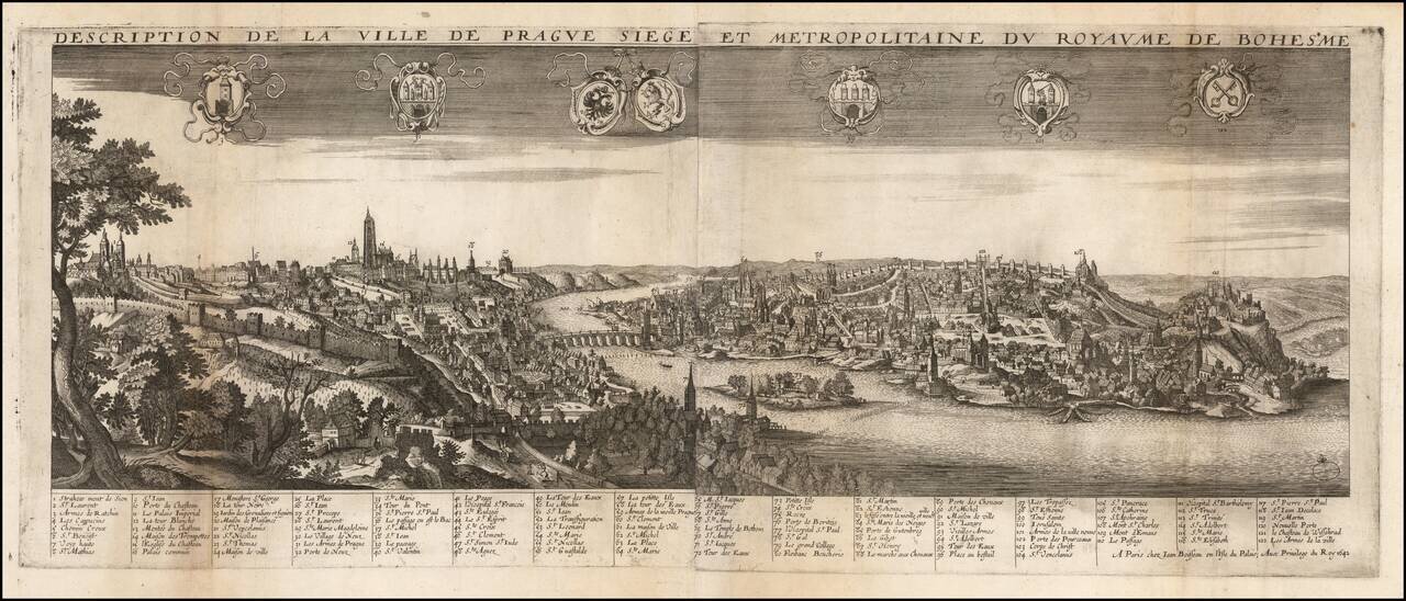
Rare early view of Prague, published in Paris by Jean Boisseau. Fine large perspective view centered on the Charles Bridge with 122 key locations identified in French in the lower margin. The view was published in Jean Boisseau's extremely rare...
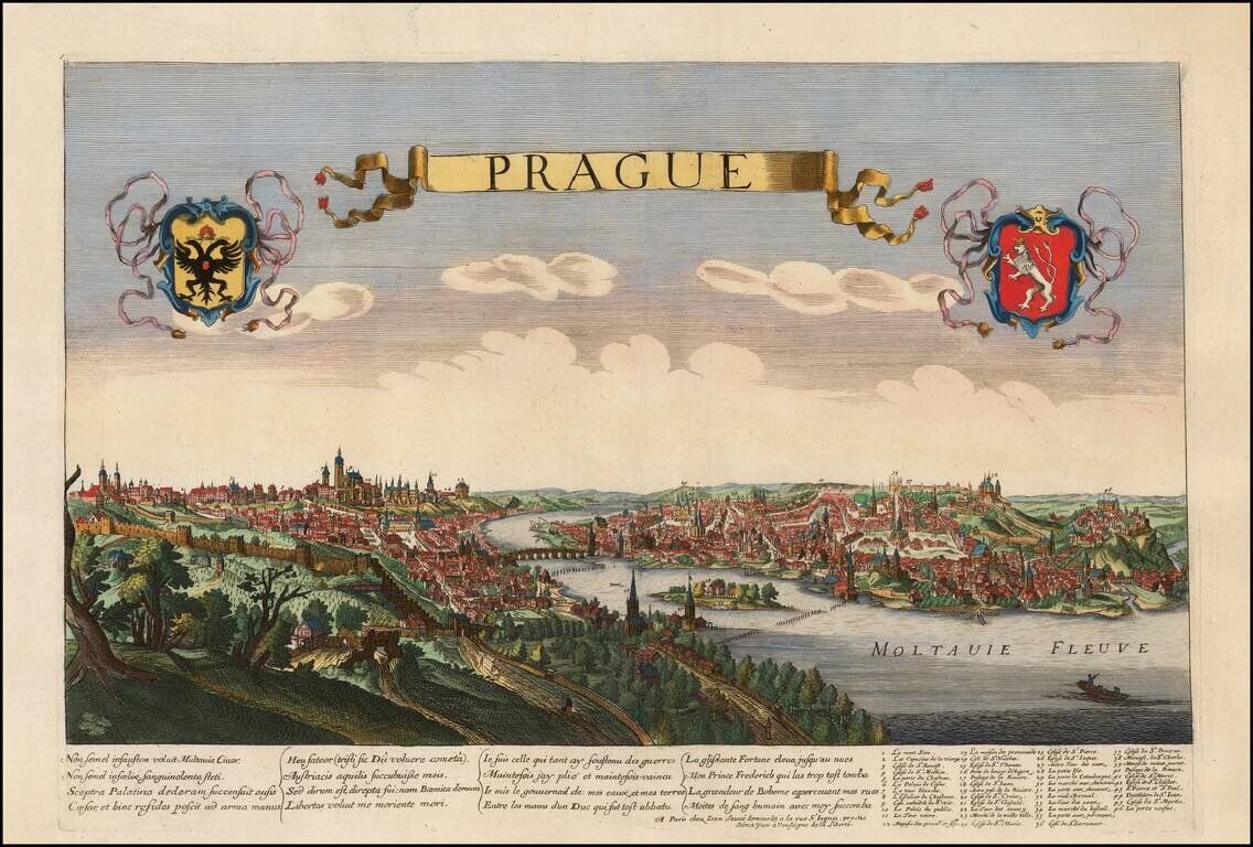
Fine view of Prague, drawn and engraved by Jean Sauve and possibly copied from either Jollain or de Jonghe. The view depicts the city with its grand hilltop castles and has a key identifying 46 important sites. The title is contained in a ribbon-style...
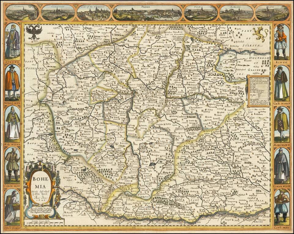
Decorative map of Bohemia, from Speed's Prospect of the World. Includes 7 cities across the top and costumed figures on either side of the map.
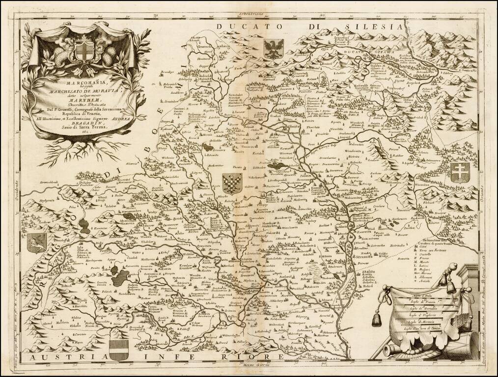
Finely engraved map of Moravia, published by Vincenzo Coronelli. Includes decorative cartouche and multiple coats of arms. Vincenzo Maria Coronelli, a Venetian scholar and Minorite Friar, was one of the most celebrated map and globe makers of his era....