
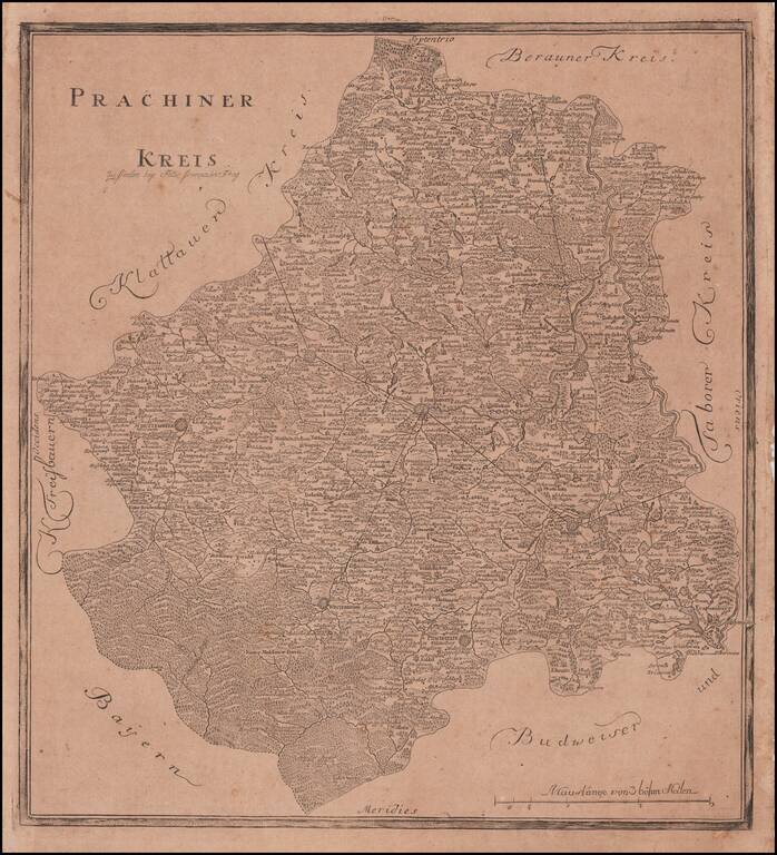
Rare Separately Published Map of Kauzim Province From The First Atlas of Bohemia Rare regional map of the Kaurzim Province, including Prag in the northwest, covering the central portion of the modern Czech Republic. The atlas contained 13 maps and...
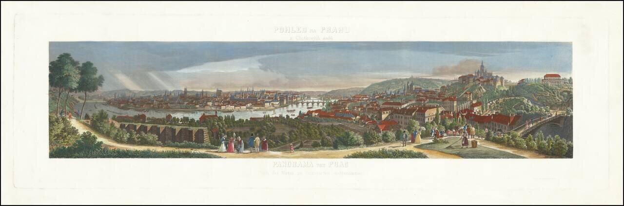
Rare panoramic view of Prague, showing the town from the Chotkovy hillside. The view is based upon a drawing by Morstat and engraved by F. Geissler.
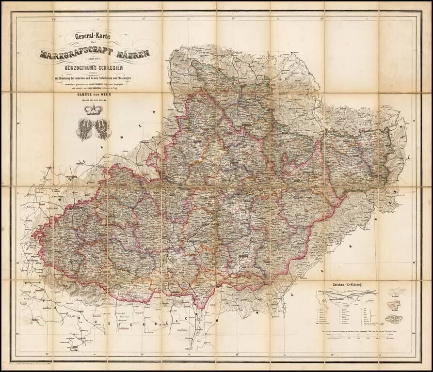
Rare map of the Moravia and Schliesen, depicting the region in remarkable and exacting detail. Includes tables, coats of arms and graphic details.
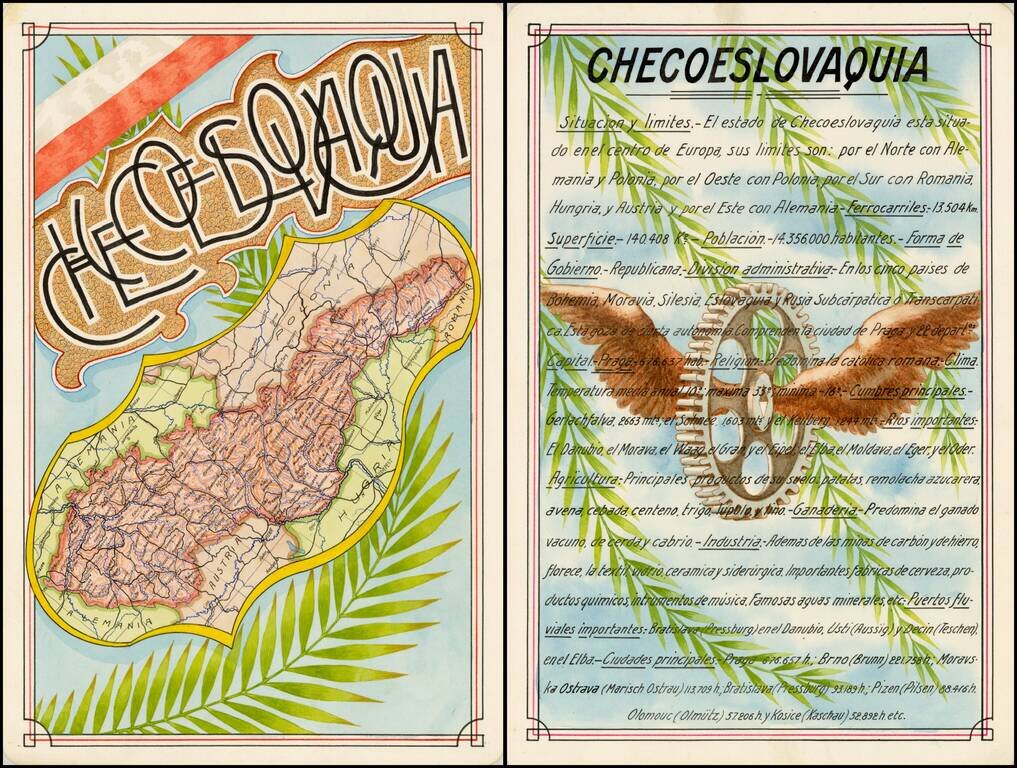
Award winning pair of manuscript cards, prepared by Antonio Raggio for the 11th Congreso de la Union Postal Universal (World Postal Congress) Exposition Filatelica Internacional, held in Buenos Aires, Argentina, in 1939. The map shows a finely...

Czech-Published Map Celebrating the Victories of the 575th Motor Ambulance Company, Published in Pilsen in 1945. Fascinating separately issued map of Western Europe focusing on the movements and exploits of the American 575th Motor Ambulance Company,...
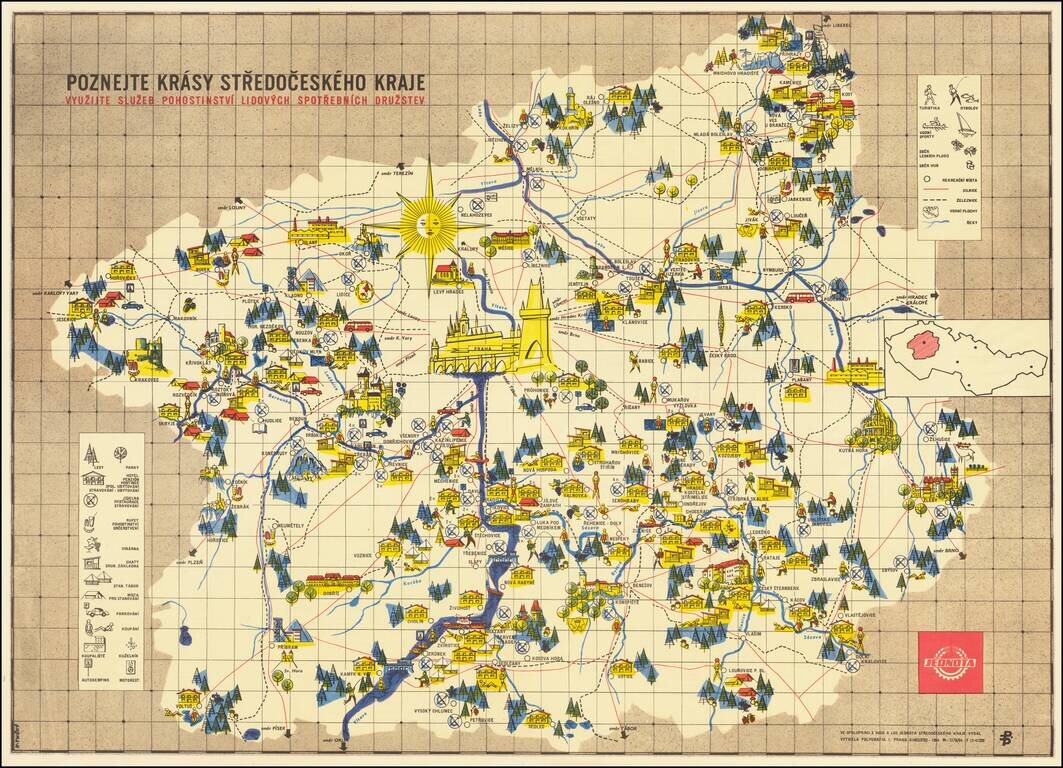
Fine example of this scarce pictorial map of the Central Bohemian regions, published by the People's Consumer Cooperatives. The title translates as: Discover the beauties of the Central Bohemian Region. Take advantage of the Hospitality Services of...
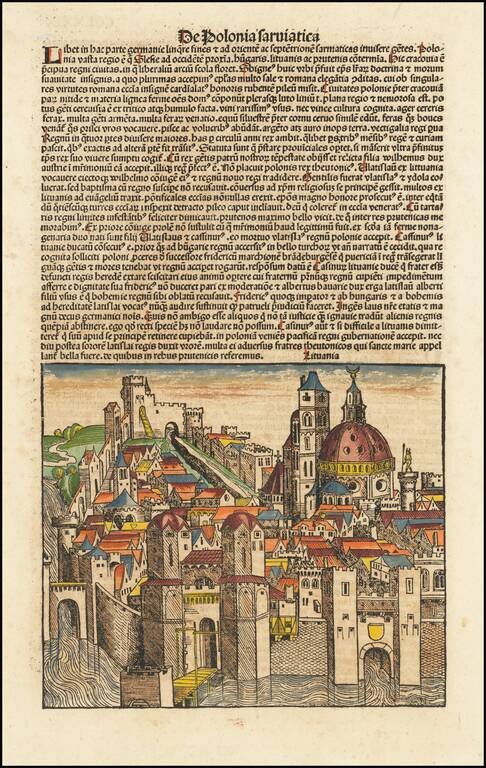
Nice full color of this fanciful view of a Lithuanian or Polish City, from the German edition of his Liber Chronicum. The...
![[Riga] Ryge](/map/small/67761.jpg)
Rare early view of Riga. Rare early town view of Riga, with the founder bishop Albert from Buxhoeveden and coat of arms of Riga. The image appeared in Croneken der Sachsen published by Schöffer in Mainz. On the verso is an image of Albrecht, coat...
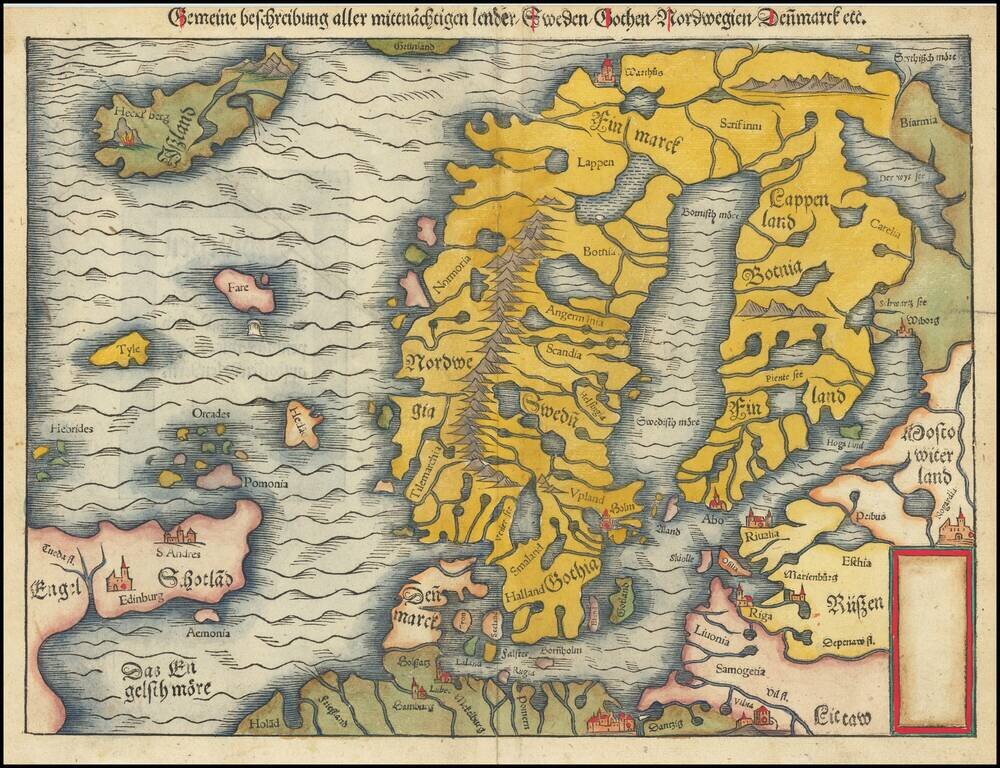
Important early modern map of Scandinavia, Iceland, and the Baltic, published in Venice by Giacomo Gastaldi. Gastaldi's modern map of Scandinavia and environs "built upon previous publications, in particular, the representation was based on the map of...
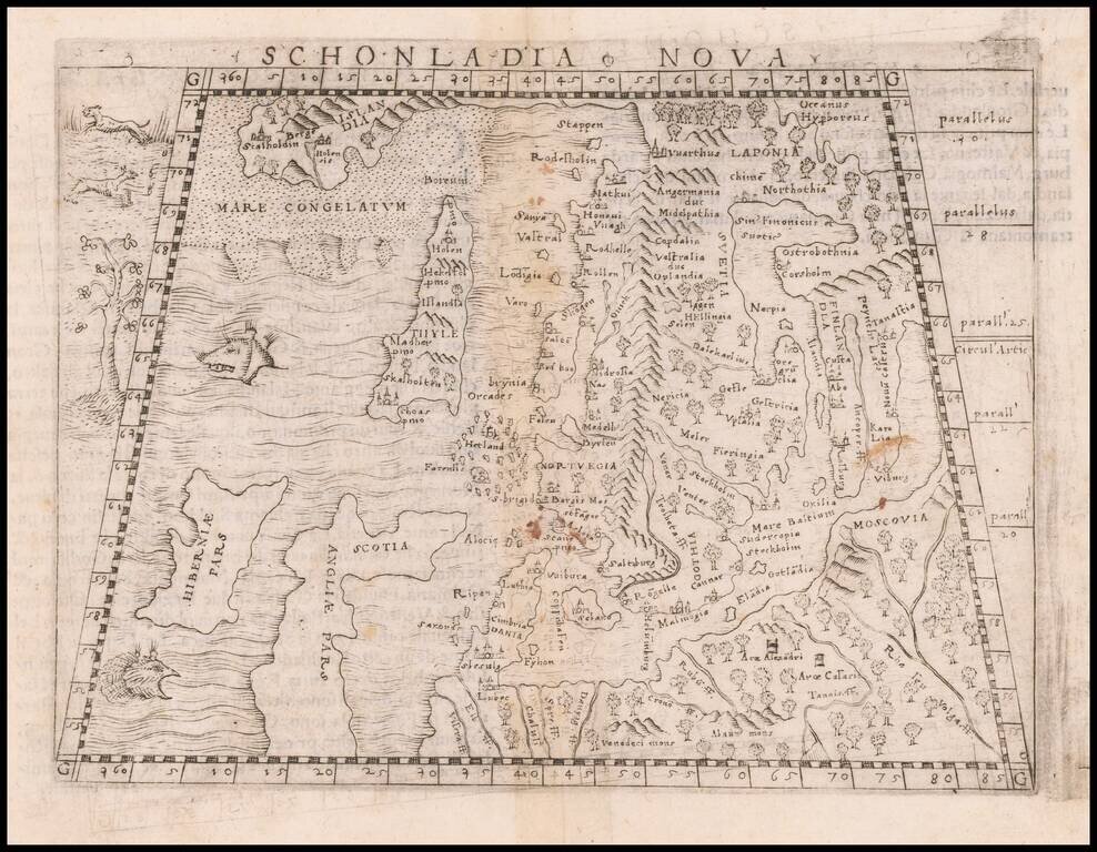
Second edition of Munster's map of Scandinavia, first issued in 1545 to replace the very rare first edition of the map, which appeared in only the first three editions of Munster's Geographia. Munster's first map relied upon the cartography of Jacob...
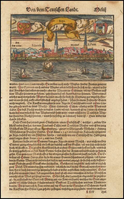
Nice example of Munster's birdseye view of Riga from the river, with decorative title banner and two coats of arms in the sky. View is from the Duna, with several major place names given. Munster's Geographia was a cartographic landmark, including...
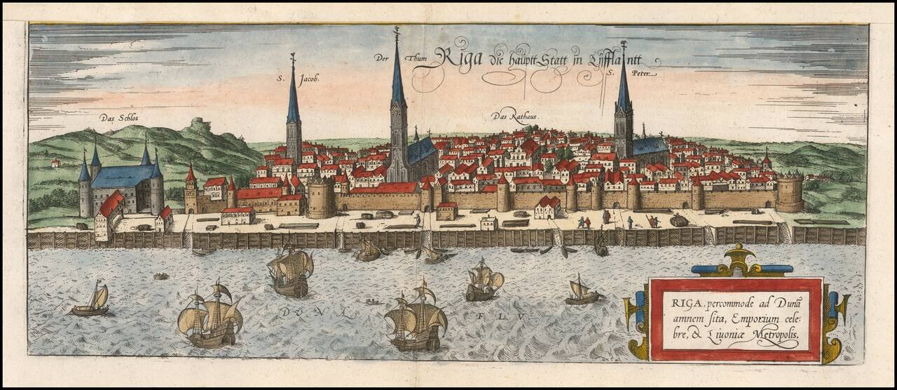
A fine early view of Riga, first published by Braun and Hogenberg in 1581. This is one of the earliest obtainable views of the city and was heavily based on Munster's slightly earlier map of the city. This map appeared in Braun and Hogenberg's...
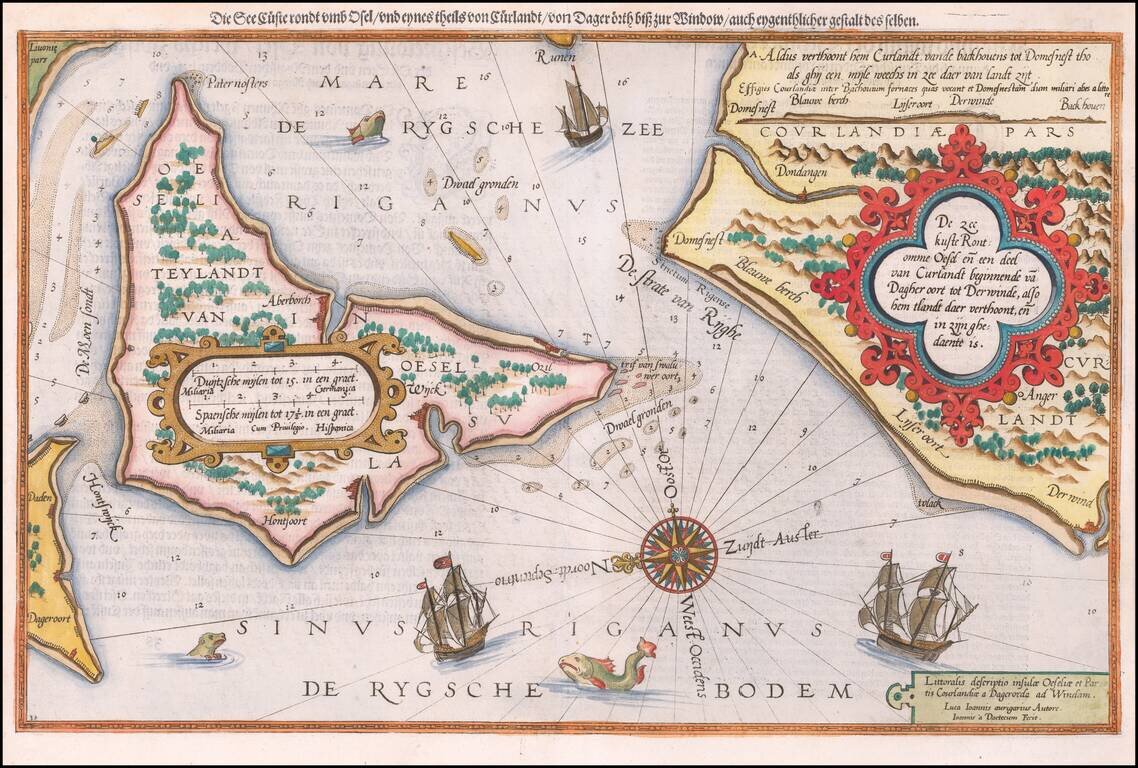
Antique map of Saaremaa and the Estonian Coastline. Striking example of the antique sea chart of the Gulf of Riga, along the Latvia-Estonia border. Includes sea monsters, sailing ships, a compass rose, and decorative cartouches, soundings, and...
Fine early example of Waghenaer's map a portion of the Gulf of Finland showing Wyburch (Vyborg), Telsborch, Narua, Niewkerck, Reisenburg, and the region just west of St. Petersburg, from Lucas Waghenaer's Spiegel der Zeevaerdt. Includes sea monsters,...
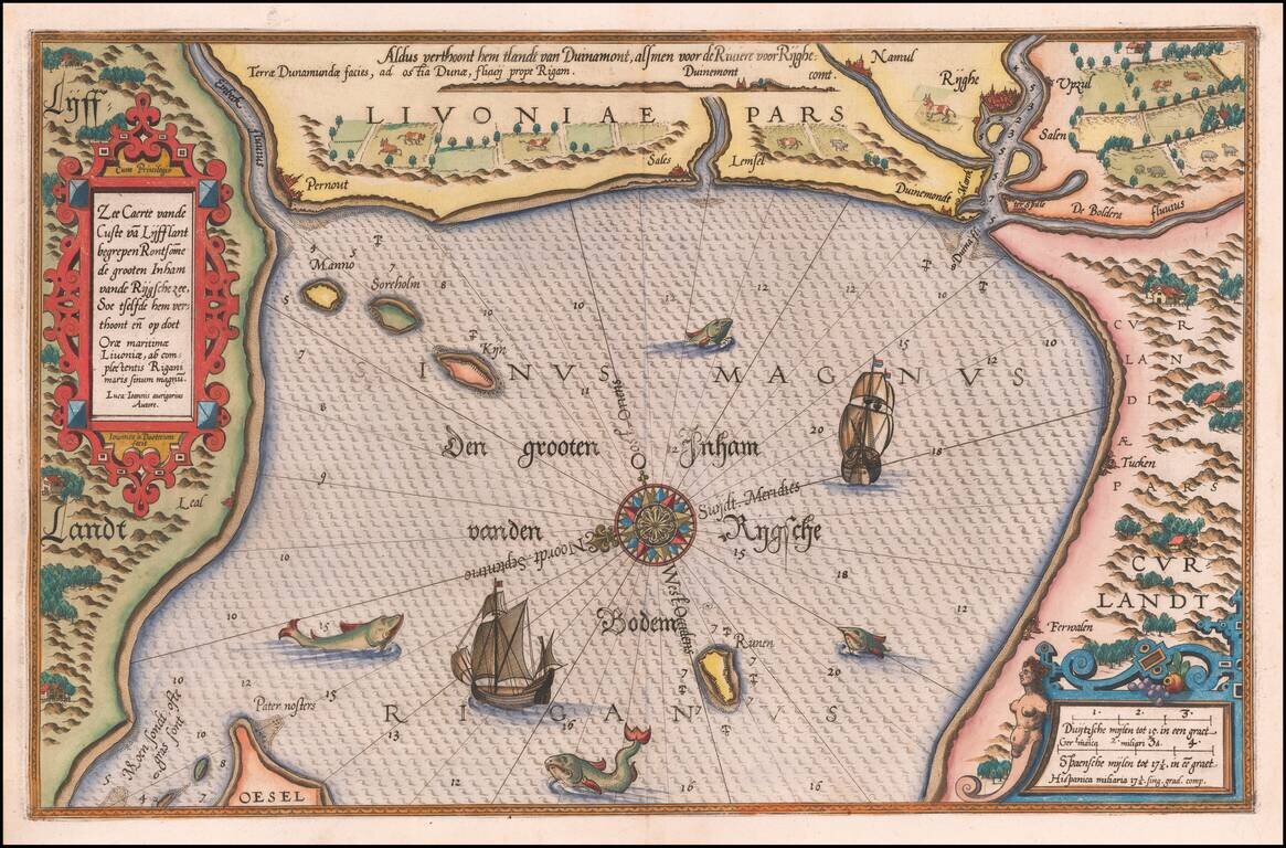
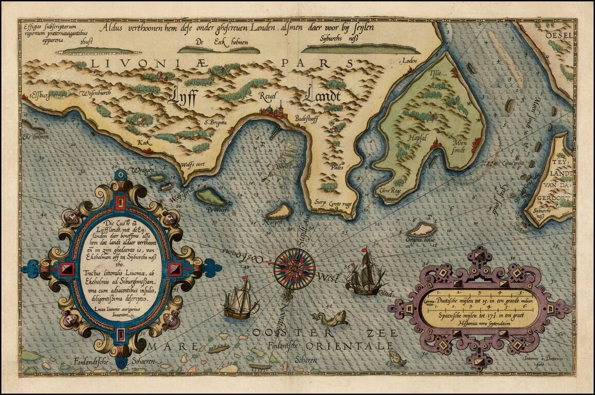
Striking example of Wagenhaer's map of the coast of Latvia, including the area around Riga and part of Curland. Includes sea monsters, sailing ships, compass rose, decorative cartouche, anchorages and soundings. Wagenhaer was a Dutch pilot who...
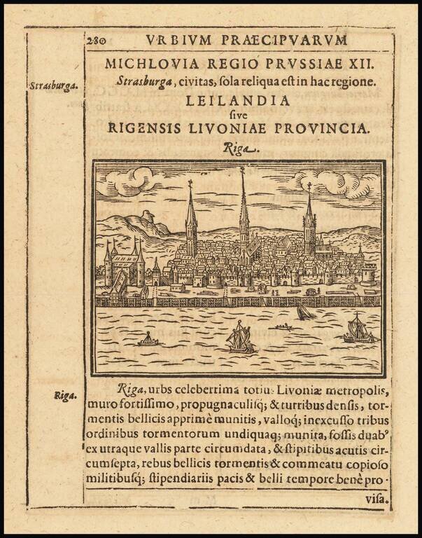
Rare early view of Riga, published in Parvum Theatrum Urbium sive Urbium Praecipuarum totius orbis Brevis & Methodica Descriptio by Adrianus Romanus, first printed in Frankfurt in 1595.