Map size in jpg-format: 9.94514MiB
Click to open in high resolution (open in new tab).
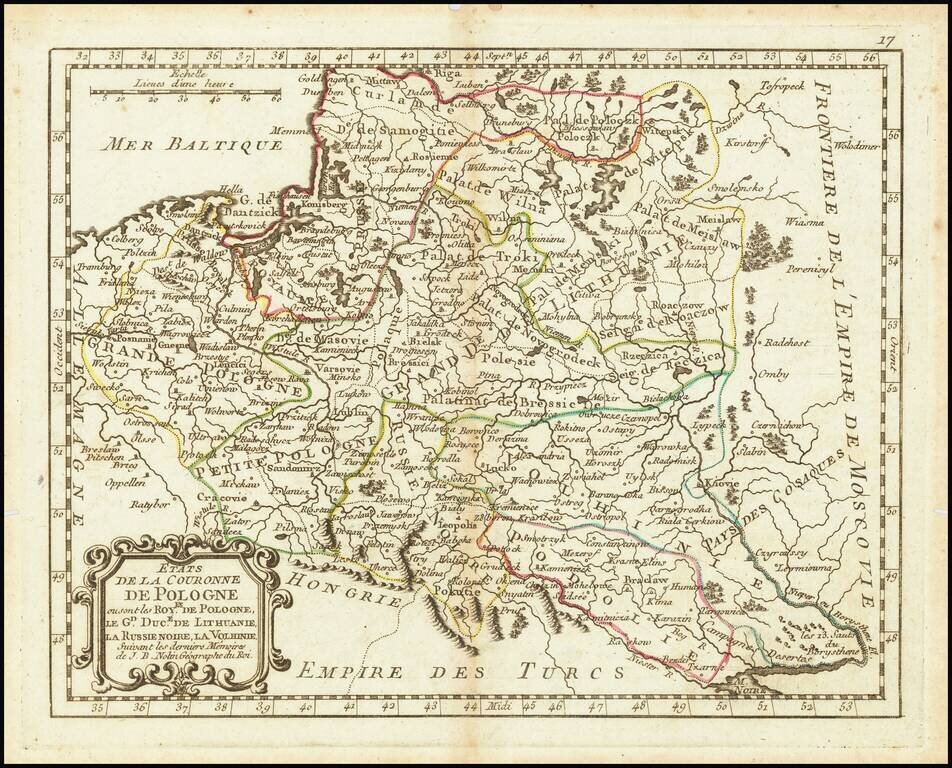
An attractive antique map of Poland showing the cities, rivers, lakes, and forests of the region during the commonwealth with the Grand Duchy of Lithuania. The various regions are demarcated and named, including Black Russia, Podolia, Volhynia, Greater and Lesser Poland, and several palatinates. Parts of adjacent countries are shown, including Russia, Turkey, Hungary, and Germany.
The map shows the Kingdom of Poland in the middle of its great decline. The establishment of the liberum veto in 1573 had strengthened democratic tendencies in the country, but it also introduced an easy way to manipulate the political system. External observers could bribe a single nobleman to stop the passage of any unfavorable legislation or the election of any hostile kings. While Prussian and Austrian statesmen also abused this veto, Russian meddling was particularly advanced, with Catherine the Great even managing to get a lover elected leader of the country.
The commonwealth would eventually commence disappearing in 1772. Three partitions between its neighboring countries would dismember both Poland and Lithuania, and an independent Poland would disappear from maps for nearly a century and a half.
As with other maps by Nolin, attention to detail is apparent in this example. It appears that Nolin has drawn some material from De Fer in making this map. This map is quite scarce.
If you are a student, write to us in telegram: @antiquemaps and indicate what material you need and for what work you need a map in high detail. We are ready to provide material on special terms. For students only!


![[Hand Drawn Prussian Military Encampment at Opole, Poland] Special Grund-Riss Des Kaeyserl Feldl Lagers bey Oppeln in Ober Schlesien](/map/small/59726.jpg)